Файл:GeneralMapOfDistancesAndHistoricCapitals.jpg
Перейти к навигации
Перейти к поиску
Размер этого предпросмотра: 744 × 599 пкс. Другие разрешения: 298 × 240 пкс | 596 × 480 пкс | 953 × 768 пкс | 1271 × 1024 пкс | 2542 × 2048 пкс | 3493 × 2814 пкс.
Исходный файл (3493 × 2814 пкс, размер файла: 6,14 Мб, MIME-тип: image/jpeg)
Этот файл находится на Викискладе. Сведения о нём показаны ниже.
Викисклад — централизованное хранилище для свободных файлов, используемых в проектах Викимедиа.
|
Краткое описание
Лицензирование
|
Это изображение является точной фотографической репродукцией оригинального двумерного произведения изобразительного искусства. Данное произведение изобразительного искусства само по себе находится в общественном достоянии по следующей причине:
Официальная позиция, занятая «Фондом Викимедиа», заключается в том, что «точные репродукции двумерных произведений изобразительного искусства, находящихся в общественном достоянии, также находятся в общественном достоянии, и заявления об обратном представляют собой нападки на саму концепцию общественного достояния». Для получения подробной информации см. Commons:Когда использовать тег PD-Art.
Эта фотографическая репродукция, следовательно, также считается находящейся в общественном достоянии. Просим учитывать, что в зависимости от местного законодательства повторное использование этого контента может быть запрещено или ограничено в вашей юрисдикции. См. Commons:Когда использовать тег PD-Art. | ||||
История файла
Нажмите на дату/время, чтобы посмотреть файл, который был загружен в тот момент.
| Дата/время | Миниатюра | Размеры | Участник | Примечание | |
|---|---|---|---|---|---|
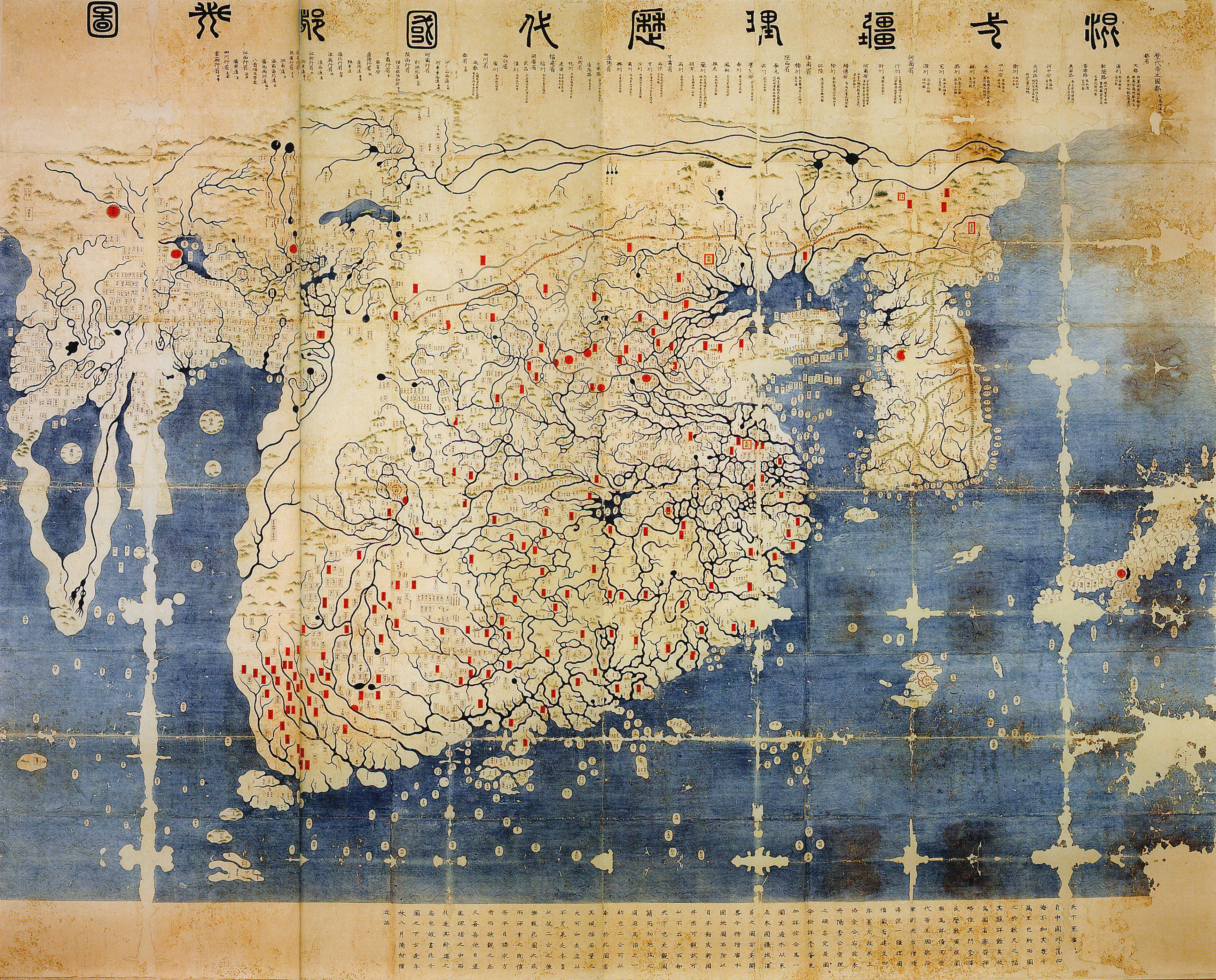
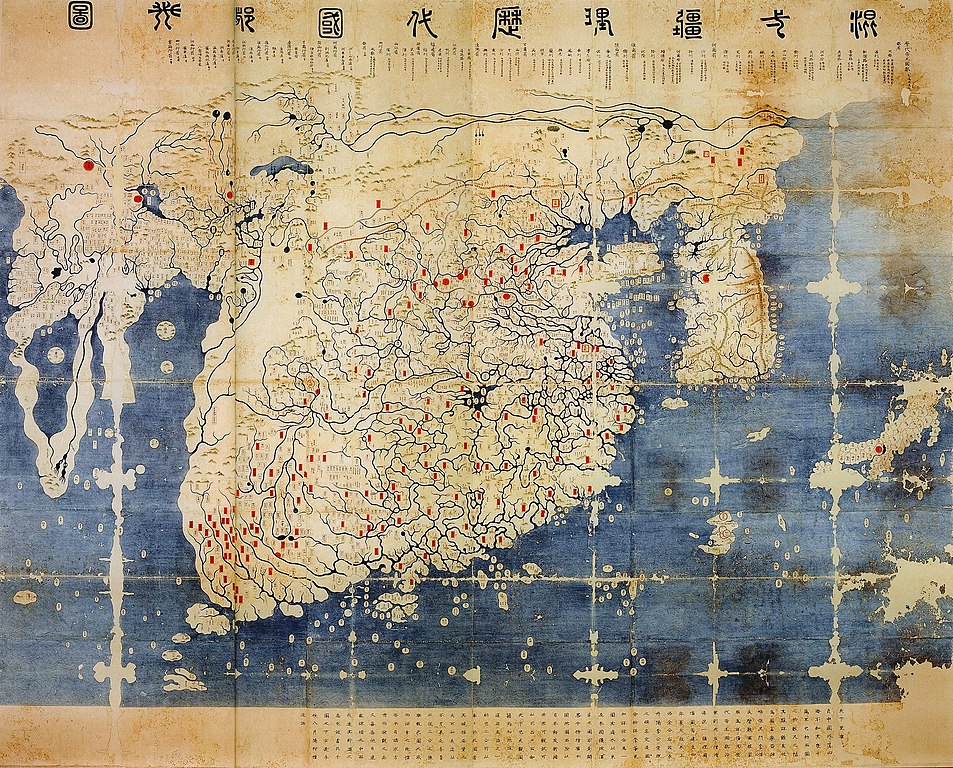
| текущий | 14:40, 11 июня 2008 | | 3493 × 2814 (6,14 Мб) | Yaan | == Summary == {{Information |Description = General map of the distances and the historic capitals (chinese: Hunyi jiangli lidai guodu zhi tu; japanese: Kon'itsu kyoori rekidai kokuto no zu), Korea, roughly 1470. Ink and paint on paper. Height 220 cm, widt |
Использование файла
Следующая страница использует этот файл:
Глобальное использование файла
Данный файл используется в следующих вики:
- Использование в en.wikipedia.org
- Использование в fr.wikipedia.org
- Использование в fr.wikiversity.org
- Использование в ko.wikipedia.org
- Использование в uk.wikipedia.org
- Использование в www.wikidata.org
- Использование в zh.wikipedia.org