Файл:Moscow satellite image.jpeg
Перейти к навигации
Перейти к поиску
Размер этого предпросмотра: 600 × 600 пкс. Другие разрешения: 240 × 240 пкс | 480 × 480 пкс | 1000 × 1000 пкс.
Исходный файл (1000 × 1000 пкс, размер файла: 396 Кб, MIME-тип: image/jpeg)
Этот файл находится на Викискладе. Сведения о нём показаны ниже.
Викисклад — централизованное хранилище для свободных файлов, используемых в проектах Викимедиа.
|
Краткое описание
| Описание |
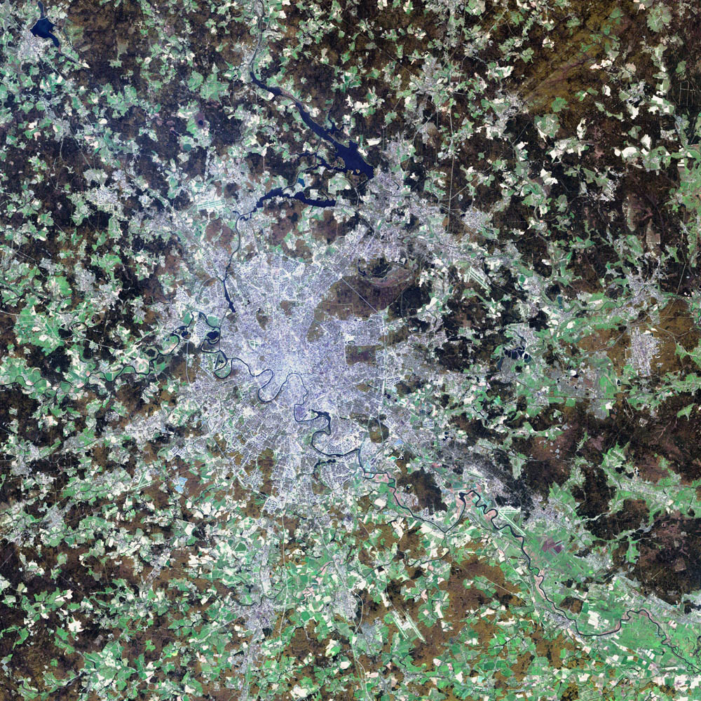
Deutsch: Satellitenbild von de:Moskau English: satellite image of the city of en:Moscow.
|
| Дата | 2 августа 2002 |
| Источник | NASA Visible Earth project, http://visibleearth.nasa.gov/view_rec.php?id=3434 |
| Автор | NASA/USGS EROS Data Center Satellite Systems Branch/Landsat 7/ETM+ |
Лицензирование
Это изображение находится в общественном достоянии, так как содержит материалы, которые первоначально получены от Геологической службы США (USGS) — агентства Министерства внутренних дел США. Дополнительную информацию см. «Официальная политика авторского права USGS» (англ.).
|
| Этот файл находится в общественном достоянии (англ. public domain), так как он был создан NASA (Национальным управлением по аэронавтике и исследованию космического пространства). Политика авторского права NASA гласит, что «Материал NASA не защищается авторским правом, если не указано иное». (См. Template:PD-USGov, страницу политики авторского права NASA или политику использования изображений JPL.) | ||
 |
Предупреждения:
|
История файла
Нажмите на дату/время, чтобы посмотреть файл, который был загружен в тот момент.
| Дата/время | Миниатюра | Размеры | Участник | Примечание | |
|---|---|---|---|---|---|
| текущий | 05:12, 8 ноября 2004 | | 1000 × 1000 (396 Кб) | Ævar Arnfjörð Bjarmason |
Использование файла
Следующие 2 страницы используют этот файл:
Глобальное использование файла
Данный файл используется в следующих вики:
- Использование в af.wikipedia.org
- Использование в ar.wikipedia.org
- Использование в be-tarask.wikipedia.org
- Использование в ca.wikipedia.org
- Использование в hif.wikipedia.org
- Использование в hr.wikipedia.org
- Использование в hu.wiktionary.org
- Использование в it.wikipedia.org
- Использование в kk.wikipedia.org
- Использование в lb.wikipedia.org
- Использование в my.wikipedia.org
- Использование в roa-tara.wikipedia.org
- Использование в sh.wikipedia.org
- Использование в sl.wikipedia.org
- Использование в yi.wikipedia.org