Файл:Caves on the Kabul River -b.jpg
Перейти к навигации
Перейти к поиску

Размер этого предпросмотра: 800 × 600 пкс. Другие разрешения: 320 × 240 пкс | 640 × 480 пкс | 1024 × 768 пкс | 1280 × 960 пкс | 2560 × 1920 пкс | 3456 × 2592 пкс.
Исходный файл (3456 × 2592 пкс, размер файла: 4,08 МБ, MIME-тип: image/jpeg)
Этот файл находится на Викискладе. Сведения о нём показаны ниже.
Викисклад — централизованное хранилище для свободных файлов, используемых в проектах Викимедиа.
|
| Описание |
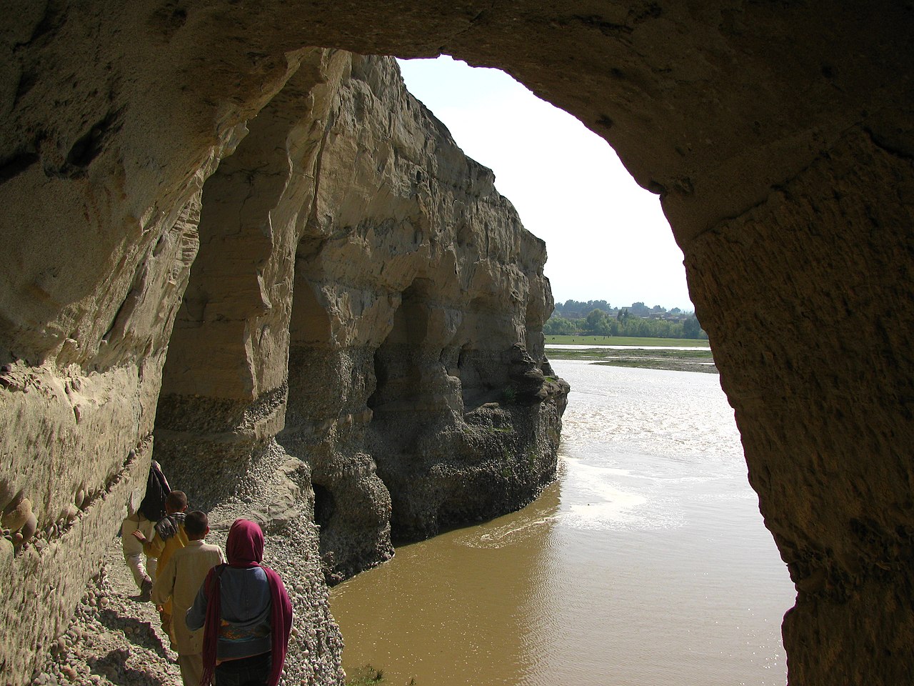
The following is the author's description of the photograph quoted directly from the photograph's Flickr page. "A view coming out of one of the caves of the Kabul River. Muddy and swollen, it's [sic] spring. ---- After visiting the village we went to the 'Buddhist Caves', which have been carved into a set of cliffs on the north side of the Kabul river. Interviews with locals yielded few results, they know virtually nothing about the pre-Islamic history of the country. These caves were part of a Buddhist monastery, and are significant because they were the home of part of the Edicts of Ashoka from around the year 272 BC probably put there by Devanampiya Tissa. The inscriptions are now in the Kabul Museum collection. The rest of the caves are completely looted. The only remains are the caves themselves, classic Buddhist 'hand' rock inscriptions, and the occasional remnants of stuccos or statues. In the year 629 the Chinese scholar Xuanzang visited the monastaries here and reported a 300 foot tall stupa. I'm not sure which stupa he is referring to of the ~37 in the area, but there is one above the caves which appears to be fairly elaborate. These caves also served in various wars over the years housing mujahadeen due to it's [sic] good lookout position and ready retreat routes. We found bullets embedded in various places. More information: en.wikipedia.org/wiki/Devanampiyatissa en.wikipedia.org/wiki/Ashoka_the_Great en.wikipedia.org/wiki/Edicts_of_Ashoka en.wikipedia.org/wiki/Xuanzang en.wikipedia.org/wiki/Stupa " |
||
| Дата | Снято: 9 апреля 2009 | ||
| Источник |
originally posted to Flickr as Kabul River
|
||
| Автор | Todd Huffman | ||
| Права (Повторное использование этого файла) |
Этот файл доступен по лицензии Creative Commons Attribution 2.0 Generic
|
| Местоположение камеры | | Это и другие изображения по их местоположению на OpenStreetMap |
|---|
История файла
Нажмите на дату/время, чтобы посмотреть файл, который был загружен в тот момент.
| Дата/время | Миниатюра | Размеры | Участник | Примечание | |
|---|---|---|---|---|---|
| текущий | 06:23, 7 октября 2009 | | 3456 × 2592 (4,08 МБ) | Geo Swan | {{Information |Description=The following is the author's description of the photograph quoted directly from the photograph's Flickr page.<br/>"A view coming out of one of the caves of the Kabul River. Muddy and swollen, it's spring.<br><br>----<br><br>Af |
Использование файла
Следующая страница использует этот файл:
Глобальное использование файла
Данный файл используется в следующих вики:
- Использование в en.wikipedia.org
- Использование в fa.wikipedia.org
- Использование в gu.wikipedia.org
- Использование в hi.wikipedia.org
- Использование в hy.wikipedia.org
- Использование в nl.wikipedia.org
- Использование в pa.wikipedia.org
- Использование в ta.wikipedia.org
- Использование в tg.wikipedia.org
- Использование в th.wikipedia.org
- Использование в uk.wikipedia.org