Файл:The Citadel of Alanya.jpg
Исходный файл (1000 × 750 пкс, размер файла: 360 Кб, MIME-тип: image/jpeg)
Этот файл находится на Викискладе. Сведения о нём показаны ниже.
Викисклад — централизованное хранилище для свободных файлов, используемых в проектах Викимедиа.
|
Краткое описание
| Описание |
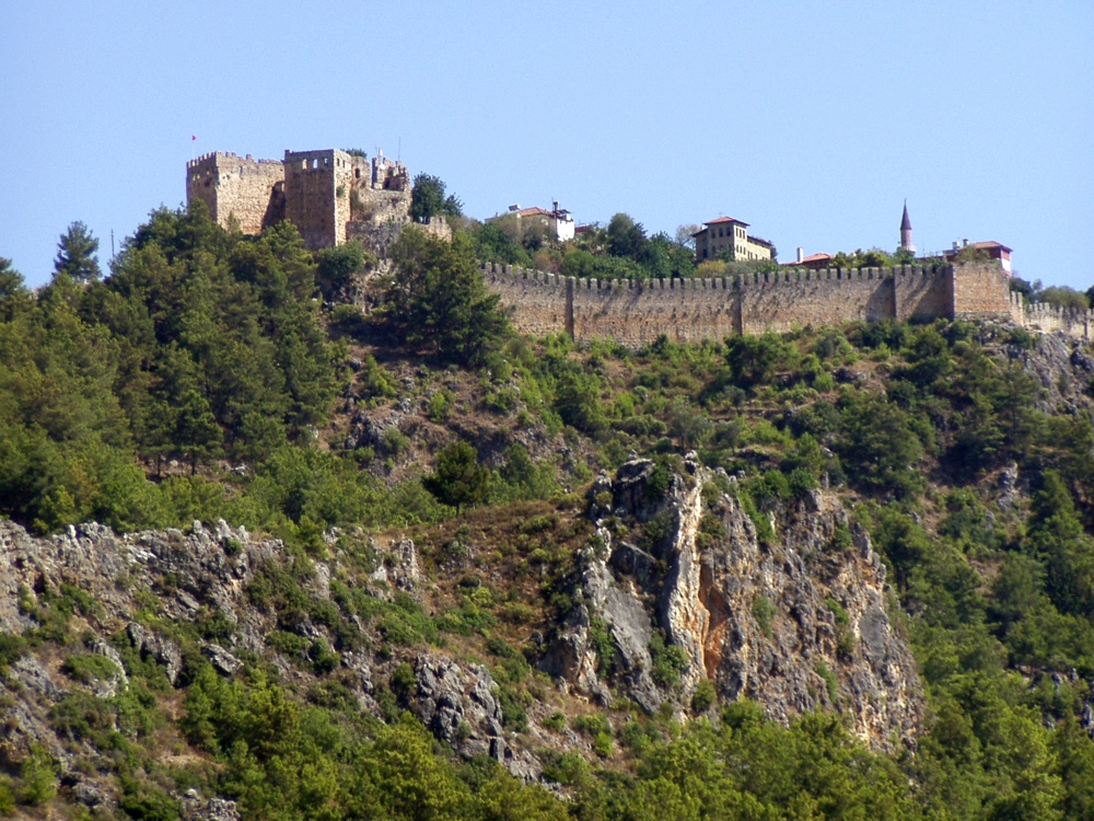
The citadel viewed from the city. The Citadel of Alanya, the walls of which are nearly 6.5 kilometres long, is on a peninsula whose height is up to 250 metres from the sea level. Although the settlement on Alanya peninsula, also known as Kandeleri, dates back to the Hellenistic Era, its cultural characteristics that can be seen today are thanks to Selcuks of the 13th century. The citadel was constructed on the demand of the Sultan of Selcuks, Alaaddin Keykubat, who conquered and had the city rebuilt in 1221. The citadel has 83 towers and 140 bastions. Nearly 400 cisterns were built to supply the city surrounded by walks in the medieval times with water. Some of the cisterns are still used today. The Seljuk Empire used Alanya as a second capital city in addition to Konya and used the city as a winter residence and made improvements there. Mongol attacks in 1243 and the Invasion of Anatolia by Egyptian Memluks weakened the Seljuk Empire which was divided in 1300, and the region came under the reign of the Karamano?ullar? dynasty. In 1427 Alanya was sold to the Memluk Sultan for five thousand gold pieces, and then in 1471 the city was included within the borders of the Ottoman Empire by Mehmet II The Conqueror. ( www.alanya.com.tr/en/47-Historical-Places.html ) |
| Дата | |
| Источник |
Türkiye - The Citadel of Alanya
|
| Автор | Robin & Bazylek from Kraków, Poland |
| Местоположение камеры | | Это и другие изображения по их местоположению на OpenStreetMap |
|---|
Лицензирование
- Вы можете свободно:
- делиться произведением – копировать, распространять и передавать данное произведение
- создавать производные – переделывать данное произведение
- При соблюдении следующих условий:
- атрибуция – Вы должны указать авторство, предоставить ссылку на лицензию и указать, внёс ли автор какие-либо изменения. Это можно сделать любым разумным способом, но не создавая впечатление, что лицензиат поддерживает вас или использование вами данного произведения.
| Это изображение, изначально опубликованное на Flickr, было досмотрено April 21, 2009 администратором или доверенным пользователем File Upload Bot (Magnus Manske), который подтвердил, что на тот момент оно было доступно на Flickr на условиях указанной лицензии. |
История файла
Нажмите на дату/время, чтобы посмотреть файл, который был загружен в тот момент.
| Дата/время | Миниатюра | Размеры | Участник | Примечание | |
|---|---|---|---|---|---|
| текущий | 15:59, 21 апреля 2009 | | 1000 × 750 (360 Кб) | File Upload Bot (Magnus Manske) | {{Information |Description= The citadel viewed from the city. The Citadel of Alanya, the walls of which are nearly 6.5 kilometres long, is on a peninsula whose height is up to 250 metres from the sea level. Although the settlement on Alanya peninsula, a |
Использование файла
Следующая страница использует этот файл:
Глобальное использование файла
Данный файл используется в следующих вики:
- Использование в ar.wikipedia.org
- Использование в ba.wikipedia.org
- Использование в de.wikipedia.org
- Использование в es.wikipedia.org
- Использование в fr.wikipedia.org
- Использование в hu.wikipedia.org
- Использование в hy.wikipedia.org
- Использование в pt.wikipedia.org
- Использование в tg.wikipedia.org