Category:Amami Islands
Jump to navigation
Jump to search

English: Category for the Amami Islands in Kagoshima Prefecture, Japan
日本語: 鹿児島県・奄美群島に関するカテゴリ
island group     | |||||
| Upload media | |||||
| Instance of |
| ||||
|---|---|---|---|---|---|
| Part of |
| ||||
| Located in protected area | |||||
| Location | Kagoshima Prefecture, Japan | ||||
| Located in or next to body of water | |||||
| Has part(s) |
| ||||
| Highest point |
| ||||
| Area |
| ||||
 | |||||
Subcategories
This category has the following 15 subcategories, out of 15 total.
- Maps of Amami Islands (21 F)
*
- Amami Gunto National Park (19 F)
A
- Amami cuisine (16 F)
K
O
T
U
- Ukejima (7 F)
Media in category "Amami Islands"
The following 13 files are in this category, out of 13 total.
-
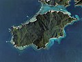
 Amami Islands NASA.jpg 850 × 802; 48 KB
-
 Amami-Gunto - DPLA - fae10dd15e97eac989faa9001bc068f7.jpg 11,392 × 9,519; 10.23 MB
-
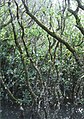 Amami-Mangrove.jpg 400 × 569; 177 KB
-
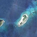
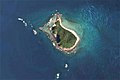
 Edateku-jima Island Aerial photograph.2008.jpg 4,098 × 3,073; 2.31 MB
-
 Eniya-Banare-jima Island Aerial photograph.2008.jpg 1,655 × 1,103; 337 KB
-
 Hajichi of Amami Islands.PNG 546 × 284; 85 KB
-
 Hanmyajima east of Yoroshima Island Aerial photograph.2008 (cropped).jpg 1,547 × 1,547; 448 KB
-
 Kiyama Island Aerial photograph.2008.jpg 1,700 × 1,275; 514 KB
-
 Okinawa and Amami Islands ISS042.jpg 3,280 × 4,928; 1.95 MB
-
 Sand-dwelling organisms (10.3897-zookeys.705.12888) Figure 2.jpg 1,512 × 865; 630 KB
-
 Sandon rock reef Aerial photograph.2001.jpg 1,033 × 688; 269 KB
-
 Sukomo-Banare Island Aerial photograph.2008.jpg 2,151 × 1,434; 622 KB
-
 Yu-Banare Island Aerial photograph.2008.jpg 1,588 × 1,058; 283 KB


_Figure_2.jpg)


.jpg)