Category:Aston (Ariège)
Jump to navigation
Jump to search
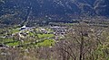
commune in Ariège, France .JPG) _OSM_03.png) | |||||
| Upload media | |||||
| Instance of | |||||
|---|---|---|---|---|---|
| Location |
| ||||
| Head of government |
| ||||
| Population |
| ||||
| Area |
| ||||
| Elevation above sea level |
| ||||
| Different from | |||||
| official website | |||||
 | |||||
Subcategories
This category has the following 13 subcategories, out of 13 total.
E
- Église Saint-Pierre d'Aston (1 F)
M
- Maps of Aston (Ariège) (10 F)
P
- Pic d'Anrodat (4 F)
- Pic de Fontargent (5 F)
- Pic de Juclà (1 F)
- Pic de l'Estany Mort (2 F)
- Pic de la Coma de Senyac (2 F)
- Pic de la Coma de Varilles (6 F)
- Pic de la Pala de Jan (2 F)
- Pic de Mil Menut (3 F)
- Pic de Ransol (2 F)
- Pic de Ruf (1 F)
- Pic de Serrère (11 F)
Media in category "Aston (Ariège)"
The following 8 files are in this category, out of 8 total.
-
 Aston jcb 2018.jpg 2,560 × 1,440; 1.21 MB
-
 Etang de Joclar (Ariège).jpg 2,272 × 1,704; 868 KB
-
 Etangs de Fontargente.jpg 6,032 × 976; 2.39 MB
-
 Pic de Thoumasset.jpg 1,039 × 1,329; 405 KB
-
 Population - Municipality code 09024.svg 475 × 355; 13 KB
-
 Rando Fontargente (8).jpg 3,840 × 2,160; 3.07 MB
-
 Rulhe.jpg 1,600 × 1,200; 627 KB
-
 Étang de Soulanet (Ariège).jpg 3,600 × 2,402; 3.24 MB

.jpg)


.jpg)

.jpg)