Category:Ballyconnell
Jump to navigation
Jump to search
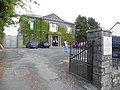
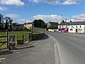
English: Ballyconnell is a town in County Cavan, Ireland. It is situated at the junction of four townlands Annagh, Cullyleenan, Doon and Derryginny in the parish of Tomregan, Barony of Tullyhaw. The town has an altitude of 55 metres above sea level. The mean daily January temperature is 4.5 degrees Celsius and the mean daily July temperature is 15 degrees Celsius. The average annual rainfall is 1,000 mm. The average annual hours of sunshine are 1,250. Ballyconnell won the Irish Tidy Towns Competition in 1971 and was joint winner with Trim in 1974.
Slovenčina: Ballyconnell ( ír. Béal Átha Conaill) je malé mesto na severe Írska, v severozápadnej časti grófstva Cavan. Žije tu 747 obyvateľov (2006).
human settlement  | |||||
| Upload media | |||||
| Instance of | |||||
|---|---|---|---|---|---|
| Location | County Cavan, Ulster, Ireland | ||||
| Population |
| ||||
| Elevation above sea level |
| ||||
 | |||||
Subcategories
This category has the following 7 subcategories, out of 7 total.
B
- Ballyconnell bridge (3 F)
- Ballyconnell library (2 F)
- Ballyconnell railway station (1 F)
M
- Market house, Ballyconnell (5 F)
S
- St Joseph's Church, Ballyconnell (14 F)
U
- Ulster Bank, Ballyconnell (1 F)
Media in category "Ballyconnell"
The following 92 files are in this category, out of 92 total.
-
 Agharaskilly.jpg 640 × 480; 61 KB
-
 Altered Images - Pólo D Restaurant - geograph.org.uk - 2914248.jpg 640 × 480; 46 KB
-
 Ballyconnell bridge.jpg 2,053 × 2,731; 2.06 MB
-
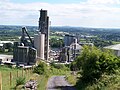
 Ballyconnell Cement Plant - geograph.org.uk - 1853761.jpg 640 × 389; 43 KB
-
 Ballyconnell cement plant.JPG 3,648 × 2,736; 2.99 MB
-
 Ballyconnell main street crossroads.jpg 2,983 × 2,233; 2.31 MB
-
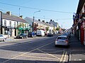 Ballyconnell main street.JPG 3,140 × 2,355; 2.31 MB
-
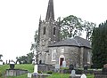 Ballyconnell Parish Church (Church of Ireland) - geograph.org.uk - 2701608.jpg 1,024 × 752; 141 KB
-
 Ballyconnell.JPG 3,084 × 2,314; 2.04 MB
-
 Barber shop, Ballyconnell - geograph.org.uk - 2914203.jpg 640 × 480; 59 KB
-
 Bayleaf Coffee House, Ballyconnell - geograph.org.uk - 2914262.jpg 640 × 480; 56 KB
-
 Bog Fence, Ballyconnell - geograph.org.uk - 305616.jpg 640 × 426; 107 KB
-
 Bookmaker, Ballyconnell - geograph.org.uk - 2914279.jpg 640 × 480; 54 KB
-
 Bridge across the Woodford canal - geograph.org.uk - 2914074.jpg 640 × 480; 58 KB
-
 Bridge Street, Ballyconnell - geograph.org.uk - 2868557.jpg 640 × 480; 55 KB
-
 Bridge Street, Ballyconnell - geograph.org.uk - 2914077.jpg 640 × 480; 51 KB
-
 Bygone items, The Molly Maguires Bar - geograph.org.uk - 1853848.jpg 640 × 480; 44 KB
-
 Cara Pharmacy, Ballyconnell - geograph.org.uk - 2914265.jpg 640 × 480; 51 KB
-
 Carrowmore, Ballyconnell.jpg 640 × 480; 47 KB
-

-
 Cavanagh, Ballyconnell.jpg 640 × 480; 57 KB
-
 Church Street - geograph.org.uk - 2914150.jpg 640 × 480; 57 KB
-
 Church Street Centre, Ballyconnell - geograph.org.uk - 2914175.jpg 640 × 480; 48 KB
-
 Church Street, Ballyconnell - geograph.org.uk - 2701617.jpg 1,024 × 710; 133 KB
-
 Church Street, Ballyconnell - geograph.org.uk - 2914144.jpg 640 × 480; 42 KB
-
 Cooney's Bar, Ballyconnell - geograph.org.uk - 2914310.jpg 640 × 480; 54 KB
-
 Courthouse, Ballyconnell - geograph.org.uk - 2914152.jpg 640 × 480; 49 KB
-

-
 Dental Practice, Ballyconnell - geograph.org.uk - 2914301.jpg 640 × 480; 62 KB
-
 Dental surgery, Ballyconnell - geograph.org.uk - 2914093.jpg 640 × 480; 44 KB
-
 Derelict shop, Ballyconnell - geograph.org.uk - 2914092.jpg 640 × 480; 48 KB
-
 Derryginny.jpg 640 × 480; 58 KB
-
 Doon, Ballyconnell.jpg 640 × 480; 66 KB
-
 Footbridge, Ballyconnell - geograph.org.uk - 2914062.jpg 640 × 480; 44 KB
-
 Former market house, Ballyconnell - geograph.org.uk - 2914225.jpg 640 × 480; 52 KB
-
 Fragrant Flowers, Ballyconnell - geograph.org.uk - 2914259.jpg 640 × 480; 47 KB
-
 Garage, Ballyconnell - geograph.org.uk - 2914142.jpg 640 × 480; 45 KB
-

-
 House Re-new, Ballyconnell - geograph.org.uk - 2914181.jpg 640 × 480; 54 KB
-
 J McBarron, Ballyconnell - geograph.org.uk - 2914210.jpg 640 × 480; 60 KB
-

-
 Kennedy's supermarket, Ballyconnell - geograph.org.uk - 2914090.jpg 640 × 480; 56 KB
-
 Killywilly - geograph.org.uk - 24715.jpg 640 × 427; 73 KB
-
 Lee's, Ballyconnell - geograph.org.uk - 2868558.jpg 640 × 480; 56 KB
-
 Lee's, Ballyconnell - geograph.org.uk - 2914196.jpg 640 × 480; 60 KB
-
 MacManus Pharmacy, Ballyconnell - geograph.org.uk - 2914280.jpg 640 × 480; 57 KB
-
 Maguire's Daybreak, Ballyconnell - geograph.org.uk - 2914193.jpg 640 × 480; 61 KB
-
 Main Street, Ballyconnell - geograph.org.uk - 1853797.jpg 640 × 480; 47 KB
-
 Main Street, Ballyconnell - geograph.org.uk - 1853804.jpg 640 × 480; 58 KB
-
 Main Street, Ballyconnell - geograph.org.uk - 2914236.jpg 640 × 480; 45 KB
-

-

-

-
 Masonic Hall, Ballyconnell - geograph.org.uk - 2914138.jpg 640 × 480; 48 KB
-
 Methodist Church, Ballyconnell - geograph.org.uk - 2914234.jpg 640 × 480; 57 KB
-
 Moher, Ballyconnell.jpg 640 × 480; 71 KB
-
 Narrow road at Snugborough - geograph.org.uk - 1853875.jpg 640 × 480; 88 KB
-
 Notice, Ballyconnell Courthouse - geograph.org.uk - 1854199.jpg 1,838 × 2,452; 768 KB
-

-
 O'Reilly Flooring, Ballyconnell - geograph.org.uk - 2914304.jpg 640 × 480; 71 KB
-
 Oifig an Phoist, Béal Átha Conaill - geograph.org.uk - 2914082.jpg 640 × 480; 58 KB
-
 Old Church, Ballyconnell - geograph.org.uk - 1853800.jpg 640 × 480; 65 KB
-
 On the border, the Woodford River - geograph.org.uk - 436875.jpg 640 × 480; 105 KB
-

-
 Plaques, Ballyconnell - geograph.org.uk - 2914075.jpg 640 × 480; 99 KB
-

-
 Property Services, Ballyconnell - geograph.org.uk - 2914253.jpg 640 × 480; 48 KB
-
 Public house, Ballyconnell - geograph.org.uk - 2914085.jpg 640 × 480; 59 KB
-
 R205 Road at Doon Heights - geograph.org.uk - 1853775.jpg 640 × 480; 49 KB
-
 RC Church at Mullaghduff - geograph.org.uk - 1854841.jpg 640 × 480; 36 KB
-
 Ronnies, Balltconnell - geograph.org.uk - 2914232.jpg 640 × 480; 54 KB
-
 Sailing on the Woodford canal - geograph.org.uk - 2914068.jpg 640 × 480; 73 KB
-

-
 Slieve Russell Hotel and Golf Course - geograph.org.uk - 910359.jpg 640 × 469; 109 KB
-
 Snugborough.jpg 640 × 480; 49 KB
-
 Spicy Hut, Ballyconnell - geograph.org.uk - 2914269.jpg 640 × 480; 52 KB
-
 The Anglers Rest, Ballyconnell - geograph.org.uk - 2914189.jpg 640 × 480; 57 KB
-
 The Brandywell, Ballyconnell - geograph.org.uk - 2914212.jpg 640 × 480; 57 KB
-
 The Crow's Nest, Ballyconnell - geograph.org.uk - 2914221.jpg 640 × 480; 58 KB
-
 The Gift Shop, Ballyconnell - geograph.org.uk - 2914281.jpg 640 × 480; 53 KB
-
 The leafy western suburbs of Ballyconnell - geograph.org.uk - 2701587.jpg 1,024 × 768; 203 KB
-
 The Molly Maguires Bar, Ballyconnell - geograph.org.uk - 1853830.jpg 640 × 480; 56 KB
-
 The Molly Maguires, Ballyconnell - geograph.org.uk - 2914223.jpg 640 × 480; 57 KB
-
 The Trading Post, Ballyconnell - geograph.org.uk - 2914273.jpg 640 × 480; 52 KB
-
 The Waterway, Ballyconnell - geograph.org.uk - 2914325.jpg 640 × 480; 52 KB
-
 The weir at Ballyduff Lock - geograph.org.uk - 1405841.jpg 640 × 480; 107 KB
-
 Tomregan Parish Hall - geograph.org.uk - 1854005.jpg 640 × 480; 39 KB
-
 Tomregan.jpg 640 × 480; 51 KB
-
 Trendles Hair Design, Ballyconnell - geograph.org.uk - 2914289.jpg 640 × 480; 54 KB
-
 Ulster Bank, Ballyconnell - geograph.org.uk - 2914218.jpg 640 × 480; 58 KB
-
 Woodford Arms, Ballyconnell - geograph.org.uk - 2914078.jpg 640 × 480; 53 KB
-
 Yum-yum Fast Food Takeaway - geograph.org.uk - 2914277.jpg 640 × 480; 57 KB


_-_geograph.org.uk_-_2701608.jpg)


_-_geograph.org.uk_-_2914069.jpg)
_-_geograph.org.uk_-_2914070.jpg)
_-_geograph.org.uk_-_2914071.jpg)


