Category:Bannow
Jump to navigation
Jump to search
town in Leinster, Republic of Ireland  | |||||
| Upload media | |||||
| Instance of | |||||
|---|---|---|---|---|---|
| Location | County Wexford, Leinster, Ireland | ||||
 | |||||
English: Bannow is an area situated in the south of County Wexford, in Ireland. An early Norman town was founded at Bannow. This town has since disappeared for unknown reasons, although the ruins of an early Norman church can still be seen there today (which dates from the 13th century). The Norman church is located near the former island of Bannow. It was a parish church, dedicated to St. Mary. It consists of a nave and chancel. The church was originally impropriated to the monks of Canterbury.
Media in category "Bannow"
The following 18 files are in this category, out of 18 total.
-
 Bait digging at Saintkierans on Bannow Bay - geograph-3148552.jpg 640 × 480; 95 KB
-
 Bannow Church - geograph.org.uk - 3146995.jpg 640 × 480; 100 KB
-
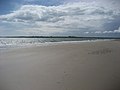
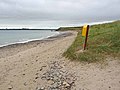 Bannow Island Beach - geograph.org.uk - 3146916.jpg 640 × 480; 75 KB
-
 BannowRCCh.JPG 729 × 547; 49 KB
-
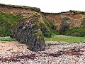
 Beach and cliffs at Blackhall Strand - geograph.org.uk - 3146925.jpg 640 × 480; 82 KB
-
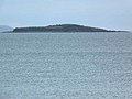 East Keeragh Island - geograph.org.uk - 3147005.jpg 640 × 480; 65 KB
-
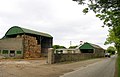 Farm and Barn - geograph.org.uk - 14599.jpg 640 × 411; 151 KB
-
 Lagoon at Bannow Island - geograph.org.uk - 3146990.jpg 640 × 480; 76 KB
-
 Silted area - geograph.org.uk - 14593.jpg 640 × 480; 324 KB
-
 TheOldHall.jpg 2,816 × 2,112; 805 KB
-
 Bannow Island - geograph.org.uk - 509854.jpg 640 × 480; 45 KB
-
 Beach and Cliffs near Bannow Bay - geograph.org.uk - 14557.jpg 640 × 480; 397 KB
-
 Coast near Bannow Bay - geograph.org.uk - 14561.jpg 640 × 480; 190 KB
-
 Farm at Bannow Bay - geograph.org.uk - 14594.jpg 640 × 480; 209 KB
-
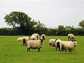 Pastureland - geograph.org.uk - 14563.jpg 640 × 480; 192 KB
-
 Road to Bannow Bay - geograph.org.uk - 14564.jpg 640 × 475; 210 KB
-
 Thatched Cottage near Bannow Bay - geograph.org.uk - 14558.jpg 640 × 480; 353 KB
-
 The Brandane Inn - geograph.org.uk - 14598.jpg 640 × 480; 168 KB


