Category:Bodmin
Jump to navigation
Jump to search
town in Cornwall, England  | |||||
| Upload media | |||||
| Instance of | |||||
|---|---|---|---|---|---|
| Location | Cornwall, South West England, England | ||||
| Population |
| ||||
 | |||||
Bodmin (Cornish: Bosvena) is a civil parish and major town in Cornwall, England, United Kingdom. It is situated south-west of Bodmin Moor.
Subcategories
This category has the following 18 subcategories, out of 18 total.
B
- Bridges in Bodmin (12 F)
C
- Carminow Cross (1 F)
- Countryside around Bodmin (58 F)
D
G
- Gilbert's Monument, Bodmin (10 F)
- Graffiti in Bodmin (11 F)
M
- Maps of Bodmin (12 F)
S
T
- John William Trevan (3 F)
W
Media in category "Bodmin"
The following 71 files are in this category, out of 71 total.
-
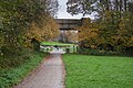 Berrycoombe Hill Bridge - geograph.org.uk - 5203886.jpg 1,600 × 1,067; 574 KB
-
 Bodmin (2021-09-08) 15.jpg 3,712 × 5,568; 15.31 MB
-
 Bodmin (2021-09-08) 44.jpg 3,712 × 5,568; 16.38 MB
-
 Bodmin (2021-09-08) 69.jpg 5,568 × 3,712; 15.95 MB
-
 Bodmin Fire Engine.jpg 5,312 × 2,988; 5.24 MB
-
 Bodmin Jail - geograph.org.uk - 5492746.jpg 640 × 480; 81 KB
-
 Bodmin Priory Pillar.jpg 4,000 × 6,000; 12.72 MB
-
 Bodmin Roofscape - geograph.org.uk - 5021460.jpg 640 × 447; 78 KB
-
 Bodmin Town Football Club - geograph.org.uk - 50317.jpg 640 × 480; 103 KB
-
 Bodmin town museum gallery.JPG 8,192 × 5,464; 14.46 MB
-
 Bodmin Town v Ivybridge Town (8162779904).jpg 3,648 × 2,736; 2.36 MB
-
 Bodmin, east end of Sainsbury's car park - geograph.org.uk - 5332346.jpg 1,600 × 1,064; 312 KB
-
 Bree Shute Lane, Bodmin, Cornwall - January 2023.jpg 4,608 × 3,456; 3.76 MB
-

-

-
 Car park at Bodmin College - geograph.org.uk - 4731262.jpg 640 × 480; 81 KB
-
 Car park at Cardinham Woods - geograph.org.uk - 6128378.jpg 640 × 480; 72 KB
-
 Car park for the Camel Trail - geograph.org.uk - 5195947.jpg 1,600 × 1,067; 437 KB
-
 Cooksland Industrial Estate - geograph.org.uk - 5333392.jpg 3,061 × 1,620; 922 KB
-
 Cooksland Industrial Estate - geograph.org.uk - 5333405.jpg 3,016 × 1,714; 1,023 KB
-
 Cornwall's Regimental Museum's portion of the Berlin wall.jpg 1,280 × 960; 277 KB
-
-
 Dunmere Halt on the Camel Trail - geograph.org.uk - 4175877.jpg 640 × 480; 182 KB
-
 Dunmere Halt Stone - geograph.org.uk - 5196822.jpg 1,242 × 1,600; 919 KB
-
 East end of Scarletts Well playing field, Bodmin - geograph.org.uk - 4567174.jpg 1,280 × 956; 1.16 MB
-

-
 Explore Bodmin mural at the end of Honey Street, Bodmin, Cornwall - August 2022.jpg 4,032 × 3,024; 3.34 MB
-
-
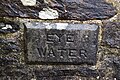 Eye Water Plaque, Bodmin (1).jpg 6,000 × 4,000; 13.59 MB
-
 Eye Water Plaque, Bodmin (2).jpg 6,000 × 4,000; 13.29 MB
-
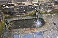 Eye Water, Bodmin.jpg 6,000 × 4,000; 13.48 MB
-
 Football match at Priory Park, Bodmin - geograph.org.uk - 2364650.jpg 1,600 × 1,200; 442 KB
-
 Former Military Camp Bodmin Cornwall - geograph.org.uk - 1062817.jpg 640 × 480; 77 KB
-
 Hellier Emblem.jpg 960 × 960; 40 KB
-
 Helliers 2019.jpg 960 × 720; 95 KB
-
 Helliers.jpg 1,437 × 960; 242 KB
-
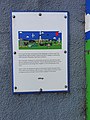
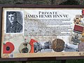
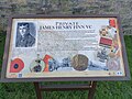 Infomation board, Finn VC Estate, Bodmin, Cornwall - January 2023.jpg 4,032 × 3,024; 4.63 MB
-
 Junction on Kirland Road - geograph.org.uk - 5251756.jpg 3,072 × 2,048; 1.16 MB
-
 New Milestone by the A389, Cooksland - geograph.org.uk - 5623197.jpg 480 × 640; 391 KB
-

-

-

-

-
-
 Old Wayside Cross (geograph 6653284).jpg 768 × 1,024; 290 KB
-
 Old Wayside Cross (geograph 6653312).jpg 720 × 960; 148 KB
-

-

-
 Origin of the name 'Finn VC Estate', Bodmin - geograph.org.uk - 4567004.jpg 1,280 × 956; 1.14 MB
-
 Path junction, Camel Trail - geograph.org.uk - 5421595.jpg 3,072 × 2,048; 1.77 MB
-
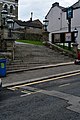
 Penbugle Lane - geograph.org.uk - 5492775.jpg 640 × 480; 75 KB
-
 Pond in Priory Park, Bodmin - geograph.org.uk - 2427579.jpg 640 × 480; 91 KB
-
 Pond in Priory Park, Bodmin - geograph.org.uk - 3342716.jpg 640 × 480; 110 KB
-
 Priory Park, home of Bodmin Town FC - geograph.org.uk - 2364644.jpg 1,600 × 1,200; 518 KB
-
 Royal Coat of Arms, Fore Street, Bodmin, Cornwall - January 2023.jpg 3,104 × 2,638; 837 KB
-
 Shelter on the Camel Trail - geograph.org.uk - 5195971.jpg 1,600 × 1,067; 1.04 MB
-
 Site of MPG Printgroup - geograph.org.uk - 5251554.jpg 3,072 × 1,512; 951 KB
-
 Slip road onto A30 northbound at Callywith - geograph.org.uk - 6017689.jpg 1,600 × 1,282; 730 KB
-
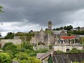
 St Lawrence - geograph.org.uk - 5254197.jpg 3,072 × 2,048; 1.11 MB
-
 St Lawrence Home Farm - geograph.org.uk - 3126875.jpg 640 × 427; 93 KB
-
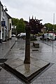
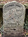
 Stone Cross - geograph.org.uk - 5203876.jpg 1,600 × 1,067; 600 KB
-
 Sunny Bank - geograph.org.uk - 5250436.jpg 3,072 × 2,048; 1.38 MB
-
 The Eye Well - geograph.org.uk - 2078911.jpg 640 × 480; 88 KB
-
 The site of Dunmere Junction - geograph.org.uk - 43650.jpg 640 × 427; 85 KB
-
 The state of religion in Bodmin, 3 - geograph.org.uk - 4387634.jpg 1,280 × 956; 1.08 MB
-
 Tollhouse by the A38 at Fourways, Bodmin - geograph.org.uk - 6076705.jpg 640 × 418; 107 KB
-
 Trafalgar Way plaque in Bodmin - geograph.org.uk - 2078927.jpg 479 × 640; 115 KB
-
 The mayor of Bodmin is escorted to the gallows to be hanged. Wellcome V0041763.jpg 3,269 × 2,324; 4.81 MB
-
 What sort of contest.......^ - geograph.org.uk - 381482.jpg 640 × 480; 89 KB
-
 Welcome to Bodmin - geograph.org.uk - 378812.jpg 640 × 480; 75 KB
-
 Wooden Post with Bracket Fungus - geograph.org.uk - 155250.jpg 427 × 640; 104 KB

_15.jpg)
_44.jpg)
_69.jpg)


.jpg)


.jpg)
.jpg)


.jpg)
.jpg)
.jpg)


