Category:Chaleur Bay
Jump to navigation
Jump to search
arm of the Gulf of Saint Lawrence located between Quebec and New Brunswick, Canada  | |||||
| Upload media | |||||
| Instance of | |||||
|---|---|---|---|---|---|
| Part of | |||||
| Location |
| ||||
| Inflows |
| ||||
| Different from | |||||
 | |||||
Subcategories
This category has the following 4 subcategories, out of 4 total.
M
- Miscou Island Lighthouse (25 F)
P
- Phare du Cap-Blanc (3 F)
Media in category "Chaleur Bay"
The following 98 files are in this category, out of 98 total.
-
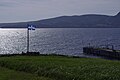
 Baie des Chaleurs, St-Omer - panoramio.jpg 2,560 × 1,920; 1.3 MB
-
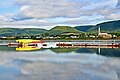
 Bonaventure,Quebec.JPG 1,728 × 1,152; 982 KB
-
 Carleton-sur-Mer (1).jpg 4,314 × 2,886; 9.77 MB
-
 Carleton-sur-Mer (2).jpg 4,288 × 2,848; 13.55 MB
-
 ChaleurBay23.jpg 300 × 202; 11 KB
-
 Entrée vers la Baie des Chaleurs - panoramio.jpg 3,840 × 2,400; 4.75 MB
-
 Heron Island in New Brunswick (Canada).JPG 909 × 682; 52 KB
-
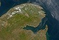
 ISS014-E-15415 - View of the Province of Quebec.jpg 3,032 × 2,064; 1.24 MB
-

-
-
 Mers111.jpg 1,920 × 1,080; 218 KB
-
 Mers112.jpg 1,920 × 1,080; 226 KB
-
 Mers113.jpg 1,920 × 1,080; 209 KB
-
 Mers114.jpg 1,920 × 1,080; 212 KB
-
 Mers119.jpg 1,920 × 1,080; 201 KB
-
 Mers120.jpg 1,920 × 1,080; 183 KB
-
 Mers121.jpg 1,920 × 1,080; 219 KB
-
 Mers122.jpg 1,920 × 1,080; 192 KB
-
 Mers123.jpg 1,920 × 1,080; 280 KB
-
 Mers124.jpg 1,920 × 1,080; 234 KB
-
 Mers125.jpg 1,920 × 1,080; 221 KB
-
 Mers126.jpg 1,920 × 1,080; 182 KB
-
 Mers127.jpg 1,920 × 1,080; 221 KB
-
 Mers128.jpg 1,920 × 1,080; 256 KB
-
 Mers129.jpg 1,920 × 1,080; 212 KB
-
 Mers130.jpg 1,920 × 1,080; 176 KB
-
 Mers131.jpg 1,920 × 1,080; 228 KB
-
 Mers132.jpg 1,920 × 1,080; 192 KB
-
 Mers133.jpg 1,920 × 1,080; 211 KB
-
 Mers134.jpg 1,920 × 1,080; 213 KB
-
 Mers135.jpg 1,920 × 1,080; 229 KB
-
 Mers136.jpg 1,920 × 1,080; 151 KB
-
 Mers137.jpg 1,920 × 1,080; 201 KB
-
 Mers138.jpg 1,920 × 1,080; 190 KB
-
 Mers143.jpg 1,920 × 1,080; 194 KB
-
 Mers144.jpg 1,920 × 1,080; 184 KB
-
 Mers145.jpg 1,920 × 1,080; 181 KB
-
 Mers146.jpg 1,920 × 1,080; 193 KB
-
 Mers147.jpg 1,920 × 1,080; 195 KB
-
 Mers149.jpg 1,920 × 1,080; 189 KB
-
 Mers150.jpg 1,920 × 1,080; 239 KB
-
 Mers151.jpg 1,920 × 1,080; 182 KB
-
 Mers152.jpg 1,920 × 1,080; 312 KB
-
 Mers153.jpg 1,920 × 1,080; 179 KB
-
 Mers154.jpg 1,920 × 1,080; 288 KB
-
 Mers155.jpg 1,920 × 1,080; 195 KB
-
 Mers156.jpg 1,920 × 1,080; 240 KB
-
 Mers157.jpg 1,920 × 1,080; 181 KB
-
 Mers158.jpg 1,920 × 1,080; 179 KB
-
 Mers159.jpg 1,920 × 1,080; 198 KB
-
 Mers160.jpg 1,920 × 1,080; 180 KB
-
 Mers161.jpg 1,920 × 1,080; 170 KB
-
 Mers162.jpg 1,920 × 1,080; 232 KB
-
 Mers163.jpg 1,920 × 1,080; 198 KB
-
 Mers164.jpg 1,920 × 1,080; 206 KB
-
 Mers165.jpg 1,920 × 1,080; 234 KB
-
 Mers166.jpg 1,920 × 1,080; 187 KB
-
 Mers167.jpg 1,920 × 1,080; 179 KB
-
 Mers168.jpg 1,920 × 1,080; 171 KB
-
 Mers169.jpg 1,920 × 1,080; 181 KB
-
 Mers170.jpg 1,920 × 1,080; 158 KB
-
 Mers171.jpg 1,920 × 1,080; 160 KB
-
 Mers172.jpg 1,920 × 1,080; 159 KB
-
 Mers173.jpg 1,920 × 1,080; 193 KB
-
 Mers174.jpg 1,920 × 1,080; 183 KB
-
 Mers175.jpg 1,920 × 1,080; 180 KB
-
 Mers176.jpg 1,920 × 1,080; 174 KB
-
 Mers177.jpg 1,920 × 1,080; 193 KB
-
 Mers178.jpg 1,920 × 1,080; 184 KB
-
 Mers179.jpg 1,920 × 1,080; 193 KB
-
 Mers180.jpg 1,920 × 1,080; 189 KB
-
 Mers181.jpg 1,920 × 1,080; 156 KB
-
 Mers182.jpg 1,920 × 1,080; 175 KB
-
 Mers183.jpg 1,920 × 1,080; 200 KB
-
 Mers184.jpg 1,920 × 1,080; 187 KB
-
 Mers185.jpg 1,920 × 1,080; 215 KB
-
 Mers186.jpg 1,920 × 1,080; 194 KB
-
 Mers187.jpg 1,920 × 1,080; 199 KB
-
 Mers188.jpg 1,920 × 1,080; 201 KB
-
 Mers189.jpg 1,920 × 1,080; 199 KB
-
 Mers190.jpg 1,920 × 1,080; 190 KB
-
 Mers191.jpg 1,920 × 1,080; 199 KB
-
 Mers192.jpg 1,920 × 1,080; 208 KB
-
 Mers193.jpg 1,920 × 1,080; 201 KB
-
 Mers194.jpg 1,920 × 1,080; 193 KB
-
 Mers195.jpg 1,920 × 1,080; 197 KB
-
 Mers196.jpg 1,920 × 1,080; 176 KB
-
 Mers197.jpg 1,920 × 1,080; 181 KB
-
 Mers198.jpg 1,920 × 1,080; 194 KB
-
 Mers199.jpg 1,920 × 1,080; 217 KB
-
 Mers200.jpg 1,920 × 1,080; 221 KB
-
 Mers201.jpg 1,920 × 1,080; 223 KB
-
 Mont Saint-Joseph, vue vers l'est.jpg 3,840 × 2,160; 1.08 MB
-
 Mont Saint-Joseph, vue vers le sud-ouest.jpg 3,840 × 1,526; 395 KB
-
Northern gannets (Sula bassana) behind a boat.webm 2 min 18 s, 1,280 × 720; 53.69 MB
-
 Passage à niveau à Chandler.jpg 4,288 × 3,216; 2.48 MB
-

-
 WV banner Chaleur Bay New Richmond Shoreline.jpg 2,100 × 300; 69 KB


.jpg)
.jpg)

.JPG)


