Category:Chaliyar River
Jump to navigation
Jump to search
river in India  | |||||
| Upload media | |||||
| Instance of | |||||
|---|---|---|---|---|---|
| Location | Kerala, India | ||||
| Length |
| ||||
| Mouth of the watercourse | |||||
| Tributary |
| ||||
 | |||||
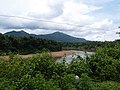
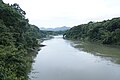
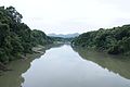
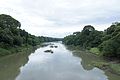
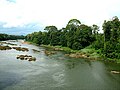
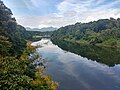
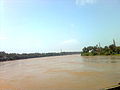
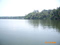
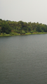
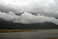
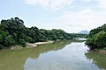
Chaliyar River (Malayalam: ചാലിയാർ) is the fourth longest river in Kerala at 169 km in length. The Chaliyar river is also known as Beypore River as it nears the Arabian Sea. The Chaliyar originates in the Western Ghats range at the Elambalari Hills in the Nilgiris district of Tamil Nadu and flows through Malappuram district for most of its length and then for around 17 km it forms the boundary between Malappuram and Kozhikode districts.
Subcategories
This category has the following 5 subcategories, out of 5 total.
Media in category "Chaliyar River"
The following 44 files are in this category, out of 44 total.
-
 Beauty of chaliyar.jpg 2,988 × 5,312; 5.52 MB
-
 Beypore Beach, Kozhikode, Kerala.jpg 1,120 × 840; 90 KB
-
 Beypore.jpg 1,000 × 750; 542 KB
-
 Branch of chaliyaar river.jpg 1,280 × 960; 598 KB
-
 Chaliar River Kerala (226716051).jpg 800 × 600; 66 KB
-
 Chaliyaar calicut bypass.JPG 3,264 × 2,448; 3.43 MB
-
 Chaliyam.jpg 3,264 × 1,836; 1.65 MB
-
 Chaliyar - Areekode Bridge.jpg 3,872 × 2,592; 2.28 MB
-
 Chaliyar - Rain (264506300).jpg 800 × 600; 53 KB
-
 Chaliyar Bypass Bridge Calicut (241659100).jpg 800 × 600; 41 KB
-
 Chaliyar Edavanna (251932360).jpg 800 × 600; 111 KB
-
 Chaliyar Kadavu before sunrise (239989737).jpg 3,264 × 2,448; 568 KB
-
 Chaliyar map.PNG 720 × 441; 166 KB
-
 Chaliyar river 0201.jpg 6,000 × 4,000; 14.19 MB
-
 Chaliyar river 0221.jpg 6,000 × 4,000; 15.06 MB
-
 Chaliyar river 0230.jpg 6,000 × 4,000; 11.44 MB
-
 Chaliyar river 0233.jpg 6,000 × 4,000; 11.56 MB
-
 Chaliyar river 0236.jpg 6,000 × 4,000; 11.5 MB
-
 Chaliyar river 0243.jpg 6,000 × 4,000; 13.47 MB
-
 Chaliyar river 0250.jpg 6,000 × 4,000; 12.38 MB
-
 Chaliyar River 1.jpg 640 × 480; 64 KB
-
 Chaliyar River at Feroke.jpg 4,032 × 3,024; 2.24 MB
-
 Chaliyar River at Nilambur.jpg 4,608 × 3,456; 2.7 MB
-
 Chaliyar River in Feroke.jpg 1,600 × 1,200; 215 KB
-
 Chaliyar River Nilambur.jpg 4,608 × 3,456; 2.1 MB
-
 Chaliyar River.jpg 500 × 375; 28 KB
-
 Chaliyar, edasserikadavu.png 1,080 × 1,920; 2.73 MB
-
 Chaliyar.JPG 2,048 × 1,536; 788 KB
-
 Chaliyar@edasserikadavu.png 1,080 × 1,920; 2.31 MB
-
 Iruvazhinji.jpg 640 × 480; 53 KB
-
 Kallai Puzha.jpg 2,560 × 1,536; 1.2 MB
-
 Kavanakkallu Bridge - Chaliyar River (269110069).jpg 800 × 600; 78 KB
-
 Misty Chuliyar - panoramio (cropped).jpg 1,458 × 208; 161 KB
-
 Misty Chuliyar - panoramio.jpg 1,458 × 974; 622 KB
-
 Misty Chuliyar with Nelli Hills - panoramio (1).jpg 1,458 × 974; 579 KB
-
 Misty Chuliyar with Nelli Hills - panoramio (2).jpg 1,458 × 974; 556 KB
-
 Misty Chuliyar with Nelli Hills - panoramio (3).jpg 1,458 × 974; 360 KB
-
 Misty Chuliyar with Nelli Hills - panoramio.jpg 1,458 × 974; 299 KB
-
 Nilambur teak forest 03812 - Chaliyar river.JPG 6,000 × 4,000; 15.41 MB
-
 River (239991214).jpg 800 × 600; 67 KB
-
 River (251932113).jpg 800 × 600; 101 KB
-
 River (2679612057).jpg 856 × 1,280; 166 KB
-
 River bank (913236622).jpg 1,600 × 1,200; 380 KB
-
 River Chaliyar.jpg 3,072 × 2,304; 3.15 MB


.jpg)


.jpg)
.jpg)
.jpg)
.jpg)


.jpg)

.jpg)
.jpg)
.jpg)


.jpg)
.jpg)
.jpg)
.jpg)

.jpg)