Category:City of Bradford
Jump to navigation
Jump to search
metropolitan borough with city status in West Yorkshire, England    | |||||
| Upload media | |||||
| Instance of |
| ||||
|---|---|---|---|---|---|
| Location | West Yorkshire, Yorkshire and the Humber, England | ||||
| Capital | |||||
| Legislative body |
| ||||
| Executive body |
| ||||
| Head of government |
| ||||
| Inception |
| ||||
| Population |
| ||||
| Area |
| ||||
| Replaces |
| ||||
| Different from | |||||
| official website | |||||
 | |||||
| Index: | * - A - B - C - D - E - F - G - H - I - J - K - L - M - N - O - P - Q - R - S - T - U - V - W - X - Y - Z 0–9 - a - b - c - d - e - f - g - h - i - j - k - l - m - n - o - p - q - r - s - t - u - v - w - x - y - z - ~ |

The City of Bradford is a local government district of West Yorkshire, England with the status of a city and metropolitan borough. It is named after its largest settlement, Bradford, but covers a far larger area which includes the towns of Keighley, Shipley, Bingley, Ilkley, Haworth, Silsden and Denholme.
Subcategories
This category has the following 45 subcategories, out of 45 total.
?
A
B
C
D
H
I
K
M
O
Q
S
T
Media in category "City of Bradford"
The following 87 files are in this category, out of 87 total.
-
 A big wheel outside City Hall, Bradford - geograph.org.uk - 6345648.jpg 1,229 × 2,000; 2.2 MB
-
 A snowy morning, Bridge Street, Bradford - geograph.org.uk - 6345647.jpg 1,831 × 2,000; 3.13 MB
-
 Abinger Close, off Rockwell Lane, Thorpe Edge - geograph.org.uk - 6336694.jpg 1,024 × 768; 123 KB
-
 Al Mahdi Mosque, Rees Way, Bradford - geograph.org.uk - 6341537.jpg 1,024 × 768; 122 KB
-

-
 Aysgarth House, Tunwell Lane, Eccleshill - geograph.org.uk - 6341468.jpg 1,024 × 768; 195 KB
-
 Best One, Stony Lane, Eccleshill - geograph.org.uk - 6336713.jpg 1,024 × 768; 181 KB
-
 Bhalla convenience store, Idle Road - geograph.org.uk - 6341493.jpg 1,024 × 768; 113 KB
-
 Brendan Court, Averingcliffe Road, Eccleshill - geograph.org.uk - 6336666.jpg 1,024 × 768; 135 KB
-
 B^M and Sainsbury's, Greengates - geograph.org.uk - 6336637.jpg 1,024 × 768; 103 KB
-
 Church of St John the Divine, Thorpe Edge - geograph.org.uk - 6336692.jpg 1,024 × 768; 111 KB
-
 City Park, Bradford - geograph.org.uk - 6346429.jpg 2,000 × 1,032; 1.76 MB
-
 City Park, Bradford, on a snowy morning - geograph.org.uk - 6344933.jpg 2,000 × 978; 1.29 MB
-
 Cottages on Stony Lane, Eccleshill - geograph.org.uk - 6336717.jpg 1,024 × 768; 142 KB
-
 Crag View, Thorpe Edge - geograph.org.uk - 6336673.jpg 1,024 × 768; 216 KB
-
 Croft Street, Bradford, in the snow - geograph.org.uk - 6344929.jpg 2,000 × 1,258; 1.75 MB
-
 Drummond Mill chimney, Lumb Lane, Bradford - geograph.org.uk - 6346425.jpg 2,000 × 1,760; 1.97 MB
-
 East Ward Labour Club, Otley Road, Bradford - geograph.org.uk - 6341531.jpg 1,024 × 768; 111 KB
-
 Eccleshill Mechanics Institute - geograph.org.uk - 6336725.jpg 1,024 × 768; 150 KB
-
 Eccleshill Pool - geograph.org.uk - 6336652.jpg 1,024 × 768; 132 KB
-
 Eccleshill recreation ground - geograph.org.uk - 6341464.jpg 1,024 × 768; 244 KB
-
 Eccleshill war memorial - geograph.org.uk - 6341459.jpg 1,024 × 767; 247 KB
-

-
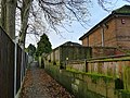
 Entrance to Undercliffe Cemetery, Otley Road - geograph.org.uk - 6341513.jpg 1,024 × 768; 168 KB
-
 Farrow Medical Centre, Otley Road, Bradford - geograph.org.uk - 6341529.jpg 1,024 × 768; 96 KB
-
 Footpath off Harrogate Road, Eccleshill - geograph.org.uk - 6336664.jpg 1,024 × 768; 281 KB
-

-

-
 Gingers and Choices, Acre Lane, Eccleshill - geograph.org.uk - 6341471.jpg 1,024 × 768; 113 KB
-
 Ginnel between Thorn Drive and Thorn Lane - geograph.org.uk - 6344928.jpg 1,548 × 2,000; 2.82 MB
-
 Ginnel between Thorn Lane and Thorn Drive - geograph.org.uk - 6345646.jpg 1,501 × 2,000; 2.81 MB
-
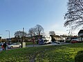 Greengates bus terminus - geograph.org.uk - 6336635.jpg 1,024 × 768; 207 KB
-
 Holybrook Avenue, off Harrogate Road, Greengates - geograph.org.uk - 6336649.jpg 1,024 × 768; 132 KB
-

-
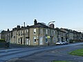
 Houses and shops, Harrogate Road, Greengates - geograph.org.uk - 6336642.jpg 1,024 × 768; 246 KB
-
 Houses on Stony Lane, Eccleshill - geograph.org.uk - 6336719.jpg 1,024 × 768; 136 KB
-
 Houses on Valley View Grove - geograph.org.uk - 6341507.jpg 1,024 × 768; 124 KB
-
 John Street, Bradford - geograph.org.uk - 6346428.jpg 2,000 × 1,936; 2.82 MB
-
 Kents Gym, Thornbridge Mews, Eccleshill - geograph.org.uk - 6341480.jpg 1,024 × 768; 88 KB
-
 Matalan, Harrogate Road, Greengates - geograph.org.uk - 6336645.jpg 1,024 × 768; 162 KB
-
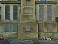 Names on the Eccleshill war memorial - geograph.org.uk - 6341460.jpg 1,024 × 768; 141 KB
-
 New housing, Victoria Road, Eccleshill - geograph.org.uk - 6336707.jpg 1,024 × 768; 94 KB
-
 Newsagent's kiosk in the snow, Centenary Square, Bradford - geograph.org.uk - 6344932.jpg 2,000 × 1,262; 2.03 MB
-
 Norfolk Gardens and City Hall, Bradford on a snowy morning - geograph.org.uk - 6344930.jpg 1,639 × 2,000; 2.67 MB
-
 Oxford Road, off Idle Road - geograph.org.uk - 6341509.jpg 768 × 1,024; 147 KB
-

-
 Peel Park Post Office - geograph.org.uk - 6341521.jpg 1,024 × 768; 99 KB
-
 Peel Park Terrace, off Idle Road - geograph.org.uk - 6341508.jpg 1,024 × 768; 131 KB
-
 Pevensey Garth, Rowantree Drive, Thorpe Edge - geograph.org.uk - 6336698.jpg 1,024 × 768; 177 KB
-
 Phone box on Otley Road - geograph.org.uk - 6341515.jpg 1,024 × 768; 129 KB
-
 Postbox on Idlethorp Way - geograph.org.uk - 6336681.jpg 1,024 × 768; 117 KB
-
 Raised pavement, Stony Lane, Eccleshill - geograph.org.uk - 6336712.jpg 1,024 × 768; 165 KB
-
 Remains of Drummond Mill, Lumb Lane, Bradford - geograph.org.uk - 6346426.jpg 2,000 × 1,337; 1.98 MB
-
 Rockwell Medical centre, Thorpe Edge - geograph.org.uk - 6336695.jpg 1,024 × 768; 177 KB
-
 Rosedale Fold, Thorpe Edge - geograph.org.uk - 6336674.jpg 1,024 × 768; 265 KB
-
 Round the back of Stone Hall Mill - geograph.org.uk - 6336735.jpg 1,024 × 768; 168 KB
-

-
 Shops on Undercliffe Road - geograph.org.uk - 6341488.jpg 1,024 × 768; 187 KB
-
 Site of Drummond Mill, Lumb Lane, Bradford - geograph.org.uk - 6346424.jpg 2,000 × 1,125; 1.72 MB
-
 Snow and a big wheel, Centenary Square, Bradford - geograph.org.uk - 6344931.jpg 1,256 × 2,000; 2.04 MB
-
 St Vincent's, Rees Way, Bradford - geograph.org.uk - 6341534.jpg 1,024 × 768; 125 KB
-
 St. Mary Magdalene Church, Bradford - geograph.org.uk - 6346423.jpg 2,000 × 887; 1.37 MB
-

-
 Stone Hall Mews, Eccleshill - geograph.org.uk - 6336736.jpg 1,024 × 768; 135 KB
-
 Stone Hall Mill (1) - geograph.org.uk - 6336733.jpg 1,024 × 768; 165 KB
-
 Stone Hall Mill (2) - geograph.org.uk - 6336734.jpg 1,024 × 768; 156 KB
-
 Super Food and Bradford Laser Cutting, Idle Road - geograph.org.uk - 6341496.jpg 1,024 × 768; 132 KB
-
 Super Food, Idle Road - detail - geograph.org.uk - 6341497.jpg 1,024 × 768; 163 KB
-
 Telephone exchange, Idle Road (1) - geograph.org.uk - 6341498.jpg 1,024 × 768; 119 KB
-
 Telephone exchange, Idle Road (2) - geograph.org.uk - 6341500.jpg 1,024 × 768; 227 KB
-
 The Barracks Tavern, Lumb Lane - geograph.org.uk - 6346427.jpg 2,000 × 963; 1.41 MB
-
 The Drive, off Harrogate Road, Greengates - geograph.org.uk - 6336651.jpg 1,024 × 768; 306 KB
-
 The former Hare and Hounds, Idle Road - geograph.org.uk - 6341505.jpg 1,024 × 768; 139 KB
-
 The Malt Kiln, Idle Road - geograph.org.uk - 6341503.jpg 1,024 × 768; 219 KB
-
 The Milners Arms, Undercliffe Road - geograph.org.uk - 6341492.jpg 1,024 × 768; 144 KB
-

-
 The Oddfellows' Arms, Eccleshill - geograph.org.uk - 6336656.jpg 1,024 × 768; 112 KB
-
 The Park Suite, Otley Road - geograph.org.uk - 6341518.jpg 1,024 × 768; 105 KB
-
 The White Hart, Victoria Road, Eccleshill - geograph.org.uk - 6336706.jpg 1,024 × 768; 162 KB
-
 Thornbridge Mews, Eccleshill - geograph.org.uk - 6341476.jpg 1,024 × 768; 90 KB
-
 Thorpe Edge Evangelical Church - geograph.org.uk - 6336671.jpg 1,024 × 768; 117 KB
-
 Through the arched window - geograph.org.uk - 6336731.jpg 480 × 639; 39 KB
-
 Tong Cemetery in the snow - geograph.org.uk - 6344939.jpg 2,000 × 1,074; 1.15 MB
-
 Tong Street, Bradford - geograph.org.uk - 6344936.jpg 2,000 × 1,296; 1.72 MB
-
 Tong Street, Bradford - geograph.org.uk - 6344937.jpg 2,000 × 962; 1.54 MB
-
 Ukrainian church, Stony Lane, Eccleshill - geograph.org.uk - 6336709.jpg 1,024 × 768; 143 KB
-
 Wellington Bob, Bromet Place, Eccleshill - geograph.org.uk - 6341482.jpg 1,024 × 768; 135 KB


_-_geograph.org.uk_-_6336733.jpg)
_-_geograph.org.uk_-_6336734.jpg)


_-_geograph.org.uk_-_6341498.jpg)
_-_geograph.org.uk_-_6341500.jpg)


