Category:Claddagh
Jump to navigation
Jump to search
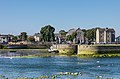
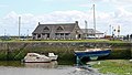
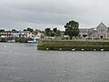
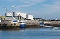
English: The Claddagh ( Irish: An Cladach - meaning, "a stony beach") is an area close to the centre of Galway city, where the Corrib River meets Galway Bay. It was formerly a fishing village, just outside the old city walls. It is just across the river from the Spanish Arch, which was the location of regular fish markets where the locals supplied the city with seafood as recently as the end of the 19th century. People have been gathering seafood and fishing from the area for millennia. It is one of the oldest former fishing villages in Ireland - its existence having been recorded since the arrival of Christianity in the 5th century.
Español: Claddagh es una localidad playera en la parte oeste de Galway en la isla de Irlanda. Sus lugareños han estado recolectando marisco y pescando en la zona durante milenios. Históricamente, su existencia ha sido reconocida desde la llegada de la cristiandad en el siglo V. El nombre está basado en la palabra irlandesa Cladach que significa Playa pedregosa. Es uno de los pueblos pesqueros más viejos del país.
Gaeilge: Is ceantar i gcathair na Gaillimhe é an Cladach. Nuair ba chathair le ballaí i seilbh Gallda í Gaillimh sna meánaoiseanna, ba é an Cladach an baile iascaireachta Gaelach thiar uaidh. Bhíodh rí ar an gCladach, a toghtaí imeasc na ndaoine, agus dheineadh sé breithiúnas ar chásanna idir na daoine. Sa Chladach, freisin, a thosaigh nós fáinne an Chladaigh, a d'iompraíodh mná i mbealaí éagsúla, ag brath ar a stádas cleamhnais.
日本語: クラダ( 英語:Claddagh, アイルランド語:An Cladach)はアイルランド共和国ゴールウェイ西部の海岸地域。歴史的にはキリスト教の伝来した5世紀から記録がみられる。地名はアイルランド語で「石の多い浜」を意味するcladachに由来。アイルランド最古の漁村の一つであった。
Nederlands: Claddagh ( Iers: An Claddagh) was tot in het begin van de twintigste eeuw een plaats in het Ierse graafschap County Galway. Tegenwoordig maakt het deel uit van de stad Galway.
Português: Claddagh (em irlandês: An Cladach, que significa "uma praia empedernida") é uma área próxima do centro da cidade de Galway, na Irlanda, onde o Rio Corrib desagua na Baía de Galway.
Русский: Кладдах (, от гэл. Cladach — «каменный пляж») — бывшая рыбацкая деревня в графстве Голуэй в Ирландии, известна как место появления первых кладдахских колец.
suburb of Galway City   | |||||
| Upload media | |||||
| Instance of | |||||
|---|---|---|---|---|---|
| Location | Galway, County Galway, Connacht, Ireland | ||||
| Population |
| ||||
| Elevation above sea level |
| ||||
 | |||||
Subcategories
This category has the following 2 subcategories, out of 2 total.
C
S
- St Mary's Church, Claddagh (2 F)
Media in category "Claddagh"
The following 72 files are in this category, out of 72 total.
-
 FRENCH(1891) p073 REPRESENTATIVES OF GLADDAGH.jpg 1,183 × 687; 536 KB
-
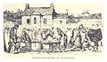
 FRENCH(1891) p074 KING OF GLADDAGH.jpg 761 × 955; 490 KB
-
 FRENCH(1891) p075 A GLADDAGH BOY MAKING TWINE.jpg 555 × 677; 228 KB
-
 FRENCH(1891) p076 THE MAIN STREET OF GLADDAGH..jpg 1,191 × 533; 440 KB
-
 Across River Corrib - geograph.org.uk - 4305976.jpg 800 × 530; 532 KB
-
 Aengus House - geograph.org.uk - 4305965.jpg 530 × 800; 524 KB
-

-
 Boat (6915172376).jpg 4,265 × 2,828; 7.72 MB
-
 Boats moored and aground at the Claddagh - panoramio.jpg 4,320 × 3,240; 2.55 MB
-
 Claddagh Lobster Pots (69082005).jpeg 1,600 × 1,201; 762 KB
-
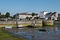
 Claddagh Quay - geograph.org.uk - 4303951.jpg 800 × 530; 452 KB
-
 Claddagh Quay - geograph.org.uk - 4303952.jpg 800 × 530; 536 KB
-
 Claddagh Quay - geograph.org.uk - 4303953.jpg 530 × 800; 466 KB
-
 Claddagh Quay - geograph.org.uk - 4304998.jpg 800 × 530; 445 KB
-
 Claddagh Quay - geograph.org.uk - 4305000.jpg 800 × 530; 534 KB
-
 Claddagh Quay - geograph.org.uk - 4305001.jpg 800 × 530; 417 KB
-
 Claddagh Quay - geograph.org.uk - 4305978.jpg 800 × 530; 508 KB
-
 Claddagh Quay - geograph.org.uk - 4305979.jpg 530 × 800; 477 KB
-
 Claddagh Quay - geograph.org.uk - 4305980.jpg 800 × 530; 473 KB
-
 Claddagh Quay, Galway (506168) (25775580303).jpg 5,284 × 3,523; 5.51 MB
-
 Claddagh Quay, Galway (506170) (25773464604).jpg 5,333 × 3,000; 4.04 MB
-
 Claddagh Quay, Galway (506174) (25785421333).jpg 2,823 × 4,235; 4 MB
-
 Claddagh Quay, Galway - panoramio (1).jpg 5,333 × 3,000; 4.01 MB
-
 Claddagh Quay, Galway - panoramio (2).jpg 5,284 × 3,523; 5.49 MB
-
 Claddagh Quay, Galway - panoramio.jpg 2,823 × 4,235; 3.98 MB
-
 El viajero ilustrado, 1878 602071 (3810558303).jpg 846 × 1,248; 360 KB
-
 Galway (6254034704).jpg 2,048 × 1,360; 1.68 MB
-
 Galway - Canal, Pedestrian Bridge ^ Square Tower - geograph.org.uk - 3027182.jpg 2,826 × 1,884; 3.63 MB
-
 Galway - Eglington Canal, Fisheries Tower, River Corrib - geograph.org.uk - 3109594.jpg 2,500 × 1,423; 2.44 MB
-
 Galway - Man ^ Dog - South of Wolfe Tone Bridge - geograph.org.uk - 3027139.jpg 2,373 × 1,582; 2.67 MB
-
 Galway - Nimmos Pier - Ard Bia Cafe - Restaurant - geograph.org.uk - 3027044.jpg 3,008 × 2,000; 4.8 MB
-

-
 Galway - River Corrib - Fisheries Tower - geograph.org.uk - 3105431.jpg 2,163 × 1,442; 1.77 MB
-
 Galway - River Corrib from Wolfe Tone Bridge - geograph.org.uk - 3027197.jpg 2,519 × 1,679; 2.9 MB
-
 Galway - River Corrib Walk - geograph.org.uk - 3029135.jpg 640 × 427; 144 KB
-
 Galway - River Corrib Walk - geograph.org.uk - 3029149.jpg 3,008 × 2,000; 3.9 MB
-
 Galway - River Corrib Walk - Security Gate - geograph.org.uk - 3029304.jpg 2,760 × 1,840; 4.39 MB
-
 Galway - River Corrib ^ O'Brien's Bridge - geograph.org.uk - 3107743.jpg 1,933 × 1,288; 1.48 MB
-
 Galway - Spanish Arch ^ Medieval Wall - SE Side - geograph.org.uk - 3027032.jpg 2,829 × 1,886; 4.45 MB
-

-

-
 Galway - View to The Long Walk from Canal Basin - geograph.org.uk - 4276143.jpg 1,024 × 768; 111 KB
-

-
 Galway - Wolfe Tone Bridge ^ River Corrib - geograph.org.uk - 3027122.jpg 2,421 × 1,614; 2.71 MB
-
 Galway City Museum - geograph.org.uk - 4312084.jpg 800 × 530; 518 KB
-
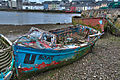
 Galway Hooker at Claddagh Quay - geograph.org.uk - 102451.jpg 640 × 480; 112 KB
-
 Gulls at Spanish Arch, Galway - geograph.org.uk - 2027013.jpg 3,072 × 2,304; 2.68 MB
-
 Harbor in Galway (6047433905).jpg 3,456 × 2,592; 1,018 KB
-
 In tow - geograph.org.uk - 4305964.jpg 800 × 530; 609 KB
-
 Looking towards the Spanish Arch, Galway - geograph.org.uk - 1878521.jpg 800 × 550; 102 KB
-

-
 New Docks - geograph.org.uk - 4305967.jpg 800 × 530; 454 KB
-
 New Docks - geograph.org.uk - 4305974.jpg 800 × 530; 432 KB
-
 River Corrib - geograph.org.uk - 4303943.jpg 800 × 530; 482 KB
-
 River Corrib - geograph.org.uk - 4305759.jpg 800 × 530; 398 KB
-
 River Corrib - geograph.org.uk - 4305977.jpg 800 × 530; 520 KB
-
 River Corrib - geograph.org.uk - 4311188.jpg 530 × 800; 465 KB
-
 River Corrib - geograph.org.uk - 4312185.jpg 800 × 530; 352 KB
-
 River Corrib and Wolf Tone Bridge - geograph.org.uk - 4932849.jpg 640 × 480; 258 KB
-
 Scrap metal pile - geograph.org.uk - 4305959.jpg 800 × 530; 488 KB
-
 Shrine - geograph.org.uk - 4312186.jpg 800 × 530; 676 KB
-
 The Claddagh Basin Galway, with the Long Walk in the background.jpg 4,496 × 3,000; 4.3 MB
-
 The Claddagh, Galway.jpg 450 × 301; 45 KB
-
 The Long Walk - geograph.org.uk - 4312081.jpg 800 × 530; 436 KB
-
 Towards Aengus House - geograph.org.uk - 4305002.jpg 800 × 530; 501 KB
-
 Towards Aengus House - geograph.org.uk - 4305751.jpg 800 × 530; 517 KB
-
 Towards Aengus House - geograph.org.uk - 4305971.jpg 800 × 530; 499 KB
-
 View of the Claddagh.tif 7,952 × 2,652; 60.37 MB
-
 Watch Tower - geograph.org.uk - 4311191.jpg 800 × 530; 410 KB
-
 Wedding photo - geograph.org.uk - 4312102.jpg 800 × 530; 498 KB
-
 Whitestrand Road, Lower Salthill, Galway City - geograph.org.uk - 3485313.jpg 1,024 × 670; 163 KB
-
 Wolfe Tone Bridge, Galway - geograph.org.uk - 2027266.jpg 2,600 × 2,140; 2.08 MB
_p073_REPRESENTATIVES_OF_GLADDAGH.jpg)
_p074_KING_OF_GLADDAGH.jpg)
_p075_A_GLADDAGH_BOY_MAKING_TWINE.jpg)
_p076_THE_MAIN_STREET_OF_GLADDAGH..jpg)


.jpg)

.jpeg)


_(25775580303).jpg)
_(25773464604).jpg)
_(25785421333).jpg)
.jpg)
.jpg)

.jpg)
.jpg)


.jpg)


