Category:Coast Guard Island
Jump to navigation
Jump to search
| Object location | | View all coordinates using: OpenStreetMap |
|---|
artificial island in Alameda County, California, United States  | |||||
| Upload media | |||||
| Instance of | |||||
|---|---|---|---|---|---|
| Location | Alameda County, California, Pacific States Region | ||||
| Located in or next to body of water | |||||
| Area |
| ||||
 | |||||
English: Category for files related to Coast Guard Island, also known as Coast Guard Base Alameda.
Media in category "Coast Guard Island"
The following 134 files are in this category, out of 134 total.
-
 Coast Guard Island.jpg 310 × 171; 20 KB
-
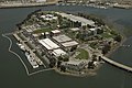
 Aerial view of Government Island in Oakland, California.jpg 3,264 × 2,448; 6 MB
-
 Coast Guard Island May 2009.jpg 3,872 × 2,592; 6.74 MB
-
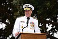
 11th District change of command ceremony 140605-G-XX113-3521.jpg 7,360 × 4,912; 12.55 MB
-
 11th District Women's Leadership Symposium 130327-G-AT057-019.jpg 3,309 × 2,160; 3.87 MB
-
 120331-G-ZX620-008 (6893433844).jpg 1,867 × 2,805; 2.07 MB
-
 2022 Coast Guard Pacific Area Change of Command 220708-G-LB502-1001.jpg 2,048 × 1,365; 1.15 MB
-
 2022 Coast Guard Pacific Area Change of Command 220708-G-LB502-1002.jpg 2,048 × 1,365; 1.91 MB
-
 2022 Coast Guard Pacific Area Change of Command 220708-G-LB502-1003.jpg 2,048 × 1,365; 747 KB
-
 2022 Coast Guard Pacific Area Change of Command 220708-G-LB502-1004.jpg 2,048 × 1,365; 864 KB
-
 2022 Coast Guard Pacific Area Change of Command 220708-G-LB502-1005.jpg 2,048 × 1,365; 798 KB
-
 2022 Coast Guard Pacific Area Change of Command 220708-G-LB502-1006.jpg 2,048 × 1,365; 1.37 MB
-
 21-Gun Salute – Division- West – Seed- 16 (25256473573).jpg 7,360 × 4,912; 13.63 MB
-
 Alameda Island and Oakland.jpg 4,032 × 1,908; 3.03 MB
-
 CGC Bertholf returns to homeport 130904-G-DN217-035.jpg 2,289 × 1,500; 2.55 MB
-
 Coast Guard Cutter Bertholf Arrives Home (2696892177).jpg 1,500 × 991; 1.23 MB
-
 Coast Guard Cutter Bertholf Commissioning (2734305384).jpg 1,936 × 1,296; 273 KB
-
 Coast Guard Cutter Bertholf DVIDS1089627.jpg 2,450 × 1,750; 1.76 MB
-
 Coast Guard Cutter Bertholf returns after 140-day deployment 140811-G-US251-711.jpg 2,592 × 2,592; 996 KB
-
 Coast Guard Cutter Bertholf returns home DVIDS1099226.jpg 4,288 × 2,848; 899 KB
-
 Coast Guard Cutter Jarvis decommissioning and transfer ceremony (8795808433).jpg 2,784 × 1,848; 569 KB
-
 Coast Guard Cutter Jarvis decommissioning and transfer ceremony (8795810235).jpg 2,784 × 1,848; 625 KB
-
 Coast Guard Cutter Jarvis decommissioning and transfer ceremony (8795811673).jpg 2,278 × 1,627; 479 KB
-
 Coast Guard Cutter Jarvis decommissioning and transfer ceremony (8806387562).jpg 2,784 × 1,848; 540 KB
-
 Coast Guard Cutter Jarvis decommissioning and transfer ceremony (8806393648).jpg 2,236 × 1,597; 371 KB
-
 Coast Guard Cutter returns to home 160422-G-AT057-176.jpg 7,360 × 4,912; 1.11 MB
-
 Coast Guard Cutter returns to homeport 160422-G-AT057-036.jpg 7,360 × 4,912; 1.02 MB
-
 Coast Guard Island Celebrates Black History Month DVIDS1085618.jpg 1,200 × 857; 837 KB
-
 Coast Guard Pacific Area holds change of command ceremony 210630-G-HR768-0082.jpg 6,016 × 4,016; 6.74 MB
-
 Coast Guard Pacific Area holds change of command ceremony 210630-G-HR768-0087.jpg 6,016 × 4,016; 4.76 MB
-
 Coast Guard Pacific Area holds change of command ceremony 210630-G-HR768-0095.jpg 6,016 × 4,016; 4.93 MB
-
 Coast Guard Pacific Area holds change of command ceremony 210630-G-HR768-0123.jpg 6,016 × 4,016; 4.13 MB
-
 Coast Guard Pacific Area holds change of command ceremony 210630-G-HR768-0136.jpg 6,016 × 4,016; 7.04 MB
-
 Coast Guard Pacific Area holds change of command ceremony 210630-G-HR768-0150.jpg 6,016 × 4,016; 3.72 MB
-
 Coast Guard Pacific Area holds change of command ceremony 210630-G-HR768-0207.jpg 6,016 × 4,016; 7.79 MB
-
 Coast Guard Pacific Area holds change-of-command ceremony 180608-G-DX668-1214.jpg 7,360 × 4,912; 7.31 MB
-
 Coast Guard Pacific Area holds change-of-command ceremony 180608-G-DX668-1309.jpg 7,360 × 4,912; 8.42 MB
-
 Coast Guard Pacific Area receives new commander 140422-G-AT057-285.jpg 3,117 × 1,896; 508 KB
-
 District 11 Change of Command 160707-G-AT057-009.jpg 7,360 × 4,912; 2.68 MB
-
 District 11 Change of Command DVIDS1083507.jpg 2,450 × 1,750; 3.38 MB
-
 Explosives Detector (33585083026).jpg 2,410 × 1,608; 2.33 MB
-

-
 Following Mom – Division- West – Seed- 8 (25584611410).jpg 7,360 × 4,912; 4.77 MB
-
 Former 11th District commander carries his district admiral flag 140605-G-XX113-3624.jpg 4,912 × 7,232; 11.27 MB
-

-

-

-

-

-

-
 Kaman K-MAX during trials at Oakland 1999.JPEG 3,000 × 2,000; 1.43 MB
-
 Man the Rails (2734304770).jpg 1,936 × 1,296; 492 KB
-
 Michelle Obama at Stratton Commissioning 120331-G-ZU774-008.jpg 2,100 × 1,500; 575 KB
-
 Michelle Obama at Stratton Commissioning 120331-G-ZU774-009.jpg 2,100 × 1,500; 482 KB
-
-
 Northern California Combined Federal Campaign 111004-G-AW789-017.jpg 2,634 × 1,604; 1.18 MB
-
 Pacific Area Change of Command DVIDS280421.jpg 2,124 × 1,978; 932 KB
-
 Pacific Area Change of Command DVIDS280424.jpg 2,848 × 4,288; 1.56 MB
-
 Pacific Area Command welcomes new commander 160815-G-AT057-104.jpg 4,912 × 7,360; 1.71 MB
-
 Pacific Area Command welcomes new commander 160815-G-AT057-162.jpg 7,360 × 4,912; 1.78 MB
-
 Shallow Water Egress Training -- 081202-G-9417H-047 DVIDS1089500.jpg 2,000 × 3,008; 1.71 MB
-

-

-
-

-
-

-
-

-

-

-
-

-

-

-

-

-

-

-

-
-

-

-
-
-

-

-

-

-

-

-

-
-

-
-

-

-
-

-

-

-
-

-

-

-
-

-

-

-

-

-

-

-

-
-

-

-

-
-

-

-
-

-

-
-
 USCG Bomb dog Ricky, wearing doggles, for a helicopter exercise 170816-G-RU729-882.jpg 6,000 × 4,000; 8.58 MB
-
 USCG Cutter Bertholf Ready to Sail (2733474879).jpg 1,354 × 898; 93 KB
-
 USCG National Security Cutter.jpg 800 × 315; 65 KB
-
 USCGC Bertholf returns to homeport after first operational patrol DVIDS1099227.jpg 3,489 × 2,317; 2.27 MB
-
 USCGC Bertholf returns to homeport after first operational patrol DVIDS1099228.jpg 4,288 × 2,848; 1.38 MB
-
 USCGC Bertholf returns to homeport after first operational patrol DVIDS1099229.jpg 4,288 × 2,848; 1.02 MB
-
 USCoastGuardCocaineApr23.07.jpg 3,008 × 2,000; 824 KB
-
 Week in the Life 2015, Tuesday, CGC Henry Blake 150929-G-YG480-895.jpg 5,520 × 3,680; 7.72 MB
-


.jpg)


.jpg)


.jpg)
.jpg)


.jpg)

.jpg)


.jpg)


_during_a_change_of_command_ceremony_at_Coast_Guard_Island_in_Alameda,_Calif.,_March_15_130315-G-AT057-001.jpg)
_Secretary_Alejandro_Mayorkas_Tours_USCGC_Stratton_Coast_Guard_Island_Alameda,_California_on_November_3,_2023_-_1.jpg)
_Secretary_Alejandro_Mayorkas_Tours_USCGC_Stratton_Coast_Guard_Island_Alameda,_California_on_November_3,_2023_-_10.jpg)
_Secretary_Alejandro_Mayorkas_Tours_USCGC_Stratton_Coast_Guard_Island_Alameda,_California_on_November_3,_2023_-_11.jpg)
_Secretary_Alejandro_Mayorkas_Tours_USCGC_Stratton_Coast_Guard_Island_Alameda,_California_on_November_3,_2023_-_12.jpg)
_Secretary_Alejandro_Mayorkas_Tours_USCGC_Stratton_Coast_Guard_Island_Alameda,_California_on_November_3,_2023_-_13.jpg)
_Secretary_Alejandro_Mayorkas_Tours_USCGC_Stratton_Coast_Guard_Island_Alameda,_California_on_November_3,_2023_-_14.jpg)
_Secretary_Alejandro_Mayorkas_Tours_USCGC_Stratton_Coast_Guard_Island_Alameda,_California_on_November_3,_2023_-_15.jpg)
_Secretary_Alejandro_Mayorkas_Tours_USCGC_Stratton_Coast_Guard_Island_Alameda,_California_on_November_3,_2023_-_16.jpg)
_Secretary_Alejandro_Mayorkas_Tours_USCGC_Stratton_Coast_Guard_Island_Alameda,_California_on_November_3,_2023_-_17.jpg)
_Secretary_Alejandro_Mayorkas_Tours_USCGC_Stratton_Coast_Guard_Island_Alameda,_California_on_November_3,_2023_-_18.jpg)
_Secretary_Alejandro_Mayorkas_Tours_USCGC_Stratton_Coast_Guard_Island_Alameda,_California_on_November_3,_2023_-_19.jpg)
_Secretary_Alejandro_Mayorkas_Tours_USCGC_Stratton_Coast_Guard_Island_Alameda,_California_on_November_3,_2023_-_2.jpg)
_Secretary_Alejandro_Mayorkas_Tours_USCGC_Stratton_Coast_Guard_Island_Alameda,_California_on_November_3,_2023_-_20.jpg)
_Secretary_Alejandro_Mayorkas_Tours_USCGC_Stratton_Coast_Guard_Island_Alameda,_California_on_November_3,_2023_-_21.jpg)
_Secretary_Alejandro_Mayorkas_Tours_USCGC_Stratton_Coast_Guard_Island_Alameda,_California_on_November_3,_2023_-_22.jpg)
_Secretary_Alejandro_Mayorkas_Tours_USCGC_Stratton_Coast_Guard_Island_Alameda,_California_on_November_3,_2023_-_23.jpg)
_Secretary_Alejandro_Mayorkas_Tours_USCGC_Stratton_Coast_Guard_Island_Alameda,_California_on_November_3,_2023_-_24.jpg)
_Secretary_Alejandro_Mayorkas_Tours_USCGC_Stratton_Coast_Guard_Island_Alameda,_California_on_November_3,_2023_-_25.jpg)
_Secretary_Alejandro_Mayorkas_Tours_USCGC_Stratton_Coast_Guard_Island_Alameda,_California_on_November_3,_2023_-_26.jpg)
_Secretary_Alejandro_Mayorkas_Tours_USCGC_Stratton_Coast_Guard_Island_Alameda,_California_on_November_3,_2023_-_27.jpg)
_Secretary_Alejandro_Mayorkas_Tours_USCGC_Stratton_Coast_Guard_Island_Alameda,_California_on_November_3,_2023_-_28.jpg)
_Secretary_Alejandro_Mayorkas_Tours_USCGC_Stratton_Coast_Guard_Island_Alameda,_California_on_November_3,_2023_-_29.jpg)
_Secretary_Alejandro_Mayorkas_Tours_USCGC_Stratton_Coast_Guard_Island_Alameda,_California_on_November_3,_2023_-_3.jpg)
_Secretary_Alejandro_Mayorkas_Tours_USCGC_Stratton_Coast_Guard_Island_Alameda,_California_on_November_3,_2023_-_30.jpg)
_Secretary_Alejandro_Mayorkas_Tours_USCGC_Stratton_Coast_Guard_Island_Alameda,_California_on_November_3,_2023_-_31.jpg)
_Secretary_Alejandro_Mayorkas_Tours_USCGC_Stratton_Coast_Guard_Island_Alameda,_California_on_November_3,_2023_-_32.jpg)
_Secretary_Alejandro_Mayorkas_Tours_USCGC_Stratton_Coast_Guard_Island_Alameda,_California_on_November_3,_2023_-_33.jpg)
_Secretary_Alejandro_Mayorkas_Tours_USCGC_Stratton_Coast_Guard_Island_Alameda,_California_on_November_3,_2023_-_34.jpg)
_Secretary_Alejandro_Mayorkas_Tours_USCGC_Stratton_Coast_Guard_Island_Alameda,_California_on_November_3,_2023_-_35.jpg)
_Secretary_Alejandro_Mayorkas_Tours_USCGC_Stratton_Coast_Guard_Island_Alameda,_California_on_November_3,_2023_-_36.jpg)
_Secretary_Alejandro_Mayorkas_Tours_USCGC_Stratton_Coast_Guard_Island_Alameda,_California_on_November_3,_2023_-_37.jpg)
_Secretary_Alejandro_Mayorkas_Tours_USCGC_Stratton_Coast_Guard_Island_Alameda,_California_on_November_3,_2023_-_38.jpg)
_Secretary_Alejandro_Mayorkas_Tours_USCGC_Stratton_Coast_Guard_Island_Alameda,_California_on_November_3,_2023_-_39.jpg)
_Secretary_Alejandro_Mayorkas_Tours_USCGC_Stratton_Coast_Guard_Island_Alameda,_California_on_November_3,_2023_-_4.jpg)
_Secretary_Alejandro_Mayorkas_Tours_USCGC_Stratton_Coast_Guard_Island_Alameda,_California_on_November_3,_2023_-_40.jpg)
_Secretary_Alejandro_Mayorkas_Tours_USCGC_Stratton_Coast_Guard_Island_Alameda,_California_on_November_3,_2023_-_41.jpg)
_Secretary_Alejandro_Mayorkas_Tours_USCGC_Stratton_Coast_Guard_Island_Alameda,_California_on_November_3,_2023_-_42.jpg)
_Secretary_Alejandro_Mayorkas_Tours_USCGC_Stratton_Coast_Guard_Island_Alameda,_California_on_November_3,_2023_-_43.jpg)
_Secretary_Alejandro_Mayorkas_Tours_USCGC_Stratton_Coast_Guard_Island_Alameda,_California_on_November_3,_2023_-_44.jpg)
_Secretary_Alejandro_Mayorkas_Tours_USCGC_Stratton_Coast_Guard_Island_Alameda,_California_on_November_3,_2023_-_45.jpg)
_Secretary_Alejandro_Mayorkas_Tours_USCGC_Stratton_Coast_Guard_Island_Alameda,_California_on_November_3,_2023_-_46.jpg)
_Secretary_Alejandro_Mayorkas_Tours_USCGC_Stratton_Coast_Guard_Island_Alameda,_California_on_November_3,_2023_-_47.jpg)
_Secretary_Alejandro_Mayorkas_Tours_USCGC_Stratton_Coast_Guard_Island_Alameda,_California_on_November_3,_2023_-_48.jpg)
_Secretary_Alejandro_Mayorkas_Tours_USCGC_Stratton_Coast_Guard_Island_Alameda,_California_on_November_3,_2023_-_49.jpg)
_Secretary_Alejandro_Mayorkas_Tours_USCGC_Stratton_Coast_Guard_Island_Alameda,_California_on_November_3,_2023_-_5.jpg)
_Secretary_Alejandro_Mayorkas_Tours_USCGC_Stratton_Coast_Guard_Island_Alameda,_California_on_November_3,_2023_-_50.jpg)
_Secretary_Alejandro_Mayorkas_Tours_USCGC_Stratton_Coast_Guard_Island_Alameda,_California_on_November_3,_2023_-_51.jpg)
_Secretary_Alejandro_Mayorkas_Tours_USCGC_Stratton_Coast_Guard_Island_Alameda,_California_on_November_3,_2023_-_52.jpg)
_Secretary_Alejandro_Mayorkas_Tours_USCGC_Stratton_Coast_Guard_Island_Alameda,_California_on_November_3,_2023_-_53.jpg)
_Secretary_Alejandro_Mayorkas_Tours_USCGC_Stratton_Coast_Guard_Island_Alameda,_California_on_November_3,_2023_-_54.jpg)
_Secretary_Alejandro_Mayorkas_Tours_USCGC_Stratton_Coast_Guard_Island_Alameda,_California_on_November_3,_2023_-_55.jpg)
_Secretary_Alejandro_Mayorkas_Tours_USCGC_Stratton_Coast_Guard_Island_Alameda,_California_on_November_3,_2023_-_56.jpg)
_Secretary_Alejandro_Mayorkas_Tours_USCGC_Stratton_Coast_Guard_Island_Alameda,_California_on_November_3,_2023_-_57.jpg)
_Secretary_Alejandro_Mayorkas_Tours_USCGC_Stratton_Coast_Guard_Island_Alameda,_California_on_November_3,_2023_-_58.jpg)
_Secretary_Alejandro_Mayorkas_Tours_USCGC_Stratton_Coast_Guard_Island_Alameda,_California_on_November_3,_2023_-_59.jpg)
_Secretary_Alejandro_Mayorkas_Tours_USCGC_Stratton_Coast_Guard_Island_Alameda,_California_on_November_3,_2023_-_6.jpg)
_Secretary_Alejandro_Mayorkas_Tours_USCGC_Stratton_Coast_Guard_Island_Alameda,_California_on_November_3,_2023_-_60.jpg)
_Secretary_Alejandro_Mayorkas_Tours_USCGC_Stratton_Coast_Guard_Island_Alameda,_California_on_November_3,_2023_-_61.jpg)
_Secretary_Alejandro_Mayorkas_Tours_USCGC_Stratton_Coast_Guard_Island_Alameda,_California_on_November_3,_2023_-_62.jpg)
_Secretary_Alejandro_Mayorkas_Tours_USCGC_Stratton_Coast_Guard_Island_Alameda,_California_on_November_3,_2023_-_7.jpg)
_Secretary_Alejandro_Mayorkas_Tours_USCGC_Stratton_Coast_Guard_Island_Alameda,_California_on_November_3,_2023_-_8.jpg)
_Secretary_Alejandro_Mayorkas_Tours_USCGC_Stratton_Coast_Guard_Island_Alameda,_California_on_November_3,_2023_-_9.jpg)

.jpg)


.jpg)
.jpg)
.jpg)
.jpg)
.jpg)