Category:Consett
Jump to navigation
Jump to search
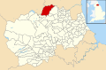
town in County Durham, UK  .png) | |||||
| Upload media | |||||
| Instance of | |||||
|---|---|---|---|---|---|
| Location | County Durham, North East England, England | ||||
 | |||||
Български: 300px|мини|Панорамен изглед от Консет
English: Consett is a town in the northwest of County Durham, England.
Nederlands: Consett is een plaats in het bestuurlijke gebied Derwentside, in het Engelse graafschap Durham. De plaats telt 27.394 inwoners.
Română: Consett este un oraş în comitatul County Durham, regiunea North East, Anglia. Oraşul se află în districtul Derwentside a cărui reşedinţă este.
Subcategories
This category has the following 14 subcategories, out of 14 total.
B
- Blackhill railway station (2 F)
C
- Consett railway station (4 F)
- Consett War Memorial (1 F)
F
- Footpaths in Consett (3 F)
H
- Hamsterley, Consett (24 F)
M
N
- Nookton Burn (29 F)
S
- Shotley Grove (5 F)
Media in category "Consett"
The following 200 files are in this category, out of 467 total.
(previous page) (next page)-
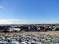
 A snowbound town centre in Consett - geograph.org.uk - 5698877.jpg 4,608 × 3,456; 3.44 MB
-
 Allensford - geograph.org.uk - 1957155.jpg 2,511 × 3,833; 1.65 MB
-
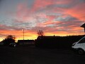 Allison Gardens at sunset - geograph.org.uk - 5210970.jpg 4,608 × 3,456; 4.49 MB
-
 Allotment Gardens - geograph.org.uk - 4010392.jpg 640 × 480; 92 KB
-
 Armistice Day Parade in Consett - geograph.org.uk - 5975727.jpg 4,368 × 3,275; 2.17 MB
-
 Autumn colours along the railway walk - geograph.org.uk - 5199925.jpg 4,095 × 3,090; 7.23 MB
-
 Autumn view over Blackhill - geograph.org.uk - 5976452.jpg 4,304 × 3,227; 2.68 MB
-
 Aynsley Terrace, Consett, in the snow - geograph.org.uk - 5615935.jpg 4,368 × 3,275; 2.91 MB
-
 B6310, Shotley Bridge - geograph.org.uk - 4894618.jpg 640 × 457; 65 KB
-
 Back Street - geograph.org.uk - 2392767.jpg 427 × 640; 248 KB
-
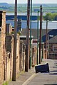
 Back street in Benfieldside - geograph.org.uk - 5637601.jpg 4,304 × 3,227; 2.62 MB
-
 Back street in Consett - geograph.org.uk - 3943224.jpg 1,600 × 1,600; 526 KB
-
 Balfour Street in the snow - geograph.org.uk - 5693190.jpg 4,608 × 3,456; 5.31 MB
-
 Bandstand at Blackhill ^ Consett Park - geograph.org.uk - 5142260.jpg 1,500 × 998; 1.16 MB
-
-
 Beef cattle with a bull - geograph.org.uk - 5577046.jpg 3,070 × 2,304; 2.48 MB
-
 Bench seat in the wall - geograph.org.uk - 5638349.jpg 4,608 × 3,456; 5.05 MB
-
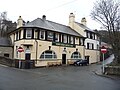
 Benchmark on The Cricketers public house - geograph.org.uk - 4202645.jpg 1,024 × 734; 202 KB
-
 Benfieldside Cemetery - geograph.org.uk - 5146534.jpg 1,500 × 1,125; 1.84 MB
-
 Berry Edge Farm - geograph.org.uk - 2875140.jpg 3,264 × 2,448; 1.61 MB
-
 Bessemer Street, Blackhill - geograph.org.uk - 5588045.jpg 4,608 × 3,456; 5.92 MB
-
 Blackhill Baptist Church - geograph.org.uk - 5636863.jpg 4,608 × 3,456; 3.28 MB
-
 Blackhill Park in the snow - geograph.org.uk - 5255016.jpg 4,608 × 3,456; 7.36 MB
-
 Bottom of Church Bank, Shotley Bridge - geograph.org.uk - 5638436.jpg 4,608 × 3,456; 3.62 MB
-
 Bradley Workshops Industrial Estate - geograph.org.uk - 5213883.jpg 4,608 × 3,456; 5.22 MB
-
 Bridge at Shotley Station - geograph.org.uk - 5620733.jpg 4,608 × 3,456; 5.6 MB
-
 Bridge over the Dene Burn on Pemberton Road - geograph.org.uk - 2934354.jpg 4,608 × 3,456; 5.77 MB
-
 Bridge over the Derwent Walk - geograph.org.uk - 4972206.jpg 4,050 × 3,044; 7.18 MB
-

-
 Builders merchants at Templetown - geograph.org.uk - 4811648.jpg 4,470 × 3,264; 5.08 MB
-

-
 Bus turning at Selby Lodge, The Grove - geograph.org.uk - 5876879.jpg 4,608 × 3,456; 6.14 MB
-
 Buses at the depot at Hownsgill Park - geograph.org.uk - 6138938.jpg 3,711 × 2,723; 1.31 MB
-
 C2C at Consett - geograph.org.uk - 3224249.jpg 640 × 480; 120 KB
-
 C2C at Consett - geograph.org.uk - 3871737.jpg 640 × 480; 86 KB
-
 C2C at Leadgate - geograph.org.uk - 3871755.jpg 640 × 480; 86 KB
-
 Cambridge Avenue, Moorside - geograph.org.uk - 5580018.jpg 4,600 × 3,446; 4.26 MB
-
 Car park, Shotley Bridge Hospital - geograph.org.uk - 5722794.jpg 640 × 480; 54 KB
-
 Caribees Plantation - geograph.org.uk - 2929058.jpg 3,264 × 2,448; 2.05 MB
-
 Cattle in snow by Brooms Farm at sunset - geograph.org.uk - 1631584.jpg 640 × 448; 104 KB
-

-
 Church Road, Blackhill - geograph.org.uk - 3652572.jpg 2,000 × 1,355; 549 KB
-

-
 Consett - Terris Novalis sculpture - geograph.org.uk - 6010680.jpg 2,920 × 5,184; 3.59 MB
-
 Consett Academy - geograph.org.uk - 5214145.jpg 3,498 × 2,434; 3.72 MB
-
-
 Consett and Sunderland Railway Path - geograph.org.uk - 4802890.jpg 1,500 × 1,000; 1.99 MB
-
 Consett Bus Station - geograph.org.uk - 510393.jpg 480 × 640; 359 KB
-
 Consett Business Park - geograph.org.uk - 5214115.jpg 4,512 × 3,326; 4.32 MB
-
 Consett fire station - geograph.org.uk - 2022508.jpg 640 × 427; 187 KB
-
 Consett Football Club - geograph.org.uk - 3971310.jpg 4,608 × 3,456; 5.57 MB
-
 Consett from the air - geograph.org.uk - 5767100.jpg 640 × 450; 147 KB
-
 Consett Gospel Hall - geograph.org.uk - 2392769.jpg 640 × 427; 250 KB
-

-
 Consett Number One Club - geograph.org.uk - 1419435.jpg 640 × 480; 147 KB
-
 Consett Park Bowling Club - geograph.org.uk - 3944100.jpg 1,600 × 1,200; 362 KB
-
 Consett Park housing development - geograph.org.uk - 643651.jpg 640 × 480; 100 KB
-
 Consett Police Station - geograph.org.uk - 5435718.jpg 4,608 × 3,456; 7.32 MB
-
 Consett Police Station - geograph.org.uk - 6310668.jpg 4,503 × 3,377; 3.3 MB
-

-
 Consett unparished area UK locator map.svg 1,425 × 934; 1.75 MB
-
 Consett ^ Sunderland Railway Path - geograph.org.uk - 2244820.jpg 2,000 × 1,169; 2.15 MB
-
 Consett ^ Sunderland Railway Path - geograph.org.uk - 2392755.jpg 640 × 427; 292 KB
-
 Consett-Blackhill Park - geograph.org.uk - 33097.jpg 640 × 430; 435 KB
-
 Consett-panorama.jpg 640 × 386; 117 KB
-
 Constance Street - geograph.org.uk - 2392765.jpg 640 × 427; 275 KB
-
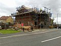
 Construction site, Consett - geograph.org.uk - 3944213.jpg 1,600 × 1,200; 477 KB
-
 Converted apartments, Blackhill - geograph.org.uk - 5975771.jpg 4,439 × 3,329; 3.06 MB
-
 Converted buildings at Little Greencroft farm - geograph.org.uk - 5940373.jpg 4,415 × 3,311; 2.78 MB
-
 Converted buildings at Snow's Green Farm - geograph.org.uk - 5288839.jpg 4,608 × 3,456; 6.53 MB
-
 Converted farm buildings at Bridgehill - geograph.org.uk - 4767426.jpg 4,394 × 3,150; 3.79 MB
-
 Copse beside Consett Rugby Club - geograph.org.uk - 5435750.jpg 4,608 × 3,456; 6.89 MB
-
 Corrugated metal barn at West Knitsley Grange - geograph.org.uk - 4734350.jpg 1,500 × 1,000; 1.5 MB
-
 Cottages at Crookhall - geograph.org.uk - 2952287.jpg 4,608 × 3,456; 5.52 MB
-
 Cottages at Shotley Grove - geograph.org.uk - 4811831.jpg 3,719 × 2,771; 5.74 MB
-
 Cows and calves - geograph.org.uk - 5434296.jpg 4,608 × 3,456; 5.71 MB
-
 Cows beside West Law Road - geograph.org.uk - 6142619.jpg 4,421 × 3,315; 2.25 MB
-
 Crookhall Farm, Consett - geograph.org.uk - 3858472.jpg 4,394 × 3,150; 4.27 MB
-

-
 Cut bench mark, Medomsley Road - geograph.org.uk - 3496396.jpg 1,296 × 1,732; 782 KB
-
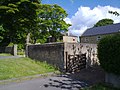
 Cutler's Hall, Shotley Bridge - geograph.org.uk - 4908232.jpg 4,608 × 3,456; 5.34 MB
-

-

-
 Cycleway at Blackhill - geograph.org.uk - 3867762.jpg 640 × 480; 71 KB
-
 Cycleway signpost at Lydgett's Junction - geograph.org.uk - 3844536.jpg 480 × 640; 136 KB
-
 Cyril Street, Consett - geograph.org.uk - 643638.jpg 640 × 480; 90 KB
-
 Dale Street - geograph.org.uk - 4010385.jpg 640 × 480; 51 KB
-
 Defaced EU symbol, Consett.jpg 4,160 × 3,120; 5.38 MB
-
 Delves Cottages, Consett - geograph.org.uk - 2090037.jpg 640 × 480; 82 KB
-
 Delves Lane, Consett - geograph.org.uk - 2090065.jpg 640 × 480; 64 KB
-
 Dene Burn near Allensford - geograph.org.uk - 6141402.jpg 4,608 × 3,456; 5.74 MB
-
 Dene Burn, Moorside - geograph.org.uk - 4767643.jpg 3,770 × 3,064; 7.8 MB
-
-

-

-
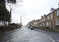
 Durham Road, Blackhill - geograph.org.uk - 3652538.jpg 2,000 × 1,333; 544 KB
-
 Early morning scene in Allensford Park - geograph.org.uk - 3100119.jpg 4,324 × 2,883; 2.54 MB
-
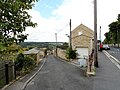
 East end of Snows Green Road at Shotley Bridge - geograph.org.uk - 6142559.jpg 4,219 × 3,165; 2.46 MB
-
 East Knitsley Grange - geograph.org.uk - 4879061.jpg 4,608 × 3,456; 6.98 MB
-
 Edith Street, Consett - geograph.org.uk - 2028246.jpg 1,500 × 1,125; 1.93 MB
-
 Edward VII postbox, Elm Park Terrace - geograph.org.uk - 4895139.jpg 341 × 640; 63 KB
-

-
 Elm Park Farm from the east - geograph.org.uk - 4810491.jpg 4,608 × 3,456; 5.26 MB
-
 Elm Park Terrace - geograph.org.uk - 4895141.jpg 640 × 480; 62 KB
-
 Entrance to Blackhill and Consett Park - geograph.org.uk - 3867765.jpg 640 × 480; 108 KB
-
 Entrance to Blackhill and Consett Park - geograph.org.uk - 3867766.jpg 640 × 480; 109 KB
-
 Entrance to Fawcett Park, Consett - geograph.org.uk - 5310400.jpg 4,608 × 3,456; 4.53 MB
-
 Estate Agents, Consett - geograph.org.uk - 4894611.jpg 640 × 480; 53 KB
-
 Fairways, Consett - geograph.org.uk - 2090382.jpg 640 × 480; 57 KB
-
 Fallen tree - geograph.org.uk - 5582646.jpg 4,608 × 3,456; 5.62 MB
-
 Farm at Todd Hill - geograph.org.uk - 4471275.jpg 4,582 × 3,420; 4.99 MB
-
 Farm road over the railway - geograph.org.uk - 6134127.jpg 4,608 × 3,456; 6.13 MB
-
 Farmhouse at Snow's Green - geograph.org.uk - 5289546.jpg 4,514 × 3,326; 5.72 MB
-
 Farmland - geograph.org.uk - 4728571.jpg 640 × 480; 84 KB
-
 Fawcett Park centrepiece (detail) - geograph.org.uk - 5932775.jpg 637 × 478; 292 KB
-
 Fawcett Park centrepiece (detail) - geograph.org.uk - 5932777.jpg 637 × 478; 242 KB
-
 Fawcett Park centrepiece - geograph.org.uk - 5932608.jpg 637 × 478; 247 KB
-
-
 Field beside Snows Green Road - geograph.org.uk - 5639242.jpg 4,608 × 3,456; 4.03 MB
-

-
 Filling station, Consett - geograph.org.uk - 1418477.jpg 640 × 480; 132 KB
-
 Fire and Rescue Brigade - geograph.org.uk - 1419716.jpg 640 × 480; 106 KB
-
 Fire Station, Consett - geograph.org.uk - 102880.jpg 640 × 480; 53 KB
-
 Flowers on the bankside - geograph.org.uk - 6143623.jpg 4,608 × 3,456; 5.55 MB
-

-
 Footpaths junction - geograph.org.uk - 4975970.jpg 4,608 × 3,456; 7.65 MB
-
 Forge Cottage - geograph.org.uk - 2888520.jpg 3,264 × 2,448; 1.75 MB
-
 Former bank building, Blackhill - geograph.org.uk - 4477861.jpg 4,608 × 3,456; 4.74 MB
-
-
 Former farm buildings at Bridgehill - geograph.org.uk - 4766346.jpg 4,608 × 3,456; 5.75 MB
-
 Former Gas showrooms, Consett - geograph.org.uk - 1630653.jpg 640 × 480; 91 KB
-
 Former mill office, Shotley Bridge - geograph.org.uk - 5977946.jpg 4,608 × 3,456; 4.12 MB
-
 Former register office, Consett - geograph.org.uk - 3496386.jpg 1,600 × 1,224; 494 KB
-
 Former vicarage, Blackhill - geograph.org.uk - 5975766.jpg 4,439 × 3,329; 3.61 MB
-
 Fountain information, Consett Park - geograph.org.uk - 3944075.jpg 1,600 × 1,200; 294 KB
-
 Front Street, Shotley Bridge - geograph.org.uk - 4895191.jpg 640 × 367; 60 KB
-
 Genisis Way from the hillside - geograph.org.uk - 5255045.jpg 4,608 × 3,456; 6.3 MB
-
 Gibson Street, Consett - geograph.org.uk - 1630612.jpg 640 × 480; 80 KB
-
 Good Companions - geograph.org.uk - 5932588.jpg 637 × 478; 344 KB
-
 Grassed area beside The Grove Primary School - geograph.org.uk - 4331074.jpg 1,500 × 1,000; 447 KB
-
 Grazing field beside the Railway path - geograph.org.uk - 5876911.jpg 4,608 × 3,456; 2.67 MB
-
 Grazing pasture south of the railway path - geograph.org.uk - 5199900.jpg 4,608 × 3,456; 6.34 MB
-
 Grazing sheep at Templetown - geograph.org.uk - 4811640.jpg 4,608 × 3,456; 5.43 MB
-
 Hall Cottage, Consett - geograph.org.uk - 5313616.jpg 4,608 × 3,456; 3.7 MB
-
 Hallgarth - geograph.org.uk - 4010760.jpg 640 × 480; 69 KB
-
 Hallgarth - geograph.org.uk - 4010790.jpg 640 × 480; 57 KB
-
 Hard-packed snow, East View, Consett - geograph.org.uk - 1630605.jpg 480 × 640; 101 KB
-
 Hardy Corner, Benfieldside, Consett - geograph.org.uk - 2090325.jpg 640 × 480; 71 KB
-
 Hardys Corner, Bridgehill - geograph.org.uk - 4908266.jpg 4,608 × 3,456; 4.77 MB
-
 Heathland at Whinney Hill - geograph.org.uk - 4767472.jpg 4,608 × 3,456; 5.55 MB
-
 Heavy snow on Medomsley Road - geograph.org.uk - 5698871.jpg 4,608 × 3,456; 3.6 MB
-
 Hillside steps - geograph.org.uk - 5311243.jpg 4,608 × 3,456; 6.14 MB
-
 Hole Row - geograph.org.uk - 1968545.jpg 3,327 × 2,136; 910 KB
-
 Homeward bound - geograph.org.uk - 1631589.jpg 640 × 446; 102 KB
-
 Hot Metal Carriage, Lydgetts Junction - geograph.org.uk - 5955014.jpg 1,024 × 768; 280 KB
-
 House at Summerhill - geograph.org.uk - 5289575.jpg 4,608 × 3,456; 5.61 MB
-
-
 Houses at Villa Real, Consett - geograph.org.uk - 2875308.jpg 3,264 × 2,448; 1.81 MB
-
 Houses on Greenways - geograph.org.uk - 5953811.jpg 640 × 480; 246 KB
-

-

-
 Houses on Snows Green Road - geograph.org.uk - 5639172.jpg 4,608 × 3,456; 3.73 MB
-
 Houses, Shotley Bridge - geograph.org.uk - 4894616.jpg 640 × 480; 63 KB
-
 Housing development, Balmoral Grove - geograph.org.uk - 1419754.jpg 640 × 480; 103 KB
-
 Hown's Wood from the railway path. - geograph.org.uk - 4975885.jpg 4,608 × 3,456; 6.15 MB
-
 Hownsgill Farm - geograph.org.uk - 1957201.jpg 3,831 × 2,509; 1.57 MB
-
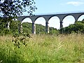 Hownsgill Viaduct - geograph.org.uk - 4651775.jpg 640 × 480; 552 KB
-
 Hownsgill Viaduct Arches - geograph.org.uk - 4365569.jpg 3,264 × 2,448; 3.2 MB
-
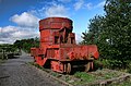
 Industrial heritage, Consett - geograph.org.uk - 3944165.jpg 844 × 1,024; 343 KB
-
 Industrial relic, Consett - geograph.org.uk - 3944185.jpg 1,600 × 1,264; 371 KB
-
 Industrial space to let - geograph.org.uk - 1419469.jpg 640 × 480; 84 KB
-
 John Street, Consett - geograph.org.uk - 3867774.jpg 640 × 480; 62 KB
-
 Junction on Pemberton Road - geograph.org.uk - 6141419.jpg 4,608 × 3,456; 3.06 MB
-
 Junction on the A692 - geograph.org.uk - 4928712.jpg 4,608 × 3,456; 6.38 MB
-
 Kings Head Social Club, Consett - geograph.org.uk - 4894607.jpg 640 × 480; 73 KB
-
 Knitsley - geograph.org.uk - 4728010.jpg 1,500 × 746; 1.03 MB
-
 Knitsley Farm Shop - geograph.org.uk - 3224257.jpg 640 × 480; 110 KB
-
 Knitsley Farm Shop - geograph.org.uk - 4386033.jpg 4,000 × 3,000; 4.89 MB
-
 Knitsley Lane, Templetown - geograph.org.uk - 2090105.jpg 640 × 480; 64 KB
-
 Lanchester Valley Railway Path - geograph.org.uk - 3225559.jpg 640 × 480; 123 KB
-
 Lanchester Valley Railway Path - geograph.org.uk - 3225563.jpg 640 × 480; 110 KB
-

-
 Lanchester Valley Railway Path near Consett - geograph.org.uk - 6011302.jpg 4,608 × 3,456; 7.08 MB
-
 Leafy lane - geograph.org.uk - 5639202.jpg 4,608 × 3,456; 5.46 MB
-
 Little Greencroft farm from the west - geograph.org.uk - 4879077.jpg 4,608 × 3,456; 5.07 MB
-
 Little Pond - geograph.org.uk - 4471262.jpg 3,887 × 3,115; 7.2 MB
-
 Little pond at Villa Real - geograph.org.uk - 5693211.jpg 3,933 × 3,206; 7.2 MB
-
 Long terrace in Consett - geograph.org.uk - 6310694.jpg 4,503 × 3,377; 2.52 MB
-
 Looking along Pemberton Road - geograph.org.uk - 6141416.jpg 4,278 × 3,031; 2.89 MB
-
 Looking down Cutlers Hall Road - geograph.org.uk - 5585764.jpg 4,608 × 3,456; 5.36 MB
-
 Looking down Cutlers Hall Road, Benfieldside - geograph.org.uk - 4908448.jpg 4,608 × 3,456; 4.97 MB
-
 Looking down Derwent Street, Blackhill - geograph.org.uk - 5588023.jpg 4,608 × 3,456; 5.53 MB
-
 Looking down Front Street in Consett - geograph.org.uk - 2875290.jpg 3,264 × 2,448; 1.7 MB
-
 Looking down the A692 - geograph.org.uk - 2905888.jpg 4,608 × 3,456; 5.45 MB
-
 Looking down the hill to Pemberton Road - geograph.org.uk - 5311689.jpg 4,438 × 3,216; 4.78 MB
-
 Looking over a snowy scene - geograph.org.uk - 5615962.jpg 4,608 × 3,456; 4.5 MB
-
 Looking over Bridgehill - geograph.org.uk - 5636871.jpg 4,608 × 3,456; 2.95 MB
-
 Looking over the fields - geograph.org.uk - 5609327.jpg 4,608 × 3,456; 5.07 MB
-
 Looking south along the Derwent Walk - geograph.org.uk - 2970250.jpg 4,608 × 3,456; 5.72 MB
-
 Looking south to Shotley Station - geograph.org.uk - 5620989.jpg 4,608 × 3,456; 4.36 MB


_-_geograph.org.uk_-_3146607.jpg)


_-_geograph.org.uk_-_5932775.jpg)
_-_geograph.org.uk_-_5932777.jpg)


