Category:County Kilkenny
Jump to navigation
Jump to search
Counties of the Republic of Ireland: Carlow · Cavan · Clare · Cork(1) · Donegal · Dún Laoghaire-Rathdown(2) · Fingal(2) · Galway(3) · Kerry · Kildare · Kilkenny · Laois · Leitrim · Limerick · Longford · Louth · Mayo · Meath · Monaghan · Offaly · Roscommon · Sligo · South Dublin(2) · Tipperary(4) · Waterford · Westmeath · Wexford · Wicklow – Separate cities: Cork(1) · Dublin(2) · Galway(3) – Former counties: Dublin(2) · South Tipperary(4) Former counties of Northern Ireland: Antrim · Armagh · Down · Fermanagh · Londonderry · Tyrone
county in Ireland    | |||||
| Upload media | |||||
| Instance of | |||||
|---|---|---|---|---|---|
| Location |
| ||||
| Capital | |||||
| Legislative body |
| ||||
| Executive body |
| ||||
| Founded by |
| ||||
| Significant event |
| ||||
| Highest point |
| ||||
| Population |
| ||||
| Area |
| ||||
| official website | |||||
 | |||||
Subcategories
This category has the following 45 subcategories, out of 45 total.
A
B
- Ballyfrunk Creamery (3 F)
- Bearna Breac Loop (12 F)
C
D
E
F
- Fiddaun Bridge (4 F)
- Fiddown Island (2 F)
- Forges in County Kilkenny (3 F)
G
H
K
- Kilmacoliver Loops (12 F)
L
M
N
- Newmarket Portal tomb (3 F)
O
- Owning Portal Tomb (5 F)
P
Q
- Quarries in County Kilkenny (4 F)
R
- Rivers in County Kilkenny (2 F)
S
- Shankill, Kilkenny (1 F)
- Stiles in County Kilkenny (6 F)
T
- Tibberaghny Standing Stone (3 F)
W
Pages in category "County Kilkenny"
The following 2 pages are in this category, out of 2 total.
Media in category "County Kilkenny"
The following 200 files are in this category, out of 991 total.
(previous page) (next page)-
 1798 plaque for John Patrick Kennedy.png 2,006 × 1,422; 3.01 MB
-
 18th Century Green's Bridge in 2010.jpg 400 × 226; 55 KB
-
 18th Green - geograph.org.uk - 5175641.jpg 640 × 480; 131 KB
-
 20120811 31 Ireland - Co. Kilkenny - Kilkenny (7939011102).jpg 3,648 × 2,736; 881 KB
-
 20120811 32 Ireland - Co. Kilkenny - Kilkenny (7939012544).jpg 3,648 × 2,736; 934 KB
-
 20120812 05 Ireland - Co. Kilkenny - Kilmoganny (7939014810).jpg 3,648 × 2,736; 1.26 MB
-
 2022-07-04 Kyleroe Dory Cottage (1).png 3,000 × 1,500; 5.88 MB
-
 2022-07-19 47a Lenehan Aglish South.png 3,008 × 2,000; 8.87 MB
-
 82 Lenehan Barn Licketstown 01.png 2,517 × 1,533; 6.47 MB
-
 82 Lenehan Barn Licketstown 02.png 3,008 × 2,000; 9.49 MB
-
 A bend on the lane over the hill, west of Windgap - geograph.org.uk - 4177973.jpg 2,000 × 1,500; 1.13 MB
-
 A row of cottages, Clonmell Road - geograph.org.uk - 4294854.jpg 2,000 × 1,341; 691 KB
-
 A sanctuary for whom^ - geograph.org.uk - 4996051.jpg 1,600 × 1,200; 674 KB
-
 A stream in Co. Kilkenny - geograph.org.uk - 5841649.jpg 3,648 × 2,736; 4.28 MB
-
 A View across the River Suir - geograph.org.uk - 5822080.jpg 800 × 533; 552 KB
-
 A view north-west of south Kilkenny - geograph.org.uk - 5817148.jpg 3,648 × 2,736; 3.97 MB
-
 A warning - geograph.org.uk - 4993688.jpg 1,600 × 1,200; 881 KB
-
 Abandoned railway - geograph.org.uk - 5473974.jpg 1,024 × 768; 167 KB
-
 Alongside the River Barrow - geograph.org.uk - 5473657.jpg 1,024 × 768; 232 KB
-
 Altered Doorway - geograph.org.uk - 6179488.jpg 800 × 596; 574 KB
-
 An unambiguous geograph - geograph.org.uk - 4993386.jpg 1,600 × 1,200; 753 KB
-
 Animal Feed - geograph.org.uk - 5328301.jpg 640 × 480; 149 KB
-
 Antenna mast - geograph.org.uk - 523484.jpg 480 × 640; 66 KB
-
 Approaching R692 turning, N76 - geograph.org.uk - 5869279.jpg 1,024 × 491; 93 KB
-
 Approaching Tullahought from the north-east - geograph.org.uk - 4178039.jpg 2,000 × 1,500; 1.58 MB
-
 Arable land - geograph.org.uk - 4994629.jpg 1,600 × 1,200; 484 KB
-
 Arable land at Mooncoin - geograph.org.uk - 1823265.jpg 640 × 426; 203 KB
-
 Arable land close to Waterford - geograph.org.uk - 1823429.jpg 640 × 428; 208 KB
-
 Arion ater - geograph.org.uk - 4939732.jpg 640 × 435; 152 KB
-
 Artwork on building, Green Street - geograph.org.uk - 4294545.jpg 2,000 × 1,338; 749 KB
-
 Autumn Colour - geograph.org.uk - 5581395.jpg 640 × 512; 227 KB
-
 Autumn Laneway - geograph.org.uk - 5170376.jpg 640 × 480; 206 KB
-
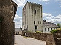
 Baleen Castle - geograph.org.uk - 5812683.jpg 800 × 600; 319 KB
-
 Ballyfoyle Moate (Co. Kilkenny) in spring.jpg 3,296 × 2,512; 4.51 MB
-
 Ballyfrunk Creamery.png 4,000 × 2,000; 8.15 MB
-
 Ballykeefe Amphitheater.jpg 4,128 × 3,096; 5.09 MB
-
 Ballykeefe Quarry ruin.jpg 4,128 × 3,096; 5.29 MB
-
 Ballykeeffe Amphitheatre - geograph.org.uk - 5328207.jpg 640 × 480; 126 KB
-
 Ballyline Crossroads - geograph.org.uk - 680509.jpg 600 × 400; 112 KB
-
 Ballyogan Gateway - geograph.org.uk - 4898019.jpg 600 × 450; 260 KB
-
 Ballyogan Standing Stone.png 3,000 × 1,500; 3.49 MB
-
 Barn and Buildings - geograph.org.uk - 6193098.jpg 800 × 600; 848 KB
-
 Barn Glengrant (2).png 3,008 × 2,000; 9.42 MB
-
 Barn Kilcraggan 01.png 3,000 × 1,500; 4.11 MB
-
 Barn Kilcraggan 02.png 3,000 × 1,500; 3.77 MB
-
 Barrier and Forest - geograph.org.uk - 4832137.jpg 600 × 450; 249 KB
-
 Beehive Building - geograph.org.uk - 5358818.jpg 480 × 640; 138 KB
-
 Beet Field - geograph.org.uk - 5852075.jpg 800 × 600; 104 KB
-
 Bench and Track - geograph.org.uk - 5322200.jpg 640 × 480; 140 KB
-
 Bend on the lane to Dunbell - geograph.org.uk - 4175051.jpg 2,000 × 1,500; 1.17 MB
-
 Beneath Catsrock Bridge - geograph.org.uk - 5841634.jpg 3,648 × 2,736; 4.03 MB
-
 Big houses, big gates - geograph.org.uk - 4996015.jpg 1,600 × 1,200; 523 KB
-
 Blackstairs Mountains - geograph.org.uk - 5695320.jpg 640 × 426; 73 KB
-
 Bleach Road Weir, Kilkenny - geograph.org.uk - 5294757.jpg 640 × 480; 83 KB
-
 Blocked Laneway - geograph.org.uk - 6179507.jpg 800 × 600; 748 KB
-
 Bloody Abandoned Water Tower - panoramio.jpg 4,320 × 3,240; 2.37 MB
-
 Bonnetstown Castle - geograph.org.uk - 4948062.jpg 600 × 450; 457 KB
-
 Bonnetstown House - geograph.org.uk - 4948054.jpg 600 × 450; 260 KB
-
 Bonnetstown Oak - geograph.org.uk - 4948095.jpg 548 × 640; 144 KB
-
 Boolyshea Castle - geograph.org.uk - 4948327.jpg 480 × 640; 99 KB
-
 Boulders and Hill - geograph.org.uk - 6303778.jpg 800 × 600; 145 KB
-
 Brandon Hill - geograph.org.uk - 5395081.jpg 640 × 480; 110 KB
-

-
 Bridge and Cottage - geograph.org.uk - 2011814.jpg 600 × 400; 186 KB
-
 Bridge and Sign - geograph.org.uk - 5169522.jpg 640 × 480; 158 KB
-
 Bridge on the boundary - geograph.org.uk - 4994644.jpg 1,600 × 1,200; 862 KB
-
 Bridge over the M9 near Hugginstown - geograph.org.uk - 6093251.jpg 800 × 533; 521 KB
-
 Bridge over the M9 near Knockadrina - geograph.org.uk - 6093563.jpg 800 × 480; 468 KB
-
 Bridge over the M9 near to Ballylusky - geograph.org.uk - 6093228.jpg 800 × 533; 534 KB
-
 Bridge over the M9 Southbound - geograph.org.uk - 6082287.jpg 800 × 533; 427 KB
-
 Bridge over the M9, Stonecarthy - geograph.org.uk - 6094441.jpg 800 × 533; 601 KB
-
 Bridge over the northbound M9 - geograph.org.uk - 6082169.jpg 800 × 533; 528 KB
-
 Bridge over the River Barrow under construction - geograph.org.uk - 5473653.jpg 1,024 × 768; 133 KB
-

-
 Bridge Parapet - geograph.org.uk - 5358824.jpg 640 × 480; 122 KB
-
 Bridge Parapet - geograph.org.uk - 5677866.jpg 640 × 480; 218 KB
-
 Bridge Parapet - geograph.org.uk - 6202759.jpg 800 × 600; 1.09 MB
-
 Bridge ^ Approach to Snow Quay (Pier) - geograph.org.uk - 5398376.jpg 3,648 × 2,736; 4.5 MB
-
 Bronze Needle Gowran.png 2,097 × 1,281; 2.73 MB
-
 Building site at Belmount - geograph.org.uk - 1825137.jpg 640 × 426; 188 KB
-
 Burnchurch Castle and Turret - geograph.org.uk - 5337729.jpg 640 × 480; 97 KB
-

-
 Burnchurch Castle, Burnchurch, Co. Kilkenny - geograph.org.uk - 6316745.jpg 681 × 1,024; 284 KB
-
 Burnchurch Church - geograph.org.uk - 5337741.jpg 480 × 640; 81 KB
-
 Callan Post Office - geograph.org.uk - 4294739.jpg 2,000 × 1,537; 835 KB
-
 Callan Rd - geograph.org.uk - 5869228.jpg 1,024 × 516; 120 KB
-
 Callan Rd, N76 - geograph.org.uk - 5869237.jpg 1,024 × 555; 110 KB
-
 Callan Rd, southbound - geograph.org.uk - 5869234.jpg 1,024 × 815; 164 KB
-
 Canal Bed - geograph.org.uk - 5365070.jpg 640 × 480; 225 KB
-
 Candid Camera - geograph.org.uk - 5695133.jpg 640 × 480; 97 KB
-
 Car Park - geograph.org.uk - 6021940.jpg 800 × 600; 126 KB
-
 CASAS TIPICAS - panoramio.jpg 4,800 × 3,200; 8.18 MB
-
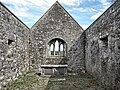
 Castle Interior - geograph.org.uk - 4948083.jpg 480 × 640; 137 KB
-
 Castle Interior - geograph.org.uk - 4948086.jpg 600 × 450; 323 KB
-
 Castle Ruin - geograph.org.uk - 4898006.jpg 480 × 640; 163 KB
-
 Castle Ruin - geograph.org.uk - 4948066.jpg 600 × 450; 498 KB
-
 Castle Ruin - geograph.org.uk - 4948324.jpg 600 × 450; 231 KB
-
 Castle Ruin - geograph.org.uk - 4948332.jpg 480 × 640; 141 KB
-
 Castlemorris Gate Lodge.png 3,000 × 1,500; 5.48 MB
-
 Castles of Leinster, Balief, Kilkenny - geograph.org.uk - 2495735.jpg 1,024 × 683; 847 KB
-
 Castles of Leinster, Brownsford, Kilkenny (1) - geograph.org.uk - 4570931.jpg 1,024 × 688; 772 KB
-
 Castles of Leinster, Brownsford, Kilkenny (2) - geograph.org.uk - 4570935.jpg 1,024 × 725; 912 KB
-
 Castles of Leinster, Brownsford, Kilkenny (3) - geograph.org.uk - 4570940.jpg 683 × 1,024; 1.22 MB
-
 Castles of Leinster, Coolhill, Kilkenny (2) - geograph.org.uk - 4570908.jpg 683 × 1,024; 1.04 MB
-
 Castles of Leinster, Coolhill, Kilkenny (3) - geograph.org.uk - 4570913.jpg 683 × 1,024; 1.36 MB
-
 Castles of Leinster, Coolhill, Kilkenny - (4) - geograph.org.uk - 4570921.jpg 1,024 × 683; 1.33 MB
-
 Castles of Leinster, Currahill, Kilkenny (1) - geograph.org.uk - 4570979.jpg 1,024 × 725; 923 KB
-
 Castles of Leinster, Currahill, Kilkenny (2) - geograph.org.uk - 4570980.jpg 1,024 × 709; 1.02 MB
-
 Castles of Leinster, Currahill, Kilkenny (3) - geograph.org.uk - 4570985.jpg 652 × 1,024; 1.04 MB
-
 Castles of Leinster, Currahill, Kilkenny (4) - geograph.org.uk - 4570991.jpg 683 × 1,024; 1.17 MB
-
 Castles of Leinster, Currahill, Kilkenny (5) - geograph.org.uk - 4570996.jpg 683 × 1,024; 1.32 MB
-
 Castles of Leinster, Kilfane, Kilkenny (1) - geograph.org.uk - 4571009.jpg 1,024 × 708; 1.15 MB
-
 Castles of Leinster, Kilfane, Kilkenny (2) - geograph.org.uk - 4571015.jpg 683 × 1,024; 1.26 MB
-
 Castles of Leinster, Kilrush, Kilkenny (1) - geograph.org.uk - 4571560.jpg 1,024 × 733; 1.27 MB
-
 Castles of Leinster, Kilrush, Kilkenny (2) - geograph.org.uk - 4571564.jpg 1,024 × 691; 1.11 MB
-
 Castles of Leinster, Kilrush, Kilkenny (3) - geograph.org.uk - 4571566.jpg 1,024 × 687; 909 KB
-
 Castles of Leinster, Kilrush, Kilkenny (4) - geograph.org.uk - 4571582.jpg 683 × 1,024; 988 KB
-
 Castles of Leinster, Kilrush, Kilkenny (5) - geograph.org.uk - 4571585.jpg 696 × 1,024; 960 KB
-
 Castles of Leinster, Tibberaghny, Kilkenny (1) - geograph.org.uk - 4570956.jpg 683 × 1,024; 959 KB
-
 Castles of Leinster, Tibberaghny, Kilkenny (2) - geograph.org.uk - 4570962.jpg 1,024 × 712; 995 KB
-
 Castles of Leinster, Tibberaghny, Kilkenny (3) - geograph.org.uk - 4570968.jpg 1,024 × 763; 1.04 MB
-
 Castles of Munster, Rockett's Castle, Waterford - geograph.org.uk - 3716059.jpg 1,024 × 739; 1,019 KB
-
 Catsrock Bridge, Co. Kilkenny - geograph.org.uk - 5838976.jpg 3,648 × 2,736; 4.79 MB
-
 Cattle behind the house - geograph.org.uk - 4994670.jpg 1,600 × 1,200; 618 KB
-
 Celtic Cross and Ruin - geograph.org.uk - 5337775.jpg 640 × 480; 156 KB
-
 CENTRO DE KILKENNY - panoramio.jpg 7,360 × 4,912; 15.15 MB
-
 Church and Castle - Burnchurch, County Kilkenny - geograph.org.uk - 6089365.jpg 1,024 × 668; 228 KB
-
 Church at Clifden - geograph.org.uk - 4948100.jpg 600 × 450; 236 KB
-
 Church Bell - geograph.org.uk - 5520022.jpg 480 × 640; 84 KB
-
 Church Doorway - geograph.org.uk - 6202734.jpg 600 × 800; 1,023 KB
-
 Church Interior - geograph.org.uk - 6140404.jpg 600 × 800; 666 KB
-
 Church Interior - geograph.org.uk - 6202736.jpg 800 × 600; 1,015 KB
-
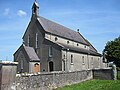
 Church of the Assumption - geograph.org.uk - 5745337.jpg 640 × 480; 116 KB
-
 Church Plaque - geograph.org.uk - 5745315.jpg 640 × 479; 115 KB
-
 Church Ruin - geograph.org.uk - 5745318.jpg 640 × 480; 165 KB
-
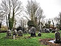 Church Ruin and Graveyard - geograph.org.uk - 5644672.jpg 640 × 480; 177 KB
-

-
 Church Steps - geograph.org.uk - 5677900.jpg 480 × 640; 135 KB
-
 Clasheen Bridge - geograph.org.uk - 5337807.jpg 640 × 480; 136 KB
-
 Clearfelled Forest - geograph.org.uk - 4877489.jpg 600 × 450; 313 KB
-
 Clearfelled Forest - geograph.org.uk - 5389712.jpg 640 × 480; 116 KB
-
 Clontubbrid Church - geograph.org.uk - 5812913.jpg 800 × 600; 212 KB
-
 Clouds and Furze - geograph.org.uk - 4898035.jpg 600 × 450; 213 KB
-
 Clouds and Pasture - geograph.org.uk - 6147149.jpg 800 × 600; 370 KB
-
 ColaisteEamannRisBlankCrest.jpg 145 × 197; 12 KB
-
 Commemorative monument - geograph.org.uk - 735554.jpg 426 × 640; 64 KB
-
 Commemorative Plaque - geograph.org.uk - 5601640.jpg 480 × 640; 150 KB
-
 Communications Mast - geograph.org.uk - 5802116.jpg 480 × 640; 81 KB
-
 Connahy (Conachadh) - geograph.org.uk - 4996033.jpg 1,600 × 1,200; 517 KB
-
 Coolaghmore Graveyard.png 2,500 × 1,241; 4.48 MB
-
 Corluddy Castle.png 3,008 × 2,000; 7.33 MB
-
 Cottage Renovation - geograph.org.uk - 5635922.jpg 640 × 480; 131 KB
-
 Cottage Ruin - geograph.org.uk - 5812901.jpg 800 × 600; 240 KB
-
 Cotton Grass Crop - geograph.org.uk - 5797610.jpg 640 × 480; 168 KB
-
 Country Lane - geograph.org.uk - 2329763.jpg 600 × 450; 272 KB
-
 Country Lane - geograph.org.uk - 5328235.jpg 640 × 480; 123 KB
-
 Country Lane - geograph.org.uk - 5339886.jpg 640 × 480; 128 KB
-
 Country Lane - geograph.org.uk - 5358860.jpg 480 × 640; 182 KB
-
 Country Lane - geograph.org.uk - 5520050.jpg 480 × 640; 191 KB
-
 Country Laneway - geograph.org.uk - 5337763.jpg 480 × 640; 129 KB
-
 Country north-west of Callan - geograph.org.uk - 4090398.jpg 2,592 × 1,944; 1.34 MB
-
 Country Road - geograph.org.uk - 5325414.jpg 640 × 480; 82 KB
-
 Country Road - geograph.org.uk - 5644760.jpg 480 × 640; 145 KB
-
 Country Road - geograph.org.uk - 5882604.jpg 800 × 600; 217 KB
-
 Country Road Junction - geograph.org.uk - 5644659.jpg 640 × 480; 148 KB
-
 Country south of Kilmanagh - geograph.org.uk - 4090422.jpg 2,592 × 1,944; 1.29 MB
-
 Country south of Kilmanagh - geograph.org.uk - 4090426.jpg 2,592 × 1,944; 1.42 MB
-
 Country south-east of Kilmanagh - geograph.org.uk - 4090441.jpg 2,592 × 1,944; 1.93 MB
-
 County Kilkenny arms.svg 512 × 562; 107 KB
-
 Cow Parsley - geograph.org.uk - 6174103.jpg 800 × 600; 532 KB
-
 Cross near Church Well, Chatsworth.jpg 4,032 × 2,016; 3.84 MB
-
 Cross Roads - geograph.org.uk - 5635918.jpg 640 × 480; 109 KB
-
 Crossing the N25 - geograph.org.uk - 1823424.jpg 640 × 428; 162 KB
-
 Cullintra Hill - geograph.org.uk - 5395056.jpg 640 × 480; 152 KB
-
 Dairyhill Junction - geograph.org.uk - 5338269.jpg 640 × 480; 141 KB
-
 Dandelions and River - geograph.org.uk - 5746490.jpg 640 × 480; 187 KB
-
 Danesfort GAA Club - geograph.org.uk - 2324413.jpg 600 × 450; 182 KB
-
 Derelict buildings, St Mullin's - geograph.org.uk - 4303365.jpg 2,000 × 1,500; 1.54 MB
-
 Desart Wood - geograph.org.uk - 5338261.jpg 640 × 480; 206 KB
-
 Detour around a fallen tree, on the Tory Hill Trail - geograph.org.uk - 4299265.jpg 1,500 × 2,000; 1.29 MB
-
 Distillery Ruin - geograph.org.uk - 5750068.jpg 640 × 522; 164 KB
-
 Disused Gateway - geograph.org.uk - 5689212.jpg 640 × 480; 233 KB
-
 Disused Water Pump - geograph.org.uk - 5348220.jpg 557 × 640; 188 KB
-
 Double Entrance - geograph.org.uk - 1156430.jpg 640 × 480; 89 KB
-
 Double Entrance - geograph.org.uk - 5520067.jpg 640 × 480; 173 KB
-
 Double Headstone - geograph.org.uk - 5812674.jpg 800 × 600; 477 KB
-
 Drainage Channel - geograph.org.uk - 5349406.jpg 640 × 480; 121 KB
-
 Drainage Channel - geograph.org.uk - 5349417.jpg 640 × 480; 123 KB
-
 Drainage Channel - geograph.org.uk - 5349444.jpg 640 × 480; 151 KB
-
 Drainage Channel - geograph.org.uk - 5349448.jpg 640 × 480; 170 KB
-
 Drainage Ditch - geograph.org.uk - 6140421.jpg 800 × 600; 555 KB
-
 Drainage Ditches - geograph.org.uk - 2373679.jpg 600 × 450; 356 KB
-
 Driveway - geograph.org.uk - 5325419.jpg 640 × 480; 124 KB
-
 Driveway to Glebe House - geograph.org.uk - 1823253.jpg 640 × 425; 267 KB
-
 Dry Stone Wall - geograph.org.uk - 5812750.jpg 800 × 600; 362 KB
-
 Dry Watercourse - geograph.org.uk - 5362068.jpg 640 × 480; 151 KB
-
 Dunnamaggan Credit Union office - geograph.org.uk - 4277324.jpg 2,996 × 1,992; 1.25 MB
-
 Dunphy's bar, Kilmaganny - geograph.org.uk - 4277298.jpg 2,000 × 1,404; 720 KB
-
 Dusty Sheep - geograph.org.uk - 5852090.jpg 800 × 527; 275 KB
-
 Dwelling and Junction - geograph.org.uk - 5347212.jpg 640 × 480; 85 KB


.jpg)
.jpg)
.jpg)
.png)


_in_spring.jpg)


.png)


_-_geograph.org.uk_-_5398376.jpg)


_-_geograph.org.uk_-_4570931.jpg)
_-_geograph.org.uk_-_4570935.jpg)
_-_geograph.org.uk_-_4570940.jpg)
_-_geograph.org.uk_-_4570908.jpg)
_-_geograph.org.uk_-_4570913.jpg)
_-_geograph.org.uk_-_4570921.jpg)
_-_geograph.org.uk_-_4570979.jpg)
_-_geograph.org.uk_-_4570980.jpg)
_-_geograph.org.uk_-_4570985.jpg)
_-_geograph.org.uk_-_4570991.jpg)
_-_geograph.org.uk_-_4570996.jpg)
_-_geograph.org.uk_-_4571009.jpg)
_-_geograph.org.uk_-_4571015.jpg)
_-_geograph.org.uk_-_4571560.jpg)
_-_geograph.org.uk_-_4571564.jpg)
_-_geograph.org.uk_-_4571566.jpg)
_-_geograph.org.uk_-_4571582.jpg)
_-_geograph.org.uk_-_4571585.jpg)
_-_geograph.org.uk_-_4570956.jpg)
_-_geograph.org.uk_-_4570962.jpg)
_-_geograph.org.uk_-_4570968.jpg)


_-_geograph.org.uk_-_4996033.jpg)


