Category:County of Görz
Jump to navigation
Jump to search
a land that emerged from the possessions of the Counts of Gorizia between the 13th and 16th centuries   | |||||
| Upload media | |||||
| Instance of | |||||
|---|---|---|---|---|---|
| Dissolved, abolished or demolished date |
| ||||
| Replaced by | |||||
 | |||||
Subcategories
This category has the following 2 subcategories, out of 2 total.
C
Media in category "County of Görz"
The following 11 files are in this category, out of 11 total.
-
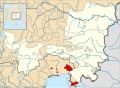 County of Gorizia locator map (1250).svg 3,120 × 2,280; 3.57 MB
-
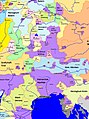
 Eastern Adriatic 1558.svg 1,920 × 1,753; 6.84 MB
-
 Erbfall der Grafschaft Görz zugunsten Österreichs.jpg 1,060 × 1,064; 521 KB
-
 HRR 1250 (Duchy of Merania).jpg 1,785 × 2,391; 909 KB
-
 Istria olim Iapidia - btv1b53042256n (1 of 2).jpg 7,855 × 6,061; 7.35 MB
-
 Istria olim Japidia - btv1b532140047 (2 of 3).jpg 6,120 × 4,768; 6.39 MB
-
 Istria olim Lapidia - CBT 5881817.jpg 5,623 × 4,427; 7.27 MB
-
 Istria olim Lapidia 1633.jpg 14,091 × 12,018; 20.12 MB
-
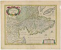 Johannes Janssonius - zemljevid Istre (17. stoletje).jpg 2,000 × 1,647; 1.27 MB
-
 Map of Italy (1402)-fr.svg 3,264 × 3,837; 336 KB
-
 Repubblica Venezia espansione in Terraferma.png 1,255 × 659; 359 KB
.svg)


.jpg)
.jpg)
.jpg)


.jpg)
-fr.svg)
