Category:Daresbury
Jump to navigation
Jump to search
village and civil parish in Cheshire, England  | |||||
| Upload media | |||||
| Instance of | |||||
|---|---|---|---|---|---|
| Location | Halton, Cheshire, North West England, England | ||||
 | |||||
Subcategories
This category has the following 5 subcategories, out of 5 total.
Media in category "Daresbury"
The following 136 files are in this category, out of 136 total.
-
 A field entrance at Red Brow - geograph.org.uk - 3418527.jpg 4,517 × 2,289; 6.89 MB
-
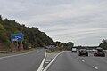
 A558 Road Bridge - geograph.org.uk - 2524425.jpg 640 × 401; 101 KB
-
 A56 looking west - geograph.org.uk - 2749930.jpg 640 × 452; 52 KB
-

-

-

-

-

-
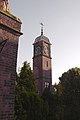
 All Saints Church at Daresbury - geograph.org.uk - 4141321.jpg 1,024 × 768; 215 KB
-
 All Saints church car park - geograph.org.uk - 3111629.jpg 1,024 × 768; 253 KB
-
 All Saints Parish Church, Daresbury - geograph.org.uk - 3196442.jpg 4,249 × 3,056; 5.8 MB
-
 All Saints' Church, Daresbury - geograph.org.uk - 2779946.jpg 3,072 × 1,920; 1.06 MB
-
 All Saints' Church, Daresbury - geograph.org.uk - 2779956.jpg 3,088 × 1,872; 1.68 MB
-
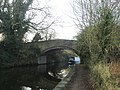
 Bridge on the Bridgewater Canal - geograph.org.uk - 428445.jpg 640 × 480; 125 KB
-
 Bridge on the Bridgewater Canal - geograph.org.uk - 428447.jpg 640 × 480; 141 KB
-

-

-

-
-

-
 Bridgewater Canal east of Norton - geograph.org.uk - 4263194.jpg 1,600 × 1,200; 474 KB
-
 Bridgewater Canal from Eastbound M56 - geograph.org.uk - 2409446.jpg 640 × 480; 71 KB
-
 Canal junction at Preston Brook - geograph.org.uk - 4392239.jpg 1,024 × 768; 170 KB
-
-
 Chancel of All Saints church, Daresbury - geograph.org.uk - 3111617.jpg 1,024 × 768; 138 KB
-
 Chester Road - geograph.org.uk - 2749943.jpg 640 × 453; 57 KB
-
 Commonside Farm, Daresbury, from the air - geograph.org.uk - 5025947.jpg 1,024 × 681; 181 KB
-
 Daresbury - Telephone Box At Junction With Chester Road - 20220927113837.jpg 4,032 × 3,024; 4.99 MB
-
 Daresbury Black Jane Farm.jpg 2,544 × 1,859; 1.05 MB
-
 Daresbury Expressway - geograph.org.uk - 2749912.jpg 640 × 480; 42 KB
-

-
 Daresbury Firs - geograph.org.uk - 3418173.jpg 4,592 × 3,056; 7.9 MB
-
 Daresbury George Gleave's Bridge.jpg 2,592 × 1,944; 1.1 MB
-
 Daresbury Hall, Warrington - derelict estate housing - geograph.org.uk - 4419619.jpg 2,175 × 1,449; 1.89 MB
-
 Daresbury Lane - geograph.org.uk - 2779961.jpg 3,056 × 2,016; 1.42 MB
-
 Daresbury Lane - geograph.org.uk - 2843144.jpg 640 × 481; 76 KB
-
 Daresbury Phone Box 2.jpg 1,353 × 2,210; 1.06 MB
-
 Daresbury Sessions House.jpg 2,524 × 1,541; 943 KB
-
 Daresbury station site geograph-3402496-by-Ben-Brooksbank.jpg 2,334 × 1,360; 3.73 MB
-
 Daresbury Tower - geograph.org.uk - 4883451.jpg 1,000 × 748; 568 KB
-
 Daresbury Village - geograph.org.uk - 2806437.jpg 640 × 480; 152 KB
-
 Dilapidated barn at Crow's Nest - geograph.org.uk - 4391725.jpg 1,024 × 768; 263 KB
-
 Eastbound off slip at J11 of M56 - geograph.org.uk - 5228016.jpg 1,600 × 1,065; 492 KB
-
 Entrance to Daresbury Firs - geograph.org.uk - 4391720.jpg 1,024 × 768; 322 KB
-

-
 Foden S21 (1962) - 15478500631.jpg 2,000 × 1,333; 453 KB
-

-
 Footbridge over Bridgewater Canal - geograph.org.uk - 2429546.jpg 640 × 454; 80 KB
-
 George Cleaves Bridge - geograph.org.uk - 2524417.jpg 640 × 393; 94 KB
-
 George Gleave's Bridge - geograph.org.uk - 4263183.jpg 1,600 × 1,200; 856 KB
-
 Glebe Farm - geograph.org.uk - 805636.jpg 600 × 450; 76 KB
-

-
 Horses near Daresbury - geograph.org.uk - 4883468.jpg 1,000 × 699; 709 KB
-
 K6 phone box in Daresbury - geograph.org.uk - 3111612.jpg 640 × 480; 50 KB
-
 Keckwick Bridge - geograph.org.uk - 2524421.jpg 640 × 422; 83 KB
-
 Keckwick Hill Bridge - geograph.org.uk - 2524419.jpg 640 × 390; 96 KB
-
 Keckwick Hill Bridge on the Bridgewater Canal - geograph.org.uk - 4391715.jpg 1,024 × 768; 327 KB
-
 Land at Poplar farm - geograph.org.uk - 2562710.jpg 640 × 409; 48 KB
-
 Life and Letters of Lewis Carroll - Darsbury Parsonage.jpg 2,791 × 1,795; 1.36 MB
-
 Low bridge on Delph Lane - geograph.org.uk - 4883442.jpg 1,000 × 703; 665 KB
-
 M56 Bridge - geograph.org.uk - 2427815.jpg 640 × 429; 74 KB
-

-
 M56 Motorway - junction 11 bridges - geograph.org.uk - 2253142.jpg 640 × 480; 47 KB
-
 M56 Motorway - Newton Lane bridge - geograph.org.uk - 2253149.jpg 640 × 480; 52 KB
-
 M56 Motorway approaching Junction 11 - geograph.org.uk - 3390613.jpg 3,695 × 1,842; 1.52 MB
-
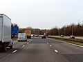
 M56 Motorway east of junction 11 - geograph.org.uk - 2253145.jpg 640 × 480; 41 KB
-

-
 M56 near Newton Cross - geograph.org.uk - 5610749.jpg 640 × 427; 420 KB
-

-
 M56, Junction 11 - geograph.org.uk - 2153827.jpg 640 × 480; 129 KB
-
 M56, Newton Cross - geograph.org.uk - 2153816.jpg 799 × 480; 149 KB
-
 Morphany Lane - geograph.org.uk - 2936590.jpg 640 × 480; 132 KB
-
 Morphany Lane - geograph.org.uk - 2936593.jpg 640 × 480; 230 KB
-
 Morphany Lane - geograph.org.uk - 2936596.jpg 640 × 480; 131 KB
-
 Nave of All Saints church, Daresbury - geograph.org.uk - 3111616.jpg 1,024 × 768; 133 KB
-
-
 Newton Cross - geograph.org.uk - 805646.jpg 615 × 461; 112 KB
-
 Newton Lane - geograph.org.uk - 3418580.jpg 4,414 × 2,616; 7.86 MB
-
 Newton Lane at Black Jane Farm - geograph.org.uk - 2842355.jpg 640 × 480; 109 KB
-
 Newton Lane at Daresbury Fruit Farm - geograph.org.uk - 2842354.jpg 640 × 481; 73 KB
-
 Norton level crossing - geograph.org.uk - 4263200.jpg 1,600 × 1,200; 621 KB
-
 Path in All Saints churchyard - geograph.org.uk - 3111626.jpg 1,024 × 768; 368 KB
-
 Please remove your boots - geograph.org.uk - 3111614.jpg 770 × 1,024; 174 KB
-
 Red Brow Lane passes under the Bridgewater Canal - geograph.org.uk - 4391733.jpg 1,024 × 768; 185 KB
-
 Red Brow Lane tunnels under the aqueduct - geograph.org.uk - 3418417.jpg 3,811 × 2,679; 5.26 MB
-
 Red Brow Lane tunnels under the aqueduct - geograph.org.uk - 3418473.jpg 4,233 × 2,818; 7.65 MB
-
 Ring 'O' Bells Public House, Daresbury - panoramio - Joe Blundell.jpg 3,648 × 2,736; 4.01 MB
-
 Ring 'O' Bells Public House, Daresbury - panoramio.jpg 3,648 × 2,736; 3.81 MB
-
 Ring O Bells Public House.jpg 240 × 180; 19 KB
-
 Road junction at Newton Cross - geograph.org.uk - 2936602.jpg 640 × 479; 174 KB
-
 Roadblock on Daresbury Lane - geograph.org.uk - 3111607.jpg 1,024 × 768; 232 KB
-

-
 Speke and Liverpool John Lennon Airport - geograph.org.uk - 5612750.jpg 2,608 × 1,956; 2.68 MB
-
 Steam on the West Coast Main Line - geograph.org.uk - 81634.jpg 640 × 426; 110 KB
-

-
 Stile near Daresbury Park - geograph.org.uk - 4391727.jpg 1,024 × 768; 189 KB
-
 Stylish barn on Hall Lane - geograph.org.uk - 4141332.jpg 1,024 × 768; 161 KB
-
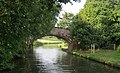
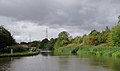
 The Bridgewater Canal - geograph.org.uk - 3418307.jpg 4,243 × 2,668; 7.97 MB
-
 The Bridgewater Canal - geograph.org.uk - 3418344.jpg 4,423 × 2,965; 7.79 MB
-
 The Bridgewater Canal - geograph.org.uk - 3418387.jpg 4,592 × 3,056; 7.37 MB
-

-

-
 The Bridgewater Canal north of Preston Brook - geograph.org.uk - 2618622.jpg 1,024 × 638; 264 KB
-
-
-

-
 The car park of the Lewis Carroll centre, Daresbury - geograph.org.uk - 3196476.jpg 4,313 × 2,870; 6.25 MB
-
 The Dental Academy, Daresbury - geograph.org.uk - 3419348.jpg 4,586 × 2,008; 7.85 MB
-
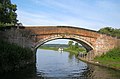
 The George Cleave's Bridge on the Bridgewater Canal - geograph.org.uk - 3418258.jpg 4,592 × 3,056; 5.93 MB
-
 The George Cleave's Bridge on the Bridgewater Canal - geograph.org.uk - 3418278.jpg 4,592 × 3,056; 7.58 MB
-
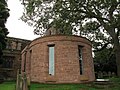 The Lewis Carroll Centre, exterior - geograph.org.uk - 3111620.jpg 1,024 × 768; 232 KB
-
 The Lewis Carroll Centre, interior - geograph.org.uk - 3111622.jpg 1,024 × 768; 132 KB
-
 The M56 approaching Junction 11 - geograph.org.uk - 6169679.jpg 2,700 × 2,025; 304 KB
-
 The M56 runs under Chester Road - geograph.org.uk - 6169689.jpg 2,700 × 2,025; 314 KB
-
 The M56 runs under Newton Lane - geograph.org.uk - 6169670.jpg 2,700 × 2,025; 397 KB
-
 The Mersey Valley Trail - geograph.org.uk - 3419382.jpg 4,336 × 2,886; 5.79 MB
-
 The Quarterly journal of the Geological Society of London (13070917805).jpg 1,211 × 2,069; 560 KB
-
 The Ring 'O' Bells - geograph.org.uk - 1725651.jpg 2,816 × 2,112; 1.58 MB
-
 The Ring 'O' Bells Pub Restaurant, Daresbury - geograph.org.uk - 2779975.jpg 3,072 × 2,016; 1.25 MB
-
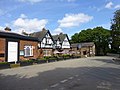 The Ring O Bells pub at Daresbury - geograph.org.uk - 4141190.jpg 1,024 × 768; 162 KB
-
 The Sessions House in Daresbury - geograph.org.uk - 3111611.jpg 1,024 × 768; 120 KB
-
 View out of the Lewis Carroll Centre - geograph.org.uk - 3111624.jpg 768 × 1,024; 181 KB
-
 View over open countryside to Daresbury Laboratory Tower - geograph.org.uk - 3313164.jpg 1,600 × 1,200; 391 KB
-
 Walton Hall - geograph.org.uk - 40494.jpg 428 × 640; 57 KB
-
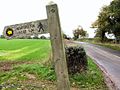
 Waymarker on Red Brow Lane, Daresbury Park - geograph.org.uk - 4391729.jpg 1,024 × 768; 162 KB
-
 Weak Bridge - geograph.org.uk - 3418240.jpg 4,592 × 3,056; 7.02 MB
-
 Westbound M56 approaching Junction 11 - geograph.org.uk - 5610751.jpg 640 × 427; 405 KB
-
 Daresbury Laboratories - geograph.org.uk - 36437.jpg 640 × 480; 59 KB
-
 Footpath near Hatton - geograph.org.uk - 70428.jpg 640 × 480; 178 KB
-
 Hatton Lodge Cottages, Hatton - geograph.org.uk - 113026.jpg 640 × 426; 143 KB
-
 Horses at New Farm, Moore - geograph.org.uk - 711969.jpg 640 × 480; 63 KB
-
 Junction of the A56 and Hobb Lane - geograph.org.uk - 113022.jpg 640 × 426; 130 KB
-
 Little Manor Farm - geograph.org.uk - 89280.jpg 640 × 426; 141 KB
-
 Out in the country - geograph.org.uk - 89260.jpg 640 × 426; 128 KB
-
 Owl's Nest Farm - geograph.org.uk - 89251.jpg 640 × 426; 69 KB
-


_near_Preston_Brook,_Cheshire_-_geograph.org.uk_-_2632662.jpg)
_near_Preston_Brook,_Cheshire_-_geograph.org.uk_-_2632728.jpg)
_near_Preston_Brook,_Cheshire_-_geograph.org.uk_-_2633299.jpg)
,_near_Preston_Brook,_Cheshire_-_geograph.org.uk_-_2619208.jpg)
,_near_Preston_Brook,_Cheshire_-_geograph.org.uk_-_2619571.jpg)


_-_15478500631.jpg)


.jpg)


