Category:Dikes
Jump to navigation
Jump to search
ridge or wall to hold back water   _Mehefin_(June)_2023_05_(cropped).jpg) | |||||
| Upload media | |||||
| Subclass of |
| ||||
|---|---|---|---|---|---|
| Location | bank | ||||
| Different from | |||||
| |||||
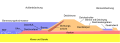
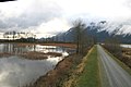
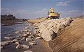
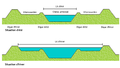
This category is for the flood protection structures. Difference between dikes and levees:
- Dikes protect land that would normally be under water from flooding.
Dikes are most often associated with the sea and areas of land below sea level. - Levees protect land that would normally be dry from flooding.
Levees are most often associated with rivers.
Source: English.stackexchange.com
Internationalization
Deutsch: Deich
Français : digue, levée
Nederlands: dijk
Subcategories
This category has the following 17 subcategories, out of 17 total.
!
- Quality images of dikes (71 F)
C
D
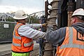
- Dike building (31 F)
F
L
M
P
- Pole dikes (4 F)
R
S
- Saemangeum Seawall (17 F)
- Schardeich (4 F)
Media in category "Dikes"
The following 108 files are in this category, out of 108 total.
-
 110421-F-WA217-052 (5658326988).jpg 4,288 × 2,848; 5.28 MB
-
 Deichbruch 1675 01.jpg 1,896 × 2,412; 2.27 MB
-
 A Dyke in the Delta at the Time of the Inundation (1878) - TIMEA.jpg 964 × 493; 95 KB
-
 Aufkadung.png 502 × 238; 1 KB
-
 Aufkadung.svg 1,057 × 706; 70 KB
-
 Auflast.svg 841 × 454; 398 KB
-
 Aufmdeich 1.JPG 1,600 × 1,200; 659 KB
-
 Aufmdeich.JPG 2,048 × 1,536; 453 KB
-
 Ausschlagung.svg 580 × 369; 37 KB
-
 Basalton PapendrechtVeersteiger 002.jpg 1,600 × 1,200; 580 KB
-
 BasaltonQuattro-detail.jpg 413 × 232; 70 KB
-
 Bekaempfung eines Deichbruchs.jpg 1,408 × 1,175; 139 KB
-
 BlockStab.jpg 572 × 571; 705 KB
-
 Caissonsluiting bij Kruiningen.jpg 4,484 × 1,033; 360 KB
-
 Cambridgeshire Dykes.svg 411 × 295; 48 KB
-
 Cherry blossoms at Isuzugawa-Tsutsumi01.jpg 1,400 × 1,050; 1.07 MB
-
 Cherry blossoms at Isuzugawa-Tsutsumi02.jpg 2,272 × 1,704; 1.44 MB
-
 Cows on German sleeper dike.jpg 2,309 × 1,732; 2.02 MB
-
 Csongrád felé félúton - panoramio.jpg 3,648 × 2,056; 3.5 MB
-
 Damage Open Colloidal Concrete.jpg 5,305 × 3,444; 8.7 MB
-
 Deich.svg 690 × 248; 221 KB
-
 Deich10.jpg 4,096 × 2,500; 121 KB
-
 Deich4.jpg 3,512 × 2,128; 1.33 MB
-
 Deich5.jpg 3,656 × 2,048; 188 KB
-
 Deich8.jpg 3,784 × 2,014; 578 KB
-
 Deichbruch Winterstein 1661.jpg 720 × 902; 466 KB
-
 Deichhöhe-fläche-volumen.png 630 × 426; 24 KB
-
 Deichquerschnitt ro.jpg 800 × 282; 37 KB
-
 Deichquerschnitt ro.svg 820 × 290; 39 KB
-
 Deichquerschnitt-multilang.svg 820 × 290; 39 KB
-
 Deichquerschnitt.png 819 × 289; 9 KB
-
 Deichquerschnitt.svg 820 × 290; 150 KB
-
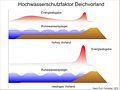 Deichvorland als Schutzfaktor.jpg 2,363 × 1,772; 309 KB
-
 Diaboolglooiing.jpg 4,971 × 3,393; 2.79 MB
-
 DijkDwarsprofiel.jpg 1,000 × 439; 950 KB
-
 Dijkhorde.jpg 1,473 × 692; 421 KB
-
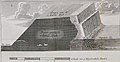 Dijkontwerp MatthijsDenBerger 1742.jpg 545 × 282; 40 KB
-
 Dike (PSF).png 1,827 × 879; 142 KB
-
 DiqueElJumeal-Catamarca 1.jpg 5,839 × 3,430; 2.6 MB
-
 DiqueElJumeal-Catamarca1.jpg 5,231 × 3,308; 2.26 MB
-
 DiqueElJumeal-Catamarca3.jpg 6,000 × 4,000; 3.56 MB
-
 Doorsnede zeedijk.png 442 × 337; 42 KB
-
 Eelmoor Flash from Eelmoor Bridge.jpg 5,184 × 3,456; 9.05 MB
-
 Elastocoast Holwerd.jpg 3,264 × 1,836; 3.2 MB
-
 Elnag dijkdoorsnede.png 2,252 × 1,365; 3.61 MB
-
 Elnag dijkdoorsnede.tif 2,252 × 1,365; 4.13 MB
-
 Enrocado.jpg 200 × 150; 6 KB
-
 Example of new coastal embankment and breakwater.jpg 1,441 × 1,136; 242 KB
-
 Gefahren für den Deich.jpg 2,859 × 1,825; 3.64 MB
-
 Glommen 7 July 2010.JPG 3,872 × 2,592; 1.62 MB
-
 Golfoploop.jpg 600 × 188; 47 KB
-
 Haringmanblok.jpg 5,388 × 3,594; 5.11 MB
-
 Hillside dyke on Bishop Forest Hill - geograph.org.uk - 715365.jpg 640 × 360; 67 KB
-
 Deichbruch.GIF 1,116 × 328; 168 KB
-
 Image of the multilayer tsunami countermeasure.jpg 2,445 × 481; 103 KB
-
 Indian folk culture 127.jpg 4,000 × 3,000; 3 MB
-
 Khu-du-lich-bien-ba-tri-ben-tre-h6.jpg 700 × 393; 87 KB
-
 Küsteningenieurwesen Deichverstärkung 1.jpg 1,376 × 1,024; 127 KB
-
 Küsteningenieurwesen Deichverstärkung 2.jpg 1,376 × 1,024; 160 KB
-
 Landmannalaugar panorama.jpg 7,500 × 1,233; 10.17 MB
-
 Levee bank caving in the Stockton area (7841764410).jpg 1,027 × 770; 625 KB
-
 Levee encroachment in the Stockton area (7841763972).jpg 907 × 680; 703 KB
-
 Levee erosion in the Sacramento area (7841767974).jpg 1,022 × 767; 495 KB
-
 Levee erosion in the Stockton area (7841763676).jpg 1,142 × 857; 840 KB
-
 Levee erosion in the Stockton area (7841764188).jpg 1,024 × 768; 562 KB
-
 Levee erosion in the Stockton area (7841766128).jpg 1,024 × 768; 1.07 MB
-
 Levee erosion near Dixon, CA (8483443588).jpg 1,632 × 1,232; 2.14 MB
-
 Levee work continues at Sacramento’s H Street bridge (15844515537).jpg 5,616 × 3,744; 7.59 MB
-
 Lights through the trees at Brastad Arena 2.jpg 4,512 × 3,456; 14.21 MB
-
 Lights through the trees at Brastad Arena 3.jpg 5,184 × 3,216; 20.34 MB
-
 Lincoln Cathedral from Sincil Bank - geograph.org.uk - 406199.jpg 640 × 480; 83 KB
-
 Map symbol dike.svg 128 × 128; 6 KB
-
 Meyers b4 s0620 b1.png 290 × 195; 19 KB
-
 Meyers b4 s0620 b2.png 260 × 244; 16 KB
-
 Meyers b4 s0621 b1.png 661 × 132; 20 KB
-
 Mikumari Zakura01.jpg 1,300 × 975; 380 KB
-
 Muraltglooiing-tekening.jpg 1,494 × 1,623; 363 KB
-
 Open Stone Asphalt Revetment.jpg 5,444 × 3,649; 6.65 MB
-
 PipingScheme.jpg 928 × 1,462; 72 KB
-
 Pitt Lake bog and dike.jpg 800 × 533; 326 KB
-
 Porseleintoren en Gele Rivier.jpg 2,362 × 1,367; 122 KB
-
 Protección de taludes con enrocado.jpg 225 × 141; 7 KB
-
 Quellkade.svg 2,161 × 677; 85 KB
-
 Quellkade2.svg 1,048 × 887; 479 KB
-
 Ritzenbüttel Schifferhäuser Schafe468.JPG 4,000 × 3,000; 4.9 MB
-
 Rivierbedding fr.png 1,324 × 755; 294 KB
-
 RunupBathPolderLarge.jpg 3,072 × 2,304; 2.96 MB
-
 Schoenberger Strand msu-2018-2137.jpg 1,404 × 1,150; 657 KB
-
 Sea defence structure terminology.jpg 2,501 × 2,232; 297 KB
-
 Stored Hillblocks in Holland.jpg 3,264 × 1,836; 1.94 MB
-
 Straat-vdDeure1.jpg 2,367 × 1,891; 897 KB
-
 Straat-vdDeure2.jpg 1,669 × 937; 516 KB
-
 Strand Yerseke.jpg 4,608 × 3,456; 5.86 MB
-
 Teensloot.jpg 3,000 × 1,989; 2.04 MB
-
 Tilted Haringmanblok near Baarland.jpg 1,600 × 1,200; 544 KB
-
 Tisza river dike near Mártély, Hungary - panoramio.jpg 1,600 × 1,148; 882 KB
-
 Trapdijk2.jpg 332 × 314; 33 KB
-
 Trapdijk3.jpg 923 × 427; 74 KB
-
 Tuimeldijk.jpg 758 × 322; 43 KB
-
 Walk the dyke. - geograph.org.uk - 293901.jpg 640 × 480; 117 KB
-
 Wave run-up on a Dutch dike with Haringman blocks.jpg 5,191 × 3,347; 5.99 MB
-
 Wave run-up.jpg 1,916 × 601; 77 KB
-
 Wielen en dijken.png 366 × 454; 10 KB
-
 Wierdijk-gravure.jpg 914 × 647; 131 KB
-
 Winter-krammat.jpg 2,589 × 1,557; 918 KB
-
 Zomer-krammat.jpg 2,525 × 1,722; 1,022 KB
-
 Набережная Амура у стадиона имени Ленина в Хабаровске.jpg 4,096 × 2,304; 2.73 MB
-
 제방 명칭.png 1,459 × 608; 26 KB
.jpg)

_-_TIMEA.jpg)


.png)


.jpg)
.jpg)
.jpg)
.jpg)
.jpg)
.jpg)
.jpg)
.jpg)


