Category:Dover, Kent
Jump to navigation
Jump to search
town and major ferry port in Kent, South East England  | |||||
| Upload media | |||||
| Instance of | |||||
|---|---|---|---|---|---|
| Location | Dover, Kent, South East England, England | ||||
| Population |
| ||||
| Elevation above sea level |
| ||||
| Different from | |||||
| official website | |||||
 | |||||
Subcategories
This category has the following 35 subcategories, out of 35 total.
A
- Aycliff, Dover (41 F)
B
- Banksy in Dover (4 F)
C
- Car Parks in Dover, Kent (11 F)
- Dover Coastguard Station (4 F)
- Coats of arms of Dover (1 F)
D
E
- East Kent Sudbury School (6 F)
H
- High Meadow (12 F)
K
L
M
- Maxton, Kent (18 F)
N
- Nemo Down (6 F)
P
S
- Samphire Hoe (90 F)
T
V
W
Media in category "Dover, Kent"
The following 200 files are in this category, out of 2,298 total.
(previous page) (next page)-
De-Dover.ogg 1.6 s; 16 KB
-
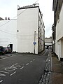
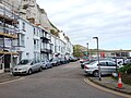
 Street Scene, Dover (4052820752).jpg 604 × 440; 111 KB
-
 3b40735r.jpg 640 × 468; 45 KB
-
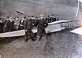
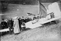 Bleriot and aeroplane.jpg 593 × 399; 83 KB
-
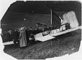
 Louis Blériot Dover 1909.jpg 2,100 × 1,491; 1.16 MB
-
 StateLibQld 1 140111 F.T. Peacey (ship).jpg 1,000 × 652; 72 KB
-
 Dover, Kent - geograph.org.uk - 511125.jpg 640 × 513; 113 KB
-
 2 ^ 4 Dolphin Passage - geograph.org.uk - 2672148.jpg 640 × 480; 86 KB
-
 2, New Street - geograph.org.uk - 5507558.jpg 2,448 × 3,264; 1.74 MB
-
 2005-07-26 - United Kingdom - England - Dover - Radar Station 4888130926.jpg 2,592 × 1,944; 4.23 MB
-
 32, Castle Avenue - geograph.org.uk - 5175459.jpg 2,448 × 3,264; 2.36 MB
-
 4, Flying Horse Lane - geograph.org.uk - 4874208.jpg 2,243 × 3,264; 1.9 MB
-
 43, Biggin Street - geograph.org.uk - 5643124.jpg 2,448 × 3,264; 1.91 MB
-
 45, High Street - geograph.org.uk - 6137123.jpg 2,448 × 3,264; 2.7 MB
-
 60th Rifle Memorial to Indian Mutiny - geograph.org.uk - 5673014.jpg 426 × 640; 63 KB
-
 60th Rifle Memorial to Indian Mutiny - geograph.org.uk - 5673016.jpg 426 × 640; 58 KB
-
 62, Biggin Street - geograph.org.uk - 5936717.jpg 2,448 × 3,120; 2.06 MB
-
 62, Castle Street - geograph.org.uk - 6137813.jpg 3,264 × 2,448; 3.72 MB
-
 62, Castle Street - geograph.org.uk - 6140146.jpg 3,264 × 2,448; 1.75 MB
-
 68, Charlton Villas, Charlton Green - geograph.org.uk - 5334854.jpg 2,448 × 3,264; 2.4 MB
-
 69, London Road - geograph.org.uk - 6198098.jpg 2,448 × 3,264; 2.43 MB
-
 70's Office Block - geograph.org.uk - 2315993.jpg 427 × 640; 107 KB
-
 9, Biggin Street - geograph.org.uk - 6051733.jpg 2,448 × 3,264; 1.86 MB
-
 9, Maison Dieu Road - geograph.org.uk - 5763139.jpg 2,448 × 3,264; 2.3 MB
-
 9-11, Beaconsfield Road - geograph.org.uk - 5521052.jpg 3,189 × 2,448; 1.81 MB
-
 9. Fehér sziklák én emlékszem rátok... - Dover (1).jpg 2,048 × 1,536; 543 KB
-
 91-119 Priory Hill - geograph.org.uk - 3695253.jpg 1,077 × 807; 232 KB
-
 A display of banners - geograph.org.uk - 3708832.jpg 905 × 1,200; 154 KB
-
 A route into Dover Castle - geograph.org.uk - 5228787.jpg 640 × 426; 115 KB
-
 A row of disused shops, Biggin Street - geograph.org.uk - 5809158.jpg 2,141 × 3,264; 1.6 MB
-

-
 A20 - geograph.org.uk - 5662749.jpg 640 × 426; 78 KB
-
 A20, Marine Parade - geograph.org.uk - 3247631.jpg 640 × 427; 65 KB
-
 A256 - geograph.org.uk - 5231884.jpg 640 × 426; 71 KB
-
 A256 - geograph.org.uk - 5302588.jpg 640 × 426; 52 KB
-
 A256 - geograph.org.uk - 5306111.jpg 640 × 426; 56 KB
-
 A256 - geograph.org.uk - 5662755.jpg 640 × 426; 73 KB
-
 A256, A258 junction - geograph.org.uk - 5231882.jpg 640 × 426; 69 KB
-
 Access road to Whiting PoultryFarm - geograph.org.uk - 2303497.jpg 3,072 × 2,304; 2.75 MB
-
 Admiralty Pier - geograph.org.uk - 5459124.jpg 4,000 × 3,000; 744 KB
-
 Adrian St - geograph.org.uk - 5672954.jpg 640 × 426; 71 KB
-
 Adrian St - geograph.org.uk - 5672957.jpg 640 × 426; 79 KB
-
 Aida sol moored beside Admiralty Pier - geograph.org.uk - 5179576.jpg 3,264 × 2,448; 1.65 MB
-
 AIDAluna moored beside the Admiralty Pier - geograph.org.uk - 5395165.jpg 3,264 × 2,448; 3.73 MB
-
 Aidavita moored beside the Admiralty Pier - geograph.org.uk - 5601286.jpg 3,264 × 2,448; 1.78 MB
-
 Albert Rd - geograph.org.uk - 5302584.jpg 640 × 426; 58 KB
-
 All lined up and nowhere to go - geograph.org.uk - 3165945.jpg 640 × 480; 68 KB
-
 Allotments, Buckland - geograph.org.uk - 5785059.jpg 640 × 450; 85 KB
-
 Allotments, Buckland - geograph.org.uk - 5785060.jpg 640 × 425; 70 KB
-
 Almost stationary traffic, Maison Dieu Road - geograph.org.uk - 6238213.jpg 3,264 × 2,448; 3.82 MB
-
 Along shore from Dover to Shakespeare Cliff, 1990 - geograph.org.uk - 4127766.jpg 2,424 × 1,389; 3.24 MB
-
 Alterations to Buckland Paper Mill, Crabble Hill - geograph.org.uk - 5429363.jpg 2,448 × 3,264; 2.29 MB
-
 Alterations to Buckland Paper Mill, Crabble Hill - geograph.org.uk - 5544002.jpg 3,264 × 2,448; 3.67 MB
-
 Alterations to Buckland Paper Mill, Crabble Hill - geograph.org.uk - 5712205.jpg 3,264 × 2,448; 2.15 MB
-
 Alterations to Buckland Paper Mill, Crabble Hill - geograph.org.uk - 5794513.jpg 2,448 × 3,264; 2.22 MB
-
 Alterations to Buckland Paper Mill, Crabble Hill - geograph.org.uk - 6162572.jpg 2,833 × 2,448; 1.71 MB
-
 Alterations to former Buckland Paper Mill, Crabble Hill - geograph.org.uk - 4761357.jpg 3,264 × 2,448; 2.01 MB
-
 Alterations to former Buckland Paper Mill, Crabble Hill - geograph.org.uk - 4875526.jpg 3,264 × 2,448; 3.9 MB
-

-

-
 Alterations to the Prince of Wales Pier - geograph.org.uk - 4982074.jpg 3,264 × 2,448; 1.97 MB
-
 Alterations to the Prince of Wales Pier - geograph.org.uk - 5026404.jpg 3,264 × 2,448; 1.86 MB
-
 Alterations to the Prince of Wales Pier - geograph.org.uk - 5028881.jpg 3,233 × 2,448; 2.34 MB
-
 Alterations to the Prince of Wales Pier - geograph.org.uk - 5053927.jpg 3,264 × 2,448; 2.07 MB
-
 Alterations to the Prince of Wales Pier - geograph.org.uk - 5075361.jpg 3,264 × 2,448; 1.94 MB
-
 Alterations to the Prince of Wales Pier - geograph.org.uk - 5084943.jpg 3,264 × 2,448; 1.88 MB
-
 Alterations to the Prince of Wales Pier - geograph.org.uk - 5097159.jpg 3,264 × 2,448; 1.93 MB
-
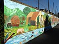
 Anchors and mural - geograph.org.uk - 5545276.jpg 1,280 × 1,600; 526 KB
-

-
 Another Ferry Leaves Port - geograph.org.uk - 5283596.jpg 1,599 × 2,399; 389 KB
-
 Approach to Shakespeare Tunnel - geograph.org.uk - 4624371.jpg 3,264 × 2,448; 1.89 MB
-
 Approach to Shakespeare Tunnel - geograph.org.uk - 5250728.jpg 3,264 × 2,448; 1.88 MB
-
 Approach to Shakespeare Tunnel - geograph.org.uk - 5267330.jpg 3,264 × 2,448; 2.05 MB
-
 Approach to Shakespeare Tunnel - geograph.org.uk - 5301962.jpg 3,264 × 2,448; 2.03 MB
-
-
 Approaching Broadlees Farm - geograph.org.uk - 5518820.jpg 4,000 × 3,000; 5.05 MB
-
 Arch below the A20 - geograph.org.uk - 5780386.jpg 640 × 426; 93 KB
-
 Archaeologia cantiana (1861) (14781986181).jpg 2,048 × 2,644; 1.71 MB
-
 Archaeological dig at 149-156, Snargate Street - geograph.org.uk - 4816459.jpg 3,126 × 2,448; 3.32 MB
-
 Archaeological dig at 149-156, Snargate Street - geograph.org.uk - 4835458.jpg 3,264 × 2,448; 2.91 MB
-
 Archaeological excavation, Russell Street - geograph.org.uk - 4767032.jpg 3,264 × 2,448; 3.78 MB
-
 Archaeological excavation, Russell Street - geograph.org.uk - 4789123.jpg 3,264 × 2,448; 2.04 MB
-
 Archaeological excavation, Russell Street - geograph.org.uk - 4847182.jpg 3,264 × 2,448; 2.28 MB
-
 Archaeological excavation, Russell Street - geograph.org.uk - 4874247.jpg 3,264 × 2,448; 1.85 MB
-
 Archaeological excavations, Russell Street carpark - geograph.org.uk - 4713539.jpg 3,264 × 2,448; 1.94 MB
-
 Archaeological excavations, Russell Street carpark - geograph.org.uk - 4713558.jpg 3,264 × 2,448; 2.29 MB
-
 Archaeological excavations, Russell Street carpark - geograph.org.uk - 4760489.jpg 3,264 × 2,448; 2.39 MB
-
 Archcliffe Fort, Dover (geograph 4607184).jpg 2,272 × 1,704; 778 KB
-
 Archcliffe Road (A20), Dover - geograph.org.uk - 3205809.jpg 897 × 658; 136 KB
-
 Archcliffe Road - geograph.org.uk - 1710605.jpg 1,024 × 683; 132 KB
-
 Archcliffe Road - geograph.org.uk - 2035507.jpg 1,024 × 683; 131 KB
-
 Artwork in a public garden - geograph.org.uk - 5399902.jpg 3,264 × 2,448; 3.87 MB
-
 ASDA - geograph.org.uk - 5302582.jpg 640 × 426; 49 KB
-
 Athol Terrace, Dover - geograph.org.uk - 5367227.jpg 3,264 × 2,448; 1.81 MB
-
 B2011 Folkestone Road - geograph.org.uk - 6183841.jpg 1,024 × 768; 515 KB
-
 B2245 (Park St) - geograph.org.uk - 5302569.jpg 640 × 426; 64 KB
-
 Ballyloc, 10A, Park Avenue - geograph.org.uk - 6030682.jpg 2,448 × 3,264; 2.1 MB
-
 Banksy in Dover - geograph.org.uk - 5446599.jpg 4,000 × 3,000; 2.84 MB
-
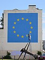 Banksy in Dover - geograph.org.uk - 5446602.jpg 3,000 × 4,000; 2.63 MB
-
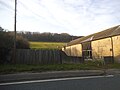 Barn by Folkestone Road, Farthingloe - geograph.org.uk - 4904848.jpg 2,304 × 1,728; 829 KB
-
 Barn by Folkestone Road, Farthingloe - geograph.org.uk - 4908824.jpg 2,304 × 1,728; 1.32 MB
-
 Barricaded underpass, Dover - geograph.org.uk - 3017250.jpg 799 × 598; 129 KB
-
 Barton County Primary School, Barton Road - geograph.org.uk - 6022100.jpg 3,053 × 2,448; 2.43 MB
-
 Barton Path, Charlton, Dover - geograph.org.uk - 5994342.jpg 640 × 480; 104 KB
-
 Barton Path, Charlton, Dover - geograph.org.uk - 5994345.jpg 640 × 480; 103 KB
-
 Beach and Slipway near Marine Parade, Dover - geograph.org.uk - 2133425.jpg 2,560 × 1,920; 408 KB
-
 Beach by Waterloo Crescent - geograph.org.uk - 2655167.jpg 640 × 274; 64 KB
-
 Beach by Waterloo Crescent - geograph.org.uk - 2655178.jpg 640 × 296; 69 KB
-
 Beach information about piling works - geograph.org.uk - 5389698.jpg 3,264 × 2,448; 3.6 MB
-
 Beach path, Dover - geograph.org.uk - 5319589.jpg 640 × 454; 78 KB
-
 Beach reconstruction at Dover - geograph.org.uk - 3898133.jpg 913 × 684; 224 KB
-
 Beach, Dover Outer Harbour - geograph.org.uk - 5673200.jpg 640 × 426; 59 KB
-
 Beauty and Hair Salons - geograph.org.uk - 2316066.jpg 480 × 640; 135 KB
-
 Bell in the De Bradelei Wharf, Dover - geograph.org.uk - 5319644.jpg 640 × 480; 81 KB
-
 Bench near Drop Redoubt Fort - geograph.org.uk - 2317869.jpg 3,072 × 2,304; 2.37 MB
-
 Bench on Western Heights - geograph.org.uk - 2317631.jpg 3,072 × 2,304; 2.38 MB
-
 Benches by Esplanade - geograph.org.uk - 3246420.jpg 427 × 640; 94 KB
-
 Benchmark on wall overlooking Priory Station - geograph.org.uk - 2027624.jpg 768 × 1,024; 300 KB
-
 Berths 9 ^ 8, Eastern Docks, Dover - geograph.org.uk - 5528450.jpg 5,184 × 3,456; 6.31 MB
-
 Black Watch moored beside the Admiralty Pier - geograph.org.uk - 5492577.jpg 3,264 × 2,448; 1.7 MB
-
 Blue Plaque St Marys Church Dover - Far Shot.jpg 3,072 × 4,080; 4.34 MB
-
 Boards, Dover Sea Sport Centre - geograph.org.uk - 5244059.jpg 640 × 426; 80 KB
-
 Boundary Groyne, Dover Outer Harbour - geograph.org.uk - 5673147.jpg 640 × 426; 72 KB
-
 BP Filling Station - geograph.org.uk - 4613398.jpg 640 × 426; 87 KB
-
 BP Filling Station - geograph.org.uk - 5297910.jpg 640 × 426; 65 KB
-
 Bricked-up refuge in cliff face - geograph.org.uk - 3161783.jpg 718 × 538; 173 KB
-
 Bridge over Railway - geograph.org.uk - 3144632.jpg 4,000 × 3,000; 3.14 MB
-
 Bridleway and cyclepath divide on North Downs - geograph.org.uk - 2289351.jpg 3,072 × 2,304; 1.6 MB
-
 Bridleway underpass under the A20 - geograph.org.uk - 2289276.jpg 3,072 × 2,304; 1.74 MB
-
 British Heart Foundation, 23, Cannon Street - geograph.org.uk - 5665414.jpg 2,448 × 3,264; 2.07 MB
-
 Broadlees Farm - geograph.org.uk - 5518827.jpg 4,000 × 3,000; 4.8 MB
-
 Broadwalk Shopping - geograph.org.uk - 4166642.jpg 640 × 480; 73 KB
-
 Brookfield Place, Dover - geograph.org.uk - 4255693.jpg 2,272 × 1,704; 813 KB
-
 Buckland Bridge - geograph.org.uk - 4677165.jpg 640 × 480; 129 KB
-
 Buckland Bridge over the River Dour - geograph.org.uk - 5994369.jpg 640 × 478; 127 KB
-
 Buckland Mill, Dover - geograph.org.uk - 3027706.jpg 4,320 × 3,240; 4.06 MB
-
 Buckland Paper Mill, Crabble Hill, Dover - geograph.org.uk - 2263799.jpg 907 × 709; 116 KB
-
 Buckland Paper Mill, Dover - geograph.org.uk - 2263834.jpg 979 × 721; 192 KB
-
 Buckland Paper Mill, Dover - geograph.org.uk - 2263844.jpg 848 × 636; 134 KB
-
 Buckland Paper Mill, Dover - geograph.org.uk - 2263855.jpg 946 × 692; 183 KB
-
 Buckland.jpg 640 × 480; 62 KB
-
 Buffer's Coffee Shop and Snack Bar - geograph.org.uk - 6178475.jpg 4,032 × 3,024; 2.99 MB
-
 Building on the outskirts of Dover - geograph.org.uk - 4059309.jpg 1,600 × 951; 670 KB
-
 Building site - geograph.org.uk - 5036134.jpg 3,264 × 2,448; 2.28 MB
-
-
 Building site, Beaconsfield Road - geograph.org.uk - 4746083.jpg 3,264 × 2,448; 1.91 MB
-
 Building site, Coombe Valley Road - geograph.org.uk - 5104226.jpg 3,264 × 2,448; 2.29 MB
-
 Building site, Russell Street - geograph.org.uk - 4882598.jpg 3,264 × 2,448; 2.41 MB
-
 Building site, Russell Street - geograph.org.uk - 4905608.jpg 3,083 × 2,448; 2.25 MB
-
 Building to let in Dover - geograph.org.uk - 1410633.jpg 640 × 426; 97 KB
-

-

-
-
 Bullwark Street - geograph.org.uk - 3487034.jpg 1,044 × 783; 193 KB
-
 Bunker concrete & sandbags anti tank position possibly S0014841 - panoramio.jpg 1,022 × 768; 274 KB
-
 Bunker concrete & sandbags possibly - S0016841 - panoramio.jpg 1,022 × 768; 277 KB
-
 Bunker next to Broadleas Farm - geograph.org.uk - 5518831.jpg 4,000 × 3,000; 4.95 MB
-
 By the railway line - geograph.org.uk - 2965080.jpg 640 × 430; 37 KB
-
 By the South Eastern Main Line - geograph.org.uk - 2707643.jpg 640 × 430; 49 KB
-
 B^M, 28, Biggin Street - geograph.org.uk - 6200270.jpg 2,448 × 3,264; 1.72 MB
-
 Cab For 1, Dour Street - geograph.org.uk - 3524485.jpg 1,011 × 758; 137 KB
-
 Call 1st Plumbing, 13, Worthington Street - geograph.org.uk - 6187759.jpg 2,448 × 3,264; 2.18 MB
-
 Call of nature - panoramio.jpg 4,320 × 3,240; 4.2 MB
-
 Cambridge Rd - geograph.org.uk - 5243999.jpg 640 × 426; 58 KB
-
 Cambridge Rd - geograph.org.uk - 5244019.jpg 640 × 426; 61 KB
-
 Cambridge Road, Dover - geograph.org.uk - 4285584.jpg 2,272 × 1,704; 756 KB
-
 Cambridge Terrace, Dover - geograph.org.uk - 4992416.jpg 3,264 × 2,448; 1.79 MB
-
 Camden Crescent, Dover - geograph.org.uk - 4285565.jpg 2,272 × 1,704; 842 KB
-
 Camden Crescent, Dover - geograph.org.uk - 5861790.jpg 4,032 × 3,024; 3.17 MB
-
 Cannon St - geograph.org.uk - 5663797.jpg 640 × 425; 77 KB
-
 Cannon St - geograph.org.uk - 5663819.jpg 640 × 426; 81 KB
-
 Caponier, Dover Castle - geograph.org.uk - 5544606.jpg 1,280 × 850; 542 KB
-
 Car ferry quay - geograph.org.uk - 3349978.jpg 640 × 445; 37 KB
-
 Caravan awaiting embarkation, Eastern Docks, Dover - geograph.org.uk - 5528439.jpg 5,184 × 3,456; 7.02 MB
-
 Carpark, St James’ Shopping Centre - geograph.org.uk - 5727192.jpg 3,264 × 2,448; 1.64 MB
-
 Castle Hill, Dover - geograph.org.uk - 1898418.jpg 2,560 × 1,920; 1.69 MB
-
 Castle St - geograph.org.uk - 5231877.jpg 640 × 426; 82 KB
-
 Castle St - geograph.org.uk - 5663777.jpg 640 × 426; 80 KB
-
 Castle Street, Dover - geograph.org.uk - 5367240.jpg 3,264 × 2,448; 1.91 MB
-
 Caught on barbed wire - geograph.org.uk - 2378094.jpg 3,072 × 2,304; 3.44 MB
-
 Celebratory floral crown, Market Square - geograph.org.uk - 5028868.jpg 3,264 × 2,270; 2.02 MB
-
 Cemetery - geograph.org.uk - 5672952.jpg 640 × 426; 116 KB
-

-
-

-

-

-

-

-
 Centurion House, Bench Street - geograph.org.uk - 4204122.jpg 807 × 1,072; 218 KB
-
 Ceylon House, 49-51, High Street - geograph.org.uk - 6147226.jpg 3,264 × 2,448; 3.99 MB
-
 Chalk cliffs - geograph.org.uk - 5780365.jpg 640 × 426; 88 KB
-
 Chalk cliffs - geograph.org.uk - 5780387.jpg 640 × 492; 120 KB
-
 Chalk cliffs, Samphire Hoe - geograph.org.uk - 5780361.jpg 640 × 426; 93 KB
-
 Chalk cliffs, Samphire Hoe - geograph.org.uk - 5780366.jpg 640 × 426; 94 KB
-
 Chalk cliffs, Samphire Hoe - geograph.org.uk - 5780372.jpg 640 × 426; 99 KB
-
 Chalk cliffs, Samphire Hoe - geograph.org.uk - 5780373.jpg 640 × 426; 93 KB
-
 Chalk grassland, Samphire Hoe - geograph.org.uk - 1837284.jpg 640 × 482; 299 KB
-

-
 Chalk of the Town - geograph.org.uk - 2318025.jpg 2,304 × 3,072; 1.89 MB
.jpg)


.jpg)


.jpg)


.jpg)


_(14781986181).jpg)


.jpg)
,_Dover_-_geograph.org.uk_-_3205809.jpg)


_-_geograph.org.uk_-_5302569.jpg)


_at_Samphire_Hoe_-_geograph.org.uk_-_2375363.jpg)
