Category:Elston
Jump to navigation
Jump to search
village and civil parish in Nottinghamshire, UK  | |||||
| Upload media | |||||
| Instance of | |||||
|---|---|---|---|---|---|
| Location | Newark and Sherwood, Nottinghamshire, East Midlands, England | ||||
| Population |
| ||||
| Different from | |||||
 | |||||
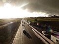
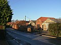
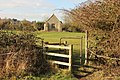
English: Elston is a small village in Nottinghamshire to the southwest of Newark, and a mile from the A46 Fosse Way. The parish of Elston lies between the rivers Trent and Devon, with "the village itself set amongst trees and farmland less than a mile from the A46. The historic market town of Newark is just five miles to the north, with the cities of Lincoln and Nottingham some eighteen miles north and southwest respectively."
Subcategories
This category has the following 7 subcategories, out of 7 total.
A
C
- The Chequers, Elston (4 F)
E
- Elston Hall (3 F)
- Elston Methodist Church (2 F)
- Elston Towers (1 F)
R
Media in category "Elston"
The following 133 files are in this category, out of 133 total.
-
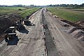
 A46 junction and bridge - geograph.org.uk - 4579779.jpg 2,256 × 1,496; 906 KB
-
 A46 new section near Eden Hall Spa - geograph.org.uk - 3464042.jpg 2,256 × 1,504; 998 KB
-
 A46 northbound - geograph.org.uk - 3657634.jpg 640 × 425; 33 KB
-
 A46 northbound - geograph.org.uk - 3657641.jpg 640 × 480; 44 KB
-
 A46 northbound - geograph.org.uk - 3657649.jpg 640 × 518; 43 KB
-
 A46 road sign - geograph.org.uk - 3464033.jpg 2,256 × 1,504; 1.01 MB
-
 Ardmore House - geograph.org.uk - 1620025.jpg 640 × 479; 92 KB
-
 Barn conversion, Elston - geograph.org.uk - 2887464.jpg 640 × 480; 62 KB
-
 Berkeley Cottage - geograph.org.uk - 1620083.jpg 640 × 479; 75 KB
-
 Breck's Lane - geograph.org.uk - 1620086.jpg 640 × 479; 66 KB
-
 Breck's Lane - geograph.org.uk - 1620087.jpg 475 × 640; 97 KB
-
 Brecks Lane towards Elston - geograph.org.uk - 2887455.jpg 640 × 480; 88 KB
-
 Brecks Lane towards Elston - geograph.org.uk - 2887460.jpg 640 × 480; 31 KB
-
 Brecks Lane towards Elston - geograph.org.uk - 3578607.jpg 640 × 465; 30 KB
-
 Brecks Lane towards Shelton - geograph.org.uk - 3578608.jpg 640 × 483; 29 KB
-
 Bridleway off Cross Lane - geograph.org.uk - 4982234.jpg 3,696 × 2,448; 2.22 MB
-
 Bridleway to Elston - geograph.org.uk - 1620089.jpg 640 × 479; 109 KB
-
 Car Dyke - geograph.org.uk - 2887451.jpg 640 × 480; 84 KB
-
 Carrgate Lane - geograph.org.uk - 1089211.jpg 640 × 427; 82 KB
-
 Carrgate Lane - geograph.org.uk - 2674153.jpg 640 × 427; 110 KB
-
 Carrgate Lane - geograph.org.uk - 2674155.jpg 640 × 427; 163 KB
-
 Carrgate Lane - geograph.org.uk - 2674156.jpg 640 × 427; 125 KB
-
 Central Drive - geograph.org.uk - 1620053.jpg 640 × 479; 85 KB
-
 Chapel Farm - geograph.org.uk - 1620022.jpg 640 × 479; 115 KB
-
 Cottages on Low Street, Elston (2) - geograph.org.uk - 2337197.jpg 1,024 × 768; 163 KB
-
 Cottages on Low Street, Elston - geograph.org.uk - 2337180.jpg 1,024 × 768; 153 KB
-
 Crop field - geograph.org.uk - 4982917.jpg 4,746 × 3,047; 6.41 MB
-
 Cross Lane - geograph.org.uk - 1089217.jpg 640 × 427; 83 KB
-
 Cross Lane - geograph.org.uk - 1620088.jpg 640 × 479; 79 KB
-
 Cross Lane - geograph.org.uk - 2336238.jpg 1,024 × 768; 101 KB
-
 Cross Lane - geograph.org.uk - 2887444.jpg 640 × 480; 74 KB
-
 Cross Lane towards Brecks Lane - geograph.org.uk - 2887448.jpg 640 × 480; 45 KB
-
 Devon Farm - geograph.org.uk - 1620092.jpg 640 × 479; 81 KB
-
 Does this count as Primrose Plantation^ - geograph.org.uk - 2846626.jpg 1,024 × 768; 233 KB
-
 Eden Hall Spa - geograph.org.uk - 2887486.jpg 800 × 507; 60 KB
-
 Eden Hall, Elston, Notts. - geograph.org.uk - 4794550.jpg 3,190 × 1,478; 744 KB
-
 Eden Spa, Elston - geograph.org.uk - 3936224.jpg 1,280 × 914; 257 KB
-
 Elston - geograph.org.uk - 1043118.jpg 640 × 427; 56 KB
-
 Elston Green - geograph.org.uk - 1620078.jpg 640 × 479; 91 KB
-

-
 Elston Mill - geograph.org.uk - 2887461.jpg 640 × 480; 49 KB
-
 Elston postbox (ref NG23 143) - geograph.org.uk - 1620068.jpg 640 × 479; 89 KB
-
 Elston telephone box - geograph.org.uk - 1620052.jpg 640 × 473; 104 KB
-
 Elston Towers - geograph.org.uk - 2679011.jpg 640 × 427; 98 KB
-
 Elston Towers, Elston - geograph.org.uk - 4158232.jpg 640 × 512; 159 KB
-

-
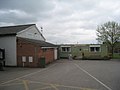 Elston Village Hall and Shop - geograph.org.uk - 2337222.jpg 1,024 × 768; 119 KB
-

-
 Elston, rainbow over the new A46 - geograph.org.uk - 2730186.jpg 640 × 480; 37 KB
-
 Elston, rainbow’s end - geograph.org.uk - 2730204.jpg 480 × 640; 39 KB
-
 Elston, southbound on the new A46 - geograph.org.uk - 2730207.jpg 640 × 480; 57 KB
-

-
 Elston, traffic cones on the A46 - geograph.org.uk - 2730196.jpg 480 × 640; 76 KB
-
 Entrance to Eden Hall Spa - geograph.org.uk - 2887472.jpg 640 × 480; 81 KB
-
 Evening sunshine at Elston Towers (Eden Spa) - geograph.org.uk - 3936225.jpg 1,280 × 795; 207 KB
-
 Farm buildings at Low Street - geograph.org.uk - 1620051.jpg 640 × 479; 89 KB
-
 Farm Buildings at The Poplars, Elston - geograph.org.uk - 2336284.jpg 1,024 × 768; 149 KB
-
 Farmland and pylons - geograph.org.uk - 2887457.jpg 640 × 480; 39 KB
-

-
 Farmland near Elston Grange - geograph.org.uk - 2889517.jpg 640 × 480; 41 KB
-
 Farmland near Sibthorpe - geograph.org.uk - 4158250.jpg 640 × 480; 115 KB
-
 Farmland off Cross Lane - geograph.org.uk - 2887446.jpg 640 × 480; 74 KB
-
 Farmland off Lodge Lane - geograph.org.uk - 2887469.jpg 640 × 480; 40 KB
-
 Farmland off Trent Lane - geograph.org.uk - 2887478.jpg 640 × 480; 37 KB
-
 Farmland towards the River Trent - geograph.org.uk - 2887483.jpg 640 × 480; 45 KB
-
 Fields north of Brecks Lane - geograph.org.uk - 3578609.jpg 640 × 475; 39 KB
-
 Footpath at Elston - geograph.org.uk - 1620046.jpg 640 × 479; 142 KB
-
 Footpath to Elston - geograph.org.uk - 4362409.jpg 1,024 × 683; 378 KB
-
 Landscape near Shelton - geograph.org.uk - 3936188.jpg 1,280 × 960; 363 KB
-
 Lay-by on the old A46 - geograph.org.uk - 2983332.jpg 3,551 × 2,647; 3.5 MB
-
 Lineham Lane - geograph.org.uk - 3578605.jpg 640 × 480; 32 KB
-
 Lineham Lane - geograph.org.uk - 3578610.jpg 640 × 498; 29 KB
-
 Lodge Lane - geograph.org.uk - 1615842.jpg 640 × 480; 125 KB
-
 Lodge Lane - geograph.org.uk - 1615843.jpg 640 × 479; 74 KB
-
 Lodge Lane - geograph.org.uk - 2679015.jpg 640 × 427; 78 KB
-
 Lodge Lane heading west - geograph.org.uk - 2887470.jpg 640 × 480; 41 KB
-
 Low Street, Elston - geograph.org.uk - 1620080.jpg 640 × 479; 118 KB
-
 Mary i Władysław Mączewscy Elston, Anglia.jpg 1,521 × 929; 459 KB
-
 Meadow Farm - geograph.org.uk - 1620091.jpg 640 × 479; 111 KB
-
 Meadow Farm - geograph.org.uk - 2887442.jpg 640 × 480; 41 KB
-
 New A46 north-east - geograph.org.uk - 2679014.jpg 640 × 427; 62 KB
-
 New A46 south-west - geograph.org.uk - 2679012.jpg 640 × 427; 83 KB
-
 New roundabout - geograph.org.uk - 2843075.jpg 1,024 × 768; 161 KB
-
 Old Chapel Lane - geograph.org.uk - 1620035.jpg 640 × 479; 127 KB
-
 Old Chapel Lane, Elston - geograph.org.uk - 2337151.jpg 1,024 × 768; 155 KB
-
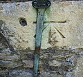 Ordnance Survey 1GL Bolt - geograph.org.uk - 4982707.jpg 640 × 596; 136 KB
-
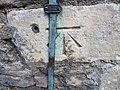 Ordnance Survey Cut Mark with Bolt (missing) - geograph.org.uk - 3891087.jpg 4,000 × 3,000; 4.32 MB
-
 Outbuildings at Lineham Farm, Elston - geograph.org.uk - 2337280.jpg 1,024 × 768; 109 KB
-
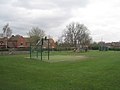 Playing field, Elston - geograph.org.uk - 2337211.jpg 1,024 × 768; 138 KB
-
 Pylons - geograph.org.uk - 3591371.jpg 564 × 640; 55 KB
-
 Signpost at Elston - geograph.org.uk - 1620070.jpg 479 × 640; 119 KB
-
 Signpost for a new roundabout - geograph.org.uk - 3195590.jpg 640 × 427; 82 KB
-
 Stoke Fields Farm - geograph.org.uk - 1620048.jpg 640 × 479; 88 KB
-

-
 The Hollies, Elston (geograph 6688457).jpg 1,024 × 768; 219 KB
-
 The Hollies, Elston - geograph.org.uk - 1620026.jpg 640 × 479; 171 KB
-
 The new A46 towards Leicester - geograph.org.uk - 2887471.jpg 640 × 480; 45 KB
-
 The Old School House - geograph.org.uk - 1620071.jpg 640 × 479; 86 KB
-
 The Old Schoolhouse, Elston - geograph.org.uk - 2336304.jpg 1,024 × 768; 121 KB
-
 The Poplars, Elston - geograph.org.uk - 1620030.jpg 640 × 479; 65 KB
-
 Toad Lane - geograph.org.uk - 1620057.jpg 640 × 479; 87 KB
-
 Toad Lane - geograph.org.uk - 2678991.jpg 640 × 427; 87 KB
-
 Top Street, Elston - geograph.org.uk - 1620064.jpg 640 × 479; 118 KB
-
 Top Street, Elston - geograph.org.uk - 2887465.jpg 640 × 480; 78 KB
-
 Tower Mill House and the former windmill, Elston - geograph.org.uk - 2336317.jpg 1,024 × 768; 138 KB
-
 Trent Lane (2) - geograph.org.uk - 2844833.jpg 1,024 × 768; 160 KB
-
 Trent Lane (2) - geograph.org.uk - 2846614.jpg 1,024 × 768; 124 KB
-
 Trent Lane (2) - geograph.org.uk - 2846641.jpg 1,024 × 768; 139 KB
-
 Trent Lane (3) - geograph.org.uk - 2846655.jpg 1,024 × 768; 168 KB
-
 Trent Lane (track) - geograph.org.uk - 2887474.jpg 640 × 480; 57 KB
-
 Trent Lane (track) - geograph.org.uk - 2887481.jpg 640 × 480; 63 KB
-
 Trent Lane (track) - geograph.org.uk - 2887484.jpg 640 × 480; 47 KB
-
 Trent Lane - geograph.org.uk - 2843053.jpg 1,024 × 768; 176 KB
-
 Trent Lane - geograph.org.uk - 2843064.jpg 1,024 × 768; 201 KB
-
 Trent Lane - geograph.org.uk - 2846604.jpg 1,024 × 768; 163 KB
-
 Trent Lane and glider - geograph.org.uk - 2846609.jpg 1,024 × 768; 98 KB
-
 Trent valley landscape - geograph.org.uk - 1620050.jpg 440 × 640; 82 KB
-
 Trent Valley landscape - geograph.org.uk - 1620112.jpg 640 × 419; 82 KB
-
 Windmill, Elston - geograph.org.uk - 1620085.jpg 479 × 640; 83 KB
-
 Bridleway - geograph.org.uk - 81011.jpg 640 × 480; 143 KB
-
 Farmland near Shelton - geograph.org.uk - 237156.jpg 640 × 427; 66 KB
-
 Farmland off Trent Lane - geograph.org.uk - 264361.jpg 640 × 480; 76 KB
-
 Farmland on Cross Lane - geograph.org.uk - 251309.jpg 640 × 427; 88 KB
-
 Firs Farm, Sibthorpe - geograph.org.uk - 251305.jpg 640 × 427; 71 KB
-
 Lineham Plantation - geograph.org.uk - 80880.jpg 640 × 480; 101 KB
-
 Longhedge Lane, Flintham - geograph.org.uk - 81089.jpg 640 × 480; 179 KB
-
 Main Street, Flintham - geograph.org.uk - 81058.jpg 640 × 480; 82 KB
-
 Moor Lane - geograph.org.uk - 84828.jpg 640 × 480; 83 KB
-
 Newfield Lane Junction - geograph.org.uk - 84636.jpg 480 × 640; 170 KB
-
 Paddocks near Sibthorpe - geograph.org.uk - 239388.jpg 640 × 427; 118 KB
-
 Pylons - geograph.org.uk - 81097.jpg 480 × 640; 68 KB
-
 Toad Lane, Elston - geograph.org.uk - 81005.jpg 640 × 480; 87 KB
-
 Trent Lane - geograph.org.uk - 264355.jpg 640 × 427; 89 KB


_-_geograph.org.uk_-_2337197.jpg)


_-_geograph.org.uk_-_1620028.jpg)

_-_geograph.org.uk_-_1620068.jpg)


_-_geograph.org.uk_-_3936225.jpg)


_-_geograph.org.uk_-_3891087.jpg)


.jpg)


_-_geograph.org.uk_-_2844833.jpg)
_-_geograph.org.uk_-_2846614.jpg)
_-_geograph.org.uk_-_2846641.jpg)
_-_geograph.org.uk_-_2846655.jpg)
_-_geograph.org.uk_-_2887474.jpg)
_-_geograph.org.uk_-_2887481.jpg)
_-_geograph.org.uk_-_2887484.jpg)


