Category:Foula
Jump to navigation
Jump to search
| Object location | | View all coordinates using: OpenStreetMap |
|---|
island of the Shetland Islands, Scotland, UK   | |||||
| Upload media | |||||
| Instance of | |||||
|---|---|---|---|---|---|
| Part of | |||||
| Location |
| ||||
| Located in or next to body of water | |||||
| Width |
| ||||
| Length |
| ||||
| Population |
| ||||
| Area |
| ||||
| Elevation above sea level |
| ||||
 | |||||
Subcategories
This category has the following 5 subcategories, out of 5 total.
Media in category "Foula"
The following 200 files are in this category, out of 375 total.
(previous page) (next page)-
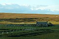
 A 'New Holland' square baler - geograph.org.uk - 5130461.jpg 640 × 480; 185 KB
-
 A road block on the Foula road - geograph.org.uk - 5130503.jpg 640 × 480; 199 KB
-
 Active peat cuttings at Lioag, Foula - geograph.org.uk - 1089290.jpg 640 × 427; 64 KB
-

-
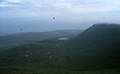
 Aerial view, Stremness, Harrier - geograph.org.uk - 2646958.jpg 635 × 498; 71 KB
-
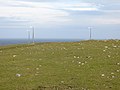
 Aerogenerator at South Ness, Foula - geograph.org.uk - 5776104.jpg 1,024 × 683; 73 KB
-
 Approaching Foula - geograph.org.uk - 39651.jpg 640 × 480; 50 KB
-
 Arctic Skua at the airstrip, Foula - geograph.org.uk - 5763506.jpg 1,024 × 682; 217 KB
-
 Arctic Tern (Sterna paradisaea), Foula - geograph.org.uk - 5815436.jpg 1,600 × 1,066; 611 KB
-
-
 Below Da Nort Bank - geograph.org.uk - 3717018.jpg 1,600 × 1,067; 619 KB
-
 Boat crane, Da Voe - geograph.org.uk - 3794612.jpg 640 × 480; 238 KB
-
 Bonxie sticks - geograph.org.uk - 3802920.jpg 640 × 853; 550 KB
-
 Braidfit and South Ness from Fadlordins, Foula - geograph.org.uk - 5776137.jpg 1,024 × 683; 165 KB
-
 Braidfit from Biggings, Foula - geograph.org.uk - 5776100.jpg 1,024 × 683; 198 KB
-
 Braidfit, Foula - geograph.org.uk - 5776095.jpg 1,024 × 683; 177 KB
-
 Breckins and the Noup from the airstrip, Foula - geograph.org.uk - 5763476.jpg 1,024 × 683; 161 KB
-
 Breckins, Foula - geograph.org.uk - 5761873.jpg 1,500 × 1,000; 489 KB
-
 Burial ground near South Ness - geograph.org.uk - 3805628.jpg 640 × 480; 297 KB
-
 Burn of Ham flowing into Ham Voe, Foula - geograph.org.uk - 5763485.jpg 1,024 × 683; 263 KB
-
 Burn of Ham, Foula - geograph.org.uk - 5763483.jpg 1,024 × 683; 213 KB
-
 Burns, Foula - geograph.org.uk - 5763403.jpg 1,024 × 683; 166 KB
-
 Burns, Foula - geograph.org.uk - 5763406.jpg 1,024 × 683; 140 KB
-
 Burns, Foula - geograph.org.uk - 5815428.jpg 1,600 × 1,065; 329 KB
-
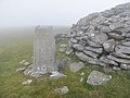
 Cairn and trig point on top of Da Sneug, Foula - geograph.org.uk - 3875996.jpg 695 × 1,024; 172 KB
-
 Cairn On Hamnafield - geograph.org.uk - 3560070.jpg 2,560 × 1,920; 3.43 MB
-
 Cattle and a Goat - geograph.org.uk - 3567569.jpg 640 × 480; 301 KB
-
 Church of Scotland Baxter Chapel, Foula - geograph.org.uk - 5763381.jpg 1,024 × 683; 171 KB
-
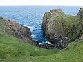
 Cliffs NE coast of Foula - geograph.org.uk - 1089343.jpg 640 × 427; 69 KB
-
 Cliffs of da Nort Bank, Foula - geograph.org.uk - 5027924.jpg 1,600 × 1,201; 638 KB
-
 Cliffs of da Nort Bank, Foula - geograph.org.uk - 5027927.jpg 1,600 × 1,203; 598 KB
-
 Cliffs, Foula.jpg 640 × 480; 181 KB
-
 Coastal heath, Foula - geograph.org.uk - 3567565.jpg 640 × 480; 248 KB
-
 Coastal View Foula - geograph.org.uk - 3560067.jpg 2,560 × 1,920; 2.63 MB
-
 Coastal View Towards Lighthouse, Foula - geograph.org.uk - 3558525.jpg 2,560 × 1,920; 2.36 MB
-
 Coastline at Hedlicliv, Foula - geograph.org.uk - 5790012.jpg 1,600 × 900; 630 KB
-
 Coastline near Huxter - geograph.org.uk - 1300214.jpg 640 × 481; 88 KB
-
 Coastllne of da Sooth Wick, Foula - geograph.org.uk - 4985843.jpg 1,600 × 1,200; 702 KB
-

-
 Croft land, Da Nort Toons - geograph.org.uk - 3806606.jpg 640 × 480; 254 KB
-
 Croft land, Foula - geograph.org.uk - 3804340.jpg 640 × 480; 302 KB
-
 Cruise ship visitors in the Foula Community Hall - geograph.org.uk - 5815404.jpg 1,600 × 1,065; 552 KB
-
 Da Baas o Stremness - geograph.org.uk - 1089322.jpg 640 × 427; 46 KB
-
 Da Biggins - geograph.org.uk - 3769298.jpg 640 × 480; 261 KB
-
 Da Burn o Ham - geograph.org.uk - 3714955.jpg 1,600 × 1,045; 747 KB
-
 Da Burn o' da Daal - geograph.org.uk - 3804350.jpg 640 × 537; 287 KB
-
 Da Burn o' Ham - geograph.org.uk - 3802956.jpg 640 × 480; 288 KB
-
 Da Burns, Foula - geograph.org.uk - 2390456.jpg 800 × 549; 113 KB
-
 Da Clay Pool - geograph.org.uk - 3807893.jpg 640 × 480; 215 KB
-
 Da Daal - geograph.org.uk - 3804302.jpg 640 × 480; 236 KB
-
 Da Est Hoevdi - geograph.org.uk - 3717060.jpg 1,600 × 1,005; 693 KB
-
 Da Hametoon - geograph.org.uk - 3804312.jpg 640 × 480; 252 KB
-
 Da Hametoon, Foula - geograph.org.uk - 3715479.jpg 1,600 × 1,023; 1.05 MB
-
 Da Head o da Taing - geograph.org.uk - 39660.jpg 640 × 483; 46 KB
-
 Da Kame - geograph.org.uk - 3559606.jpg 2,560 × 1,920; 3.46 MB
-
 Da Kame - geograph.org.uk - 3807899.jpg 640 × 480; 212 KB
-
 Da Kame - geograph.org.uk - 3807906.jpg 640 × 480; 190 KB
-
 Da Kame - geograph.org.uk - 3807912.jpg 640 × 480; 221 KB
-
 Da Lang Hoevdi, Foula, from the air - geograph.org.uk - 5815401.jpg 1,600 × 1,065; 538 KB
-
 Da Mill Loch - geograph.org.uk - 3553368.jpg 640 × 480; 246 KB
-
 Da Nab - geograph.org.uk - 3567546.jpg 640 × 460; 281 KB
-
 Da Nibb - Da Nab - geograph.org.uk - 3805665.jpg 640 × 480; 300 KB
-
 Da Nort Bank - geograph.org.uk - 3807884.jpg 640 × 480; 189 KB
-
 Da Nort Bank - geograph.org.uk - 496980.jpg 640 × 429; 126 KB
-
 Da Nort Hoevdi, Foula - geograph.org.uk - 4985849.jpg 1,600 × 1,200; 717 KB
-
 Da Noup - geograph.org.uk - 3567491.jpg 640 × 468; 250 KB
-
 Da Noup - geograph.org.uk - 3806556.jpg 640 × 480; 229 KB
-
 Da Ristie - geograph.org.uk - 3806600.jpg 640 × 480; 210 KB
-
 Da Ristie and Gaada Stack - geograph.org.uk - 5129550.jpg 640 × 480; 128 KB
-
 Da Run Hoevdi from Da Lang Hoevdi, Foula - geograph.org.uk - 6030504.jpg 1,067 × 1,600; 1.08 MB
-
 Da Sheepie, Foula - geograph.org.uk - 4991199.jpg 1,600 × 1,198; 718 KB
-
 Da Sneug - geograph.org.uk - 344867.jpg 640 × 393; 32 KB
-
 Da Sneug and Tounafjeld, Foula - geograph.org.uk - 4986822.jpg 1,600 × 1,200; 596 KB
-
 Da Sneug from Hamnafield, Foula - geograph.org.uk - 2390463.jpg 800 × 535; 60 KB
-
 Da Sneug, Foula - geograph.org.uk - 2390494.jpg 800 × 544; 72 KB
-
 Da Sneug, triangulation pillar - geograph.org.uk - 3570585.jpg 640 × 480; 256 KB
-
 Da Swaa, Foula - geograph.org.uk - 4986464.jpg 1,600 × 1,201; 696 KB
-
 Da West Hurds - geograph.org.uk - 3805634.jpg 640 × 480; 245 KB
-

-
 Departure, FOA - geograph.org.uk - 3804285.jpg 640 × 371; 176 KB
-
 Descending from Da Kame - geograph.org.uk - 3756979.jpg 686 × 1,024; 246 KB
-
 Direction stone near the airstrip, Foula - geograph.org.uk - 5763479.jpg 1,024 × 683; 217 KB
-
 Distant Foula IMG 1905 (19820470505).jpg 4,189 × 2,306; 3.4 MB
-
 East ridge of Hamnafield - geograph.org.uk - 3808703.jpg 640 × 480; 267 KB
-
 Edge of the World IMG 8766 (17463495316).jpg 4,272 × 2,460; 3.59 MB
-
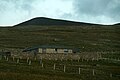
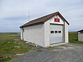 Fire station, Foula - geograph.org.uk - 3804251.jpg 640 × 480; 253 KB
-
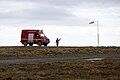 Fire tender at Foula airstrip - geograph.org.uk - 5763502.jpg 1,024 × 683; 96 KB
-
 Fishing boat off the northern coast of Foula - geograph.org.uk - 3717131.jpg 1,600 × 1,066; 708 KB
-
 FOA - geograph.org.uk - 3570593.jpg 640 × 480; 231 KB
-
 Former post office, Foula - geograph.org.uk - 3553344.jpg 640 × 480; 317 KB
-
 Former post office, Foula - geograph.org.uk - 3802945.jpg 640 × 480; 291 KB
-
 Foula aerodrome - geograph.org.uk - 3150811.jpg 640 × 427; 71 KB
-
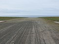
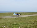
 Foula airstrip - geograph.org.uk - 3804246.jpg 640 × 480; 242 KB
-
 Foula banner.jpg 3,850 × 550; 801 KB
-
 Foula Chapel - geograph.org.uk - 3558535.jpg 2,560 × 1,920; 3.3 MB
-
 Foula comms - geograph.org.uk - 5130556.jpg 640 × 480; 122 KB
-
 Foula crop of Ordnance Survey One-Inch Sheet 4 Shetland, Published 1961.jpg 1,716 × 1,720; 287 KB
-
 Foula ewe and lamb - geograph.org.uk - 3806567.jpg 640 × 480; 364 KB
-
 Foula ferry - geograph.org.uk - 8676.jpg 640 × 221; 50 KB
-
 Foula from the north end of the airstrip - geograph.org.uk - 4999453.jpg 2,592 × 1,944; 1.59 MB
-
 Foula Lighthouse (geograph 5027735).jpg 1,600 × 1,200; 557 KB
-
 Foula map and information board at the harbour - geograph.org.uk - 5130536.jpg 5,184 × 3,888; 6.03 MB
-
 Foula pier 1981 - geograph.org.uk - 650584.jpg 640 × 592; 72 KB
-
 Foula post office.jpg 640 × 391; 98 KB
-
 Foula Primary School - geograph.org.uk - 3560089.jpg 2,560 × 1,920; 3.67 MB
-
 Foula Primary School - geograph.org.uk - 3806570.jpg 640 × 640; 306 KB
-
 Foula Primary School - geograph.org.uk - 5130573.jpg 640 × 480; 190 KB
-
 Foula Primary School - geograph.org.uk - 5763319.jpg 1,024 × 683; 121 KB
-
 Foula Primary School and Community Centre - geograph.org.uk - 4986477.jpg 1,600 × 1,198; 582 KB
-
 Foula School - geograph.org.uk - 3553330.jpg 640 × 316; 155 KB
-
 Foula school and solar panel array - geograph.org.uk - 5130576.jpg 640 × 480; 220 KB
-
 Foula sheep - geograph.org.uk - 3804353.jpg 640 × 480; 303 KB
-
 Foula sheep - geograph.org.uk - 5027788.jpg 1,600 × 1,200; 517 KB
-

-

-

-
-
 Foula WW I War Memorial - geograph.org.uk - 3560123.jpg 2,540 × 1,894; 2.47 MB
-
 Foula's only Council House - geograph.org.uk - 4985977.jpg 1,600 × 1,200; 608 KB
-
 Foula's road following Da Crookit Burn - geograph.org.uk - 4985997.jpg 1,600 × 1,202; 433 KB
-
 Foula.PNG 272 × 388; 12 KB
-
 Freyers from Hiorawick, Foula - geograph.org.uk - 5771501.jpg 1,024 × 682; 166 KB
-
 Freyers from the Ristie Nesses, Foula - geograph.org.uk - 5771460.jpg 1,024 × 682; 137 KB
-
 Freyers, Foula - geograph.org.uk - 5898163.jpg 1,600 × 1,065; 660 KB
-
 Fulmars Attack - geograph.org.uk - 3559618.jpg 2,560 × 1,920; 2.45 MB
-
 Gaada Stack (geograph 496975).jpg 1,200 × 789; 489 KB
-
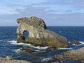 Gaada Stack (geograph 4991193).jpg 1,600 × 1,200; 598 KB
-
 Gaada Stack from Hamnafield, Foula - geograph.org.uk - 2390501.jpg 800 × 520; 86 KB
-
 Garmin navigation display - geograph.org.uk - 5130604.jpg 5,184 × 3,888; 6.25 MB
-
 Geo at the Head o' da Hurd, South Ness, Foula - geograph.org.uk - 5763352.jpg 1,024 × 683; 216 KB
-
 Geo o' Muntavie, Stremness, Foula - geograph.org.uk - 5771511.jpg 1,024 × 682; 145 KB
-
 Gone Fishing IMG 2312 (34549903981).jpg 4,272 × 2,254; 2.21 MB
-

-
 Halfmoon above Hamnafield, Foula - geograph.org.uk - 5815430.jpg 1,600 × 1,065; 218 KB
-
 Ham and its kale yard, Foula - geograph.org.uk - 5027688.jpg 1,600 × 1,600; 1.19 MB
-
 Ham from Bodlifield, Foula - geograph.org.uk - 5776148.jpg 1,024 × 682; 193 KB
-
 Ham from the ridge of Hamnafield, Foula - geograph.org.uk - 3716722.jpg 1,600 × 1,066; 600 KB
-
 Ham Little, Foula - geograph.org.uk - 5893997.jpg 1,600 × 1,065; 698 KB
-
 Ham Voe, Foula - geograph.org.uk - 5763459.jpg 1,024 × 683; 194 KB
-
 Ham Yard, Foula - geograph.org.uk - 5763469.jpg 1,024 × 683; 152 KB
-
 Ham, Foula - geograph.org.uk - 5763471.jpg 1,024 × 683; 135 KB
-
 Ham, Foula - geograph.org.uk - 5763473.jpg 1,024 × 683; 133 KB
-
 Hametoun and the Noup, Foula, from the air - geograph.org.uk - 5894020.jpg 1,600 × 1,065; 428 KB
-
 Hametoun, Foula - geograph.org.uk - 5763326.jpg 1,024 × 683; 156 KB
-
 Hametoun, Foula - geograph.org.uk - 5776108.jpg 1,024 × 683; 159 KB
-
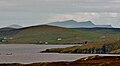
 Hamnafield and Mill Loch, Foula - geograph.org.uk - 5763291.jpg 1,024 × 683; 108 KB
-
 Hamnafield from Bodlifield, Foula - geograph.org.uk - 5776158.jpg 1,024 × 682; 187 KB
-
 Hamnafield from the Sneug, Foula - geograph.org.uk - 5790064.jpg 1,600 × 900; 554 KB
-
 Hamnafield from Tounafield, Foula - geograph.org.uk - 5776187.jpg 1,024 × 682; 157 KB
-
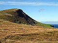
 Hamnafield, Foula - geograph.org.uk - 344872.jpg 640 × 393; 24 KB
-
 Harbour at Ham, Foula - geograph.org.uk - 5893999.jpg 1,600 × 1,065; 726 KB
-
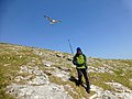
 Harrier - geograph.org.uk - 3806594.jpg 640 × 480; 307 KB
-
 Harrier and the Sneuga, Foula - geograph.org.uk - 5763419.jpg 1,024 × 683; 168 KB
-
 Hesti Geo, Foula - geograph.org.uk - 4979393.jpg 1,600 × 1,201; 919 KB
-
 Hesti Geo, South Ness, Foula - geograph.org.uk - 5763372.jpg 1,024 × 683; 164 KB
-
 High Cliffs of Foula 2005.jpg 1,200 × 1,600; 1.45 MB
-
 Hiorawick and Strem Ness - geograph.org.uk - 1089300.jpg 640 × 377; 48 KB
-
 Hiorawick Coastal View - geograph.org.uk - 3507408.jpg 2,560 × 1,920; 3.31 MB
-
 Hiorawick, Foula - geograph.org.uk - 5771503.jpg 1,024 × 684; 104 KB
-
 House with a view IMG 1337 (14573088979).jpg 4,272 × 2,212; 3.36 MB
-
 Inside the Foula chapel - geograph.org.uk - 5763481.jpg 1,024 × 683; 60 KB
-
 Inside the Foula telephone box - geograph.org.uk - 2390312.jpg 599 × 800; 113 KB
-
 Irises beside the Burn of Ham, Foula - geograph.org.uk - 5763487.jpg 1,024 × 683; 222 KB
-
 Island of Dreams IMG 1706 (33494365714).jpg 4,234 × 2,290; 2.11 MB
-
 Kriggy - geograph.org.uk - 3805648.jpg 640 × 480; 311 KB
-
 Landing preparations - geograph.org.uk - 3804265.jpg 640 × 480; 262 KB
-
 Landing, Foula - geograph.org.uk - 3804269.jpg 640 × 480; 239 KB
-
 Leraback, Ham, Foula - geograph.org.uk - 5763313.jpg 1,024 × 683; 179 KB
-
 Loch from Bodlifield, Foula - geograph.org.uk - 5776167.jpg 1,024 × 683; 151 KB
-
 Loch, Foula - geograph.org.uk - 5763400.jpg 1,024 × 683; 203 KB
-
 Loch, Foula - geograph.org.uk - 5898172.jpg 1,600 × 1,065; 492 KB
-
 Lochans in the coastal grazing land, Foula - geograph.org.uk - 4985834.jpg 1,600 × 1,200; 567 KB
-
 Lochs o' da Fleck from the Sneug, Foula - geograph.org.uk - 5776191.jpg 1,024 × 682; 134 KB
-
 Lone Flight IMG 1964 (28081023391).jpg 4,218 × 2,247; 2.56 MB
-
 Looking back to Da Kame - geograph.org.uk - 3756982.jpg 1,024 × 723; 142 KB
-

-
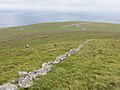
 Looking south on the road across Foula - geograph.org.uk - 5130466.jpg 640 × 480; 139 KB
-
 Looking towards da Noup from da Sooth Ness - geograph.org.uk - 5027762.jpg 1,600 × 1,199; 757 KB
-
 Mill Loch and Ham from Bodlifield, Foula - geograph.org.uk - 5776143.jpg 1,024 × 682; 219 KB
-

-
 Mill Loch, Foula - geograph.org.uk - 344876.jpg 640 × 416; 44 KB
-
 Moorland, Foula - geograph.org.uk - 3802963.jpg 640 × 480; 250 KB
-
 Mucklebrik's Wick - geograph.org.uk - 344914.jpg 424 × 640; 73 KB
-
 Mucklebrik's Wick, Foula - geograph.org.uk - 2390303.jpg 553 × 800; 149 KB
-
 Mucklegrind - geograph.org.uk - 5129545.jpg 640 × 480; 195 KB
-
 Mucklegrind, Foula - geograph.org.uk - 5763435.jpg 1,024 × 683; 149 KB
-
 Mucklegrind, Foula - geograph.org.uk - 5771421.jpg 1,024 × 682; 139 KB
-
 Mucklegrind, Foula - geograph.org.uk - 5815417.jpg 1,600 × 1,065; 532 KB
-
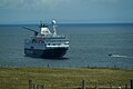 MV Ocean Endeavour off Ham, Foula - geograph.org.uk - 5815407.jpg 1,600 × 1,065; 381 KB
-
 Mystic Island IMG 1530 (27771251882).jpg 4,245 × 2,286; 3.55 MB
-
 Nebbifield from the south, Foula - geograph.org.uk - 5777310.jpg 800 × 533; 196 KB
-
 Nebbifield, Foula - geograph.org.uk - 2390481.jpg 548 × 800; 115 KB
-
 Nebbifield, Foula - geograph.org.uk - 5776210.jpg 1,024 × 682; 210 KB
-
 Nessaskerry, South Ness, Foula - geograph.org.uk - 5790039.jpg 1,600 × 900; 666 KB
-
 New Advance, The Voe - geograph.org.uk - 3553320.jpg 640 × 480; 260 KB
-
 Newborn lamb, Da Hametoon - geograph.org.uk - 3804327.jpg 640 × 480; 319 KB
-
 Night Calm IMG 2314 (34295604260).jpg 4,236 × 2,481; 2.33 MB
-
 Nightfall IMG 1704 (33950902010).jpg 4,256 × 2,447; 2.26 MB
-
 Noosts below Ham, Foula - geograph.org.uk - 5027699.jpg 1,600 × 1,200; 1.05 MB
-
 North cliffs of Foula - geograph.org.uk - 5898169.jpg 1,600 × 1,065; 482 KB


,_Foula_-_geograph.org.uk_-_5815436.jpg)


,_Skeld,_Foula_-_geograph.org.uk_-_5771400.jpg)


.jpg)

.jpg)


.jpg)


.jpg)
.jpg)
.jpg)
.jpg)


.jpg)
.jpg)


.jpg)
_in_the_surf_in_Klettgeo,_Foula_-_geograph.org.uk_-_5771519.jpg)


.jpg)


.jpg)


.jpg)


.jpg)


.jpg)
.jpg)

