Category:Galston, East Ayrshire
Jump to navigation
Jump to search

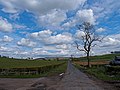
Galston is a town in East Ayrshire, Scotland which has a population of 5198, (2001). It is situated in wooded countryside 4 miles up-river from Kilmarnock and is one a group of small towns located in the Irvine Valley between the towns of Hurlford and Newmilns. The area of Loudoun is also home to Loudoun Castle theme park.
town in East Ayrshire, Scotland, UK  | |||||
| Upload media | |||||
| Instance of |
| ||||
|---|---|---|---|---|---|
| Location |
| ||||
| Population |
| ||||
| Different from | |||||
 | |||||
Subcategories
This category has the following 18 subcategories, out of 18 total.
A
- Alton Muirhouse Farm (4 F)
- Auchencloigh, Galston (3 F)
B
- Bankhead lochan (2 F)
- Burn Anne (8 F)
C
D
- Darvel transmitter (6 F)
L
- Loudoun Castle (theme park) (2 F)
- Loudoun Gowf Club (3 F)
- Loudoun lime kilns (3 F)
M
- Mean Muir (10 F)
N
- Nether Newton Farm (2 F)
P
- Galston Parish Church (68 F)
- Polbaith Burn (2 F)
R
- Raithmuir (2 F)
S
- St Sophia's church, Galston (38 F)
Media in category "Galston, East Ayrshire"
The following 200 files are in this category, out of 205 total.
(previous page) (next page)-
 'The Clinchyard Mount' - Galston - geograph.org.uk - 6128379.jpg 4,320 × 3,240; 3.32 MB
-
 'The Four Corners' - Galston - geograph.org.uk - 6159549.jpg 3,889 × 2,917; 3.11 MB
-

-

-

-
-
 A71 and A719 junction at Galston - geograph.org.uk - 5880938.jpg 640 × 488; 59 KB
-
 A71 at Galston - geograph.org.uk - 1860580.jpg 640 × 480; 48 KB
-
 A719 at Galston boundary - geograph.org.uk - 4573686.jpg 640 × 481; 69 KB
-
 A719 near Galston - geograph.org.uk - 4556326.jpg 1,600 × 1,200; 395 KB
-
 A719 near Galston - geograph.org.uk - 4556332.jpg 1,600 × 1,200; 421 KB
-
 B744 approaching Galston - geograph.org.uk - 4556337.jpg 1,600 × 1,200; 313 KB
-
 B744 Road Junction - geograph.org.uk - 6128219.jpg 3,970 × 2,978; 2.77 MB
-
 Baile nan Gall 1149291.jpg 347 × 640; 156 KB
-
 Balmoral Mill Shop, Polwarth Street, Galston - geograph.org.uk - 4023835.jpg 5,184 × 3,456; 7.41 MB
-
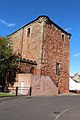
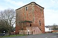
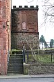
 Barr Castle - Galston - geograph.org.uk - 6073864.jpg 3,675 × 2,796; 1.61 MB
-
 Barr Castle - Galston - geograph.org.uk - 6074219.jpg 4,320 × 3,240; 3.87 MB
-
 Barr Castle - Galston - geograph.org.uk - 6159703.jpg 2,963 × 2,222; 2.36 MB
-
 Barr Castle Car Park, Galston - geograph.org.uk - 4205658.jpg 1,920 × 1,280; 1.97 MB
-
 Barr Castle Car Park, Galston - geograph.org.uk - 6070830.jpg 2,976 × 1,984; 3.55 MB
-
 Barr Castle Car Park, Galston - geograph.org.uk - 6070881.jpg 2,976 × 1,984; 1.11 MB
-
 Barr Castle Garden, Galston - geograph.org.uk - 6070877.jpg 2,976 × 1,984; 3.94 MB
-
 Barr Castle Gardens, Galston - geograph.org.uk - 4205687.jpg 1,920 × 1,280; 1.54 MB
-
 Barr Castle Gardens, Galston - geograph.org.uk - 4205690.jpg 1,920 × 1,280; 1.39 MB
-
 Barr Castle Gardens, Galston - geograph.org.uk - 6070872.jpg 2,976 × 1,984; 2.51 MB
-
 Barr Castle, Galston - geograph.org.uk - 4025379.jpg 1,600 × 1,067; 625 KB
-
 Barr Castle, Galston - geograph.org.uk - 4205648.jpg 1,170 × 1,832; 483 KB
-
 Barr Castle, Galston - geograph.org.uk - 4205681.jpg 1,851 × 1,159; 362 KB
-
 Barr Castle, Galston - geograph.org.uk - 4205683.jpg 1,280 × 1,920; 1.16 MB
-
 Barr Castle, Galston - geograph.org.uk - 4205684.jpg 1,280 × 1,920; 1.59 MB
-
 Barr Castle, Galston - geograph.org.uk - 5944787.jpg 1,024 × 768; 287 KB
-
 Barr Castle, Galston - geograph.org.uk - 6070798.jpg 1,984 × 2,976; 2.47 MB
-
 Barr Castle, Galston - geograph.org.uk - 6070818.jpg 2,976 × 1,984; 3.68 MB
-
 Barr Castle, Galston - geograph.org.uk - 6070829.jpg 2,976 × 1,984; 3.95 MB
-
 Barr Castle, Galston - geograph.org.uk - 6070856.jpg 2,976 × 1,984; 3.55 MB
-
 Barr Castle, Galston - geograph.org.uk - 6070860.jpg 1,984 × 2,976; 3.09 MB
-
 Barr Castle, Galston - geograph.org.uk - 6070863.jpg 2,976 × 1,984; 3.24 MB
-
 Barr Castle, Galston - geograph.org.uk - 6070870.jpg 1,984 × 2,976; 2.85 MB
-
 Barr Castle, Galston - geograph.org.uk - 6070893.jpg 1,984 × 2,976; 3.11 MB
-
 Barr Castle, Galston - geograph.org.uk - 6070904.jpg 2,976 × 1,984; 3.05 MB
-
 Barr Street, Galston - geograph.org.uk - 4205653.jpg 1,920 × 1,280; 1.03 MB
-
 Barr Street, Galston - geograph.org.uk - 4205655.jpg 1,920 × 1,280; 1.58 MB
-
 Barr Street, Galston - geograph.org.uk - 6070883.jpg 1,984 × 2,976; 3.22 MB
-
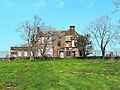
 Barward Farm - Galston - geograph.org.uk - 6149699.jpg 4,320 × 3,240; 3.28 MB
-
 Barward farm, Galston - geograph.org.uk - 274462.jpg 640 × 436; 80 KB
-
 Belvedere Plantation - Galston - geograph.org.uk - 6073760.jpg 3,587 × 2,690; 2.17 MB
-
 Bentinck Street, Galston - geograph.org.uk - 4205718.jpg 1,920 × 1,280; 982 KB
-
 Bentinck Street, Galston - geograph.org.uk - 4205722.jpg 1,920 × 1,280; 1.29 MB
-
 Blair's Free School building, Galston, East Ayrshire.jpg 3,635 × 3,077; 2.24 MB
-
 BP filling station at Galston - geograph.org.uk - 1860577.jpg 640 × 480; 43 KB
-
 Brewland Street, Galston - geograph.org.uk - 1149286.jpg 427 × 640; 165 KB
-
 Bridge over Anne Burn - geograph.org.uk - 4559803.jpg 1,600 × 1,200; 499 KB
-
 Bridge Street, Galston - geograph.org.uk - 4018432.jpg 5,184 × 3,456; 5.86 MB
-
 Buck's Head, Bridge Street, Galston - geograph.org.uk - 4018419.jpg 5,184 × 3,456; 7.13 MB
-
 Buildings at Waterside - geograph.org.uk - 338964.jpg 640 × 480; 102 KB
-
 Burn Anne - geograph.org.uk - 2276016.jpg 640 × 480; 127 KB
-
 Burn Anne, Galston - geograph.org.uk - 6070802.jpg 1,984 × 2,976; 3.55 MB
-
 Burn Anne, Galston - geograph.org.uk - 6070806.jpg 1,772 × 2,797; 1.35 MB
-
 Cemetery Road, Galston - geograph.org.uk - 6026522.jpg 1,024 × 557; 117 KB
-
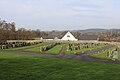
 Cemetery, Galston - geograph.org.uk - 6070940.jpg 2,976 × 1,984; 3.13 MB
-
 Cemetery, Galston - geograph.org.uk - 6070941.jpg 2,976 × 1,984; 3.88 MB
-
 Cemetery, Galston - geograph.org.uk - 6070943.jpg 2,976 × 1,984; 1.71 MB
-
 Cemetery, Galston - geograph.org.uk - 6070945.jpg 2,976 × 1,984; 3 MB
-
 Cemetery, Galston - geograph.org.uk - 6070946.jpg 2,976 × 1,984; 3.68 MB
-
 Cemetery, Galston - geograph.org.uk - 6070947.jpg 2,976 × 1,984; 1.27 MB
-
 Cemetery, Galston - geograph.org.uk - 6070949.jpg 2,976 × 1,984; 3.71 MB
-
 Cemetery, Galston - geograph.org.uk - 6070951.jpg 2,976 × 1,984; 3.94 MB
-
 Cemetery, Galston - geograph.org.uk - 6070955.jpg 2,976 × 1,984; 3.28 MB
-
 Cemetery, Galston - geograph.org.uk - 6070957.jpg 2,976 × 1,984; 3.85 MB
-
 Cemetery, Galston - geograph.org.uk - 6070962.jpg 2,976 × 1,984; 3.38 MB
-
 Cessnock Castle - Galston - geograph.org.uk - 6073809.jpg 3,719 × 2,789; 3.49 MB
-
 Chapel Lane, Galston - geograph.org.uk - 4205640.jpg 1,920 × 1,280; 1.39 MB
-
 Church Lane at Cross Street, Galston - geograph.org.uk - 4018378.jpg 1,600 × 1,067; 466 KB
-
 Clinchyard - geograph.org.uk - 257178.jpg 640 × 408; 108 KB
-
 Clinchyard Farm - geograph.org.uk - 257184.jpg 640 × 344; 105 KB
-
 Dead end^ Really^ - geograph.org.uk - 170743.jpg 640 × 482; 113 KB
-

-
 Door to Barr Castle, Galston - geograph.org.uk - 6070815.jpg 1,984 × 2,976; 3.29 MB
-

-
 East Newton Limestone Quarry.JPG 4,556 × 2,498; 5.67 MB
-
 Entrance to Barr Castle Garden, Galston - geograph.org.uk - 6070851.jpg 2,976 × 1,984; 995 KB
-
 Entrance to Barr Castle, Galston - geograph.org.uk - 6070811.jpg 1,984 × 2,976; 3.62 MB
-
 Entrance to Cessnock Castle - geograph.org.uk - 6141624.jpg 3,004 × 2,253; 3.18 MB
-
 Entrance to Cowgrove farm - geograph.org.uk - 225160.jpg 480 × 640; 81 KB
-
 Exit from Barr Castle Garden, Galston - geograph.org.uk - 6070844.jpg 2,976 × 1,984; 2.84 MB
-
 Farm road to Hillend - geograph.org.uk - 4559792.jpg 1,600 × 1,200; 666 KB
-
 Farm Road, near Whatriggs - geograph.org.uk - 1493151.jpg 640 × 480; 100 KB
-
 Field Boundary - geograph.org.uk - 1491886.jpg 640 × 480; 96 KB
-
 Fish ladder on Burn Anne at Burn Anne Bridge - geograph.org.uk - 6026543.jpg 1,024 × 575; 254 KB
-
 Flats to go, Galston - geograph.org.uk - 1149331.jpg 640 × 427; 145 KB
-
 Footbridge over Burn Anne - geograph.org.uk - 6026547.jpg 1,024 × 575; 246 KB
-

-
 Gallow Law memorial - geograph.org.uk - 3791871.jpg 2,048 × 1,536; 1.08 MB
-
 Galston - geograph.org.uk - 350592.jpg 640 × 480; 113 KB
-
 Galston Cemetery - geograph.org.uk - 6070908.jpg 2,976 × 1,984; 2.25 MB
-
 Galston Cemetery - geograph.org.uk - 6070911.jpg 2,976 × 1,984; 2.72 MB
-
 Galston Cemetery - geograph.org.uk - 6070914.jpg 2,976 × 1,984; 2.88 MB
-
 Galston Cemetery - geograph.org.uk - 6070916.jpg 2,976 × 1,984; 2.29 MB
-
 Galston Cemetery - geograph.org.uk - 6070920.jpg 2,976 × 1,984; 3.32 MB
-
 Galston Cemetery - geograph.org.uk - 6070926.jpg 2,976 × 1,984; 3.05 MB
-
 Galston Cemetery - geograph.org.uk - 6070928.jpg 2,976 × 1,984; 2.62 MB
-
 Galston Cemetery - geograph.org.uk - 6070929.jpg 2,976 × 1,984; 2.54 MB
-
 Galston Cemetery - geograph.org.uk - 6070931.jpg 2,976 × 1,984; 3.02 MB
-
 Galston Cemetery - geograph.org.uk - 6070933.jpg 2,976 × 1,984; 3.1 MB
-
 Galston Cemetery - geograph.org.uk - 6070937.jpg 2,976 × 1,984; 2.49 MB
-
 Galston Cemetery - geograph.org.uk - 6070963.jpg 2,976 × 1,984; 3.24 MB
-
 Galston Cemetery - geograph.org.uk - 6070964.jpg 2,976 × 1,984; 3.13 MB
-
 Galston Cemetery - geograph.org.uk - 6070967.jpg 2,976 × 1,984; 3.58 MB
-
 Galston Cemetery - geograph.org.uk - 6070971.jpg 2,976 × 1,984; 2.91 MB
-
 Galston Cemetery - geograph.org.uk - 6070972.jpg 2,976 × 1,984; 3.04 MB
-
 Galston Cemetery - geograph.org.uk - 6070974.jpg 2,976 × 1,984; 3.14 MB
-
 Galston Cemetery - geograph.org.uk - 6070982.jpg 2,976 × 1,984; 2.77 MB
-
 Galston Cemetery - geograph.org.uk - 6070986.jpg 2,976 × 1,984; 2.45 MB
-
 Galston Cemetery - geograph.org.uk - 6070987.jpg 2,976 × 1,984; 2.47 MB
-
 Galston Cemetery - geograph.org.uk - 6070991.jpg 2,976 × 1,984; 2.71 MB
-
 Galston Cemetery - geograph.org.uk - 6070996.jpg 2,976 × 1,984; 2.97 MB
-
 Galston Cemetery - geograph.org.uk - 6070999.jpg 2,976 × 1,984; 2.67 MB
-
 Galston Cemetery - geograph.org.uk - 6071013.jpg 2,976 × 1,984; 3.53 MB
-
 Galston Cemetery Car Park - geograph.org.uk - 6071003.jpg 2,976 × 1,984; 2.84 MB
-
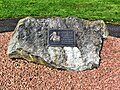 Galston Coal Mining Memorial - geograph.org.uk - 6123939.jpg 3,941 × 2,955; 2.98 MB
-
 Galston Community Centre - geograph.org.uk - 4205635.jpg 1,920 × 1,280; 1.24 MB
-
 Galston Community Library - geograph.org.uk - 4025396.jpg 5,184 × 3,456; 6.9 MB
-
 Galston from the air (geograph 2071561).jpg 2,592 × 1,944; 3.96 MB
-
 Galston Parish (19); Loudon Parish (30).jpg 6,000 × 2,849; 2.08 MB
-
 Galston Parish Church - geograph.org.uk - 6163420.jpg 3,838 × 2,878; 4.16 MB
-
 Galston Primary School (Former), Glebe Road, Galston - geograph.org.uk - 6124520.jpg 2,671 × 3,560; 4.54 MB
-
 Galston Primary School (Former), Glebe Road, Galston - geograph.org.uk - 6124540.jpg 4,179 × 3,135; 3.84 MB
-
 Galston Primary School (Former), Glebe Road, Galston - geograph.org.uk - 6124557.jpg 3,710 × 3,221; 2.14 MB
-
 Galston station site geograph-3555607-by-Ben-Brooksbank.jpg 2,352 × 1,406; 2.7 MB
-
 Galston Town Hall, East Ayrshire.jpg 4,472 × 3,672; 3.29 MB
-
 Galston War Memorial - geograph.org.uk - 4025407.jpg 3,456 × 5,184; 6.49 MB
-
 Galston War Memorial - geograph.org.uk - 6073920.jpg 3,165 × 4,264; 1.78 MB
-
 Houses in Galston - geograph.org.uk - 6071005.jpg 2,976 × 1,984; 2.75 MB
-
 Howletburn road-end - geograph.org.uk - 170745.jpg 640 × 481; 109 KB
-

-
 It did not save U Save - geograph.org.uk - 1149325.jpg 640 × 427; 175 KB
-
 James Smith Covenanter Memorial, Gallow Law, Molmont Hill, East Ayrshire. Detail.jpg 4,583 × 2,577; 2.09 MB
-

-
 James Smith's Covenanter memorial, Gallow Law, Molmont Hill, Galston.jpg 4,896 × 2,752; 2.38 MB
-
 Jock's Lodge - geograph.org.uk - 6141591.jpg 3,946 × 2,908; 2.49 MB
-
 Ladyton Loch - geograph.org.uk - 1845671.jpg 640 × 426; 63 KB
-
 Little Sorn Farm.JPG 2,288 × 1,712; 1.3 MB
-

-
 Lodge St, Peter, Galston - geograph.org.uk - 6070823.jpg 1,984 × 2,976; 2.68 MB
-
 Loudon Academy, Galston.jpg 800 × 511; 108 KB
-
 LoudonAcademy.jpg 530 × 237; 40 KB
-
 Loudoun Academy, Galston - geograph.org.uk - 2252684.jpg 640 × 481; 58 KB
-
 Loudoun Academy, Galston - geograph.org.uk - 338965.jpg 640 × 487; 65 KB
-
 Loudoun Academy, Galston - geograph.org.uk - 4027527.jpg 5,184 × 3,456; 7.53 MB
-

-
 Masons Arms, Henrietta Street, Galston - geograph.org.uk - 4025391.jpg 1,600 × 1,067; 534 KB
-
 Meadow and Woodland Burial Site, Galston - geograph.org.uk - 6071008.jpg 2,976 × 1,984; 3.18 MB
-
 Meadow and Woodland Burial Site, Galston - geograph.org.uk - 6071018.jpg 2,976 × 1,984; 3.71 MB
-
 Meadow and Woodland Burial Site, Galston - geograph.org.uk - 6071022.jpg 2,976 × 1,984; 4.32 MB
-
 Meadow and Woodland Burial Site, Galston - geograph.org.uk - 6071024.jpg 2,976 × 1,984; 3.89 MB
-
 Memorial Bench, Galston - geograph.org.uk - 6070840.jpg 2,976 × 1,984; 3.68 MB
-
 Memorial Plaque, Galston - geograph.org.uk - 6070899.jpg 2,976 × 1,984; 4.79 MB
-
 Memorial Plaque, Galston - geograph.org.uk - 6070901.jpg 2,976 × 1,984; 4.32 MB
-
-
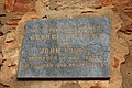
 Memorial stone to Andrew Blair of Longhouse, Galston in the parish churchyard.jpg 3,562 × 2,097; 4.05 MB
-
 Memorial to Andrew Blair of Longhouse, Galston in the parish churchyard.jpg 3,262 × 2,914; 4.9 MB
-
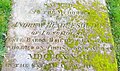
 Memorial to the Clarks of Holme House, Galston in the parish churchyard.jpg 3,856 × 2,954; 2.2 MB
-
 Memorials to the Clarks of Holme House, Galston in the parish churchyard.jpg 4,896 × 3,405; 3.04 MB
-
 Memorials to the Clarks of Holme House, Galston.jpg 4,895 × 2,735; 4.17 MB
-
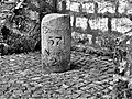 Milestone at Galston Cross - geograph.org.uk - 6158708.jpg 3,372 × 2,530; 2.34 MB
-
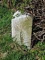
 Milestone on the B744 - Galston - geograph.org.uk - 6128827.jpg 3,272 × 2,454; 2.18 MB
-
 Milestone on the B744 - geograph.org.uk - 6129372.jpg 3,143 × 4,189; 7.05 MB
-
 Milestone on the B744 - geograph.org.uk - 6129403.jpg 3,240 × 4,320; 4.3 MB
-
 Milton Road, Galston - geograph.org.uk - 4205628.jpg 1,920 × 1,280; 1.19 MB
-
 Minor Road at Oldwalls Farm - geograph.org.uk - 2921971.jpg 3,748 × 2,811; 6.5 MB
-
 Minor Road Oldwalls Farm - geograph.org.uk - 2922124.jpg 3,720 × 2,613; 6.45 MB
-
 Neat hedges above Threepwood - geograph.org.uk - 6026561.jpg 1,024 × 575; 214 KB
-
 Nether Newton - geograph.org.uk - 4027511.jpg 5,184 × 3,456; 7.73 MB
-

-

-
 Orchard Street, Galston - geograph.org.uk - 4018352.jpg 5,184 × 3,456; 7.04 MB
-
 Orchard Street, Galston - geograph.org.uk - 4205626.jpg 1,920 × 1,280; 1.44 MB
-
 Orchard Street, Galston - geograph.org.uk - 4205632.jpg 1,920 × 1,280; 1.54 MB
-
 Polwarth Street, Galston - geograph.org.uk - 4023824.jpg 5,184 × 3,456; 7.66 MB
-
 Portland Arms Hotel, Galston (geograph 4018397).jpg 1,600 × 1,067; 461 KB
-
 Ruins at East Threepwood, near Galston - geograph.org.uk - 2276714.jpg 640 × 480; 111 KB
-

-
 Scots pines at Millands - geograph.org.uk - 224944.jpg 640 × 480; 79 KB
-
 Small Woodland and Farmland - geograph.org.uk - 2922233.jpg 3,748 × 2,811; 5.69 MB
-
 Sornbeg Farm - Galston - geograph.org.uk - 6128215.jpg 3,932 × 2,949; 1.98 MB
-
 Sparnelbank Farm - Galston - geograph.org.uk - 6159753.jpg 3,761 × 2,821; 2.65 MB
-
 Sparnelbank Farm - Galston - geograph.org.uk - 6160690.jpg 3,844 × 2,883; 3.47 MB
-
 St Sophia's Church - Galston - geograph.org.uk - 6073824.jpg 2,876 × 3,834; 4.55 MB
-
 Stewartonflower2.JPG 2,288 × 1,712; 1.3 MB
-
 The Barr Castle, East Ayrshire - view from the town centre.jpg 3,512 × 2,009; 1.42 MB
-
 The Barr Castle, Galston, East Ayrshire. West side.jpg 4,438 × 2,516; 2.13 MB
-
 The Blair's Free School building, Galston, East Ayrshire.jpg 4,539 × 3,203; 2.59 MB
-
 The Burn Anne path through Burnhouse Brae Wood - geograph.org.uk - 6026537.jpg 575 × 1,024; 246 KB
-
 The Burn Anne path through Burnhouse Brae Wood - geograph.org.uk - 6026539.jpg 1,024 × 549; 241 KB
-
 The Burn Anne path through Burnhouse Brae Wood - geograph.org.uk - 6026541.jpg 548 × 1,024; 251 KB
-
 The Irvine Valley Path Network - geograph.org.uk - 6070889.jpg 2,976 × 1,984; 3.38 MB
-
 The Upper Irvine Valley - geograph.org.uk - 5613163.jpg 480 × 640; 145 KB
-
 The Upper Irvine Valley - geograph.org.uk - 5613164.jpg 640 × 480; 154 KB
-
 The Wee Shop, Galston - geograph.org.uk - 4205630.jpg 1,920 × 1,280; 1.39 MB
-
 Threepwood Farm - geograph.org.uk - 2276026.jpg 640 × 480; 61 KB


.jpg)
;_Loudon_Parish_(30).jpg)

,_Glebe_Road,_Galston_-_geograph.org.uk_-_6124520.jpg)
,_Glebe_Road,_Galston_-_geograph.org.uk_-_6124540.jpg)
,_Glebe_Road,_Galston_-_geograph.org.uk_-_6124557.jpg)


.jpg)


