Category:Haddenham, Buckinghamshire
Jump to navigation
Jump to search
English: Haddenham is a large village and is also a civil parish within Aylesbury Vale district in Buckinghamshire, England. It is about north-east of Thame.
village in Buckinghamshire, England, UK  | |||||
| Upload media | |||||
| Instance of | |||||
|---|---|---|---|---|---|
| Location | Haddenham, Aylesbury Vale, Buckinghamshire, South East England, England | ||||
| Population |
| ||||
 | |||||
Subcategories
This category has the following 8 subcategories, out of 8 total.
Media in category "Haddenham, Buckinghamshire"
The following 197 files are in this category, out of 197 total.
-

-

-
-
 A418 Aylesbury Road in open country - geograph.org.uk - 3021314.jpg 640 × 480; 68 KB
-
 A418 near Roundhill Farm - geograph.org.uk - 3021296.jpg 640 × 480; 61 KB
-
 A418 nearing Thame roundabout - geograph.org.uk - 2865255.jpg 640 × 428; 58 KB
-
 A418 west at Budnall Farm junction - geograph.org.uk - 2865244.jpg 640 × 452; 98 KB
-
 A418 west of Haddenham - geograph.org.uk - 3021311.jpg 640 × 480; 73 KB
-
 A418 west of Kings Cross junctions - geograph.org.uk - 3021294.jpg 640 × 480; 77 KB
-
 AA Telephone Box and disused Garage in Haddenham, Bucks - geograph.org.uk - 6146896.jpg 2,592 × 1,944; 1.38 MB
-
 AA Telephone Box in Haddenham, Bucks - geograph.org.uk - 6146895.jpg 2,592 × 1,944; 1.35 MB
-
 Aylesbury Road between Thame and Haddenham - geograph.org.uk - 5679375.jpg 2,048 × 1,536; 1.39 MB
-
 Aylesbury Road crosses the railway - geograph.org.uk - 4086543.jpg 1,500 × 999; 220 KB
-
 Aylesbury Road in summer sunshine - geograph.org.uk - 3021291.jpg 640 × 480; 61 KB
-
-
 Aylesbury Road to Thame - geograph.org.uk - 4086512.jpg 1,500 × 958; 127 KB
-
 Aylesbury Road to Thame - geograph.org.uk - 4086517.jpg 1,500 × 999; 229 KB
-
 Aylesbury Road to Thame - geograph.org.uk - 4086520.jpg 1,500 × 999; 209 KB
-
 Aylesbury Road to Thame - geograph.org.uk - 4086529.jpg 1,500 × 999; 135 KB
-
 Aylesbury Road to Thame - geograph.org.uk - 4096977.jpg 1,500 × 999; 202 KB
-
 Aylesbury Road, Haddenham - geograph.org.uk - 5679215.jpg 1,974 × 1,434; 698 KB
-
 Aylesbury Road, Haddenham - geograph.org.uk - 5679217.jpg 2,048 × 1,536; 1.4 MB
-
 Aylesbury Road, Westlington - geograph.org.uk - 5681246.jpg 2,304 × 1,728; 886 KB
-
 Bag Hill Barn, Haddenham - geograph.org.uk - 4706152.jpg 640 × 428; 82 KB
-
 Benchmark on barn on Aston Road - geograph.org.uk - 2068745.jpg 768 × 1,024; 218 KB
-
 Benchmark on railway bridge south of Haddenham - geograph.org.uk - 2068694.jpg 768 × 1,024; 251 KB
-
-
 Benchmark on ^2 Crabtree Road - geograph.org.uk - 2066771.jpg 768 × 1,024; 318 KB
-
 Benchmark on ^45 Townside - geograph.org.uk - 2065935.jpg 768 × 1,024; 322 KB
-
 Bend into High Street - geograph.org.uk - 3847849.jpg 1,500 × 986; 129 KB
-
 Big Sign for Haddenham Business Park - geograph.org.uk - 6061665.jpg 4,686 × 3,155; 1.85 MB
-
 Bolt from the Sky - geograph.org.uk - 530587.jpg 640 × 480; 77 KB
-
 Bradmoor Farm - geograph.org.uk - 5747066.jpg 4,032 × 3,024; 2.29 MB
-
-
 Bridleway from Scotsgrove Mill to Haddenham - geograph.org.uk - 4178302.jpg 3,648 × 2,736; 4.96 MB
-
 Bridleway to Haddenham - geograph.org.uk - 5641508.jpg 6,000 × 4,000; 6.35 MB
-
 Budnall Farm, north of Haddenham - geograph.org.uk - 43176.jpg 640 × 480; 169 KB
-
 Bus at The House Of Spice - geograph.org.uk - 4372009.jpg 4,000 × 2,492; 1.14 MB
-
 Cabinet makers premises, Haddenham, Buckinghamshire-geograph-3230561-by-Michael-Trolove.jpg 2,560 × 1,920; 1.04 MB
-
 Church of St Mary - geograph.org.uk - 3375330.jpg 640 × 430; 34 KB
-
 Church Way - geograph.org.uk - 969685.jpg 640 × 480; 74 KB
-
 Churchway, Haddenham - geograph.org.uk - 4372040.jpg 3,428 × 2,564; 1.74 MB
-

-

-
 Cottages at Grove End, Haddenham - geograph.org.uk - 529951.jpg 640 × 480; 93 KB
-
 Cottages in Station Road, Haddenham - geograph.org.uk - 530567.jpg 640 × 480; 99 KB
-
 Cottages in Station Road, Haddenham - geograph.org.uk - 530580.jpg 640 × 480; 74 KB
-
 Cotteshill Farm, Haddenham - geograph.org.uk - 43337.jpg 640 × 480; 105 KB
-
 Curiosity in woods near Cuddington - geograph.org.uk - 388522.jpg 640 × 480; 225 KB
-
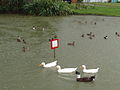
 Ducks going bonkers in Haddenham - geograph.org.uk - 4024976.jpg 1,236 × 1,000; 851 KB
-
 Ducks in the rain at Haddenham - geograph.org.uk - 43454.jpg 640 × 478; 170 KB
-
 Elephant Grass by the Path - geograph.org.uk - 6060172.jpg 4,653 × 2,890; 2.04 MB
-

-
 Entrance to the Animal Hospital - geograph.org.uk - 3229542.jpg 640 × 480; 119 KB
-
-
 Farm buildings near Haddenham - geograph.org.uk - 43181.jpg 640 × 480; 168 KB
-
 Farmland by Scotsgrove House - geograph.org.uk - 5641451.jpg 6,000 × 4,000; 4.27 MB
-
 Farmland near Haddenham - geograph.org.uk - 5641460.jpg 6,000 × 4,000; 4.78 MB
-
 Field by railway line - geograph.org.uk - 969816.jpg 640 × 480; 90 KB
-
 Field near Cuddington - geograph.org.uk - 371127.jpg 640 × 480; 108 KB
-
 Field near Grove End Farm - geograph.org.uk - 5641501.jpg 6,000 × 4,000; 6.7 MB
-
 Field near Grove End Farm - geograph.org.uk - 5641522.jpg 6,000 × 4,000; 4.17 MB
-

-
 Field up to Folly farm - geograph.org.uk - 969766.jpg 640 × 480; 48 KB
-
 Flint Road, Haddenham - geograph.org.uk - 883130.jpg 640 × 430; 100 KB
-
 Follow the arrows and hope for the best - geograph.org.uk - 6062266.jpg 5,152 × 3,864; 4.31 MB
-
-
 Footpath to Chearsley - geograph.org.uk - 1186768.jpg 640 × 480; 97 KB
-
 Fowler's Field - geograph.org.uk - 4935057.jpg 6,000 × 4,000; 6.44 MB
-
 Green road from Haddenham to Thame - geograph.org.uk - 528427.jpg 640 × 480; 121 KB
-
 Cottages beyond Haddenham duck pond-geograph-3230575-by-Michael-Trolove.jpg 2,560 × 1,920; 1.07 MB
-
 Duckpond by the church in Haddenham - geograph.org.uk - 43222.jpg 640 × 480; 106 KB
-
 Pond at Haddenham-geograph-4232824-by-Bikeboy.jpg 4,320 × 3,240; 4.35 MB
-
 Stanbridge road - geograph.org.uk - 969709.jpg 640 × 480; 50 KB
-
 The Rose and Thistle, Haddenham - geograph.org.uk - 530559.jpg 640 × 480; 89 KB
-
 Village Duck Pond, Haddenham-geograph-2110126-by-Richard-Rogerson.jpg 3,072 × 2,304; 3.56 MB
-
 Haddenham - A cluster of signs - geograph.org.uk - 4075822.jpg 1,000 × 1,333; 1.37 MB
-
 Haddenham - Aylesbury Font - Animal carving - geograph.org.uk - 4075841.jpg 1,919 × 1,000; 1.38 MB
-
 Haddenham - Aylesbury Font - Bowl and carving - geograph.org.uk - 4075829.jpg 1,333 × 1,000; 1.1 MB
-
 Haddenham - Duck and Church - geograph.org.uk - 4024964.jpg 1,000 × 1,245; 1.18 MB
-
 Haddenham - Duck Pond - geograph.org.uk - 4075817.jpg 1,333 × 1,000; 1.05 MB
-
 Haddenham - St Mary's - "Aylesbury" font - geograph.org.uk - 4024994.jpg 1,000 × 1,409; 1.06 MB
-
 Haddenham - St Mary's - across the duck pond - geograph.org.uk - 4024960.jpg 1,389 × 1,000; 1.16 MB
-
 Haddenham 5.jpg 839 × 568; 183 KB
-
 Haddenham and Thame Parkway Station - geograph.org.uk - 4528117.jpg 640 × 419; 53 KB
-
 Haddenham Buckinghamshire England Meadow with Poppies.jpg 1,072 × 804; 292 KB
-
 Haddenham Business Park - geograph.org.uk - 43346.jpg 640 × 479; 180 KB
-
 Haddenham duck pond - geograph.org.uk - 3576312.jpg 4,752 × 3,168; 3.15 MB
-
 Haddenham Duck Pond - geograph.org.uk - 860045.jpg 640 × 480; 123 KB
-
 Haddenham duck pond and cottages-geograph-3576303-by-Roger-Davies.jpg 4,752 × 3,168; 2.81 MB
-
 Haddenham duck pond-geograph-3230599-by-Michael-Trolove.jpg 2,560 × 1,920; 1.06 MB
-
 Haddenham fire station - geograph.org.uk - 473121.jpg 640 × 427; 180 KB
-

-
 Haddenham Methodist Church - geograph.org.uk - 6179035.jpg 2,592 × 1,944; 1.37 MB
-
 Haddenham roundabout on A418 - geograph.org.uk - 2865248.jpg 640 × 430; 54 KB
-
 Haddenham sewage treatment works - geograph.org.uk - 43330.jpg 640 × 478; 191 KB
-
 Haddenham village centre - geograph.org.uk - 3576308.jpg 4,752 × 3,168; 2.39 MB
-
 Haddenham village centre-geograph-3847851-by-Steve-Daniels.jpg 1,500 × 919; 117 KB
-
 Haddenham village sign - geograph.org.uk - 3230608.jpg 1,920 × 2,560; 892 KB
-
 Haddenham ^ Thame Parkway Park ^ Ride - geograph.org.uk - 4935041.jpg 6,000 × 4,000; 7.19 MB
-
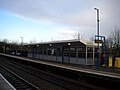
 Haddenham ^ Thame Parkway railway station - geograph.org.uk - 6078276.jpg 1,024 × 768; 116 KB
-
 Haddenham, Church End - geograph.org.uk - 883119.jpg 640 × 430; 89 KB
-

-
 Haddenham, Towards Church End - geograph.org.uk - 883142.jpg 640 × 430; 86 KB
-
 Haddenham.jpg 500 × 375; 38 KB
-
 Heading to Scotsgrove Mill - geograph.org.uk - 1233741.jpg 640 × 480; 81 KB
-
 Hewdon Farm, near Haddenham - geograph.org.uk - 43926.jpg 640 × 480; 93 KB
-
 Houses in Townside, Haddenham - geograph.org.uk - 43335.jpg 640 × 480; 91 KB
-
 Houses on Willis Road, Haddenham - geograph.org.uk - 2996638.jpg 1,600 × 1,067; 437 KB
-
 In a railway cutting north of Haddenham - geograph.org.uk - 4528119.jpg 640 × 426; 103 KB
-
 In the stubble near Folly Farm - geograph.org.uk - 2059121.jpg 800 × 600; 142 KB
-
 In the Swamp - geograph.org.uk - 6062263.jpg 5,152 × 3,864; 3.61 MB
-
 Kings Cross junction, A418 - geograph.org.uk - 3021293.jpg 640 × 480; 76 KB
-
 Lake near Haddenham - geograph.org.uk - 4371621.jpg 3,840 × 2,868; 1.72 MB
-
 Lane junction on the A418 - geograph.org.uk - 3021290.jpg 640 × 480; 73 KB
-
-
 Lavender (42325103795).jpg 4,032 × 3,024; 2.57 MB
-
 Lay-by on Aylesbury Road - geograph.org.uk - 4096966.jpg 1,500 × 999; 137 KB
-
 Lay-by on Aylesbury Road - geograph.org.uk - 5679223.jpg 2,048 × 1,536; 1.4 MB
-
 Layby on Aylesbury Road, Haddenham - geograph.org.uk - 5682620.jpg 2,048 × 1,536; 1.36 MB
-
 Leaving Haddenham - geograph.org.uk - 1233728.jpg 640 × 480; 106 KB
-
 Looking across to Scotsgrove Mill - geograph.org.uk - 1233757.jpg 640 × 480; 82 KB
-
 Mallard Croft, Haddenham - geograph.org.uk - 4372038.jpg 3,796 × 2,616; 2.04 MB
-
 Manor Farm - geograph.org.uk - 3375323.jpg 640 × 430; 42 KB
-
 Manor Farm - geograph.org.uk - 4528145.jpg 640 × 426; 46 KB
-
 Mill Lane, Scotsgrove - geograph.org.uk - 4178337.jpg 3,648 × 2,736; 2.93 MB
-
 Mill stream at Scotsgrove - geograph.org.uk - 4178353.jpg 3,648 × 2,736; 4.41 MB
-
 Mini-roundabout in Haddenham - geograph.org.uk - 43180.jpg 640 × 480; 109 KB
-
 More New Housing in Haddenham - geograph.org.uk - 4372023.jpg 3,932 × 2,628; 1.32 MB
-
 Morecraft House - geograph.org.uk - 3230622.jpg 640 × 480; 63 KB
-
 New Housing by the Station - geograph.org.uk - 4372018.jpg 3,908 × 3,000; 2.01 MB
-
 Open grassland at Bradmoor Farm - geograph.org.uk - 5747050.jpg 4,032 × 3,024; 1.66 MB
-
 Outer Aylesbury Ring at Haddenham - geograph.org.uk - 6063257.jpg 4,629 × 3,262; 2.98 MB
-
 Outer Aylesbury Ring at Round Hill - geograph.org.uk - 6063261.jpg 4,690 × 3,287; 1.62 MB
-
 Pansies (35313393421).jpg 4,032 × 3,024; 1.56 MB
-

-

-
 Path and road to Haddenham - geograph.org.uk - 4935118.jpg 6,000 × 4,000; 4.07 MB
-
 Path to Snakemoor - geograph.org.uk - 4935090.jpg 6,000 × 4,000; 5.55 MB
-
 Physical Graffiti - geograph.org.uk - 3230665.jpg 2,560 × 1,920; 1.11 MB
-
 Pond Close, Haddenham - geograph.org.uk - 46692.jpg 640 × 479; 122 KB
-
 Public bridleway sign by Scotsgrove Mill - geograph.org.uk - 4178335.jpg 3,648 × 2,736; 4.33 MB
-
 Public bridleway sign obscured by hops - geograph.org.uk - 4178318.jpg 3,648 × 2,736; 4.03 MB
-
 Quaker Burial Ground, Haddenham - geograph.org.uk - 6179809.jpg 2,592 × 1,944; 1.35 MB
-
 Railway at Haddenham - geograph.org.uk - 53716.jpg 640 × 480; 110 KB
-
 Railway bridge over track from Manor Farm - geograph.org.uk - 2068721.jpg 1,024 × 768; 224 KB
-
 Railway north west of Haddenham ^ Thame Parkway - geograph.org.uk - 6078279.jpg 1,024 × 768; 127 KB
-
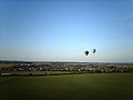
 Red Kite (Milvus milvus) over Haddenham - geograph.org.uk - 4024971.jpg 1,306 × 1,000; 609 KB
-
 River Thame - geograph.org.uk - 4528121.jpg 640 × 426; 76 KB
-
 Road from Thame to Haddenham - geograph.org.uk - 43341.jpg 640 × 480; 119 KB
-
 Road junction seen from east side of Churchways - geograph.org.uk - 2066303.jpg 1,024 × 768; 169 KB
-

-
 Roundabout on Aylesbury Road - geograph.org.uk - 4086536.jpg 1,500 × 996; 134 KB
-
 Roundhill Farm - geograph.org.uk - 2932951.jpg 1,600 × 1,063; 313 KB
-
 Scotsgrove Mill - bridleway doesn't continue to Thame - geograph.org.uk - 4178291.jpg 3,648 × 2,736; 4.23 MB
-
 Scotsgrove Mill garden path - geograph.org.uk - 530508.jpg 640 × 480; 158 KB
-
 Sheds by Yolsum Plantation - geograph.org.uk - 6061671.jpg 5,184 × 3,456; 3.78 MB
-
 Sheerstock, Haddenham - geograph.org.uk - 530601.jpg 640 × 480; 107 KB
-
 Shops along Banks Road. - geograph.org.uk - 4372029.jpg 4,000 × 3,000; 2.04 MB
-
 Signage at Haddenham roundabout - geograph.org.uk - 3021299.jpg 640 × 480; 63 KB
-
 Signpost at the Crossing - geograph.org.uk - 6060158.jpg 4,879 × 3,460; 2.69 MB
-
 Soay sheep - geograph.org.uk - 5641528.jpg 6,000 × 4,000; 5.6 MB
-
 Solar panels, Manor Farm - geograph.org.uk - 3375325.jpg 640 × 430; 45 KB
-
 Spot the River Thame - geograph.org.uk - 3375298.jpg 640 × 430; 27 KB
-
 Spring in woods near Cuddington - geograph.org.uk - 388528.jpg 480 × 640; 224 KB
-
 Stan Bridge and road junction - geograph.org.uk - 2065904.jpg 1,024 × 768; 174 KB
-
 Stanbridge Road - geograph.org.uk - 5747057.jpg 4,032 × 3,024; 1.76 MB
-
 Stanbridge Road - geograph.org.uk - 5747061.jpg 4,032 × 3,024; 2.58 MB
-
 Stanbridge road - geograph.org.uk - 969787.jpg 640 × 480; 66 KB
-
 Station Road, Haddenham - geograph.org.uk - 3230635.jpg 2,560 × 1,920; 1.05 MB
-
 Taxi office, Haddenham ^ Thame Parkway station - geograph.org.uk - 6078289.jpg 1,024 × 768; 105 KB
-
 Telephone Exchange, Haddenham, Bucks - geograph.org.uk - 958911.jpg 640 × 480; 56 KB
-
 Thame Road in Haddenham - geograph.org.uk - 3847848.jpg 1,500 × 999; 197 KB
-
 Thame Road into Haddenham - geograph.org.uk - 3847841.jpg 1,500 × 999; 147 KB
-
 Thame Road junction, A418 - geograph.org.uk - 3021317.jpg 640 × 480; 88 KB
-
 Thame Road to Haddenham - geograph.org.uk - 3847833.jpg 1,500 × 999; 128 KB
-
 Thame Road to Haddenham - geograph.org.uk - 3847835.jpg 1,500 × 999; 165 KB
-
 Thame Road to Haddenham - geograph.org.uk - 3847839.jpg 1,500 × 999; 142 KB
-
 The A418 to Thame - geograph.org.uk - 4086533.jpg 1,500 × 999; 164 KB
-
 The Gables, Haddenham - geograph.org.uk - 4414651.jpg 3,668 × 2,800; 2.84 MB
-
 The road from Haddenham to Aylesbury - geograph.org.uk - 3847854.jpg 1,500 × 902; 207 KB
-
 The road from Haddenham to Aylesbury - geograph.org.uk - 3847856.jpg 1,500 × 839; 166 KB
-
 The Rose and Thistle pub, Haddenham - geograph.org.uk - 4232836.jpg 4,320 × 3,240; 2.98 MB
-

-
 Tree lined A418 near Bigstrup Farm - geograph.org.uk - 3021289.jpg 640 × 480; 76 KB
-
 Trees by Aylesbury Road, Haddenham - geograph.org.uk - 5682623.jpg 2,048 × 1,536; 1.38 MB
-

-
 View towards Haddenham Church - geograph.org.uk - 4528144.jpg 640 × 356; 36 KB
-
 Village pond and church, Haddenham - geograph.org.uk - 4706131.jpg 640 × 428; 86 KB
-
 Village sign, Haddenham - geograph.org.uk - 4232829.jpg 4,320 × 3,240; 4.49 MB
-
 Waiting room, Haddenham ^ Thame Parkway - geograph.org.uk - 6078283.jpg 1,024 × 768; 106 KB
-
 Willow crop near Scotsgrove Mill - geograph.org.uk - 5641513.jpg 6,000 × 4,000; 5.88 MB
-
 Winter fields and trees near Haddenham - geograph.org.uk - 6060179.jpg 5,152 × 3,864; 3.85 MB
-
 Woodways out of Haddenham - geograph.org.uk - 3847853.jpg 1,500 × 906; 187 KB
-
 Yellow on the Green - geograph.org.uk - 4371587.jpg 4,000 × 3,000; 2.27 MB
-
 Yolsum Plantation - geograph.org.uk - 1186752.jpg 640 × 480; 74 KB
-
 Yolsum Plantation - geograph.org.uk - 3375303.jpg 640 × 350; 29 KB


.jpg)


.jpg)


_over_Haddenham_-_geograph.org.uk_-_4024971.jpg)


