Category:Inishmaan
Jump to navigation
Jump to search
Main Wikipedia article: Inishmaan.
island on the west coast of Ireland  | |||||
| Upload media | |||||
| Instance of | |||||
|---|---|---|---|---|---|
| Part of | |||||
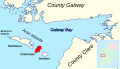
| Location | County Galway, Connacht, Ireland | ||||
| Located in or next to body of water | |||||
| Width |
| ||||
| Length |
| ||||
| Population |
| ||||
| Area |
| ||||
| Elevation above sea level |
| ||||
 | |||||

Subcategories
This category has the following 5 subcategories, out of 5 total.
Media in category "Inishmaan"
The following 48 files are in this category, out of 48 total.
-
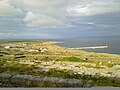
 An Caladh Mór - geograph.org.uk - 3565272.jpg 640 × 480; 83 KB
-
 An Dún, Inishmaan - geograph.org.uk - 3564501.jpg 640 × 480; 90 KB
-
 Beach and dunes at Ceann Gainimh - geograph.org.uk - 3565284.jpg 640 × 480; 85 KB
-
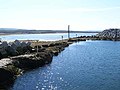
 Breakwater, Inishmaan - geograph.org.uk - 3565266.jpg 640 × 480; 70 KB
-
 Breakwater, Inishmaan - geograph.org.uk - 3565267.jpg 640 × 480; 74 KB
-
 Cill Ceananach - geograph.org.uk - 3564575.jpg 640 × 480; 154 KB
-
 Cill Ceananach - geograph.org.uk - 3565262.jpg 640 × 480; 121 KB
-
 Cliff on Inishmaan - geograph.org.uk - 3564477.jpg 640 × 480; 145 KB
-
 Cliff on Inishmaan - geograph.org.uk - 3564564.jpg 640 × 480; 111 KB
-
 Donkey cart on Inishmaan - geograph.org.uk - 3564519.jpg 640 × 480; 115 KB
-
 Gaelic sign at Inis Meáin.jpg 1,200 × 1,600; 186 KB
-
 Graveyard, Cill Ceananach - geograph.org.uk - 3564582.jpg 640 × 480; 120 KB
-
 Gregory's Sound.jpg 3,264 × 2,448; 2.31 MB
-
 Harbour entrance, Inishmaan - geograph.org.uk - 3565269.jpg 640 × 480; 59 KB
-
 Inis Meain 2.JPG 3,264 × 2,448; 5.06 MB
-
 Inis Meain 3.JPG 3,264 × 2,448; 5.34 MB
-
 Inis Meáin cemetery.jpg 1,600 × 1,200; 246 KB
-
 Inis Meáin cemetery2.jpg 1,600 × 1,200; 336 KB
-
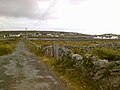 Inis Meáin Road.jpg 1,600 × 1,200; 192 KB
-
 Inishmaan - Aran Islands.svg 700 × 400; 1.09 MB
-
 Inishmaan Harbour - panoramio.jpg 3,264 × 2,448; 1.65 MB
-
 Inishmaan harbour at low tide - geograph.org.uk - 3565270.jpg 640 × 480; 73 KB
-
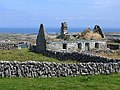
 Inishmaan Ruins - panoramio.jpg 3,264 × 2,448; 1.56 MB
-

-
 Inishmaan turbines.jpeg 3,264 × 2,448; 1 MB
-
 Inishmaan, Aran Islands - geograph.org.uk - 147618.jpg 640 × 480; 65 KB
-
 Inismeain turbines.JPG 3,264 × 2,448; 5.48 MB
-
 Lane on the east side of Inishmaan - geograph.org.uk - 3565276.jpg 640 × 480; 116 KB
-
 Lane, Inishmaan - geograph.org.uk - 3564549.jpg 640 × 480; 99 KB
-
 Leaba Dhiarmada 'is Gráinne.jpg 1,600 × 1,200; 405 KB
-
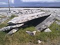
 Limestone pavement, Inishmaan - geograph.org.uk - 3564532.jpg 640 × 480; 71 KB
-
 Old Harbour Inis Meáin.jpg 1,600 × 1,200; 288 KB
-
 Old pier, Inishmaan - geograph.org.uk - 3564558.jpg 640 × 480; 109 KB
-
 Old pier, Inishmaan - geograph.org.uk - 3565263.jpg 640 × 480; 70 KB
-
 Panorama Inis Meáin.jpg 1,600 × 1,200; 448 KB
-
 Rocky shore, Inishmaan - geograph.org.uk - 3565279.jpg 640 × 480; 113 KB
-
 Ruined cottage, Inishmaan - geograph.org.uk - 3564494.jpg 640 × 480; 101 KB
-

-

-
 Spare Xblocs at Inishmaan harbour - geograph.org.uk - 3565271.jpg 640 × 480; 94 KB
-
 Templesaghtmacree Church, Carrownlisheen.jpg 3,264 × 2,448; 3.64 MB
-
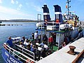 The "Happy Hooker" at Inishmaan pier - geograph.org.uk - 3565268.jpg 640 × 480; 94 KB
-
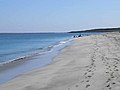
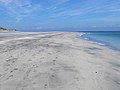 The beach at Ceann Gainimh - geograph.org.uk - 3565282.jpg 640 × 480; 45 KB
-
 The beach at Ceann Gainimh - geograph.org.uk - 3565283.jpg 640 × 480; 44 KB
-
 The path to the Clochán - geograph.org.uk - 3564452.jpg 640 × 480; 91 KB
-
 The path to the Clochán - geograph.org.uk - 3564462.jpg 640 × 480; 129 KB
-
 Trá Leitreach - geograph.org.uk - 3565264.jpg 640 × 480; 87 KB
-
 Village Inis Meáin.jpg 1,600 × 1,200; 270 KB


