Category:Kasaragod district
Jump to navigation
Jump to search

English: Kasaragod district (Malayalam: കാസര്ഗോഡ് (ജില്ല)) is one of the 14 districts in the state of Kerala, India. Kasaragod was organised as a separate district on May 24, 1985, and is the northernmost district of Kerala.
District of Kerala, India   | |||||
| Upload media | |||||
| Instance of | |||||
|---|---|---|---|---|---|
| Location |
| ||||
| Capital | |||||
| Founded by | |||||
| Inception |
| ||||
| Population |
| ||||
| Area |
| ||||
| Different from | |||||
| official website | |||||
 | |||||
Subcategories
This category has the following 8 subcategories, out of 8 total.
*
Media in category "Kasaragod district"
The following 16 files are in this category, out of 16 total.
-
 Cheemeni 2.jpg 4,080 × 3,060; 4.71 MB
-
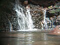 Cheemeni.jpg 8,160 × 6,120; 9.08 MB
-
 Gray pancy.jpg 4,080 × 3,060; 2.87 MB
-
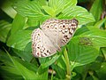 Grey pancy.jpg 4,080 × 3,060; 2.98 MB
-
 Hillstation.soordelu.jpg 500 × 667; 129 KB
-
 Human Garden - Model.jpg 1,586 × 2,024; 877 KB
-
 Human Garden laid out.jpg 3,072 × 2,304; 2.75 MB
-
 Kite fest at Bekal Pallikkara Beach of Kasaragod dist 07.jpg 8,000 × 6,000; 8.92 MB
-
 Malayalam wiki studyclass - DHSS Kanhangad Kasaragod Dt Rajesh odayanchal is speaking.jpg 4,000 × 3,000; 4.05 MB
-
 Navagraha plants.jpg 640 × 480; 205 KB
-
 Soolaap kav, Cheemeni 2.jpg 4,080 × 3,060; 7.76 MB
-
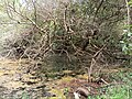 Soolaap kav, Cheemeni.jpg 4,080 × 3,060; 8.16 MB
-
 Soolap kav 2.jpg 8,160 × 6,120; 18.32 MB
-
 Soolap kav.jpg 8,160 × 6,120; 15.43 MB
-
 Soordelu Hill Station top.jpg 1,280 × 960; 161 KB
-
 Star trees.jpg 640 × 480; 186 KB


