Category:Kent County, Maryland
Jump to navigation
Jump to search
Counties of Maryland: Allegany · Anne Arundel · Baltimore · Calvert · Caroline · Carroll · Cecil · Charles · Dorchester · Frederick · Garrett · Harford · Howard · Kent · Montgomery · Prince George's · Queen Anne's · Somerset · St. Mary's · Talbot · Washington · Wicomico · Worcester · Independent city: Baltimore
county in Maryland, United States     | |||||
| Upload media | |||||
| Instance of | |||||
|---|---|---|---|---|---|
| Part of | |||||
| Named after | |||||
| Location | Maryland | ||||
| Located in or next to body of water | |||||
| School district |
| ||||
| Capital | |||||
| Inception |
| ||||
| Population |
| ||||
| Area |
| ||||
| Elevation above sea level |
| ||||
| Different from | |||||
| official website | |||||
 | |||||
Subcategories
This category has the following 14 subcategories, out of 14 total.
Media in category "Kent County, Maryland"
The following 18 files are in this category, out of 18 total.
-
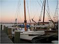
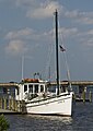 Annie D at Chestertown.jpg 2,160 × 3,051; 3.61 MB
-
 Choptank Electric Co-op 69kV - Kent County, MD (39938089574).jpg 4,608 × 3,456; 5.23 MB
-
 Cypress Creek Bridge (21636296301).jpg 1,024 × 768; 341 KB
-
 DSCF0460 - Flickr - USDAgov.jpg 2,816 × 2,112; 3.08 MB
-
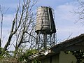 Ellwood Farm, water tower (21615876032).jpg 1,024 × 768; 295 KB
-
 John Cadwalader's grave.JPG 1,600 × 1,200; 438 KB
-
 KentCountyMD.jpg 640 × 424; 273 KB
-
 Maryland State Route 292 (16651644778).jpg 4,608 × 3,456; 5.89 MB
-
 Skipjack Elsworth (21439269130).jpg 501 × 379; 37 KB
-
 A souvenir history of the parish of St. Paul's, Kent County, Maryland (IA souvenirhistoryo00denr).pdf 785 × 1,308, 62 pages; 2.55 MB
-
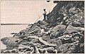
 Tolchester folio Maryland Plate II.jpg 2,084 × 1,211; 1.11 MB
-
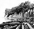
 Tolchester folio Maryland Plate VI.jpg 1,210 × 1,066; 664 KB
-
 Tolchester folio Maryland Plate VII.jpg 1,660 × 1,066; 888 KB
-
 Tolchester folio Maryland Plate VIII.jpg 1,588 × 1,066; 873 KB
-
 Tolchester folio Maryland Plate X.jpg 1,980 × 1,056; 868 KB
-
 USA Kent County, Maryland age pyramid.svg 520 × 600; 7 KB
-
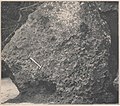
 Vertically jointed clay of Raritan formation dnh00206.jpg 3,866 × 3,265; 1.88 MB
-
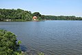 View of Still Pond Creek - panoramio.jpg 3,245 × 2,199; 1.97 MB

.jpg)
.jpg)

.jpg)


.jpg)
.jpg)


