Category:Khelvachauri
Jump to navigation
Jump to search
| Object location | | View all coordinates using: OpenStreetMap |
|---|
 | |||||
| Upload media | |||||
| Instance of | |||||
|---|---|---|---|---|---|
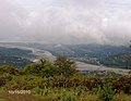
| Location | Khelvachauri Municipality, Adjara, Georgia | ||||
| Population |
| ||||
| Elevation above sea level |
| ||||
 | |||||
Media in category "Khelvachauri"
The following 2 files are in this category, out of 2 total.
-
 Khelvachauri.jpg 1,200 × 800; 817 KB
-
 ხიდი მდინარე ჭოროხზე (G.N. 2010).jpg 1,876 × 1,460; 1.21 MB
.jpg)