Category:Knocknagree
Jump to navigation
Jump to search
English: The village has in 2004-2005 seen extensive redevelopment on the "Fairfield" or Village Green. Before the advent of the modern cattle-mart it was the venue of one of the largest livestock markets in Munster. The monthly "fair " as it was known died out in the 1970s. The village is near the southern edge of the area known as Sliabh Luachra (rush mountain), a bastion of traditional Irish fiddle music.
town in Munster, Ireland  | |||||
| Upload media | |||||
| Instance of | |||||
|---|---|---|---|---|---|
| Location |
| ||||
 | |||||
Media in category "Knocknagree"
The following 9 files are in this category, out of 9 total.
-
 Country near Knocknagree - geograph.org.uk - 4949438.jpg 2,592 × 1,944; 1.45 MB
-
 Country near Laghtsigh Cross Roads - geograph.org.uk - 4949466.jpg 2,592 × 1,944; 1.31 MB
-
 Country south of Knocknagree - geograph.org.uk - 4949424.jpg 2,592 × 1,944; 1.25 MB
-
 Country south of Knocknagree - geograph.org.uk - 4949445.jpg 2,592 × 1,944; 939 KB
-
 Knocknagree Church - geograph.org.uk - 786394.jpg 640 × 480; 60 KB
-
 Knocknagree village centre - geograph.org.uk - 5005319.jpg 1,024 × 768; 159 KB
-
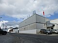 Munster Joinery, Lacka Cross - geograph.org.uk - 5005296.jpg 1,024 × 768; 113 KB
-
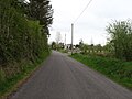 The L5166 heading for Cullen - geograph.org.uk - 4949430.jpg 2,592 × 1,944; 1.68 MB
-
 The L5166 heading for Knocknagree - geograph.org.uk - 4949451.jpg 2,592 × 1,944; 1.3 MB


