Category:Kunoy
Jump to navigation
Jump to search

island in the Faroe Islands   | |||||
| Upload media | |||||
| Instance of | |||||
|---|---|---|---|---|---|
| Part of | |||||
| Location | Kunoy Municipality, Norðoyar | ||||
| Located in or next to body of water | |||||
| Highest point |
| ||||
| Population |
| ||||
| Area |
| ||||
| Elevation above sea level |
| ||||
| Different from | |||||
| official website | |||||
 | |||||
Subcategories
This category has the following 6 subcategories, out of 6 total.
Media in category "Kunoy"
The following 38 files are in this category, out of 38 total.
-
 Bus routes on the northern islands (map, Faroe).jpg 573 × 644; 99 KB
-
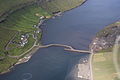 Causeway Kunoy.JPG 3,888 × 2,592; 3.09 MB
-
 Detailed map kunoy 2006.jpg 614 × 886; 185 KB
-
 Faroe Islands Føroyar Færøerne Wyspy Owcze 2019 (1).jpg 1,500 × 844; 1.45 MB
-
 Faroe stamp 352 kunoy.jpg 447 × 306; 35 KB
-
 Faroe stamp 486 maria cruise - sunnari enda a kunoynni.jpg 367 × 247; 46 KB
-
 Faroenature Kunoy.jpg 640 × 426; 94 KB
-
 FaroeseRamKunoy.JPG 3,072 × 2,304; 3.03 MB
-
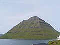
 Fjall í Færeyjum.jpg 4,608 × 2,592; 2.03 MB
-
 Haraldssund, Faroe Islands (3).JPG 2,560 × 1,704; 2.52 MB
-
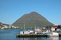 Harbour of klaksvik, faroe islands.jpg 768 × 511; 116 KB
-
 Kalsoy from Klakkur.jpg 3,648 × 2,736; 4.34 MB
-
 Kittiwakes at Kalsoy.jpg 4,256 × 2,848; 2.69 MB
-
 Klaksvík Kunoy 1.JPG 3,444 × 2,586; 5.57 MB
-
 Klaksvík Kunoy 2.JPG 3,444 × 2,586; 5.48 MB
-
 Klaksvík Kunoy 3.JPG 3,444 × 2,586; 4.79 MB
-
 Klaksvík Kunoy 4.JPG 3,444 × 2,586; 4.63 MB
-
 Klaksvík Kunoy 5.JPG 3,444 × 2,586; 4.98 MB
-
 Klaksvík Kunoy 6.JPG 3,444 × 2,586; 4.84 MB
-
 Klaksvík otbp banner 3.jpg 2,144 × 715; 650 KB
-
 Klaksvík.2010.1.jpg 3,872 × 2,592; 2.27 MB
-
 Kunoy bygd.1.jpg 2,560 × 1,704; 848 KB
-
 Kunoy Faroe Islands 2019.jpg 4,032 × 3,024; 2.96 MB
-
 Kunoy from the Ocean.jpg 4,256 × 2,848; 3.44 MB
-
 Kunoy kort.png 569 × 795; 75 KB
-
 Kunoy map.jpg 569 × 795; 97 KB
-
 Kunoy natur.5.jpg 640 × 426; 24 KB
-
 Kunoy Tunnel, Faroe Islands.jpg 2,213 × 3,327; 7.27 MB
-
 Kunoy Village Demography (1985-2009).png 798 × 448; 20 KB
-
 Kunoy village on Faroe map.png 688 × 1,035; 24 KB
-
 Kunoy, Faroe Islands (6).JPG 2,560 × 1,704; 1.15 MB
-
 Kunoy.jpg 2,560 × 1,704; 1.57 MB
-
 Kunoyarnes A-12.jpg 4,977 × 2,612; 8.32 MB
-
 Map-position-kunoyar-kommuna-2005.png 600 × 800; 24 KB
-
 Panorama of Klaksvik.jpg 3,648 × 2,736; 4.63 MB
-
 Position of Kunoy on Faroe map.png 688 × 1,035; 19 KB
-
 Stamps of the Faroe Islands-14.jpg 692 × 913; 557 KB
-
 Trøllanes Kalsoy.3.jpg 1,995 × 1,325; 331 KB
.jpg)


.jpg)


.JPG)


.png)

.JPG)


