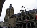
Category:Kölner Rathaus
Jump to navigation
Jump to search
| Object location | | View all coordinates using: OpenStreetMap |
|---|
historical building in Cologne, western Germany    | |||||
| Upload media | |||||
| Instance of |
| ||||
|---|---|---|---|---|---|
| Location | Altstadt-Nord, Cologne-Innenstadt, Cologne, Cologne Government Region, North Rhine-Westphalia, Germany | ||||
| Architectural style | |||||
| Has part(s) | |||||
| Heritage designation | |||||
| official website | |||||
 | |||||
| This category shows a heritage building in Germany, located in the North Rhine-Westphalian city Köln (no. 114). |
Subcategories
This category has the following 13 subcategories, out of 13 total.
E
G
- Goldenes Buch der Stadt Köln (59 F)
- Gästebuch der Stadt Köln (267 F)
K
- Kölner Wand (8 F)
M
R
- Rathauslaube (Köln) (47 F)
S
T
V
- Verbundbrief (14 F)
Media in category "Kölner Rathaus"
The following 60 files are in this category, out of 60 total.
-
 POPPEL(1852) p443 DAS RATHHAUS IN CÖLN.jpg 1,047 × 1,702; 758 KB
-
 19060111 Köln Rathaus.jpg 1,200 × 1,817; 481 KB
-
 2013-08-10 07-12-57 Ballonfahrt über Köln EH 0596.jpg 5,159 × 3,023; 7.98 MB
-
 2013-08-10 07-13-31 Ballonfahrt über Köln EH 0597.jpg 3,621 × 3,222; 6 MB
-
 2020-12-30-Heumarkt Köln-0326.jpg 5,464 × 3,640; 11.94 MB
-
 2020-12-30-Heumarkt Köln-1.jpg 5,462 × 4,596; 16.29 MB
-
 5697321.Erwin Quedenfeldt.jpg 1,638 × 2,749; 832 KB
-
 5946715.Erwin Quedenfeldt.jpg 1,970 × 2,648; 1.02 MB
-
 Alter Markt Köln um 1850.jpg 3,885 × 2,624; 6.16 MB
-
 Balkon an der Prophetenkammer vom Historischen Rathaus Köln - Günter Lossow-7122.jpg 2,799 × 4,920; 9.59 MB
-
 Balkon an der Prophetenkammer vom Historischen Rathaus Köln - Günter Lossow-7124.jpg 3,207 × 4,095; 9.53 MB
-
 Balkon an der Prophetenkammer vom Historischen Rathaus Köln - Günter Lossow-7125.jpg 3,187 × 4,177; 9.72 MB
-
 Balkon an der Prophetenkammer vom Historischen Rathaus Köln - Günter Lossow-7127.jpg 4,008 × 3,348; 10.01 MB
-
 Balkon an der Prophetenkammer vom Historischen Rathaus Köln - Günter Lossow-7128.jpg 4,353 × 3,237; 10.14 MB
-
 Cologne - panoramio (1).jpg 900 × 1,200; 436 KB
-
 CologneTownHallTower.jpg 533 × 800; 238 KB
-
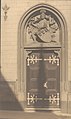
 Das Portal am Rathhaus in Coln, RP-F-F24489.jpg 1,627 × 2,557; 517 KB
-
 Der Kölner Rathausturm - panoramio.jpg 3,000 × 4,000; 3.27 MB
-
 Exterieur van het stadhuis van Keulen met loggia, RP-F-F01210-J.jpg 3,675 × 4,909; 2.79 MB
-

-
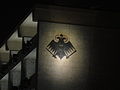 Germany Coat of Arms on Cologne City Hall Building 2015.JPG 2,048 × 1,536; 1.18 MB
-
 Groß St. Martin - Stapelhaus - Rathausturm - Abendämmerung (9733 4 5).jpg 3,800 × 2,500; 3.25 MB
-
 Hansasaal Rathaus dombaumeister weyer lithographie.jpg 600 × 778; 72 KB
-
 Karneval vor dem Kölner Rathaus.jpg 2,304 × 3,456; 3.46 MB
-
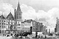
 Koeln in Bildern, Tafel 14. Das Rathaus vom Altermarkt gesehen.jpg 2,508 × 3,446; 2.72 MB
-
 Koeln in Bildern, Tafel 7. Das Rathaus. Vorderfront.jpg 2,172 × 3,002; 2.48 MB
-
 Köln, Historisches Rathaus -- 2014 -- 1908.jpg 3,505 × 4,378; 7.69 MB
-
 Kunibert in Köln am Rathaus.jpg 240 × 210; 8 KB
-
 Köln - Historisches Rathaus (1).jpg 4,000 × 3,000; 2.62 MB
-
 Köln - panoramio - Halina Frederiksen (12).jpg 640 × 480; 72 KB
-
 Köln 2010-04-30 – Historisches Rathaus - panoramio.jpg 2,592 × 3,456; 2.76 MB
-
 Köln a. Rh., Alter Markt mit Rathaus.jpg 2,163 × 1,371; 345 KB
-
 Köln a. Rhein. Rathaus.jpg 2,179 × 3,354; 1.02 MB
-
 Köln bei Nacht, der Klassiker!.jpg 5,881 × 2,752; 1.42 MB
-
 Köln Historisches Rathaus BW 2018-08-18 15-04-24.jpg 3,436 × 4,930; 4.37 MB
-
 Köln Rathaus 19 Jh.jpg 1,137 × 1,744; 974 KB
-
 Köln rathaus winter.jpg 3,210 × 5,106; 4.81 MB
-
 Köln, Rathaus, 1. Obergeschoss, Heinrich Bartmann 1938.tif 3,853 × 1,735; 1.12 MB
-
 Köln-Innenstadt-Judengasse-149.jpg 1,536 × 2,048; 1.82 MB
-
 Köln-Rathaus-Bronzewand-047.JPG 1,536 × 2,048; 923 KB
-
 Köln-Rathaus-Kupferstich-um-1655.jpg 694 × 716; 316 KB
-
 Kölner Rathaus - Fasade.jpg 5,568 × 3,712; 2.43 MB
-
 Kölner Rathaus - panoramio.jpg 3,672 × 4,896; 7.98 MB
-
 Kölner Rathaus tower.JPG 3,456 × 4,608; 4.2 MB
-
 Kölner Rathaus, OG 1938.png 3,770 × 1,730; 657 KB
-
 NRW, Cologne - Historisches Rathaus 01.jpg 3,264 × 2,448; 4.71 MB
-
 PanoramaColonia.JPG 2,048 × 1,536; 1.81 MB
-
 Planungszelle-Köln-1979.jpg 2,016 × 1,512; 833 KB
-
 Plasmanscher Keller Rathaus Köln.jpg 1,145 × 1,166; 987 KB
-

-
 Rathaus Koeln 1900.jpg 2,588 × 3,533; 2.93 MB
-
 Rathaus Koeln2007.jpg 1,600 × 1,200; 536 KB
-
 Rathaus, Koeln, from SW.jpg 1,182 × 1,780; 418 KB
-
 Rathaus-Köln-Kupferstich-1798.jpg 980 × 721; 223 KB
-
 Rathaus-Köln.JPG 1,707 × 1,536; 772 KB
-
 Rathausplatz, Köln, Germany (6342416904).jpg 2,592 × 3,888; 8.43 MB
-
 Rathhaus in Coln, RP-F-F24487.jpg 1,622 × 2,555; 496 KB
-

-
 Zonder titel PK-F-MM.5090 - recto.tiff 1,323 × 2,008; 7.63 MB
-

_p443_DAS_RATHHAUS_IN_C%C3%96LN.jpg)


.jpg)


_Der_Rhein_%26_Seine_Umgebungen_(serietitel),_RP-F-F06073.jpg)

.jpg)


.jpg)
.jpg)


.jpg)

_und_Anton_W%C3%BCnsch_(Lithografie),_1827_(from_book).jpg)
