Category:Lam
Jump to navigation
Jump to search
market municipality of Germany in Bavaria    | |||||
| Upload media | |||||
| Instance of |
| ||||
|---|---|---|---|---|---|
| Part of |
| ||||
| Location | Cham, Upper Palatinate, Bavaria, Germany | ||||
| Population |
| ||||
| Area |
| ||||
| Elevation above sea level |
| ||||
| Different from | |||||
| official website | |||||
 | |||||
Subcategories
This category has the following 5 subcategories, out of 5 total.
Media in category "Lam"
The following 12 files are in this category, out of 12 total.
-
 DEU Lam COA.svg 455 × 504; 4 KB
-
 Wappen Lam.png 150 × 160; 71 KB
-
 AK - Lam - Litho - 1900.jpg 1,372 × 1,831; 704 KB
-
 AK - Lamer Winkel - Pernat - 1911.jpg 1,600 × 2,000; 1.77 MB
-
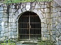
 Fürstenzeche Lore.jpg 2,048 × 1,536; 700 KB
-
 Germania-Magna26.JPG 2,048 × 1,536; 822 KB
-
 Lam (Bavorsko) Fürstenzeche (1).jpg 2,000 × 1,338; 1.81 MB
-
 Lam (Bavorsko) Fürstenzeche (2).jpg 2,000 × 1,338; 1.83 MB
-
 LAM nieder.png 480 × 360; 5 KB
-
 Lam, CHA - Buchetbühl nördl - St 2154 - Lam v NW, Lamer Winkel, Arber.jpg 4,608 × 2,592; 610 KB
-
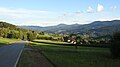
 Lam. Blick von Nordosten.jpg 4,528 × 1,744; 2.07 MB
-
 Panorama-Lam.JPG 6,763 × 1,399; 1.25 MB


_F%C3%BCrstenzeche_(1).jpg)
_F%C3%BCrstenzeche_(2).jpg)

