Category:Maidenhead
Jump to navigation
Jump to search
town and unparished area in Berkshire, England  | |||||
| Upload media | |||||
| Instance of | |||||
|---|---|---|---|---|---|
| Location | Windsor and Maidenhead, Berkshire, South East England, England | ||||
| Located in or next to body of water | |||||
| Population |
| ||||
| official website | |||||
 | |||||
Subcategories
This category has the following 26 subcategories, out of 26 total.
A
- A308(M) motorway (3 F)
- A404(M) motorway (4 F)
B
- Boyn Hill (9 F)
C
F
H
M
- Maidenhead Bridge (37 F)
- Maidenhead Clock Tower (6 F)
- Maidenhead Fire Station (1 F)
- Maidenhead Mosque (3 F)
- Maidenhead Town Hall (3 F)
- Maidenhead War Memorial (2 F)
P
- Pizza Express, Maidenhead (2 F)
R
S
- Smythes Almshouses (14 F)
- St Luke's Church, Maidenhead (3 F)
Media in category "Maidenhead"
The following 200 files are in this category, out of 583 total.
(previous page) (next page)-
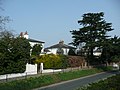
 "Brocket" Boyn Hill Avenue - geograph.org.uk - 5769652.jpg 4,814 × 3,256; 3.41 MB
-

-
 25 Broadway, Maidenhead.jpg 2,560 × 1,920; 2.3 MB
-
 27 Bridge Street, Maidenhead.jpg 2,560 × 1,920; 2.06 MB
-
 3 Mobile, Maidenhead - geograph.org.uk - 3607677.jpg 640 × 430; 58 KB
-
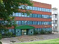
 3 offices on Grenfell Place, Maidenhead - geograph.org.uk - 2811983.jpg 1,600 × 1,200; 591 KB
-
 3 offices on the A308, Maidenhead - geograph.org.uk - 4615083.jpg 2,124 × 1,450; 1,005 KB
-
 38 Castle Hill, Maidenhead.jpg 1,920 × 2,560; 2.24 MB
-
 41 Queen Street, Maidenhead.jpg 1,920 × 2,560; 2.17 MB
-
 90 Moorbridge Road, Maidenhead.jpg 2,560 × 1,920; 2.16 MB
-
 A closed club - geograph.org.uk - 4282859.jpg 640 × 528; 69 KB
-
 A308 - geograph.org.uk - 3529680.jpg 640 × 401; 56 KB
-
 A308 - geograph.org.uk - 3607687.jpg 640 × 430; 71 KB
-
 A308, Maidenhead - geograph.org.uk - 5377324.jpg 640 × 426; 61 KB
-
 A308, Maidenhead - geograph.org.uk - 5377332.jpg 640 × 426; 81 KB
-
 A4 - geograph.org.uk - 3607604.jpg 640 × 430; 69 KB
-
 A4 Bath Road nears Oldfield Road - geograph.org.uk - 4862407.jpg 640 × 480; 90 KB
-
 A4 Bridge over the River Thames - geograph.org.uk - 5375133.jpg 640 × 273; 35 KB
-
 A4 Bridge Road, Maidenhead - geograph.org.uk - 6178043.jpg 1,024 × 684; 349 KB
-
 A4, Bad Godesburg Way, Maidenhead - geograph.org.uk - 6178034.jpg 1,024 × 684; 358 KB
-
 A4, Bridge Rd - geograph.org.uk - 3560050.jpg 640 × 430; 87 KB
-
 A4, Bridge Rd - geograph.org.uk - 4168698.jpg 640 × 430; 69 KB
-
 A4, Maidenhead - geograph.org.uk - 3560044.jpg 640 × 430; 61 KB
-
 A4, Maidenhead Bridge - geograph.org.uk - 4168705.jpg 640 × 430; 75 KB
-
 A4094 - geograph.org.uk - 3561381.jpg 640 × 430; 67 KB
-
 A4094 - geograph.org.uk - 3561400.jpg 640 × 430; 88 KB
-
 A4094 Lower Cookham Road - geograph.org.uk - 6178053.jpg 1,024 × 684; 425 KB
-
 A4094 Lower Cookham Road - geograph.org.uk - 6178056.jpg 1,024 × 684; 438 KB
-
 A4094 Lower Cookham Road - geograph.org.uk - 6178058.jpg 1,024 × 684; 347 KB
-
 A4094 Ray Mead Road, Maidenhead - geograph.org.uk - 6178047.jpg 1,024 × 684; 384 KB
-
 Ad hoc anti-'traveller' barrier, North Town Moor - geograph.org.uk - 3753789.jpg 1,024 × 768; 338 KB
-
 Ada Lewis Trough, Maidenhead - geograph.org.uk - 2545945.jpg 1,024 × 680; 259 KB
-
 Albert Street , Maidenhead - geograph.org.uk - 4120002.jpg 3,508 × 2,960; 2.78 MB
-
 Aldebury Road, Maidenhead - geograph.org.uk - 855570.jpg 640 × 480; 150 KB
-
 All Saints Church, Boyn Hill Road - geograph.org.uk - 5769664.jpg 5,472 × 3,648; 4.08 MB
-

-

-
 All Saints, Boyn Hill, Maidenhead - geograph.org.uk - 5896058.jpg 480 × 640; 93 KB
-
 All Saints, Boyn Hill, Maidenhead - geograph.org.uk - 5896110.jpg 640 × 480; 93 KB
-
 All Saints, Boyn Hill, Maidenhead - geograph.org.uk - 5896193.jpg 640 × 640; 116 KB
-
 All Saints, Boyn Hill, Maidenhead - geograph.org.uk - 5898170.jpg 621 × 640; 109 KB
-
 All Saints, Boyn Hill, Maidenhead - geograph.org.uk - 5898284.jpg 640 × 480; 86 KB
-

-

-

-

-

-
 Allotments, North Town, Maidenhead - geograph.org.uk - 855565.jpg 640 × 480; 172 KB
-
 ARM, Maidenhead - geograph.org.uk - 3560037.jpg 640 × 430; 80 KB
-
 Atkinson Keane - geograph.org.uk - 3555572.jpg 640 × 430; 90 KB
-
 B3028 - geograph.org.uk - 5922101.jpg 1,024 × 681; 141 KB
-

-
 Bath Road at the junction of Boyn Hill Road - geograph.org.uk - 4609598.jpg 2,304 × 1,728; 807 KB
-
 Bath Road entering Maidenhead - geograph.org.uk - 2811945.jpg 1,442 × 1,194; 564 KB
-

-

-

-
 Benchmark on garage of ^20 Braywick Road - geograph.org.uk - 2193317.jpg 600 × 800; 126 KB
-
 Benchmark on Gringer Hill railway bridge - geograph.org.uk - 2193863.jpg 632 × 800; 193 KB
-

-

-
 Benchmark on The Anchor pub, York Road - geograph.org.uk - 2193498.jpg 600 × 800; 194 KB
-
 Benchmark on the Job Centre, 3 Park Road - geograph.org.uk - 2193552.jpg 600 × 800; 167 KB
-

-
 Blackmoor Lane - geograph.org.uk - 3607498.jpg 640 × 430; 69 KB
-
 Blackmoor Lane - geograph.org.uk - 3607504.jpg 640 × 430; 66 KB
-
 Boat on the River Thames - geograph.org.uk - 3561336.jpg 640 × 430; 92 KB
-
 Boulters Court - geograph.org.uk - 3561498.jpg 640 × 430; 109 KB
-
 Boulters Meadow - geograph.org.uk - 3607506.jpg 640 × 430; 75 KB
-
 Boyn Hill's Anglican community - geograph.org.uk - 5896154.jpg 640 × 433; 75 KB
-

-
 Braywick Road at the entrance to the sports ground - geograph.org.uk - 3665528.jpg 2,048 × 1,536; 1.49 MB
-
 Braywick Road, Maidenhead - geograph.org.uk - 3665530.jpg 2,048 × 1,536; 1.41 MB
-
 Braywick Road, Maidenhead - geograph.org.uk - 6178021.jpg 1,024 × 684; 378 KB
-
 Bridge Eyot - geograph.org.uk - 4168739.jpg 640 × 430; 85 KB
-
 Bridge Gardens - geograph.org.uk - 4168703.jpg 640 × 430; 119 KB
-
 Bridge Gardens - geograph.org.uk - 4168707.jpg 640 × 430; 105 KB
-
 Bridge over the River Thames - geograph.org.uk - 5582542.jpg 640 × 283; 37 KB
-
 Bridge Rd - geograph.org.uk - 4168695.jpg 640 × 430; 94 KB
-
 Bridge Rd, A4 - geograph.org.uk - 4168697.jpg 640 × 430; 80 KB
-
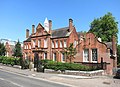
 Bridgwater Lodge.jpg 4,608 × 2,592; 3.87 MB
-
 Broadway - geograph.org.uk - 3529683.jpg 640 × 430; 72 KB
-
 Broadway - geograph.org.uk - 3607653.jpg 640 × 430; 74 KB
-
 Broadway - geograph.org.uk - 4207808.jpg 640 × 430; 71 KB
-
 Broadway - geograph.org.uk - 4739989.jpg 640 × 426; 75 KB
-
 Brookwood Cottage - geograph.org.uk - 3607453.jpg 640 × 430; 69 KB
-

-
 Built in 1870 - geograph.org.uk - 5962919.jpg 5,022 × 2,749; 1.99 MB
-
 Bus stop on Braywick Road, Maidenhead - geograph.org.uk - 3665532.jpg 2,048 × 1,536; 1.5 MB
-
 Business premises - geograph.org.uk - 4168684.jpg 640 × 430; 72 KB
-
 C S Lewis Salvage Experts - geograph.org.uk - 5315717.jpg 640 × 426; 76 KB
-
 Cadet Hut, Holman Leaze - geograph.org.uk - 3607575.jpg 640 × 430; 101 KB
-
 Cannon in Grenfell Park - geograph.org.uk - 4119984.jpg 2,592 × 3,066; 2.31 MB
-
 Car park entrance, Broadway - geograph.org.uk - 4739986.jpg 640 × 426; 70 KB
-
 Carved Log beside Bray Road - geograph.org.uk - 5963733.jpg 4,712 × 3,450; 3.3 MB
-
 Carved tree trunk by Strand Water - geograph.org.uk - 5316645.jpg 5,202 × 3,465; 4.72 MB
-
 Carving and Bench - geograph.org.uk - 4116293.jpg 3,760 × 2,672; 3.41 MB
-
 Carving with a Can - geograph.org.uk - 4116642.jpg 1,067 × 1,600; 759 KB
-
 Castle Hill, Maidenhead.jpg 2,560 × 1,920; 2.32 MB
-
 Chapel Arches Maidenhead.jpg 768 × 576; 270 KB
-
 Chapel Arches.jpg 1,600 × 1,200; 566 KB
-
 Chef Peking - geograph.org.uk - 3561378.jpg 640 × 430; 85 KB
-
 Chestnut Close - geograph.org.uk - 3607470.jpg 640 × 430; 91 KB
-
 Church Close quadrangle - geograph.org.uk - 3209827.jpg 1,900 × 1,425; 686 KB
-
 Cincom - geograph.org.uk - 4282854.jpg 640 × 430; 59 KB
-
 Cincom - geograph.org.uk - 5377330.jpg 640 × 426; 77 KB
-
 Cincom Offices - geograph.org.uk - 4739972.jpg 640 × 426; 60 KB
-
 Cincom Offices - geograph.org.uk - 4739974.jpg 640 × 426; 69 KB
-
 Cinecom - geograph.org.uk - 3607680.jpg 640 × 430; 62 KB
-
 City centre, Maidenhead - geograph.org.uk - 4207786.jpg 640 × 430; 63 KB
-
 Claires Court School - geograph.org.uk - 3607451.jpg 640 × 430; 93 KB
-
 Cliveden View Shopping Centre - geograph.org.uk - 5980596.jpg 4,902 × 3,142; 1.73 MB
-
 Clock Tower - geograph.org.uk - 4739981.jpg 426 × 640; 75 KB
-
 Colourful Tree, Walker Road - geograph.org.uk - 5962955.jpg 4,848 × 2,818; 1.97 MB
-
 Concorde Business Park, Maidenhead - geograph.org.uk - 6024765.jpg 4,510 × 2,933; 2.66 MB
-
 Cookham Road approaching Bridge Road - geograph.org.uk - 4566988.jpg 2,560 × 1,920; 2 MB
-
 Cookham Road, Maidenhead - geograph.org.uk - 5980626.jpg 4,845 × 3,048; 2.02 MB
-
 Cookham Road, Maidenhead - geograph.org.uk - 849526.jpg 640 × 480; 118 KB
-
 Cox Green , Bath Road A4 - geograph.org.uk - 6267978.jpg 4,608 × 3,456; 3.96 MB
-
 Cox Green , Junction 9B The Thicket - geograph.org.uk - 6267977.jpg 4,608 × 3,456; 4.35 MB
-
 Cox Green , The A404(M) - geograph.org.uk - 6267979.jpg 4,608 × 3,456; 4.24 MB
-
 Cox Green , The A404(M) - geograph.org.uk - 6267980.jpg 4,608 × 3,456; 5.35 MB
-
 Cox Green , The A404(M) - geograph.org.uk - 6267981.jpg 4,608 × 3,456; 4.96 MB
-
 Cresset Towers - geograph.org.uk - 122682.jpg 640 × 493; 85 KB
-
 Cul-de-sac off Holman Leaze - geograph.org.uk - 3607561.jpg 640 × 430; 62 KB
-
 Demolished buildings - geograph.org.uk - 3321008.jpg 640 × 480; 84 KB
-
 Derek Rd - geograph.org.uk - 3561412.jpg 640 × 430; 115 KB
-
 Derelict building, Queen St - geograph.org.uk - 4207824.jpg 640 × 430; 66 KB
-
 Derelict Office - geograph.org.uk - 1448018.jpg 640 × 480; 179 KB
-
 Desborough Bowling Club - geograph.org.uk - 3556034.jpg 640 × 430; 55 KB
-
 Disused building, Maidenhead station - geograph.org.uk - 4666138.jpg 1,024 × 768; 152 KB
-
 Diwa Indian Restaurant - geograph.org.uk - 4115377.jpg 3,772 × 2,744; 1.93 MB
-
 Drainage channel in Maidenhead - geograph.org.uk - 3556040.jpg 640 × 430; 112 KB
-
 Dustywing (FP HH) (23923457241).jpg 1,620 × 1,080; 368 KB
-
 Empty Premises, St Mark's Road - geograph.org.uk - 5769590.jpg 5,039 × 3,140; 3.57 MB
-
 Entering Maidenhead on Bath Road - geograph.org.uk - 2811950.jpg 1,600 × 1,200; 617 KB
-
 Entrance to Football Ground - geograph.org.uk - 3556025.jpg 640 × 430; 58 KB
-
 Entrance to pergola and panel garden at Woolley Hall near Maidenhead.png 970 × 552; 877 KB
-
 Entrance to The Bridge Clinic - geograph.org.uk - 3560051.jpg 640 × 430; 133 KB
-
 Entrance to the Haven of Rest, Bridge Street - geograph.org.uk - 3668272.jpg 3,000 × 4,000; 4.34 MB
-
 Everslet Insurance Services - geograph.org.uk - 3560038.jpg 640 × 430; 79 KB
-
 Eyot, River Thames - geograph.org.uk - 3561403.jpg 640 × 430; 90 KB
-
 Eyots on the Thames - geograph.org.uk - 3561386.jpg 640 × 378; 79 KB
-
 Farmland and copse, Maidenhead - geograph.org.uk - 910781.jpg 640 × 480; 151 KB
-

-
 Farmland, Maidenhead - geograph.org.uk - 857228.jpg 640 × 480; 145 KB
-
 Farmland, Maidenhead - geograph.org.uk - 857233.jpg 640 × 480; 147 KB
-
 Flats backing onto the A308, Maidenhead - geograph.org.uk - 4615077.jpg 2,234 × 1,632; 1.1 MB
-
 Flooded watercourse - geograph.org.uk - 3846764.jpg 640 × 480; 79 KB
-
 Flooded watercourse - geograph.org.uk - 3846772.jpg 640 × 480; 88 KB
-
 Foot Tunnel under the Railway - geograph.org.uk - 248296.jpg 640 × 480; 68 KB
-
 Football ground - geograph.org.uk - 5922096.jpg 1,024 × 681; 222 KB
-
 Footbridge in Maidenhead - geograph.org.uk - 3556039.jpg 640 × 430; 132 KB
-
 Footbridges over White Brook - geograph.org.uk - 2178846.jpg 640 × 425; 111 KB
-
 Footbridges over White Brook - geograph.org.uk - 2178859.jpg 640 × 425; 104 KB
-
 Footpath alongside The Cut - geograph.org.uk - 3671197.jpg 4,000 × 3,000; 4.15 MB
-

-
 Footpath off Blackmoor Lane - geograph.org.uk - 3607517.jpg 640 × 430; 86 KB
-
 Footpath off Dereswood - geograph.org.uk - 3607487.jpg 640 × 430; 76 KB
-
 Footpath to Blackmoor Lane - geograph.org.uk - 3607496.jpg 640 × 430; 89 KB
-
 Footpath under the railway - geograph.org.uk - 4207596.jpg 640 × 430; 122 KB
-
 Forelease Rd - geograph.org.uk - 5922098.jpg 1,024 × 681; 178 KB
-
 Forenza, Moorbridge Rd - geograph.org.uk - 3560035.jpg 640 × 430; 76 KB
-
 Forlease Rd, Moorbridge Rd junction - geograph.org.uk - 4168683.jpg 640 × 430; 56 KB
-
 Forlease Road at the junction of Moorbridge Road - geograph.org.uk - 2811971.jpg 1,600 × 1,200; 626 KB
-
 Former Technical School, Marlow Road - geograph.org.uk - 4122993.jpg 640 × 466; 88 KB
-
 Former Technical School, Marlow Road, Maidenhead.jpg 2,560 × 1,920; 2.32 MB
-
 Frascati Way, Maidenhead - geograph.org.uk - 4867669.jpg 2,048 × 1,536; 1.5 MB
-
 Garden entrance at Woolley Hall near Maidenhead.png 712 × 970; 1.25 MB
-
 Garden house at Woolley Hall near Maidenhead.png 700 × 717; 846 KB
-
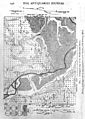 Geological map of Maidenhead district Wellcome M0016957.jpg 2,792 × 3,924; 4.89 MB
-
 Grass Eyot - geograph.org.uk - 4168759.jpg 640 × 430; 91 KB
-
 Great Western Main Line, Maidenhead - geograph.org.uk - 4207608.jpg 640 × 430; 88 KB
-
 Great Western Main Line, Maidenhead - geograph.org.uk - 4207611.jpg 640 × 430; 72 KB
-
 Green Way - geograph.org.uk - 3206899.jpg 2,272 × 1,704; 3.53 MB
-
 Greenoaks Performance Cars on Bath Road - geograph.org.uk - 4612533.jpg 2,304 × 1,728; 1.22 MB
-
 Greggs, Maidenhead - geograph.org.uk - 4168674.jpg 640 × 430; 70 KB
-
 Grenfell Park, Maidenhead - geograph.org.uk - 89700.jpg 597 × 400; 107 KB
-
 Grenfell Road, Maidenhead - geograph.org.uk - 4252327.jpg 4,000 × 3,000; 1.96 MB
-
 Grosvenor Drive - geograph.org.uk - 3561405.jpg 640 × 430; 80 KB
-
 Grosvenor Drive - geograph.org.uk - 4168764.jpg 640 × 430; 85 KB
-
 Grove Rd - geograph.org.uk - 3556028.jpg 640 × 430; 72 KB
-
 Guards Club Park Maidenhead.jpg 768 × 576; 205 KB
-
 GW main line crossing the Jubilee River (17340495615).jpg 3,648 × 2,432; 1.9 MB
-
 Haven of Rest - geograph.org.uk - 4168694.jpg 640 × 430; 101 KB
-
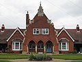 Haven of Rest Almshouses Maidenhead - geograph.org.uk - 958707.jpg 640 × 480; 65 KB
-
 Haven of Rest Almshouses.jpg 2,560 × 1,920; 2.12 MB
-
 Haven of Rest, Bridge Street - geograph.org.uk - 3668265.jpg 4,000 × 3,000; 4.28 MB
-
 Haven of Rest, Bridge Street - geograph.org.uk - 3668268.jpg 4,000 × 3,000; 4.1 MB
-
 Hay Field alongside Green Lane - geograph.org.uk - 5963727.jpg 5,184 × 3,456; 4.1 MB
-
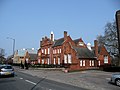
 Headquarters of the Commonwealth War Graves Commission.jpg 2,560 × 1,920; 2.26 MB
-
 Heron in the river - geograph.org.uk - 5963721.jpg 4,604 × 3,292; 2.03 MB
-
 High St Colonnade - geograph.org.uk - 4168678.jpg 640 × 430; 76 KB
-
 High St, Maidenhead - geograph.org.uk - 4168675.jpg 640 × 430; 88 KB
-
 High Street, Maidenhead - geograph.org.uk - 664197.jpg 640 × 469; 79 KB
-
 High Street, Maidenhead.jpg 2,560 × 1,920; 2.01 MB
-
 Hindhay Lane, Maidenhead - geograph.org.uk - 857229.jpg 640 × 480; 134 KB
-
 Hindhay Lane, Maidenhead - geograph.org.uk - 857232.jpg 640 × 480; 141 KB
-

-
 Hobgoblin - geograph.org.uk - 3607632.jpg 640 × 430; 75 KB

%27_(11297480765).jpg)


_-_geograph.org.uk_-_6267979.jpg)
_-_geograph.org.uk_-_6267980.jpg)
_-_geograph.org.uk_-_6267981.jpg)


_(23923457241).jpg)


.jpg)


