Category:Nationalpark Unteres Odertal
Jump to navigation
Jump to search
Deutsch: Der Nationalpark Unteres Odertal
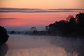
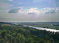
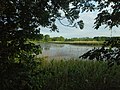
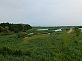
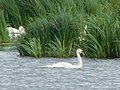
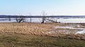
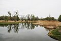
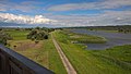
English: The Lower Oder Valley National Park is a cultural landscape of marshes and Polders in the Lower Oder Valley. The National Park includes six polders, opened in autumn for the fertilising Oder floods and closed from April on in order to drain a bit. The polders are the Lunow-Stolper Polder (1.620 ha), the Fiddichower Polder (1.725 ha), the Criewener Polder (1.480 ha), the Schwedter Polder (1.370 ha), all the four central polders, and the two marginal polders Schlosswiesenpolder (220 ha) and Friedrichsthaler Polder (687 ha).
Polski: Park Krajobrazowy Dolina Dolnej Odry
national park in Brandenburg, Germany    | |||||
| Upload media | |||||
| Instance of | |||||
|---|---|---|---|---|---|
| Named after | |||||
| Location | |||||
| Located in or next to body of water | |||||
| IUCN protected areas category | |||||
| Inception |
| ||||
| Area |
| ||||
| official website | |||||
 | |||||
Subcategories
This category has the following 14 subcategories, out of 14 total.
A
- Aussichtsturm Mescherin (2 F)
B
- Beobachtungsturm Stützkow (4 F)
- Brückenstraße Schwedt (9 F)
G
- Gutmundsee (3 F)
M
- Mummertgraben (6 F)
N
- Nationalparkhaus (Criewen) (2 F)
S
- Schwedter Polder (8 F)
- Schwedter Querfahrt (27 F)
W
Z
- Ziems Loch (3 F)
Media in category "Nationalpark Unteres Odertal"
The following 200 files are in this category, out of 821 total.
(previous page) (next page)-
 20180519 045242 IMG 0127.jpg 3,888 × 2,592; 2.83 MB
-
 20180519 045702 IMG 0137.jpg 3,888 × 2,592; 2.85 MB
-
 2366 Polder.jpg 6,720 × 4,480; 14.98 MB
-
 Am Morgen.JPG 3,888 × 2,592; 4.21 MB
-
 Auenlandschaft Naturpark Unteres Odertal (Mai 2016).jpg 5,472 × 3,648; 8.04 MB
-
 Auf Kranichtour.jpg 1,536 × 2,560; 686 KB
-
 Blick von Krajnik-Dolny.jpg 1,226 × 887; 457 KB
-
 Brandenburg Unteres Odertal Biberlandschaft9013.jpg 2,816 × 1,584; 2.23 MB
-
 Brandenburg Unteres Odertal BlaueWiesenpflanzeInGegensonne 5133.jpg 2,816 × 1,584; 1.05 MB
-
 Brandenburg Unteres Odertal Ente 5954.jpg 2,816 × 1,584; 2.4 MB
-
 Brandenburg Unteres Odertal Grauammer 9023.jpg 1,293 × 765; 172 KB
-
 Brandenburg Unteres Odertal Graureiher 8568.jpg 4,000 × 2,248; 2.19 MB
-
 Brandenburg Unteres Odertal HalmMitWassertropfen 5066.jpg 2,816 × 1,584; 1.35 MB
-
 Brandenburg Unteres Odertal Kolbenwasserkäfer.jpg 2,816 × 1,584; 1.57 MB
-
 Brandenburg Unteres Odertal Kornblume 6051.jpg 2,816 × 1,584; 1.04 MB
-
 Brandenburg Unteres Odertal Kornblume mit Insekt.jpg 2,816 × 1,584; 1.4 MB
-
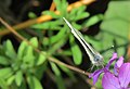
 Brandenburg Unteres Odertal Libelle 8403.jpg 2,816 × 1,584; 1.43 MB
-
 Brandenburg Unteres Odertal Libelle 9254.jpg 1,820 × 1,061; 727 KB
-
 Brandenburg Unteres Odertal Oder Winter 0703.JPG 1,920 × 1,080; 752 KB
-
 Brandenburg Unteres Odertal Poldersee 5034.jpg 4,000 × 2,248; 3.22 MB
-
 Brandenburg Unteres Odertal Polderwiese 7674.jpg 4,000 × 2,248; 3.08 MB
-
 Brandenburg Unteres Odertal Polderwiese Fruehling 0966.JPG 4,000 × 2,248; 3.92 MB
-
 Brandenburg Unteres Odertal Polderwiese Fruehling 1930.JPG 4,000 × 2,248; 4.46 MB
-
 Brandenburg Unteres Odertal Polderwiese Fruehling 9189.JPG 2,816 × 1,584; 1.03 MB
-
 Brandenburg Unteres Odertal Polderwiese Herbst 3285.JPG 4,000 × 2,248; 3.3 MB
-
 Brandenburg Unteres Odertal Polderwiese Herbst 3287.JPG 4,000 × 2,248; 3.35 MB
-
 Brandenburg Unteres Odertal Polderwiese Herbst 6828.JPG 4,000 × 2,248; 3.1 MB
-
 Brandenburg Unteres Odertal Polderwiese Herbst 6831.JPG 4,000 × 2,248; 3.68 MB
-
 Brandenburg Unteres Odertal Polderwiese Morgens 6377.jpg 4,000 × 2,248; 3.2 MB
-
 Brandenburg Unteres Odertal Polderwiese Sommer 0122.JPG 2,816 × 1,584; 1.86 MB
-
 Brandenburg Unteres Odertal Polderwiese Sommer 4156.JPG 3,264 × 2,448; 3.03 MB
-
 Brandenburg Unteres Odertal Polderwiese Winter 3096.JPG 3,264 × 2,448; 2.91 MB
-
 Brandenburg Unteres Odertal Polderwiese Winter 7196.JPG 2,272 × 1,704; 950 KB
-
 Brandenburg Unteres Odertal Polderwiese Winter 8005.JPG 4,000 × 2,248; 3.04 MB
-
 Brandenburg Unteres Odertal Pusteblume 0119.jpg 2,816 × 1,584; 2.03 MB
-
 Brandenburg Unteres Odertal Pusteblume 5388.jpg 2,550 × 1,434; 1.7 MB
-
 Brandenburg Unteres Odertal Pusteblume 6728.jpg 4,000 × 2,248; 2.32 MB
-
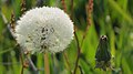 Brandenburg Unteres Odertal PusteblumeMitTau 9012.jpg 2,816 × 1,584; 1.71 MB
-
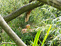
 Brandenburg Unteres Odertal Rehwild und Vogel 8881.jpg 2,816 × 1,584; 2.47 MB
-
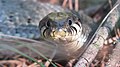 Brandenburg Unteres Odertal Ringelnatter 6022.jpg 2,816 × 1,584; 1.5 MB
-
 Brandenburg Unteres Odertal Ringelnatter 6025.jpg 2,816 × 1,584; 1.49 MB
-
 Brandenburg Unteres Odertal Ringelnatter 8499.jpg 2,816 × 1,584; 1.42 MB
-
 Brandenburg Unteres Odertal Schmetterling von vorn 1784.jpg 1,495 × 1,022; 323 KB
-
 Brandenburg Unteres Odertal Schwedt 6546.jpg 4,000 × 2,248; 3.29 MB
-
 Brandenburg Unteres Odertal Sommer 9240.jpg 3,908 × 2,158; 1.76 MB
-
 Brandenburg Unteres Odertal Stockente 2846.jpg 2,816 × 1,584; 1.32 MB
-
 Brandenburg Unteres Odertal Wassertropfen 8283.jpg 2,816 × 1,584; 1.05 MB
-
 Brandenburg Unteres Odertal Winter Sonnenaufgang 0464.jpg 2,816 × 1,584; 2.14 MB
-
 Bäume an der Oder bei Schwedt.jpg 4,928 × 3,264; 15.94 MB
-
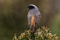 Common Redstart (Phoenicurus phoenicurus).jpg 2,051 × 1,364; 1.3 MB
-
 Deich bei Lunow.jpg 4,128 × 3,096; 3.67 MB
-
 Der Frühling bricht sich Bahn mit perfekter Spiegelung im Nationalpark Unteres Odertal.jpg 5,184 × 3,456; 13.04 MB
-
 Des Bibers Arbeitsplatz im Nationalpark Unters Odertal.jpg 5,184 × 3,456; 14.29 MB
-
 Die Oder im Nationalpark "Unteres Odertal" am Ort Criewen 02.jpg 5,463 × 2,396; 7.38 MB
-
 Die Oder im Nationalpark "Unteres Odertal" am Ort Criewen 03.jpg 4,778 × 3,185; 7.87 MB
-
 Die Oder im Nationalpark Unteres Odertal am Ort Criewen 01.jpg 5,472 × 3,648; 8.41 MB
-
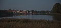 Die Stadt Gartz im Nationalpark Unteres Odertal nach Sonnenuntergang.jpg 4,925 × 2,311; 9.05 MB
-
 Eingang zum Nationalpark Unteres Odertal.JPG 4,608 × 3,072; 6.27 MB
-

-
 FauleMummert.jpg 2,288 × 1,712; 2.7 MB
-
 Feuchtwiese NP Unteres Odertal 24.07.11.JPG 3,888 × 2,592; 5.42 MB
-
 Fluss-Auenlandschaft im Nationalpark Unteres Odertal.jpg 8,235 × 6,600; 2.19 MB
-
 Froschsprung - Nationalpark Unteres Odertal.png 1,920 × 1,080; 2.2 MB
-
 Frozen oder river near schwedt.jpg 2,048 × 1,536; 606 KB
-
 Frühling im Nationalpark Unteres Odertal bei Schwedt.jpg 4,489 × 2,864; 12.8 MB
-
 Heckrinder NP Unteres Odertal 24.07.11.JPG 3,888 × 2,592; 4.3 MB
-
 Heckrinderherde Nationalpark Unteres Odertal.jpg 2,048 × 1,536; 539 KB
-
 Hochwasserschutzgebiet.JPG 2,592 × 3,888; 4.37 MB
-
 Idylle im Mai.jpg 5,472 × 3,648; 5.82 MB
-
 Im Nationalpark Unteres Odertal bei Schwedt.jpg 4,928 × 3,264; 10.86 MB
-
 Im Wald des Nationalpark Unteres Odertal.jpg 3,372 × 2,529; 9.91 MB
-
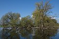
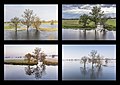 Oder Polder in allen Jahreszeiten.jpg 5,256 × 3,720; 4.95 MB
-
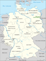 Karte Nationalpark Unteres Odertal.png 750 × 1,000; 202 KB
-
 Kraftwerk Polen im Unteren Odertal (2).jpg 5,846 × 3,629; 13.57 MB
-
 Kraftwerk Polen im Unteren Odertal.jpg 6,700 × 4,000; 20.75 MB
-
 Logo Nationalpark Unteres Odertal.svg 549 × 198; 27 KB
-
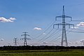 Maste an der Oder.jpg 5,472 × 3,648; 13.59 MB
-
 Morgenlicht an der Oder in Schwedt.jpg 4,891 × 3,127; 9.91 MB
-
 National Park Lower Oder Valley.jpg 4,626 × 1,600; 1.65 MB
-
 Nationalpark Unteres Odertal 01.jpg 3,549 × 2,662; 5.67 MB
-
 Nationalpark Unteres Odertal 02.jpg 4,368 × 2,912; 6.95 MB
-
 Nationalpark Unteres Odertal 03.jpg 4,000 × 3,000; 7.95 MB
-
 Nationalpark Unteres Odertal 04.jpg 4,000 × 3,000; 9.3 MB
-
 Nationalpark Unteres Odertal 05.jpg 3,900 × 2,925; 9.78 MB
-
 Nationalpark Unteres Odertal, Auenwald.jpg 2,560 × 1,920; 1.77 MB
-
 Nationalpark Unteres Odertal, Aussicht aus der Vogelbeobachtungsstation.jpg 4,608 × 3,456; 3.9 MB
-
 Nationalpark Unteres Odertal, Aussichtsplattform in Mescherin.jpg 4,800 × 920; 1.14 MB
-
 Nationalpark Unteres Odertal, Aussichtspunkt Stützkow.jpg 4,608 × 3,456; 4.09 MB
-
 Nationalpark Unteres Odertal, Bachlauf am Auenpfad.jpg 3,456 × 4,608; 3.49 MB
-
 Nationalpark Unteres Odertal, Bachlauf im Auenwald.jpg 3,456 × 4,608; 3.54 MB
-
 Nationalpark Unteres Odertal, Blick auf den Stolper Turm.jpg 4,608 × 3,456; 3.95 MB
-
 Nationalpark Unteres Odertal, Blick vom Aussichtsturm in Mescherin.jpg 4,608 × 3,456; 4.11 MB
-
 Nationalpark Unteres Odertal, Brücke in Stützkow.jpg 4,608 × 3,456; 3.85 MB
-
 Nationalpark Unteres Odertal, Brütende Schwäne.jpg 4,608 × 3,456; 6.5 MB
-
 Nationalpark Unteres Odertal, Entenfamilie Mescherin.jpg 4,608 × 3,456; 3.53 MB
-
 Nationalpark Unteres Odertal, Fischreiher in Mescherin.jpg 4,608 × 3,456; 3.66 MB
-
 Nationalpark Unteres Odertal, Graureiher beim Nisten.jpg 4,608 × 3,456; 7.72 MB
-
 Nationalpark Unteres Odertal, Graureiher vor Schwedt.jpg 4,608 × 3,456; 6.11 MB
-
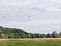
 Nationalpark Unteres Odertal, Gruppe von Kranichen vor Stolzenhagen.jpg 4,608 × 3,456; 3.57 MB
-
 Nationalpark Unteres Odertal, Haubentaucher.jpg 4,608 × 3,456; 7.38 MB
-
 Nationalpark Unteres Odertal, Kleines Polnisches Dorf.jpg 4,608 × 3,456; 3.91 MB
-
 Nationalpark Unteres Odertal, Kranich mit Kind.jpg 4,608 × 3,456; 7.28 MB
-
 Nationalpark Unteres Odertal, Kraniche vor Stolzenhagen.jpg 4,608 × 3,456; 3.71 MB
-
 Nationalpark Unteres Odertal, Lehrpfad im Auenwald.jpg 3,456 × 4,608; 3.57 MB
-
 Nationalpark Unteres Odertal, Nahaufnahme vom Aussichtsturm in Mescherin.jpg 4,608 × 3,456; 4.03 MB
-
 Nationalpark Unteres Odertal, Nistende Kormorane.jpg 4,608 × 3,456; 7.7 MB
-
 Nationalpark Unteres Odertal, Nistender Graureiher.jpg 4,608 × 3,456; 7.72 MB
-
 Nationalpark Unteres Odertal, Panoramablick in Stützkow.jpg 4,800 × 920; 1.12 MB
-
 Nationalpark Unteres Odertal, Polderwiesen am Abend.jpg 4,523 × 3,393; 2.28 MB
-
 Nationalpark Unteres Odertal, Polderwiesen.jpg 4,608 × 3,456; 5.84 MB
-
 Nationalpark Unteres Odertal, Schlosspark Criewen.jpg 4,608 × 3,456; 3.9 MB
-
 Nationalpark Unteres Odertal, Schwäne an der Beobachtungsstation.jpg 4,608 × 3,456; 3.87 MB
-
 Nationalpark Unteres Odertal, Schwäne an der Vogelbeobachtungsstation.jpg 4,608 × 3,456; 3.5 MB
-
 Nationalpark Unteres Odertal, Schwäne auf dem Kanal.jpg 4,608 × 3,456; 3.79 MB
-
 Nationalpark Unteres Odertal, Schwäne im Nebel.jpg 4,608 × 3,456; 4.19 MB
-
 Nationalpark Unteres Odertal, Schwäne mit Kindern auf dem Kanal.jpg 4,608 × 3,456; 3.7 MB
-
 Nationalpark Unteres Odertal, Stolpe, Oder, Koordinaten 52.977273,14.109209.jpg 4,032 × 2,268; 7.22 MB
-
 Nationalpark Unteres Odertal, Stolper Turm.jpg 2,560 × 1,920; 1.83 MB
-
 Nationalpark Unteres Odertal, Sumpflandschaft im Auenwald.jpg 4,608 × 3,456; 3.85 MB
-
 Nationalpark Unteres Odertal, westliches Oderufer, Blick ostwärts auf Piasek, Polen.jpg 5,147 × 2,895; 2.69 MB
-

-
 Nationalpark Unteres Odertal, zwischen Criewen und Zaton Dolna.jpg 5,312 × 2,988; 2.68 MB
-
 Nationalpark Unteres Odertal.JPG 3,456 × 2,304; 3.85 MB
-
 Nationalpark unteres Odertal.jpg 3,264 × 1,840; 1.57 MB
-
 Natur-Idylle pur am Brönkewehr im Nationalpark Unteres Odertal.jpg 5,184 × 3,456; 14.63 MB
-
 NP Unteres Odertal between Stolpe and Schwedt 2021-07-10 01.jpg 8,368 × 5,584; 20.22 MB
-
 NP Unteres Odertal between Stolpe and Schwedt 2021-07-10 02.jpg 8,368 × 5,584; 19.37 MB
-
 NP Unteres Odertal between Stolpe and Schwedt 2021-07-10 03.jpg 8,368 × 5,584; 16.53 MB
-
 NP Unteres Odertal between Stolpe and Schwedt 2021-07-10 04.jpg 8,368 × 5,584; 17.23 MB
-
 NP Unteres Odertal between Stolpe and Schwedt 2021-07-10 05.jpg 8,368 × 5,584; 17.18 MB
-
 NP Unteres Odertal between Stolpe and Schwedt 2021-07-10 06.jpg 8,368 × 5,584; 21.15 MB
-
 NP Unteres Odertal between Stolpe and Schwedt 2021-07-10 07.jpg 8,368 × 5,584; 20.14 MB
-
 NP Unteres Odertal between Stolpe and Schwedt 2021-07-10 08.jpg 8,368 × 5,584; 18.24 MB
-
 NP Unteres Odertal between Stolpe and Schwedt 2021-07-10 09.jpg 8,368 × 5,584; 20.27 MB
-
 NP Unteres Odertal between Stolpe and Schwedt 2021-07-10 10.jpg 8,368 × 5,584; 22.76 MB
-
 NP Unteres Odertal between Stolpe and Schwedt 2021-07-10 100.jpg 8,368 × 5,584; 23.09 MB
-
 NP Unteres Odertal between Stolpe and Schwedt 2021-07-10 101.jpg 8,368 × 5,584; 23.07 MB
-
 NP Unteres Odertal between Stolpe and Schwedt 2021-07-10 102.jpg 8,368 × 5,584; 22.7 MB
-
 NP Unteres Odertal between Stolpe and Schwedt 2021-07-10 103.jpg 8,368 × 5,584; 21.32 MB
-
 NP Unteres Odertal between Stolpe and Schwedt 2021-07-10 104.jpg 8,368 × 5,584; 19.43 MB
-
 NP Unteres Odertal between Stolpe and Schwedt 2021-07-10 105.jpg 8,368 × 5,584; 24.34 MB
-
 NP Unteres Odertal between Stolpe and Schwedt 2021-07-10 106.jpg 8,368 × 5,584; 16.77 MB
-
 NP Unteres Odertal between Stolpe and Schwedt 2021-07-10 107.jpg 8,368 × 5,584; 18.93 MB
-
 NP Unteres Odertal between Stolpe and Schwedt 2021-07-10 108.jpg 8,368 × 5,584; 17.25 MB
-
 NP Unteres Odertal between Stolpe and Schwedt 2021-07-10 109.jpg 8,368 × 5,584; 18.41 MB
-
 NP Unteres Odertal between Stolpe and Schwedt 2021-07-10 11.jpg 8,368 × 5,584; 19.32 MB
-
 NP Unteres Odertal between Stolpe and Schwedt 2021-07-10 110.jpg 8,368 × 5,584; 18.94 MB
-
 NP Unteres Odertal between Stolpe and Schwedt 2021-07-10 111.jpg 8,368 × 5,584; 19.29 MB
-
 NP Unteres Odertal between Stolpe and Schwedt 2021-07-10 112.jpg 8,368 × 5,584; 16.95 MB
-
 NP Unteres Odertal between Stolpe and Schwedt 2021-07-10 113.jpg 8,368 × 5,584; 18.93 MB
-
 NP Unteres Odertal between Stolpe and Schwedt 2021-07-10 114.jpg 8,368 × 5,584; 19.48 MB
-
 NP Unteres Odertal between Stolpe and Schwedt 2021-07-10 115.jpg 8,368 × 5,584; 20.95 MB
-
 NP Unteres Odertal between Stolpe and Schwedt 2021-07-10 116.jpg 8,368 × 5,584; 21.19 MB
-
 NP Unteres Odertal between Stolpe and Schwedt 2021-07-10 117.jpg 8,368 × 5,584; 20.96 MB
-
 NP Unteres Odertal between Stolpe and Schwedt 2021-07-10 118.jpg 8,368 × 5,584; 20.56 MB
-
 NP Unteres Odertal between Stolpe and Schwedt 2021-07-10 119.jpg 8,368 × 5,584; 20.35 MB
-
 NP Unteres Odertal between Stolpe and Schwedt 2021-07-10 12.jpg 8,368 × 5,584; 23.49 MB
-
 NP Unteres Odertal between Stolpe and Schwedt 2021-07-10 120.jpg 8,368 × 5,584; 20.63 MB
-
 NP Unteres Odertal between Stolpe and Schwedt 2021-07-10 121.jpg 8,368 × 5,584; 20.11 MB
-
 NP Unteres Odertal between Stolpe and Schwedt 2021-07-10 122.jpg 8,368 × 5,584; 19.22 MB
-
 NP Unteres Odertal between Stolpe and Schwedt 2021-07-10 123.jpg 8,368 × 5,584; 19.41 MB
-
 NP Unteres Odertal between Stolpe and Schwedt 2021-07-10 124.jpg 8,368 × 5,584; 18.99 MB
-
 NP Unteres Odertal between Stolpe and Schwedt 2021-07-10 125.jpg 8,368 × 5,584; 19.44 MB
-
 NP Unteres Odertal between Stolpe and Schwedt 2021-07-10 126.jpg 8,368 × 5,584; 19.73 MB
-
 NP Unteres Odertal between Stolpe and Schwedt 2021-07-10 127.jpg 8,368 × 5,584; 20.69 MB
-
 NP Unteres Odertal between Stolpe and Schwedt 2021-07-10 128.jpg 8,368 × 5,584; 17.12 MB
-
 NP Unteres Odertal between Stolpe and Schwedt 2021-07-10 129.jpg 8,368 × 5,584; 17.25 MB
-
 NP Unteres Odertal between Stolpe and Schwedt 2021-07-10 13.jpg 8,368 × 5,584; 23.44 MB
-
 NP Unteres Odertal between Stolpe and Schwedt 2021-07-10 130.jpg 8,368 × 5,584; 22.1 MB
-
 NP Unteres Odertal between Stolpe and Schwedt 2021-07-10 131.jpg 8,368 × 5,584; 22.84 MB
-
 NP Unteres Odertal between Stolpe and Schwedt 2021-07-10 132.jpg 8,368 × 5,584; 22.41 MB
-
 NP Unteres Odertal between Stolpe and Schwedt 2021-07-10 133.jpg 8,368 × 5,584; 23.19 MB
-
 NP Unteres Odertal between Stolpe and Schwedt 2021-07-10 134.jpg 8,368 × 5,584; 20.88 MB
-
 NP Unteres Odertal between Stolpe and Schwedt 2021-07-10 135.jpg 8,368 × 5,584; 22.03 MB
-
 NP Unteres Odertal between Stolpe and Schwedt 2021-07-10 136.jpg 8,368 × 5,584; 23.16 MB
-
 NP Unteres Odertal between Stolpe and Schwedt 2021-07-10 137.jpg 8,368 × 5,584; 22.39 MB
-
 NP Unteres Odertal between Stolpe and Schwedt 2021-07-10 138.jpg 8,368 × 5,584; 22.83 MB
-
 NP Unteres Odertal between Stolpe and Schwedt 2021-07-10 139.jpg 8,368 × 5,584; 23.35 MB
-
 NP Unteres Odertal between Stolpe and Schwedt 2021-07-10 14.jpg 8,368 × 5,584; 19.67 MB
-
 NP Unteres Odertal between Stolpe and Schwedt 2021-07-10 140.jpg 8,368 × 5,584; 20.34 MB
-
 NP Unteres Odertal between Stolpe and Schwedt 2021-07-10 141.jpg 8,368 × 5,584; 21.35 MB
-
 NP Unteres Odertal between Stolpe and Schwedt 2021-07-10 142.jpg 8,368 × 5,584; 23.17 MB
-
 NP Unteres Odertal between Stolpe and Schwedt 2021-07-10 143.jpg 8,368 × 5,584; 23.01 MB
-
 NP Unteres Odertal between Stolpe and Schwedt 2021-07-10 144.jpg 8,368 × 5,584; 22.88 MB
-
 NP Unteres Odertal between Stolpe and Schwedt 2021-07-10 145.jpg 8,368 × 5,584; 22.53 MB
-
 NP Unteres Odertal between Stolpe and Schwedt 2021-07-10 146.jpg 8,368 × 5,584; 23.56 MB
-
 NP Unteres Odertal between Stolpe and Schwedt 2021-07-10 147.jpg 8,368 × 5,584; 22.7 MB
-
 NP Unteres Odertal between Stolpe and Schwedt 2021-07-10 148.jpg 8,368 × 5,584; 22.77 MB
-
 NP Unteres Odertal between Stolpe and Schwedt 2021-07-10 149.jpg 8,368 × 5,584; 22.25 MB
-
 NP Unteres Odertal between Stolpe and Schwedt 2021-07-10 15.jpg 8,368 × 5,584; 17.47 MB
-
 NP Unteres Odertal between Stolpe and Schwedt 2021-07-10 150.jpg 8,368 × 5,584; 23.09 MB
-
 NP Unteres Odertal between Stolpe and Schwedt 2021-07-10 151.jpg 8,368 × 5,584; 20.99 MB
-
 NP Unteres Odertal between Stolpe and Schwedt 2021-07-10 152.jpg 8,368 × 5,584; 21.68 MB
-
 NP Unteres Odertal between Stolpe and Schwedt 2021-07-10 153.jpg 8,368 × 5,584; 22.59 MB
-
 NP Unteres Odertal between Stolpe and Schwedt 2021-07-10 154.jpg 8,368 × 5,584; 22.78 MB
-
 NP Unteres Odertal between Stolpe and Schwedt 2021-07-10 155.jpg 8,368 × 5,584; 22.61 MB
-
 NP Unteres Odertal between Stolpe and Schwedt 2021-07-10 156.jpg 8,368 × 5,584; 22.98 MB
-
 NP Unteres Odertal between Stolpe and Schwedt 2021-07-10 157.jpg 8,368 × 5,584; 22.91 MB
-
 NP Unteres Odertal between Stolpe and Schwedt 2021-07-10 158.jpg 8,368 × 5,584; 23.43 MB
-
 NP Unteres Odertal between Stolpe and Schwedt 2021-07-10 159.jpg 8,368 × 5,584; 20.77 MB


.jpg)


.jpg)


.jpg)


.jpg)


