Category:Ourthe
Jump to navigation
Jump to search
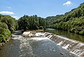
English: The Ourthe is a 165 km long river in the Ardennes in Belgium. It is a right tributary to the river Meuse.
river in Belgium  Most přes řeku v Esneux .png) | |||||
| Upload media | |||||
| Instance of | |||||
|---|---|---|---|---|---|
| Location |
| ||||
| Length |
| ||||
| Elevation above sea level |
| ||||
| Origin of the watercourse |
| ||||
| Mouth of the watercourse | |||||
| Drainage basin | |||||
| Tributary |
| ||||
 | |||||
Subcategories
This category has the following 32 subcategories, out of 32 total.
- Ourthe in Bohon (4 F)
- Ourthe in Bomal (17 F)
- Ourthe in Comblain-au-Pont (7 F)
- Ourthe in Comblain-la-Tour (6 F)
- Ourthe in Engreux (7 F)
- Ourthe in Gouvy (3 F)
- Ourthe in Grandhan (2 F)
- Ourthe in Hampteau (1 F)
- Ourthe in Hony (1 F)
- Ourthe in Lavacherie (6 F)
- Ourthe in Logne (1 F)
- Ourthe in Nadrin (2 F)
- Ourthe in Ourt (3 F)
- Ourthe in Sy (20 F)
B
C
L
- Lac de Nisramont (8 F)
R
- Rochers de Sy (6 F)
- Rochers de Tilff (5 F)
T
Media in category "Ourthe"
The following 28 files are in this category, out of 28 total.
-
 KaartOurthe.jpg 692 × 500; 439 KB
-
 Aux pieds des roches.jpg 4,000 × 3,000; 5.53 MB
-
 Betchete.jpeg 300 × 172; 13 KB
-
 Bij Chanxhe, zicht op l'Ourthe IMG 9779 2019-06-02 15.27.jpg 4,534 × 3,053; 9.55 MB
-
 Crete d Ourthe 01.jpg 2,048 × 1,536; 769 KB
-
 Crete d Ourthe 02.jpg 2,048 × 1,536; 589 KB
-
 L'Ourthe au fil du temps.pdf 1,225 × 1,745, 31 pages; 5.54 MB
-
 La Maison sur la Rivière (8348133475).jpg 5,736 × 3,632; 19.81 MB
-
 Le rocher du Héron.jpg 1,536 × 2,048; 1.45 MB
-
 Limace orange.jpg 2,560 × 1,920; 1.93 MB
-
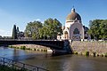 Liège, l'église Saint-Vincent IMG 9796 2019-06-02 17.45.jpg 5,452 × 3,648; 13.21 MB
-
 Loix-Ourte.jpg 1,073 × 1,309; 1.17 MB
-
 Neupre - La Roche aux Faucons - Ourthe 01.jpg 6,000 × 4,000; 7.35 MB
-
 Neupre - La Roche aux Faucons - Ourthe 02.jpg 6,000 × 4,000; 6.21 MB
-
 Neupre - La Roche aux Faucons - Ourthe 03.jpg 6,000 × 4,000; 5.8 MB
-
 Neupre - La Roche aux Faucons - Ourthe 04.jpg 6,000 × 4,000; 8.33 MB
-
 Ourthe (rivière).png 478 × 603; 418 KB
-
 Ourthe 20080217 3.jpg 3,456 × 2,304; 3.71 MB
-
 Ourthe occidentale à Wyompont.JPG 3,168 × 4,752; 15.4 MB
-
 Ourthe occidentale.png 517 × 550; 306 KB
-
 Ourthe Orientale.JPG 1,200 × 1,600; 1.37 MB
-
 Ourthe orientale.png 600 × 355; 246 KB
-
 Ourthe333.JPG 1,600 × 1,200; 1.28 MB
-
 Pollution Ourthe 20080217 1.jpg 3,468 × 2,308; 7.74 MB
-
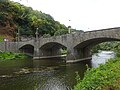 Pont de Sçay 2.jpg 4,896 × 3,672; 6.07 MB
-

-
 Taxodium distichum (Rendeux) JPG1.jpg 2,496 × 1,664; 3.05 MB
-
 View of the Ourthe from the Rue de l'Ourthe bridge near Noiseux, Somme-Leuze, 2004.jpg 2,272 × 1,343; 1.9 MB


.jpg)


.jpg)
_JPG1.jpg)
