Category:Peist
Jump to navigation
Jump to search
| Object location | | View all coordinates using: OpenStreetMap |
|---|
former municipality of Switzerland in Graubünden   | |||||
| Upload media | |||||
| Instance of | |||||
|---|---|---|---|---|---|
| Location | Grisons, Switzerland | ||||
| Area |
| ||||
| Elevation above sea level |
| ||||
| Replaced by |
| ||||
| official website | |||||
 | |||||
Subcategories
This category has the following 4 subcategories, out of 4 total.
G
- Guisanplatz (Arosa) (2 F)
P
- Peist railway station (7 F)
- Prätschseen (4 F)
R
- Reformierte Kirche Peist (4 F)
Media in category "Peist"
The following 24 files are in this category, out of 24 total.
-
 Arosa-Express.jpg 4,368 × 2,912; 3.17 MB
-
 Esche Peist tibert.ch 0840.jpg 1,636 × 1,493; 726 KB
-
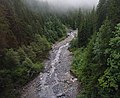 Frauentobelbach.jpg 4,393 × 3,600; 9.32 MB
-
 Hautichopf in winter - panoramio.jpg 5,184 × 3,456; 5 MB
-
 Karte Gemeinde Peist 2007.png 1,181 × 968; 266 KB
-
 Karte Gemeinde Peist 2008.png 1,181 × 968; 265 KB
-
 Karte Gemeinde Peist 2009.png 1,476 × 1,211; 454 KB
-
 Karte Gemeinde Peist 2010.png 1,476 × 1,211; 445 KB
-
 Karte Gemeinde Peist.png 1,181 × 933; 230 KB
-
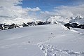
 Mountains near Arosa - panoramio.jpg 5,184 × 3,456; 4.46 MB
-
 Peist 2020.jpeg 3,700 × 2,806; 2.2 MB
-
 Peist von Langwies Matten.jpg 4,000 × 3,000; 3.29 MB
-
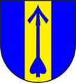 Peist wappen.svg 438 × 480; 3 KB
-
 Peist1.jpg 2,592 × 1,633; 1.09 MB
-
 Peist2.jpg 2,576 × 1,624; 1.03 MB
-
 Scenic view near Fuchs - panoramio (3).jpg 5,184 × 3,456; 5.35 MB
-
 Scenic view near Fuchs - panoramio (4).jpg 5,184 × 3,456; 5.66 MB
-
 Scenic view near Fuchs - panoramio (5).jpg 5,184 × 3,456; 5.11 MB
-
 Scenic view near Fuchs - panoramio.jpg 5,184 × 3,456; 5.16 MB
-
 Schanfigg Peist.jpg 2,592 × 1,944; 1.11 MB
-
 Schanfigg westlich.jpg 2,586 × 1,656; 1.13 MB
-
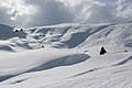
 Skiing traces in Arosa - panoramio.jpg 5,184 × 3,456; 6.09 MB
-
 Strasse Peist Loos.jpg 4,032 × 3,024; 3.44 MB
-
 Strasse Peist Peister Alp.jpg 4,032 × 3,024; 3.68 MB


.jpg)
.jpg)
.jpg)


