Category:Pottendorf
Jump to navigation
Jump to search
municipality in Baden District, Lower Austria, Austria .jpg)  | |||||
| Upload media | |||||
| Instance of |
| ||||
|---|---|---|---|---|---|
| Location | Baden District, Lower Austria, Austria | ||||
| Population |
| ||||
| Area |
| ||||
| Elevation above sea level |
| ||||
| official website | |||||
 | |||||
Subcategories
This category has the following 10 subcategories, out of 10 total.
!
B
- Bahnhof Pottendorf-Landegg (3 F)
- Bahnhof Wampersdorf (13 F)
C
E
F
N
S
- Schloss Pottendorf (82 F)
W
Media in category "Pottendorf"
The following 32 files are in this category, out of 32 total.
-
 4124 026 7619 Wampersdorf.jpg 5,134 × 3,422; 13.35 MB
-
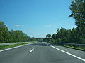
 A3 Pottendorf 1.JPG 3,321 × 2,491; 1.62 MB
-
 A3 Pottendorf 2.JPG 3,480 × 2,610; 1.7 MB
-
 A3 Pottendorf 3.JPG 3,648 × 2,736; 2.56 MB
-
 Aufnahmeblatt 4857-1c Pottendorf Landegg Ebenfurth Hornstein.jpg 10,373 × 7,505; 36.45 MB
-
 Aufnahmeblatt 4857-1c Pottendorf Landegg-cropped.jpg 4,453 × 3,249; 3.5 MB
-
 Kneipp Pottendorf.jpg 4,720 × 3,173; 7.3 MB
-
 Landegg Gelöbniskreuz.JPG 1,313 × 1,969; 3.27 MB
-
 Landegg Nepomukstatue.JPG 1,313 × 1,969; 2.76 MB
-
 Map at pottendorf.png 400 × 240; 3 KB
-
 Pottendorf 3012.jpg 5,184 × 3,456; 7.42 MB
-
 Pottendorf 3016.jpg 5,184 × 3,456; 12.48 MB
-
 Pottendorf Florianikapelle.JPG 1,969 × 1,313; 2.43 MB
-
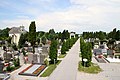 Pottendorf Friedhof.JPG 1,535 × 1,023; 1.38 MB
-
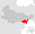 Pottendorf im Bezirk BN.PNG 645 × 623; 27 KB
-
 Pottendorf in BN.PNG 935 × 543; 25 KB
-
 Pottendorf Nepomukstatue.JPG 1,392 × 1,969; 3.68 MB
-
 Pottendorf Pieta.JPG 1,336 × 1,890; 2.55 MB
-
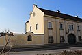
 Pottendorf Rathaus.JPG 1,181 × 787; 858 KB
-
 Pottendorf Rotherhof.JPG 1,575 × 1,050; 1.64 MB
-
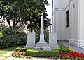 Pottendorf Soldatendenkmal.JPG 2,362 × 1,670; 4.22 MB
-
 Pottendorf,-ehem.-Arbeiterwohnhaus,--Henneberplatz-4-11-(um-1980).jpg 3,228 × 2,150; 3.92 MB
-
 Pottendorf.png 143 × 150; 27 KB
-
 Schloss Pottendorf - ducks crossing sign.jpg 2,384 × 3,824; 4.6 MB
-
 Umgebung von Pottendorf und Loretto in Ungarn - Schweickhardt 1837 - Sektion 28.jpg 4,468 × 2,990; 12.18 MB
-
 Wampersdorf Gnadenstuhl.JPG 1,393 × 1,969; 3.11 MB
-
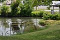
 Wampersdorf Leitha 40294.jpg 1,280 × 794; 800 KB
-
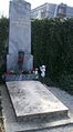
 Wampersdorf Soldatendenkmal.JPG 1,890 × 1,337; 2.83 MB
-
 Windpark Pottendorf.svg 1,931 × 1,499; 3.25 MB
-
 WinterHorst.jpg 389 × 703; 228 KB
-
 Wäscheschwemme & Kneipp Pottendorf.jpg 4,598 × 2,986; 6.03 MB
-
 Wäscheschwemme Pottendorf.jpg 4,405 × 3,185; 7.06 MB


