Category:Prechistensky Lane
Jump to navigation
Jump to search
| Object location | | View all coordinates using: OpenStreetMap |
|---|
street in Khamovniki District, Russia  | |||||
| Upload media | |||||
| Instance of | |||||
|---|---|---|---|---|---|
| Location | Khamovniki District, Central Administrative Okrug, Moscow, Russia | ||||
| Length |
| ||||
 | |||||
Subcategories
This category has the following 4 subcategories, out of 4 total.
Media in category "Prechistensky Lane"
The following 11 files are in this category, out of 11 total.
-
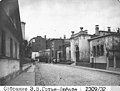 Gautier-Dufayet 2309-32 Myortvy Lane from Starokonyushenny Lane 1913.jpg 2,817 × 2,126; 1.04 MB
-
 Gautier-Dufayet 2416-43 Myortvy and Starokonyushenny Lanes 1913.jpg 2,799 × 2,126; 845 KB
-
 Gautier-Dufayet 2432-59 Myortvy Lane from Prechistenka Street 1913.jpg 2,948 × 2,126; 863 KB
-
 Moscow, Prechistensky Lane 5a - Vera Mukhina house (30635926204).jpg 3,264 × 2,178; 1.14 MB
-
 Moscow, Prechistensky Lane 5a - Vera Mukhina house (31361575271).jpg 3,264 × 2,178; 1.34 MB
-
 Moscow, Prechistensky Lane 7 inside the block (30635925964).jpg 3,264 × 2,178; 905 KB
-
 Mukhina vi house.jpg 2,554 × 1,915; 773 KB
-
 Prechistensky lane sign.jpg 4,454 × 2,969; 8.64 MB
-
 Walcot prechistensky 8.JPG 800 × 1,067; 258 KB
-
 Особняк Гутхейля Пречистенский пер 8.jpg 4,899 × 2,417; 4.97 MB
-
 ПереулокПРЕЧИСТЕНСКИЙ - panoramio.jpg 1,600 × 1,200; 799 KB


.jpg)
.jpg)
.jpg)


