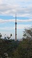
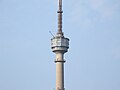
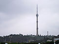
Category:Pyongyang TV Tower
Jump to navigation
Jump to search
| Object location | | View all coordinates using: OpenStreetMap |
|---|
North Korean telecommunications tower  | |||||
| Upload media | |||||
| Instance of |
| ||||
|---|---|---|---|---|---|
| Location | Pyongyang, DPRK | ||||
| Inception |
| ||||
| Date of official opening |
| ||||
| Height |
| ||||
| Elevation above sea level |
| ||||
 | |||||
Media in category "Pyongyang TV Tower"
The following 27 files are in this category, out of 27 total.
-
 0650 - Nordkorea 2015 - Pjöngjang (22551499268).jpg 4,805 × 3,182; 2.51 MB
-
 0652 - Nordkorea 2015 - Pjöngjang (22781776140).jpg 2,842 × 4,291; 1.94 MB
-
 0654 - Nordkorea 2015 - Pjöngjang (22551413567).jpg 2,380 × 4,775; 2.14 MB
-
 1216 - Nordkorea 2015 - Pjöngjang (22785047270).jpg 3,159 × 4,773; 3.05 MB
-
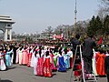 Day of the Sun of 2012 - 12 - Pyongyang, North Korea.jpg 800 × 600; 345 KB
-
 DPRK - (40244968884).png 2,797 × 4,195; 17.91 MB
-
 Dprk pyongyang tv tower 05.jpg 400 × 600; 27 KB
-
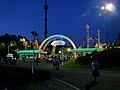 Kaeson Youth Park Pleasure Ground entrance with Pyongyang TV Tower at night.jpg 1,493 × 1,120; 274 KB
-
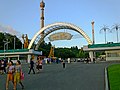 Kaeson Youth Park Pleasure Ground entrance with Pyongyang TV Tower.jpg 1,493 × 1,120; 292 KB
-
 Laika ac Pyongyang (11958672684).jpg 5,184 × 3,456; 3.87 MB
-
 Laika ac Pyongyang TV Tower (7975197159).jpg 3,328 × 5,002; 5.98 MB
-
 Laika ac TV Tower (11959276566).jpg 3,456 × 5,184; 4.09 MB
-
 Mansudae Grand Monument 01.JPG 2,504 × 3,392; 1.58 MB
-
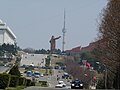 Mansudae Grand Monument and Pyongyang TV Tower.jpg 800 × 600; 300 KB
-
 Moran Hill Pyongyang, DPRK (14037890289).jpg 2,530 × 4,498; 15.26 MB
-
 Moranbong Park - 04.jpg 5,504 × 3,096; 5.47 MB
-
 PYONGYANG CITY DPRK NORTH KOREA OCT 2012 (8648692594).jpg 5,184 × 2,650; 9.76 MB
-
 Pyongyang TV Tower (6647263701).jpg 3,456 × 2,304; 1.79 MB
-
 Pyongyang TV Tower 01.JPG 2,544 × 3,440; 1.64 MB
-
 Pyongyang TV Tower 02.JPG 3,488 × 2,616; 1.8 MB
-
 Pyongyang TV Tower, Kaeson Youth Park Pleasure Ground and murals.jpg 1,493 × 1,120; 314 KB
-
 Pyongyang TV Tower, North Korea.jpg 768 × 1,024; 627 KB
-
 Pyongyang-TV-Tower-2014.jpg 2,896 × 3,318; 1.78 MB
-
 Revolutionary Martyrs Cemetery 03.JPG 3,443 × 2,562; 1.65 MB
-
 Television Tower Pyongyang (6075115266).jpg 3,600 × 2,700; 5.23 MB
-
 View Pyongyang 09.JPG 3,449 × 2,563; 1.79 MB
-
 View Pyongyang 21.JPG 3,488 × 2,616; 2.09 MB
.jpg)
.jpg)
.jpg)
.jpg)

.png)


.jpg)
.jpg)
.jpg)


.jpg)

.jpg)
.jpg)


.jpg)

