Category:San Bernardino County, California
Jump to navigation
Jump to search
Counties of California: Alameda · Alpine · Amador · Butte · Calaveras · Colusa · Contra Costa · Del Norte · El Dorado · Fresno · Glenn · Humboldt · Imperial · Inyo · Kern · Kings · Lake · Lassen · Los Angeles · Madera · Marin · Mariposa · Mendocino · Merced · Modoc · Mono · Monterey · Napa · Nevada · Orange · Placer · Plumas · Riverside · Sacramento · San Benito · San Bernardino · San Diego · San Joaquin · San Luis Obispo · San Mateo · Santa Barbara · Santa Clara · Santa Cruz · Shasta · Sierra · Siskiyou · Solano · Sonoma · Stanislaus ·Sutter · Tehama · Trinity · Tulare · Tuolumne · Ventura · Yolo · Yuba – Consolidated city-county: San Francisco
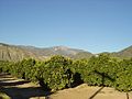
English: San Bernardino County — county of the Inland Empire and Greater Los Angeles Area, within southern California.
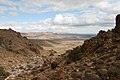
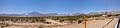
- Much of the county is within the Mojave Desert, north and east of the San Bernardino Mountains.
county in California, United States     | |||||
| Upload media | |||||
| Instance of | |||||
|---|---|---|---|---|---|
| Part of | |||||
| Named after | |||||
| Location | California, Pacific States Region | ||||
| Capital | |||||
| Inception |
| ||||
| Highest point | |||||
| Population |
| ||||
| Area |
| ||||
| official website | |||||
 | |||||
Subcategories
This category has the following 31 subcategories, out of 31 total.
B
- Black Meadow Landing (3 F)
C
- Castle Mountain Project (2 F)
- Chemehuevi Reservation (2 F)
D
- Dome Fire (4 F)
G
- Gene Pump Plant (21 F)
- Gene Wash Reservoir and Dam (10 F)
H
I
- Iron Mountain Pump Plant (13 F)
M
- Mountain Pass mine (6 F)
N
P
- Palms Oasis Trail (3 F)
T
W
- Whitsett Pump Plant (19 F)
- Willow Hole Trail (5 F)
Pages in category "San Bernardino County, California"
This category contains only the following page.
Media in category "San Bernardino County, California"
The following 200 files are in this category, out of 459 total.
(previous page) (next page)-
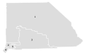
 Map of California highlighting San Bernardino County.svg 1,022 × 1,171; 495 KB
-
 San bernardino County.png 200 × 231; 12 KB
-
 "Lo Gas" sign, welcome to abandoned station - panoramio.jpg 2,592 × 1,936; 2.91 MB
-
 - panoramio (3979).jpg 2,048 × 1,536; 755 KB
-
 Flag of San Bernardino County, California.png 360 × 216; 8 KB
-

-
 2011 San Bernardino County Supervisorial district map.svg 512 × 331; 102 KB
-
-

-

-
 3 mar morongo.jpg 7,135 × 1,678; 2 MB
-
 50 Year Old Chrome - panoramio.jpg 2,400 × 1,800; 394 KB
-
-
 A Lone Desert Resident - panoramio.jpg 2,592 × 1,560; 884 KB
-
 A Lone Power Pole - panoramio.jpg 2,592 × 1,936; 1.88 MB
-
 A Long Dirt Road - panoramio.jpg 2,592 × 1,936; 2.16 MB
-
 A New Day, Oak Glen, CA 3-13 (15578052316).jpg 2,450 × 1,996; 2.07 MB
-
 Abandoned Baker landfill perimeter fence ^ sign - panoramio.jpg 2,592 × 1,936; 2.07 MB
-
 Abandoned Houses - panoramio.jpg 4,000 × 3,000; 4.61 MB
-
 Abandoned Mobile Home, Inside - panoramio.jpg 2,592 × 1,936; 1.61 MB
-
 Abandoned Mobile House in Baker - panoramio.jpg 2,592 × 1,936; 2.25 MB
-
 Allesandro Road to San Timoteo Canyon, Redlands 1-2012 (6750066867).jpg 1,492 × 1,008; 436 KB
-
 Along Old Rt. 66, Amboy, CA, Roy's Cafe 2005 (6595774387).jpg 1,820 × 1,253; 426 KB
-
 Along Old Rt. 66, Amboy, CA, Roy's Motel 2005 (6589854427).jpg 1,981 × 1,400; 516 KB
-
 Along Old Rt. 66, Amboy, CA, Roy's Place 2005 (6589853873).jpg 1,505 × 1,533; 333 KB
-
 Along Old Rt. 66, Barstow, CA, Harvey House and Depot 2005 (6595400659).jpg 1,644 × 1,146; 343 KB
-
 Alumni House, U of R 10-14-12 (8204141668).jpg 1,750 × 1,291; 484 KB
-
 America's Highways 1776–1976 - page 378.jpg 2,472 × 3,458; 7.15 MB
-
 Andrews House at Hart Mine - panoramio.jpg 800 × 1,200; 850 KB
-
 Another Keeper - panoramio.jpg 2,400 × 1,800; 963 KB
-
 Apple Valley, CA, USA - panoramio.jpg 2,560 × 1,920; 1.04 MB
-
 Autopista 215.JPG 2,592 × 1,728; 723 KB
-
 Back Entrance to Molycorp2 - panoramio.jpg 2,592 × 1,936; 2.27 MB
-
 Back of Ruined Mobile Home - panoramio.jpg 2,592 × 1,936; 1.64 MB
-
 Back Storage Shed, Refrigerator and Freezer - panoramio.jpg 2,592 × 1,936; 1.77 MB
-
 Back Way In To MolyCorp - panoramio.jpg 1,936 × 2,592; 2.71 MB
-
 Backup Units Waiting on Standby - panoramio.jpg 2,592 × 1,936; 2.35 MB
-
 Bad Things Happened Here - panoramio.jpg 2,400 × 1,800; 577 KB
-
 Band Audience 7-4-2012 (7529116198).jpg 1,548 × 1,008; 536 KB
-
 Be Nice to the Ducks, Pond, Seven Oaks 4-5-14 (13738683415).jpg 1,770 × 1,485; 1.28 MB
-
 Bear Mountain, Big Bear Lake.jpg 4,806 × 3,161; 13.96 MB
-
 Behind the Great MolyCorp Debris Pile - panoramio.jpg 2,592 × 1,936; 2.44 MB
-
 Behind The Wheel (5754255334).jpg 640 × 480; 111 KB
-
 Bibliography of marine geology and oceanography, California coast (1955) (20181515159).jpg 3,764 × 2,738; 2.79 MB
-
 Big bear city airport.jpg 3,872 × 2,592; 4.42 MB
-
 Big Bear Lake - panoramio.jpg 2,048 × 1,536; 1.28 MB
-
 Big Bear Mountain - panoramio.jpg 2,048 × 1,536; 1.3 MB
-
 Big Bear, CA - panoramio.jpg 1,024 × 768; 257 KB
-
 Bo Diddley poster featuring Buddy Reed Richard Innes and Jerry Smith.jpg 2,470 × 4,016; 1.79 MB
-
 Boarded up house - panoramio.jpg 2,592 × 1,936; 2.43 MB
-
 Boarded up old house - panoramio.jpg 2,592 × 1,936; 2.12 MB
-
 Bringing you the NEXT GENERATION of transit.jpeg 3,024 × 4,032; 1.52 MB
-
 Broken Windmill - panoramio.jpg 1,600 × 1,067; 1.42 MB
-
 Bunker - panoramio (14).jpg 4,288 × 3,216; 3.38 MB
-
 Buried Fiberoptic Fiber - panoramio.jpg 1,936 × 2,592; 2.81 MB
-
 Burned out mill at Rock Springs - panoramio.jpg 1,600 × 1,067; 1.6 MB
-
 Cabin Site - panoramio.jpg 2,400 × 1,800; 637 KB
-
 Cabin Site Stone Patio - panoramio.jpg 2,400 × 1,800; 974 KB
-
 Cabin Site Valley - panoramio.jpg 2,400 × 1,800; 588 KB
-
 Cafe 247.jpg 960 × 720; 257 KB
-
 CAfires TAS2003298 lrg.jpg 3,657 × 3,015; 2.59 MB
-
 California ski resort (Unsplash).jpg 3,648 × 5,472; 7.01 MB
-
 California-Vidal-Building-4.jpg 4,608 × 3,456; 3.65 MB
-
 California-Vidal-Building-Gas Station.jpg 4,608 × 3,456; 3.67 MB
-
 California-Vidal-House-4.jpg 3,777 × 2,685; 1.92 MB
-
 California-Vidal-House.jpg 4,608 × 3,456; 4.25 MB
-
 California-Vidal-Wateer Tank.jpg 4,608 × 3,456; 3.81 MB
-
 California-Vidal-Wyatt Earp and Josephine Sarah Marcus Cottage-2.jpg 3,456 × 4,608; 3.67 MB
-
 California-Vidal-Wyatt Earp and Josephine Sarah Marcus Cottage-3.jpg 4,608 × 3,456; 3.33 MB
-
 California-Vidal-Wyatt Earp and Josephine Sarah Marcus Cottage-5.jpg 4,608 × 3,456; 3.42 MB
-
 California-Vidal.jpg 4,608 × 3,456; 3.64 MB
-
 California-Vidall-Building- J. M. Heacock Building.jpg 4,110 × 3,130; 3.07 MB
-
 Calzona by Drone.jpg 3,968 × 2,976; 6.1 MB
-
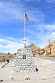
 Camp Cajon Monument in San Bernardino County, California. East side of monument.jpg 1,800 × 2,700; 2.83 MB
-
-
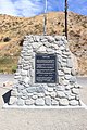
 Camp Cajon Monument in San Bernardino County, California. South side of monument.jpg 1,800 × 2,700; 3.3 MB
-
 Camp Cajon Monument in San Bernardino County, California. West side of monument.jpg 1,800 × 2,700; 4.62 MB
-
 CampClipper 1943.jpg 789 × 429; 42 KB
-
 Cell Tower and Power Lines - panoramio.jpg 1,936 × 2,592; 2.33 MB
-
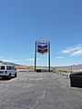 Chevron in the dessert - panoramio.jpg 2,448 × 3,264; 2.93 MB
-
 ChickPublicationslogo.png 156 × 52; 1 KB
-
 Chrome Still Shines - panoramio.jpg 2,400 × 1,800; 705 KB
-
 Colorado River CA AZ (NBY 433108).jpg 821 × 527; 68 KB
-
 Communications Antenna for the Relay - panoramio.jpg 2,592 × 1,936; 1.71 MB
-
 Composer Cuong Manh Nguyen(Nguyen Manhh Cuong).jpg 2,448 × 3,264; 2 MB
-
 Country Gentleman, Oak Glen, CA (5991915456).jpg 659 × 711; 197 KB
-
 Cryptobiotic Soil (I thnk so anyway...) - Flickr - brewbooks.jpg 3,264 × 2,448; 6.6 MB
-
 Crystal Springs Trail - panoramio.jpg 1,600 × 1,067; 1.48 MB
-
 Cucamonga Peak - panoramio.jpg 8,080 × 1,600; 4.48 MB
-
 Dancing Stormtrooper filming location - panoramio.jpg 1,780 × 1,200; 1.87 MB
-
 Danger, Use dragline when working on or near water - panoramio.jpg 2,592 × 1,936; 2.58 MB
-
 Death Valley View - Flickr - brewbooks.jpg 3,264 × 1,896; 1.92 MB
-
 Desert - panoramio (23).jpg 4,000 × 3,000; 4.57 MB
-
 Desert - panoramio (24).jpg 4,000 × 3,000; 4.86 MB
-
 Desert - panoramio (25).jpg 4,000 × 3,000; 4.49 MB
-
 Desert Habitat - Flickr - brewbooks.jpg 3,264 × 1,716; 2.48 MB
-
 Desert in Bloom - Geraea canescens - Flickr - brewbooks (1).jpg 3,264 × 2,448; 5.45 MB
-
 Desert in Bloom - Geraea canescens - Flickr - brewbooks (2).jpg 3,264 × 2,448; 4.16 MB
-
 Desert Rd - panoramio.jpg 4,416 × 3,312; 5.03 MB
-
 Desert Train in the Distance, Entering Nipton - panoramio.jpg 2,592 × 1,936; 2.07 MB
-
 Desert7777.jpg 4,032 × 3,024; 5.34 MB
-
 Diamonds on Green Valley Lake, CA 4-16 (26399935141).jpg 2,100 × 1,551; 1.87 MB
-
 Driveway of Old Abandoned House - panoramio.jpg 2,592 × 1,936; 2.19 MB
-
 Eastbound Freight, San Timoteo Canyon 4-12 (17594475558).jpg 1,510 × 1,084; 699 KB
-
 Eighty Cubic Feet of Rust - panoramio.jpg 2,400 × 1,800; 728 KB
-
 Emptiness - panoramio.jpg 1,971 × 1,936; 891 KB
-
 Exploring Desert Caves (Unsplash).jpg 4,240 × 2,832; 10.14 MB
-
 Fatboy's house - panoramio.jpg 3,472 × 2,604; 1.72 MB
-
 Fenner Gas Stop - panoramio.jpg 2,816 × 1,872; 1.29 MB
-
 Frankish Bldg 1.JPG 4,608 × 3,456; 3.3 MB
-
 Frankish Bldg 2.JPG 4,608 × 3,456; 3.26 MB
-
 Frankish Bldg 3.JPG 4,608 × 3,456; 4.02 MB
-
 Frankish Bldg 4.JPG 4,608 × 3,456; 3.91 MB
-
 Frankish Bldg 5.JPG 4,608 × 3,456; 2.61 MB
-
 Frankish Bldg 6.JPG 4,608 × 3,456; 4.15 MB
-
 Frankish Bldg 7.JPG 4,608 × 3,456; 4.08 MB
-
 Freeway 215 San Bernardino CA.JPG 2,592 × 1,728; 509 KB
-
 Freeway Onramps with distant Cell Repeater Tower - panoramio.jpg 2,592 × 1,936; 1.7 MB
-
 Front Main Window... All Smashed Out - panoramio.jpg 1,936 × 2,592; 1.8 MB
-
 Front of Abandoned House - panoramio.jpg 2,592 × 1,936; 2.04 MB
-
 Front yard of deserted house - panoramio.jpg 2,592 × 1,936; 2.34 MB
-
 Gap Kids, Kilbourn Hall - panoramio.jpg 2,560 × 1,920; 1.88 MB
-
 Gas Pipeline - panoramio.jpg 1,024 × 768; 99 KB
-
 Gate with Flag 7-7-12 (7598734408).jpg 1,204 × 1,236; 608 KB
-
 Gold MT rock garden - panoramio.jpg 3,264 × 2,448; 3.76 MB
-
 Gorra SBSD, Califòrnia. 2016-01-11-1780.jpg 1,066 × 940; 122 KB
-
 Government Holes - panoramio.jpg 1,600 × 1,067; 1.74 MB
-
 Hari Joshi during a recent visit to California.jpg 3,264 × 2,448; 1.45 MB
-
 Hart Mine - panoramio (1).jpg 1,600 × 1,067; 1.62 MB
-
 Hart Mine - panoramio.jpg 1,600 × 1,067; 1.49 MB
-
 Hart Peak-Castle Mtn CA.jpg 4,608 × 3,072; 4.79 MB
-
 Hay Hooks, San Timoteo Canyon, Redlands, CA 1-2012 (6727034315).jpg 1,244 × 1,360; 762 KB
-
 HDTS Pipes Canyon (14523111626).jpg 3,264 × 2,448; 2.76 MB
-
 HEADFRAME, 1965 - NOW GONE - panoramio.jpg 945 × 934; 1.08 MB
-
 Hedco Hall, U of R 10-14-12 (8204156128).jpg 1,750 × 1,335; 332 KB
-
 Helios 1, 2 ^ 3 - panoramio.jpg 7,430 × 1,735; 1.97 MB
-
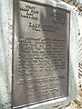
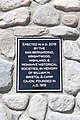
 Henry Harbinson Sinclair Plaque.jpg 922 × 766; 343 KB
-
 I gotta dookie - panoramio.jpg 3,157 × 1,850; 4.16 MB
-
 Image of cloud formation.jpg 3,024 × 4,032; 1.18 MB
-
 Imperial headquarters on the far left - panoramio.jpg 1,776 × 1,196; 2.26 MB
-
 Imperial Headquarters on the far right - panoramio.jpg 1,776 × 1,170; 2.02 MB
-
 Inlandempire citrusgrove.jpg 640 × 480; 143 KB
-
 Inside one of the Lava Tube Caves at Pisgah. This one is SPJ.JPG 4,608 × 3,456; 5.42 MB
-
 Interactive Inland Empire Map.svg 830 × 600; 1.45 MB
-
 John Rains House 1.JPG 4,608 × 3,456; 6.16 MB
-
 John Rains House 2.JPG 4,608 × 3,456; 4.48 MB
-
 John Rains House 3.JPG 4,608 × 3,456; 5.35 MB
-
 John Rains House 4.JPG 4,608 × 3,456; 5.14 MB
-
 John Rains House 5.JPG 4,608 × 3,456; 5.31 MB
-
 John Rains House 6.JPG 4,608 × 3,456; 5.5 MB
-
 Johnson Valley OHV Area - panoramio.jpg 3,264 × 2,448; 1.67 MB
-
 Johnson Valley, California (31571584951).jpg 4,928 × 3,264; 6.96 MB
-

-
 Joshua Tree Natl. Park, 49 Palms Oasis Trail - panoramio.jpg 3,648 × 2,736; 3.32 MB
-
 Joshua Tree-Junipers Hesperia CA 10.jpg 8,064 × 6,048; 42.62 MB
-
 Jump rock, Copper Canyon, Lake Havasu 01 - panoramio.jpg 494 × 659; 312 KB
-
 Jump rock, Copper Canyon, Lake Havasu 02 - panoramio.jpg 1,112 × 946; 728 KB
-
 Jump rock, Copper Canyon, Lake Havasu 03 - panoramio.jpg 391 × 646; 191 KB
-
 Lake Arrowhead Resort Pool.jpg 4,032 × 3,024; 3.04 MB
-
 LAKE GREGORY - panoramio - strib1946 (1).jpg 2,288 × 1,712; 1,009 KB
-
 LAKE GREGORY - panoramio - strib1946.jpg 1,536 × 959; 292 KB
-
 LAKE GREGORY - panoramio.jpg 1,792 × 1,200; 1.54 MB
-
 Las Vegas 2010 04 - panoramio.jpg 4,000 × 3,000; 3.12 MB
-
 Lenwood CA.jpg 3,072 × 2,304; 1.76 MB
-
 Living Room Looking Out Over Neighbor - panoramio.jpg 2,592 × 1,936; 1.58 MB
-
 Lo Gas sign - panoramio.jpg 2,592 × 1,936; 1.76 MB
-
 Local Hangout and Abandoned Ruin - panoramio.jpg 2,592 × 1,936; 2.54 MB
-
 Looking In Through Living Room Window - panoramio.jpg 2,592 × 1,936; 1.7 MB
-
 Lytle Creek, Mt Baldy 3-16-13l (8568643885).jpg 1,750 × 1,313; 1.07 MB
-
 Mail Call, Oak Glen, CA 11-17-13zj (11518290605).jpg 1,150 × 973; 449 KB
-

-
 Main Prison Entrance - panoramio.jpg 2,592 × 1,936; 1.89 MB
-
 Mclb barstow insig.png 337 × 418; 142 KB
-
 Milky Way Children S Forest California (213877301).jpeg 2,048 × 1,152; 652 KB
-
 Mill Creek Zanja Bridge, Mentone, CA 6-12 (7455168436).jpg 2,052 × 1,700; 1.08 MB
-
 Mill Creek Zanja Bridge, Mentone, CA 6-12 (7455169156).jpg 1,551 × 1,129; 641 KB
-
 Mill Creek Zanja Bridge, Mentone, CA 6-24-12a (7455165660).jpg 1,525 × 1,105; 531 KB
-
 Mill Creek Zanja Bridge, Mentone, CA 6-24-12c (7455167422).jpg 1,480 × 2,136; 1.02 MB
-
 Mini Solar Generating Station, main reflector, east of Nipton - panoramio.jpg 2,592 × 1,936; 2.23 MB
-
 Miniature Thermal Solar Energy Generating Station - panoramio.jpg 2,592 × 1,936; 2.54 MB
-
 Mitchell Caverns - panoramio.jpg 1,600 × 1,067; 1.25 MB
-
 Mojave Desert (211034223).jpeg 2,048 × 1,050; 636 KB
-
 Mojave Desert - panoramio.jpg 2,048 × 1,536; 1.31 MB
-
 Mojave Desert, United States (Unsplash HKEIt lpuNw).jpg 3,264 × 2,448; 4.84 MB
-
 Mojave Evoque.jpg 945 × 1,339; 360 KB
-
 Mojave Joshua Tree - panoramio.jpg 2,592 × 1,936; 2.24 MB
-
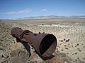 Mojave megaphone near Baker, CA.jpg 1,200 × 900; 232 KB
-
 Mojave National Preserve, Kelso, United States (Unsplash).jpg 6,436 × 3,058; 4.83 MB
-
 Mojave Rd Foundations - panoramio.jpg 1,600 × 1,067; 1.69 MB
-
 Mojave Rocks - panoramio.jpg 1,600 × 1,067; 1.22 MB
-
 MolyCorp's Background Dirt Road - panoramio.jpg 2,592 × 1,936; 2.05 MB
-
 MolyCorp's Settling Ponds - panoramio.jpg 2,592 × 1,936; 2.55 MB
-
 Greta Morris.jpg 140 × 154; 42 KB
-
 Mountain-Home-Village-CA.jpg 3,264 × 2,448; 4.68 MB
-
 Mountains along California State Route 177.jpg 3,377 × 2,339; 3.71 MB
-
 Mysterious Pump Station for "Seepage" - panoramio.jpg 1,936 × 2,592; 2.38 MB
-
 Next to Needles, California, USA - panoramio.jpg 3,264 × 2,448; 1.82 MB
-
 Nipton, California sign.jpg 2,816 × 2,112; 2.8 MB
-
 Noah Purifoy (15086522668).jpg 2,048 × 1,368; 168 KB
-
 Noah Purifoy (15086524358).jpg 2,048 × 1,368; 407 KB


.jpg)


.jpg)


.jpg)


.jpg)
.jpg)
.jpg)
.jpg)
.jpg)
.jpg)


.jpg)
.jpg)


.jpg)
_(20181515159).jpg)


.jpg)


.jpg)


.jpg)

.jpg)
.jpg)
_-_Flickr_-_brewbooks.jpg)


.jpg)
.jpg)
.jpg)

.jpg)
.jpg)


.jpg)

.jpg)


.jpg)


.jpg)


.jpg)


.jpg)
.jpg)

.jpg)


.jpg)


.jpg)


.jpg)
.jpg)


.jpeg)
.jpg)
.jpg)
.jpg)
.jpg)


.jpeg)

.jpg)


.jpg)


.jpg)
.jpg)