Category:Spas-Zagorye
Jump to navigation
Jump to search
| Object location | | View all coordinates using: OpenStreetMap |
|---|
Administrative centre of rural settlements in the municipal area of Maloyaroslavetsky District the Kaluga region, Russia   | |||||
| Upload media | |||||
| Instance of | |||||
|---|---|---|---|---|---|
| Location |
| ||||
| Population |
| ||||
| official website | |||||
 | |||||
Subcategories
This category has only the following subcategory.
Media in category "Spas-Zagorye"
The following 9 files are in this category, out of 9 total.
-
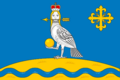 Flag of Spas-Zagorye.png 600 × 400; 34 KB
-
 Kaluga Wikiexpedition (2016-06-11) 0338.jpg 2,048 × 3,648; 3.7 MB
-
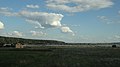 Maloyaroslavetsky District, Kaluga Oblast, Russia - panoramio (7).jpg 4,608 × 2,592; 2.54 MB
-
 Population village Spas-Zagorje (2010-2015).jpg 357 × 72; 14 KB
-
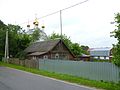 Spas-Zagorye 2016-06-11.jpg 4,320 × 3,240; 5.28 MB
-
 Spas-Zagorye school.jpg 4,320 × 3,240; 5.45 MB
-
 Деревянный храм в селе Трёхсвятское. (начало XX века).jpg 1,077 × 771; 155 KB
-
 Мост на Протве P1090542.jpg 3,072 × 2,304; 1.25 MB
-
 Мост на Протве P1090543.jpg 3,072 × 2,304; 1.3 MB
_0338.jpg)
.jpg)


.jpg)


.jpg)