Category:Tell Atlas
Jump to navigation
Jump to search
mountain range  Άποψη της υπο-οροσειράς Τζουρτζουρά | |||||
| Upload media | |||||
| Instance of | |||||
|---|---|---|---|---|---|
| Location |
| ||||
| Has part(s) | |||||
| Width |
| ||||
| Length |
| ||||
| Mountain range | |||||
| Highest point | |||||
| Elevation above sea level |
| ||||
 | |||||
العربية: الأطلس التلي
English: Tell Atlas
Subcategories
This category has the following 9 subcategories, out of 9 total.
B
- Babor Mountains (24 F)
- Babors (2 F)
- Beni-Chougrane Range (28 F)
C
D
E
- Edough Massif (5 F)
K
T
- Titteri (5 F)
Media in category "Tell Atlas"
The following 16 files are in this category, out of 16 total.
-
 Ahmed Rachedi Mila Algerie 2012.jpg 960 × 720; 72 KB
-
 AitAR.JPG 3,648 × 2,736; 4.71 MB
-
 Akaoudj 02.jpg 604 × 453; 55 KB
-
 At Menguellat.JPG 2,592 × 970; 412 KB
-
 At Usammar.JPG 2,592 × 1,944; 884 KB
-
 Baie Béjaïa.jpg 1,024 × 681; 203 KB
-
 Constantine falls.jpg 755 × 1,024; 202 KB
-
 Corniche Kabylie.jpg 800 × 533; 122 KB
-
 Iazzuggen.JPG 2,272 × 1,704; 853 KB
-
 Kabylievillage.jpg 2,592 × 1,944; 2.04 MB
-
 Kadiria Est.jpg 1,280 × 960; 1.28 MB
-
 Oran vu depuis le Murdjadjo 1930.JPG 2,168 × 1,662; 542 KB
-
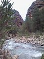 Semiane River 2.jpg 1,200 × 1,600; 775 KB
-
 Semiane River.jpg 1,200 × 1,600; 812 KB
-
 Sidi-Daoud-Algeria.jpg 1,145 × 500; 119 KB
-
 Taqa et igufaf.JPG 2,592 × 1,944; 999 KB


