Category:Warmond
Jump to navigation
Jump to search
village and former municipality in South Holland, the Netherlands     | |||||
| Upload media | |||||
| Spoken text audio | |||||
|---|---|---|---|---|---|
| Instance of | |||||
| Location |
| ||||
| Population |
| ||||
| official website | |||||
 | |||||
Subcategories
This category has the following 10 subcategories, out of 10 total.
Media in category "Warmond"
The following 75 files are in this category, out of 75 total.
-
 Warmond wapen 1816.svg 248 × 274; 7 KB
-
 Warmond wapen.svg 1,017 × 725; 449 KB
-
 Flag of Warmond.svg 450 × 300; 2 KB
-
 Warmond flag outline.png 450 × 300; 1 KB
-
 Spoorwegongeval bij Warmond (1980).jpg 2,631 × 1,973; 2.7 MB
-
 31 bloemen van de Agave victoriae reginae..JPG 1,200 × 1,600; 737 KB
-
 35 bloemen van de Agave victoriae reginae.JPG 4,288 × 3,216; 4.44 MB
-
 Afgemeerde lelievletten bij het Boterhuiseiland.jpg 4,032 × 3,024; 4.4 MB
-

-
 Beby hooivaarts in warmond - panoramio.jpg 2,256 × 1,496; 959 KB
-
 Boerderij tussen de bomen nr. NC 4 - Warmond - 20483218 - RCE.jpg 1,200 × 900; 152 KB
-
 Bos Huys te Warmont.jpg 600 × 150; 195 KB
-
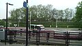 Bushalte Station Sassenheim.jpg 2,880 × 1,616; 956 KB
-
-

-
 Daisies - panoramio.jpg 2,592 × 1,944; 1.68 MB
-
 Detail kozijn wateras deur met buitenstoel - Warmond - 20250016 - RCE.jpg 1,200 × 1,200; 260 KB
-
 Exterieur - Warmond - 20249902 - RCE.jpg 1,200 × 791; 304 KB
-
 Foggy sea - panoramio.jpg 2,272 × 1,704; 2.13 MB
-
 GC Kagerzoom2.JPG 2,816 × 2,112; 2.89 MB
-
 Gemeentewapens van Warmond, Vianen, Woerden en Haarlem, RP-T-00-479-49(V).jpg 2,032 × 1,136; 259 KB
-
 Gevel aan de Dorpsstraat naar het noord-oosten - Warmond - 20250009 - RCE.jpg 899 × 1,200; 208 KB
-
 Gevel aan de Dorpsstraat naar het noord-oosten - Warmond - 20250010 - RCE.jpg 1,200 × 868; 152 KB
-
 Godslamp - Warmond - 20249893 - RCE.jpg 595 × 1,200; 146 KB
-
 Haaswijk", zijgevel - Warmond - 20249983 - RCE.jpg 1,200 × 796; 269 KB
-
 Het dorp Warmond met rechts een theekoepel, RP-T-1888-A-1741.jpg 6,322 × 3,786; 2.95 MB
-
 Hoekwater polderkaart - Hofpolder (Warmond).PNG 419 × 321; 367 KB
-
 Hoekwater polderkaart - Veerpolder (Warmond).PNG 431 × 320; 383 KB
-
 Hoekwater polderkaart - Voorhofpolder (Warmond).PNG 384 × 320; 334 KB
-
 Huis te Warmond, RP-T-1948-150.jpg 4,754 × 3,834; 2.85 MB
-
-

-
 Kaag Sociëteit (Kager plassen, Netherlands 2016) (27463681323).jpg 2,048 × 1,152; 774 KB
-
 Kaagerplassen - panoramio - Lucas Mevius.jpg 2,592 × 1,944; 1.74 MB
-
 Kaagerplassen - panoramio.jpg 2,592 × 1,944; 2.34 MB
-
 Koningin Beatrix krijgt een bloemetje aangeboden in Warmond, Bestanddeelnr 932-5689.jpg 3,669 × 2,437; 1.62 MB
-
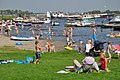 Netherlands, Kagerplassen, Koudenhoorn, recreatiestrand.JPG 2,144 × 1,424; 822 KB
-
 Netherlands, Kagerplassen, map of 1617.jpg 6,494 × 4,083; 10.1 MB
-
 Netherlands, Kagerplassen, Zijp (1).JPG 2,144 × 1,424; 728 KB
-
 Netherlands, Kagerplassen, Zijp (2).JPG 2,144 × 1,424; 815 KB
-
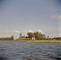
 Netherlands, Warmond, Broek- en Simontjespolder.JPG 2,144 × 1,424; 782 KB
-
 Netherlands, Warmond, Lakerpolder, Tuinder- of Kogjespolder.jpg 5,488 × 3,504; 3.01 MB
-
 Netherlands, Zijl (4).jpg 1,176 × 1,540; 1,014 KB
-
 NIMH - 2011 - 5293 - Aerial photograph of Warmond, The Netherlands.jpg 4,000 × 2,682; 2.85 MB
-
 NIMH - 2155 047586 - Aerial photograph of Warmond, The Netherlands.jpg 3,708 × 2,572; 2.24 MB
-
Nl-Warmond-article.ogg 9 min 40 s; 5.76 MB
-
Nl-Warmond.ogg 1.8 s; 21 KB
-
 Overzicht gevelwand - Warmond - 20250031 - RCE.jpg 1,200 × 798; 200 KB
-
 Overzicht Kagerplassen - Warmond - 20365471 - RCE.jpg 1,200 × 1,198; 164 KB
-
 Overzicht Kogjespolder - Warmond - 20365472 - RCE.jpg 1,200 × 1,190; 177 KB
-
 Sailing on the Kaag (Warmond, The Netherlands 2019) (48731620981).jpg 2,832 × 2,018; 1.38 MB
-
 Sailing on the Kaag (Warmond, The Netherlands 2019) (48731621011).jpg 3,264 × 1,972; 1.8 MB
-
-
 Stork in love.jpg 512 × 640; 93 KB
-
 Sunset at Kaag lake (Warmond, The Netherlands 2018) (28941693307).jpg 5,552 × 2,584; 2.77 MB
-
 Sunset at Kaag lake (Warmond, The Netherlands 2018) (28941693947).jpg 5,216 × 2,584; 2.67 MB
-
 Sunset at Kaag lake (Warmond, The Netherlands 2018) (42973679585).jpg 3,200 × 1,992; 1.43 MB
-
 Sunset at Kaag lake (Warmond, The Netherlands 2018) (43160659764).jpg 3,264 × 1,642; 1.22 MB
-
 Swan - panoramio.jpg 2,592 × 1,944; 2.69 MB
-
 Tussen Oud Ade en Warmond, polderpanorama bij Huize Brugzicht foto7 2017-04-09 10.47.jpg 4,352 × 2,800; 7.55 MB
-
 V1 lanceerbaan Warmond 1.JPG 5,184 × 3,888; 7.44 MB
-
 V1 lanceerbaan Warmond 2.JPG 5,184 × 3,888; 7.32 MB
-
 Voor- en gedeelte rechter zijgevel - Warmond - 20249984 - RCE.jpg 1,200 × 790; 329 KB
-
 Voor- en zijgevel nr. KB 5 - Warmond - 20483214 - RCE.jpg 1,200 × 900; 282 KB
-
 Voorgevel - Warmond - 20249982 - RCE.jpg 1,200 × 789; 266 KB
-
 Voorgevel - Warmond - 20472619 - RCE.jpg 1,200 × 900; 237 KB
-
 Warmond - Koudenhoornbrug.jpg 6,000 × 4,000; 10.16 MB
-
 Warmond vanaf de Kagerplassen.jpg 3,486 × 992; 827 KB
-
 Warmond vlag voor 1965.svg 450 × 300; 2 KB
-
 Warmond, Netherlands - panoramio (1).jpg 1,496 × 2,256; 1.28 MB
-
 Warmond, Netherlands - panoramio (2).jpg 1,952 × 3,264; 1.7 MB
-
 Warmond, Netherlands - panoramio.jpg 1,496 × 2,256; 1.69 MB
-
 Weiland met koeien en kerktoren achter geboomte - Warmond - 20319239 - RCE.jpg 1,200 × 829; 143 KB
-
 Zij- en voorgevel nr. KB 3 - Warmond - 20483213 - RCE.jpg 1,200 × 900; 261 KB
-
 Zijgevel nr. KB 4 - Warmond - 20483212 - RCE.jpg 1,200 × 900; 261 KB


.jpg)


%5E_.._-_panoramio.jpg)


,_Inventarisnummer_NL-HlmNHA_52001565_02.JPG)
,_Inventarisnummer_NL-HlmNHA_52001565_01.JPG)


.jpg)


.PNG)
.PNG)
.PNG)


_(27463681323).jpg)


.JPG)
.JPG)


.jpg)


_(48731620981).jpg)
_(48731621011).jpg)


_(28941693307).jpg)
_(28941693947).jpg)
_(42973679585).jpg)
_(43160659764).jpg)


.jpg)
.jpg)


