Category:Widnes
Jump to navigation
Jump to search
Deutsch: Widnes ist eine Stadt in der Unitary Authority Halton im Nordwesten Englands. Sie liegt am nördlichen Ufer des Flusses Mersey, gegenüber Runcorn und gehört zur Region North West England. Widnes hat 55.686 Einwohner (2001). (→Widnes)
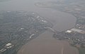
English: Widnes is an industrial town within the borough of Halton, in Cheshire, England, with an urban area population of 57,663 in 2004. It is located on the northern bank of the River Mersey where the estuary narrows to form the Runcorn Gap. Directly to the south across the Mersey is the town of Runcorn. Upstream and to the east is the town of Warrington, and downstream to the west is the neighbouring area of Speke, of the city of Liverpool. Historically part of Lancashire, the town later came under Cheshire for administrative purposes in the 1974 local government reorganisation. (→Widnes)
Français : Widnes est une ville industrielle anglaise dans le comté d'Halton (Cheshire) avec une population de en 2004. (→Widnes)
Italiano: Widnes è una città di 53.410 abitanti della contea del Cheshire, in Inghilterra. (→Widnes)
Nederlands: Widnes is een plaats en civil parish in het bestuurlijke gebied Halton, in het Engelse graafschap Cheshire met 53.410 inwoners. (→Widnes)
Norsk nynorsk: Widnes er ein industriby i distriktet Halton i Cheshire i England med om lag 55 000 innbyggjarar. Han ligg på nordsida av elva Mersey der estuaret smalnar til og dannar Runcorn Gap. Like sør på andre sida av Mersey ligg byen Runcorn. Oppoverelva og 13 km mot aust ligg byen Warrington og nedover mot elva mot vest ligg Liverpool. Byen var historisk ein del av Lancashire, og kom seinare inn under Cheshire for administrative føremål i 1974. (→Widnes)
Polski: Widnes - miasto przemysłowe w hrabstwie Cheshire w północno-zachodniej Anglii. Ludność wynosi 57 663 mieszkańców (2004). (→Widnes)
Română: Widnes este un oraș în comitatul Cheshire, regiunea North West, Anglia. Orașul se află în districtului unitar Halton a cșrui reședință este. (→Widnes)
town in Cheshire, England  Hen Neuadd y Dref, Widnes | |||||
| Upload media | |||||
| Instance of | |||||
|---|---|---|---|---|---|
| Location | Halton, Cheshire, North West England, England | ||||
| Population |
| ||||
 | |||||
Subcategories
This category has the following 17 subcategories, out of 17 total.
A
B
D
F
H
- Halton Community Transport (2 F)
L
M
- Mersey Way in Widnes (3 F)
P
S
- Spike Island, Cheshire (25 F)
T
V
W
- West Bank, Cheshire (221 F)
- Widnes RUFC (7 F)
Media in category "Widnes"
The following 200 files are in this category, out of 315 total.
(previous page) (next page)-
 A generously proportioned bridge over the St Helens Canal - geograph.org.uk - 2561041.jpg 4,341 × 2,889; 6.91 MB
-
 A relatively modern building apparently disused - geograph.org.uk - 2829348.jpg 4,334 × 2,285; 5.76 MB
-
 A.M.Jones Scrap Metal Yard at rest, Widnes - geograph.org.uk - 4420076.jpg 5,472 × 3,648; 5.12 MB
-

-
 A533 curving north of the A562 junction - geograph.org.uk - 2883211.jpg 638 × 453; 139 KB
-
 Alan Foster, 2011.jpeg 275 × 183; 8 KB
-
 Albert Rd, Widnes - geograph.org.uk - 4621749.jpg 3,264 × 2,448; 1.91 MB
-
 Albert Road, Widnes - geograph.org.uk - 5410335.jpg 6,000 × 4,000; 3.64 MB
-
 Approaching a busy road junction - geograph.org.uk - 3746747.jpg 3,264 × 2,448; 3.9 MB
-

-
 ASDA, Widnes - geograph.org.uk - 2846807.jpg 4,525 × 3,011; 5.72 MB
-
 Ashley Way West-A568 junction - geograph.org.uk - 2295564.jpg 640 × 480; 58 KB
-
 Astmoor Saltmarsh and Hempstone Point - geograph.org.uk - 279708.jpg 640 × 457; 158 KB
-
 Autologic KP04HVT - Flickr - Alan Sansbury.jpg 2,560 × 1,920; 2.4 MB
-
 Autologic WX05AUK - Flickr - Alan Sansbury.jpg 3,424 × 2,568; 3.91 MB
-
 Autologic WX55YVY - Flickr - Alan Sansbury.jpg 3,424 × 2,568; 4.03 MB
-
 Autologic WX56ETU - Flickr - Alan Sansbury.jpg 3,424 × 2,568; 4.05 MB
-
 Bankfield School, Liverpool Road - geograph.org.uk - 668977.jpg 640 × 480; 50 KB
-
 Barlows Green Lane - geograph.org.uk - 2533146.jpg 640 × 480; 62 KB
-
 Beach and view across the Mersey, Hale - geograph.org.uk - 496188.jpg 640 × 480; 101 KB
-
 Benkid77 Green Oaks Sign, Widnes 250709.JPG 1,280 × 1,024; 307 KB
-
 Benkid77 Widnes Car Park 1 250709.JPG 1,280 × 1,024; 265 KB
-
 Benkid77 Widnes Car Park 2 250709.JPG 1,024 × 1,280; 256 KB
-
 Benkid77 Widnes Market 250709.JPG 1,024 × 1,280; 326 KB
-
 Benkid77 Widnes Road 1 250709.JPG 1,024 × 1,280; 292 KB
-
 Bennets Lane - geograph.org.uk - 2561719.jpg 4,592 × 2,232; 6.04 MB
-
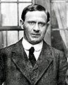 Bernacchi at WIdnes.jpg 339 × 423; 29 KB
-
 Birchfield Park Cricket Club - Clubhouse - geograph.org.uk - 5852456.jpg 1,600 × 902; 330 KB
-
 Birchfield Park Cricket Club - geograph.org.uk - 5852453.jpg 1,600 × 902; 345 KB
-
 Bleak industrial wasteland near Widnes - geograph.org.uk - 4337398.jpg 5,472 × 3,648; 2.32 MB
-
 Bobbie Goulding.jpg 126 × 353; 49 KB
-
 Bottle banks, Dundalk Road, Widnes.JPG 4,320 × 3,240; 3.07 MB
-
 Boys and Girls sculpture at ASDA Widnes (1).JPG 4,320 × 3,240; 4.35 MB
-
 Boys and Girls sculpture at ASDA Widnes (2).JPG 4,320 × 3,240; 4.3 MB
-
 Bridge and Barrels - geograph.org.uk - 1002997.jpg 640 × 414; 72 KB
-
 Bridge Widnes - Runcorn - geograph.org.uk - 1151251.jpg 640 × 390; 40 KB
-
 Britannia and Jubilee bridges - geograph.org.uk - 1532151.jpg 640 × 434; 51 KB
-
 Britannia Railway Bridge - panoramio.jpg 1,280 × 1,024; 114 KB
-
 Carter House Bridge - geograph.org.uk - 5412549.jpg 6,000 × 4,000; 5.24 MB
-

-
 Carterhouse Bridge from the west - geograph.org.uk - 988036.jpg 640 × 426; 51 KB
-
 Carterhouse Bridge, from the north - geograph.org.uk - 141987.jpg 640 × 426; 97 KB
-
 Carterhouse Bridge, Widnes - geograph.org.uk - 988010.jpg 640 × 426; 55 KB
-
 Catalyst - 2015-08-08 - Andy Mabbett - 24.JPG 3,872 × 2,592; 4.58 MB
-
 Catalyst Museum, Widnes - panoramio.jpg 3,264 × 2,448; 2.22 MB
-
 Cemetery chapels.jpg 2,592 × 1,944; 975 KB
-
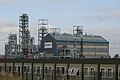 Chemical works - geograph.org.uk - 1002977.jpg 640 × 426; 78 KB
-
 Chemicals Factory, Shell Green - geograph.org.uk - 3428338.jpg 640 × 480; 528 KB
-
 Chorley's Lane, Crow Wood - geograph.org.uk - 1016368.jpg 640 × 480; 67 KB
-
 Church on St Mary's Road, West Bank - geograph.org.uk - 5892708.jpg 1,024 × 768; 139 KB
-
 Clincton Wood Local Nature Reserve - geograph.org.uk - 930361.jpg 640 × 480; 150 KB
-
 Closure of the Transpennine Trail - geograph.org.uk - 5412436.jpg 6,000 × 4,000; 4.35 MB
-

-
 Construction of the new Mersey Gateway road bridge - geograph.org.uk - 4420096.jpg 3,583 × 2,388; 2.16 MB
-
 Cranshaw Lane - geograph.org.uk - 6058695.jpg 6,000 × 4,000; 7.28 MB
-
 Crosville 101 Y24CMS - Flickr - Alan Sansbury.jpg 3,424 × 2,568; 3.96 MB
-
 Daffodil patch by Lunt's Heath Road - geograph.org.uk - 6058687.jpg 6,000 × 4,000; 4.06 MB
-
 David Mills.JPG 795 × 815; 458 KB
-
 Demolition of thermPhos factory, Widnes - geograph.org.uk - 4544479.jpg 3,438 × 5,159; 3.96 MB
-
 Demolition of thermPhos factory, Widnes - geograph.org.uk - 4572665.jpg 5,472 × 3,648; 5.47 MB
-
 Derelict land - presumably zoned for industry - geograph.org.uk - 2560921.jpg 4,592 × 3,056; 7.1 MB
-
 Desoto Road East, Widnes - geograph.org.uk - 5889420.jpg 1,600 × 1,065; 460 KB
-
 Ditton Road, Widnes - geograph.org.uk - 1888015.jpg 4,224 × 3,168; 2.18 MB
-
 Drainage into the Mersey - geograph.org.uk - 5414374.jpg 6,000 × 4,000; 6.22 MB
-
 Dundalk Road, Widnes (1).JPG 4,320 × 3,240; 4.18 MB
-
 Dundalk Road, Widnes (2).JPG 4,320 × 3,240; 3.83 MB
-
 Dundalk Road, Widnes (3).JPG 4,320 × 3,240; 4.49 MB
-
 Earle Road roundabout - geograph.org.uk - 3746822.jpg 3,264 × 2,448; 3.03 MB
-
 Entrance to derelict industrial land - geograph.org.uk - 5412497.jpg 6,000 × 4,000; 4.81 MB
-
 F&A Guardian 1875 extract.jpg 237 × 394; 108 KB
-
 Fallen lamppost in industrial wasteland Widnes - geograph.org.uk - 4337410.jpg 5,472 × 3,648; 2.5 MB
-

-
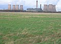
 Fiddler's Ferry Power Station - geograph.org.uk - 5952488.jpg 640 × 385; 60 KB
-
 Fields beside the rail line at Hale Bank - geograph.org.uk - 5889409.jpg 1,600 × 1,065; 395 KB
-
 Fly-tipped chair, industrial wasteland, Widnes - geograph.org.uk - 4420078.jpg 4,176 × 2,784; 4.34 MB
-
 Footbridge over the Sankey Canal - geograph.org.uk - 2260364.jpg 1,200 × 803; 148 KB
-
 Footbridge over the Sankey Canal - geograph.org.uk - 3436029.jpg 640 × 480; 474 KB
-
 Former crossing on the Sankey Canal - geograph.org.uk - 141979.jpg 640 × 426; 67 KB
-

-
 Frederick Herbert Gossage (1831–1907), Mayor of Widnes (1892–1893).jpg 925 × 1,200; 101 KB
-
 Fun on the sands - geograph.org.uk - 1098038.jpg 640 × 426; 39 KB
-
 Future Flower - geograph.org.uk - 3428567.jpg 482 × 640; 445 KB
-
 G-SGRP Agusta AW109 (9150976015).jpg 2,560 × 1,920; 1.89 MB
-
 Gorsey Lane - geograph.org.uk - 2533154.jpg 640 × 480; 50 KB
-
 Gorsey Lane - geograph.org.uk - 2561114.jpg 4,052 × 2,707; 5.98 MB
-
 Green Oaks Shopping Centre, Widnes (1).JPG 3,240 × 4,320; 3.56 MB
-
 Green Oaks Shopping Centre, Widnes (2).JPG 4,320 × 3,240; 3.55 MB
-
 Greenway, Widnes Waterfront - geograph.org.uk - 3428634.jpg 640 × 481; 381 KB
-
 Gridlock on Victoria Road - geograph.org.uk - 5410371.jpg 5,662 × 3,775; 2.67 MB
-

-
 Halton Borough Council sculpture, Widnes (1).JPG 3,240 × 4,320; 3.07 MB
-
 Halton Borough Council sculpture, Widnes (2).JPG 3,240 × 4,320; 2.79 MB
-
 Halton Municipal Building, Widnes - geograph.org.uk - 3428741.jpg 640 × 481; 419 KB
-
 Halton Transport 57 LIG1623 (8581554997).jpg 3,424 × 2,568; 4.11 MB
-

-
 Hough Green, Widnes & Runcorn Barnstaple Mansfield RJD 18.jpg 2,608 × 1,639; 843 KB
-
 Houses on Kingsway - geograph.org.uk - 2866619.jpg 640 × 480; 64 KB
-
 Industrial wasteland awaiting redevelopment - geograph.org.uk - 3746771.jpg 3,264 × 2,448; 5.32 MB
-
 Industrial wasteland looking towards Widnes ^ Runcorn - geograph.org.uk - 4337389.jpg 3,686 × 2,457; 1.8 MB
-
 Irwell Street, West Bank - geograph.org.uk - 1368813.jpg 640 × 425; 85 KB
-
 It's seen worse times - geograph.org.uk - 140846.jpg 640 × 426; 95 KB
-
 Jubilee Bridge - geograph.org.uk - 1532165.jpg 640 × 428; 61 KB
-
 King George V Playing Fields, Widnes (1).JPG 4,320 × 3,240; 3.09 MB
-
 Kingsway (B5419), heading south - geograph.org.uk - 2866623.jpg 640 × 480; 97 KB
-
 Kingsway Learning Centre.jpg 4,288 × 2,864; 5.89 MB
-
 Kingsway, Widnes (1).JPG 4,320 × 3,240; 3.6 MB
-
 Landscaped path, Widnes Waterfront - geograph.org.uk - 3434687.jpg 640 × 480; 421 KB
-
 Liverpool Road, The Albion - geograph.org.uk - 3428770.jpg 640 × 427; 375 KB
-
 Liverpool z samolotu - panoramio.jpg 4,288 × 3,216; 2.92 MB
-

-
 Looking Out From Sutton Manor - geograph.org.uk - 1464400.jpg 640 × 429; 45 KB
-

-
 Low tide on the Mersey - geograph.org.uk - 1368770.jpg 640 × 425; 101 KB
-
 Lower House Lane - geograph.org.uk - 2111084.jpg 640 × 480; 63 KB
-
 Lunt's Bridge Farm, Widnes - geograph.org.uk - 466897.jpg 640 × 480; 84 KB
-
 Marshland View - geograph.org.uk - 2260366.jpg 1,200 × 803; 141 KB
-
 Mayne 32 NIB4162 - Flickr - Alan Sansbury.jpg 3,424 × 2,568; 4 MB
-
 Meditating in Hometown.jpg 1,397 × 2,100; 749 KB
-
 Mersey Bore.JPG 4,320 × 3,240; 3 MB
-
 Mersey Gateway Bridge North Tower Under Construction - geograph.org.uk - 4970652.jpg 2,784 × 1,568; 1.98 MB
-
 Mersey Gateway construction - geograph.org.uk - 4942096.jpg 640 × 474; 64 KB
-
 Mersey Gateway North Approach Under Construction - geograph.org.uk - 4970668.jpg 2,784 × 1,568; 2.09 MB
-
 Mersey Lock.jpg 2,592 × 1,944; 1,016 KB
-
 Mersey waterfront - geograph.org.uk - 2865347.jpg 640 × 480; 78 KB
-
 Moor Lane South (B5419) - geograph.org.uk - 2866632.jpg 640 × 480; 72 KB
-
 New bridge across the Mersey - geograph.org.uk - 4509659.jpg 3,264 × 2,448; 3.45 MB
-
 New flyover for the Mersey Gateway - geograph.org.uk - 5410378.jpg 6,000 × 4,000; 7.06 MB
-
 New industrial unit under construction - geograph.org.uk - 5412475.jpg 6,000 × 4,000; 5.85 MB
-
 New Mersey Crossing - geograph.org.uk - 5011224.jpg 5,472 × 3,648; 5.34 MB
-
 New Mersey Crossing - geograph.org.uk - 5012695.jpg 5,472 × 3,648; 2.72 MB
-
 New Mersey Crossing from Widnes Warth - geograph.org.uk - 5283709.jpg 2,605 × 1,501; 370 KB
-
 New Mersey Crossing supports in place - geograph.org.uk - 4759351.jpg 4,230 × 2,820; 4.23 MB
-
 New Mersey Crossing under construction - geograph.org.uk - 4544459.jpg 1,842 × 1,228; 409 KB
-
 Oakland Street, West Bank - geograph.org.uk - 1637371.jpg 640 × 427; 70 KB
-
 Old stack - Widnes - geograph.org.uk - 5804904.jpg 480 × 640; 49 KB
-
 Old Sunday School - geograph.org.uk - 871880.jpg 640 × 480; 102 KB
-
 Open leisure area - geograph.org.uk - 3746797.jpg 1,600 × 1,200; 399 KB
-
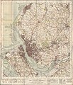 Ordnance Survey One-Inch Sheet 100 Liverpool, Published 1947.jpg 10,933 × 12,775; 16.46 MB
-
 Ordnance Survey One-Inch Sheet 100 Liverpool, Published 1966.jpg 8,244 × 9,891; 11.11 MB
-
 Pallet fire, Widnes - geograph.org.uk - 4572666.jpg 2,495 × 1,663; 1.2 MB
-
 Pet shop, Widnes (1).JPG 3,240 × 4,320; 3.67 MB
-

-
 Pond at Prescot Road, Widnes (1).JPG 4,320 × 3,240; 2.95 MB
-
 Pond at Prescot Road, Widnes (2).JPG 4,320 × 3,240; 4.12 MB
-
 Pond at Prescot Road, Widnes (3).JPG 4,320 × 3,240; 3.77 MB
-
 Railway Bridge over Earle Road - geograph.org.uk - 3434669.jpg 640 × 481; 551 KB
-
 Remains of the Transporter Bridge - geograph.org.uk - 1003029.jpg 640 × 426; 123 KB
-
 River Mersey - geograph.org.uk - 3428587.jpg 640 × 481; 458 KB
-

-
 River Mersey, Widnes - geograph.org.uk - 3428648.jpg 640 × 481; 405 KB
-
 Riverside College Widnes - panoramio.jpg 4,288 × 2,864; 4.83 MB
-
 Roadside hoarding by A557, Widnes - geograph.org.uk - 448098.jpg 640 × 426; 110 KB
-
 Roadside hoarding near A557, Widnes - geograph.org.uk - 491341.jpg 640 × 427; 102 KB
-
 Royal Visit by George V to Widnes 7 July 1913.jpg 1,207 × 718; 498 KB
-
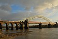
 Runcorn Bridge - geograph.org.uk - 1842807.jpg 800 × 534; 153 KB
-
 Runcorn Bridge - geograph.org.uk - 276887.jpg 640 × 427; 62 KB
-
 Runcorn Bridge from the air - geograph.org.uk - 1962698.jpg 3,872 × 2,480; 740 KB
-
 Runcorn Bridge. - geograph.org.uk - 107116.jpg 640 × 427; 74 KB
-
 Runcorn Sands - geograph.org.uk - 1003023.jpg 640 × 426; 33 KB
-

-

-
 Sailing away from Spike Island - geograph.org.uk - 1419655.jpg 640 × 480; 96 KB
-
 Saint Bede's RC Church Widnes - panoramio.jpg 4,288 × 2,864; 5.19 MB
-
 Salt Marsh at Widnes Waterfront - geograph.org.uk - 3428457.jpg 640 × 427; 504 KB
-
 Salt marsh between the St Helens Canal and the River Mersey - geograph.org.uk - 2560990.jpg 4,592 × 3,056; 7.09 MB
-
 Sankey Canal - geograph.org.uk - 3428465.jpg 640 × 481; 453 KB
-
 Sankey Canal from Carter House Bridge - geograph.org.uk - 3428363.jpg 640 × 481; 467 KB
-
 Sankey Canal, Carter House Bridge - geograph.org.uk - 3428367.jpg 640 × 481; 484 KB
-
 Sankey Canal, Footbridge at Spike Island - geograph.org.uk - 3435045.jpg 640 × 481; 455 KB
-

-
 Sankey Canal, Widnes - geograph.org.uk - 3428392.jpg 640 × 480; 473 KB
-
 Sankey Canal, Widnes - geograph.org.uk - 3428415.jpg 640 × 481; 449 KB
-
 Sculpture on Trans Pennine Trail - geograph.org.uk - 2865359.jpg 480 × 640; 45 KB
-
 Selwyns Travel 38 FJ06GGO - Flickr - Alan Sansbury.jpg 2,560 × 1,920; 2.14 MB
-
 Sensible Automotive MX60AEJ - Flickr - Alan Sansbury.jpg 2,560 × 1,920; 2.37 MB
-
 Shops on Victoria Road, Widnes.JPG 4,320 × 3,240; 3.17 MB
-
 Silver Jubilee Bridge maintenance, Halton - geograph.org.uk - 5777199.jpg 5,267 × 3,511; 2.05 MB
-
 Simms Cross Public House.jpg 4,288 × 2,864; 5.3 MB
-
 Soggy field on the edge of Lunt's Heath - geograph.org.uk - 6058702.jpg 6,000 × 4,000; 4.26 MB
-
 Spike Island 1875.jpg 1,753 × 2,033; 611 KB
-
 Spike Island.jpg 2,481 × 1,504; 1.21 MB
-
 St Helens (Sankey) Canal - geograph.org.uk - 3435050.jpg 640 × 481; 491 KB
-
 St Helens Canal - geograph.org.uk - 2865325.jpg 640 × 480; 59 KB
-
 St Helens Canal - geograph.org.uk - 2865332.jpg 640 × 480; 107 KB
-
 St Helens Canal - geograph.org.uk - 2865340.jpg 640 × 480; 45 KB
-
 St Helens Canal - geograph.org.uk - 2865351.jpg 640 × 480; 45 KB
-
 St Lukes, Farnworth - geograph.org.uk - 1078482.jpg 508 × 640; 424 KB
-
 St Lukes, Farnworth - geograph.org.uk - 1078486.jpg 640 × 472; 339 KB
-
 St Paul's Parish Church Widnes - panoramio.jpg 4,288 × 2,864; 6.63 MB
-
 St Paul's Parish Church, Widnes - geograph.org.uk - 5410361.jpg 6,000 × 4,000; 7.75 MB
-

-
 Stobart Stadium Halton - geograph.org.uk - 2829372.jpg 4,494 × 2,460; 6.13 MB
-

-

-
 Street View taken from Victoria Rd Widnes - panoramio.jpg 4,288 × 2,864; 4.06 MB
-
 Survey equipment, New Mersey Crossing construction, Widnes - geograph.org.uk - 4759356.jpg 3,564 × 2,376; 1.66 MB
-
 Tan House Lane - geograph.org.uk - 3428360.jpg 640 × 481; 420 KB
-
 Tesco distribution centre, Widnes (geograph 4524270).jpg 1,024 × 683; 158 KB
-
 Tesco Extra - Widnes - geograph.org.uk - 5804937.jpg 640 × 480; 62 KB
-
 The A557 runs under a railway bridge - geograph.org.uk - 4343402.jpg 1,500 × 981; 109 KB


.JPG)
.JPG)


.JPG)
.JPG)
.JPG)


,_Mayor_of_Widnes_(1892%E2%80%931893).jpg)


.jpg)


.JPG)
.JPG)


_Stadium,_Lower_House_Lane_-_geograph.org.uk_-_3428709.jpg)
.JPG)
.JPG)


.JPG)
,_heading_south_-_geograph.org.uk_-_2866623.jpg)

.JPG)


_-_geograph.org.uk_-_2866632.jpg)


.JPG)

.JPG)
.JPG)
.JPG)


_-_geograph.org.uk_-_5780730.jpg)


_Canal_-_geograph.org.uk_-_3435050.jpg)


.jpg)


.jpg)