Файл:American attack on Quebec.svg

Исходный файл (SVG-файл, номинально 883 × 1077 пкс, размер файла: 752 КБ)
Этот файл находится на Викискладе. Сведения о нём показаны ниже.
Викисклад — централизованное хранилище для свободных файлов, используемых в проектах Викимедиа.
|
Краткое описание
| Описание |
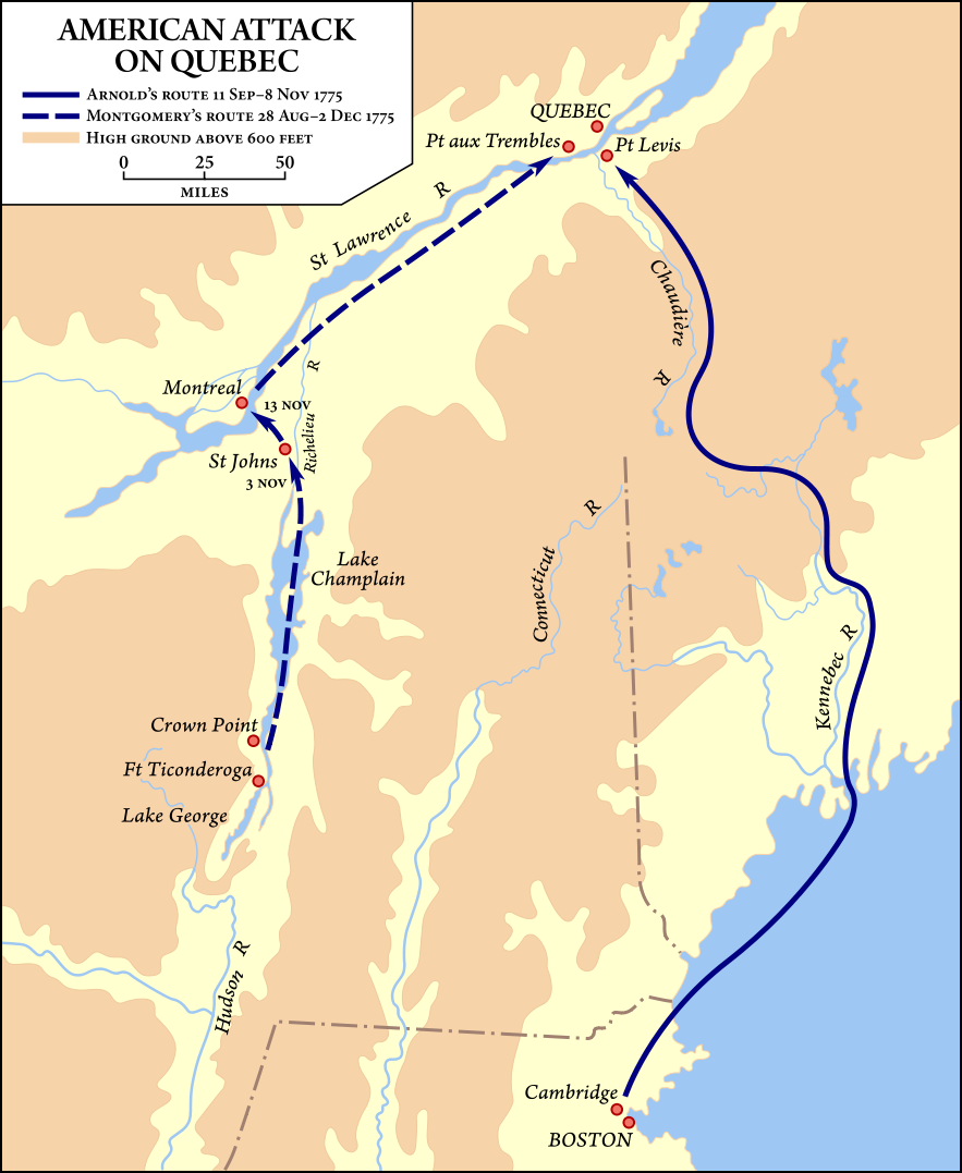
Map showing the routes taken by the Benedict Arnold and Richard Montgomery expeditions into Quebec as part of the American Invasion of Canada (1775). Это векторное изображение было создано с помощью Inkscape и затем отредактировано вручную. |
| Дата | Vectorized September 19–20, 2008 |
| Источник | Vector version of Image:American quebec 1775.jpg, from American Military History, United States Army Center of Military History, 1989, courtesy of the University of Texas Libraries, The University of Texas at Austin. |
| Автор | United States Army Center of Military History, vector version by Fvasconcellos (обсуждение · вклад) |
| Права (Повторное использование этого файла) |
This image is derived from a work of the U.S. government and, as such, is in the public domain. |
| Другие версии | Image:American quebec 1775.jpg |
Лицензирование
| This image is in the public domain because it contains materials that originally came from the United States Army Center of Military History, subject to the following qualification.
Note: The images of all badges, insignia, decorations and medals on the "CMH Online" web site are produced by the United States Army Institute of Heraldry and protected by Title 18, United States Code, Section 704 and the Code of Federal Regulations (32 CFR, Part 507). Permission to use these images for commercial purposes must be obtained from The Institute of Heraldry prior to their use. |

|
История файла
Нажмите на дату/время, чтобы посмотреть файл, который был загружен в тот момент.
| Дата/время | Миниатюра | Размеры | Участник | Примечание | |
|---|---|---|---|---|---|
| текущий | 01:54, 21 сентября 2008 | | 883 × 1077 (752 КБ) | Fvasconcellos | ==Summary== {{validSVG}} {{Information |Description=Map showing the routes taken by the {{w|Benedict Arnold}} and {{w|Richard Montgomery}} expeditions into Quebec as part of the American {{w|Invasion of Canada (1775)}}.<br/> Vector version of [[:Image:Ame |
Использование файла
Следующая страница использует этот файл:
Глобальное использование файла
Данный файл используется в следующих вики:
- Использование в ca.wikipedia.org
- Использование в da.wikipedia.org
- Использование в de.wikipedia.org
- Использование в en.wikipedia.org
- Использование в es.wikipedia.org
- Использование в fr.wikipedia.org
- Использование в he.wikipedia.org
- Использование в id.wikipedia.org
- Использование в it.wikipedia.org
- Использование в ja.wikipedia.org
- Использование в ko.wikipedia.org
- Использование в ms.wikipedia.org
- Использование в pt.wikipedia.org
- Использование в ro.wikipedia.org
- Использование в sh.wikipedia.org
- Использование в uk.wikipedia.org
- Использование в www.wikidata.org
- Использование в zh.wikipedia.org