Файл:Flooding near the Betsiboka River, Madagascar 2010-03-23 lrg.jpg
Перейти к навигации
Перейти к поиску
Размер этого предпросмотра: 600 × 600 пкс. Другие разрешения: 240 × 240 пкс | 480 × 480 пкс | 768 × 768 пкс | 1024 × 1024 пкс | 2048 × 2048 пкс | 3000 × 3000 пкс.
Исходный файл (3000 × 3000 пкс, размер файла: 5,34 МБ, MIME-тип: image/jpeg)
Этот файл находится на Викискладе. Сведения о нём показаны ниже.
Викисклад — централизованное хранилище для свободных файлов, используемых в проектах Викимедиа.
|
Краткое описание
| Описание |
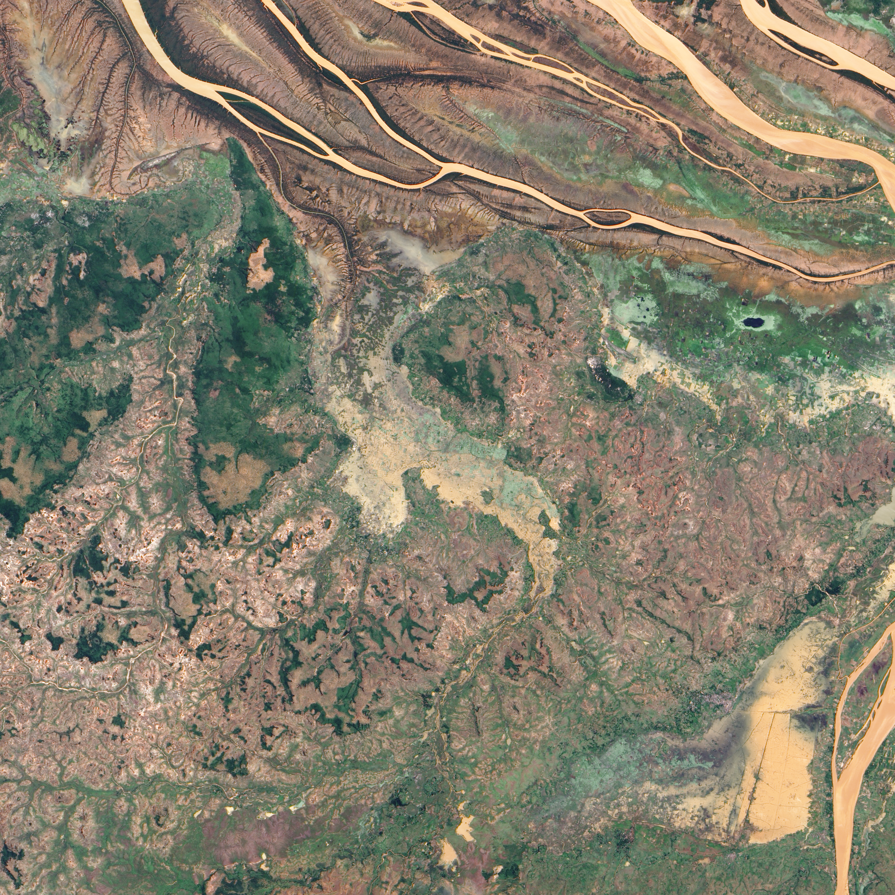
English: In northwestern Madagascar, the Betsiboka River flows toward the coast, its braided streams emptying into the Bombetoka Bay. In late March 2010, however, not long after Tropical Cyclone Hubert passed through the region, part of the river pushed over its banks, flooding nearby agricultural fields.
The Advanced Land Imager (ALI) on NASA’s Earth Observing-1 (EO-1) satellite captured this natural-color image on March 23, 2010. Immediately south of the Betsiboka River, which is visible in the large image, this area is roughly 40 kilometers (25 miles) from the coast. The wide beige-and-green swath filling most of the image is flooded, and uneven rectangles demarcate individual fields. Only areas of relatively high ground appear to have escaped standing water. |
| Дата | |
| Источник | http://earthobservatory.nasa.gov/NaturalHazards/view.php?id=43240&src=nha |
| Автор | NASA |
| Другие версии |
|

Лицензирование
| Этот файл находится в общественном достоянии (англ. public domain), так как он был создан NASA (Национальным управлением по аэронавтике и исследованию космического пространства). Политика авторского права NASA гласит, что «Материал NASA не защищается авторским правом, если не указано иное». (См. Template:PD-USGov, страницу политики авторского права NASA или политику использования изображений JPL.) | ||
 |
Предупреждения:
|
История файла
Нажмите на дату/время, чтобы посмотреть файл, который был загружен в тот момент.
| Дата/время | Миниатюра | Размеры | Участник | Примечание | |
|---|---|---|---|---|---|
| текущий | 00:53, 26 января 2013 | | 3000 × 3000 (5,34 МБ) | Slick-o-bot | Bot: convert to a non-interlaced jpeg (see bug #17645) |
| 00:50, 26 марта 2010 |  | 3000 × 3000 (5,04 МБ) | Captain-tucker | {{Information |Description={{en|In northwestern Madagascar, the Betsiboka River flows toward the coast, its braided streams emptying into the Bombetoka Bay. In late March 2010, however, not long after Tropical Cyclone Hubert passed through the region, par |
Использование файла
Нет страниц, использующих этот файл.
Глобальное использование файла
Данный файл используется в следующих вики:
- Использование в en.wikipedia.org
- Использование в fr.wikipedia.org
- Использование в ha.wikipedia.org