Файл:25 de Abril Bridge Lisbon (10061877435).jpg
Исходный файл (4868 × 2440 пкс, размер файла: 2,49 МБ, MIME-тип: image/jpeg)
Этот файл находится на Викискладе. Сведения о нём показаны ниже.
Викисклад — централизованное хранилище для свободных файлов, используемых в проектах Викимедиа.
|
.jpg?uselang=ru)
Краткое описание
| Описание |
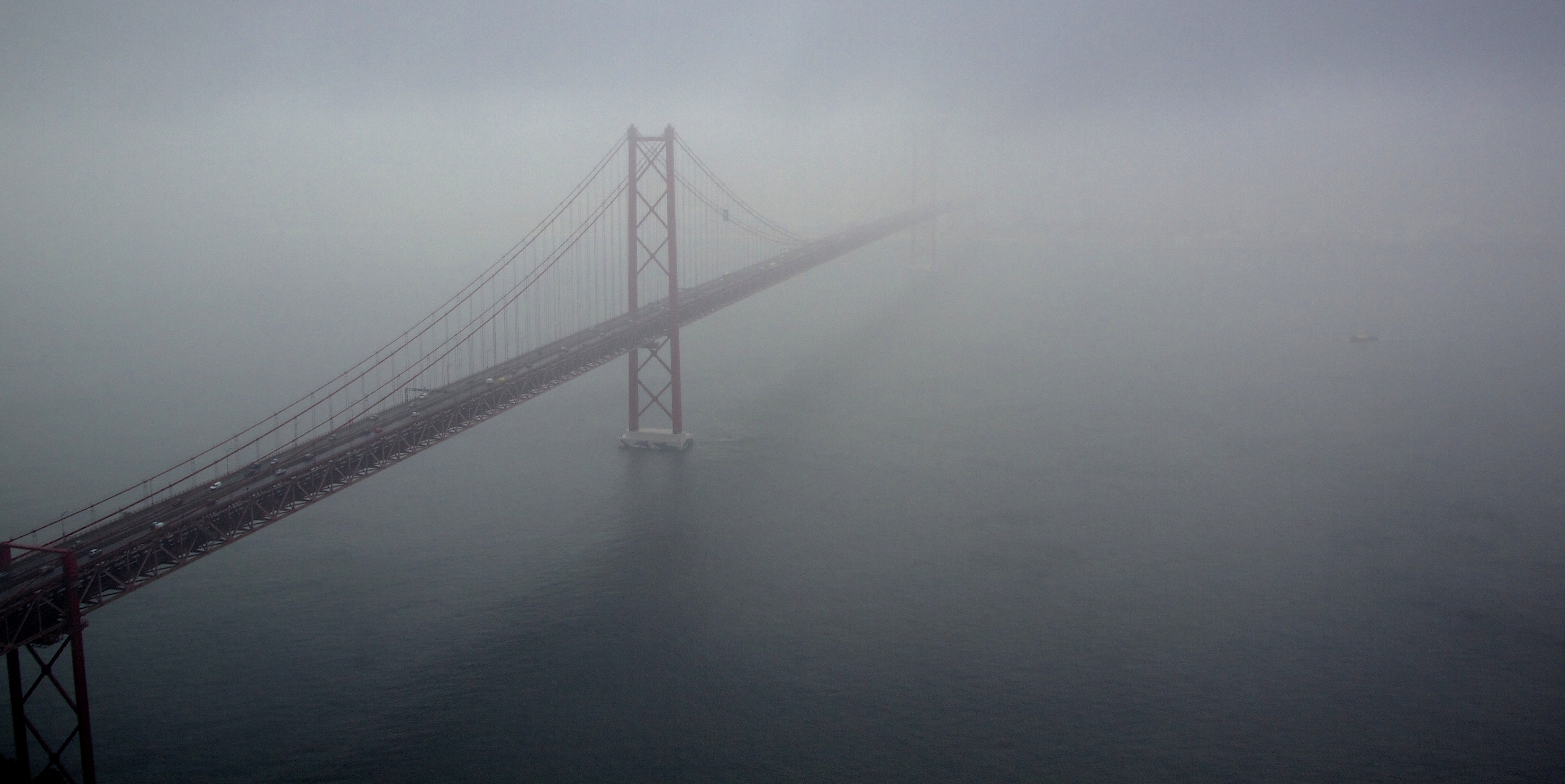
The 25 de Abril Bridge (Ponte 25 de Abril "25th of April Bridge", is a suspension bridge connecting the city of Lisbon, capital of Portugal, to the municipality of Almada on the left (south) bank of the Tejo river. It was inaugurated on August 6, 1966 and a train platform was added in 1999. Because it is a suspension bridge and has similar colouring, it is often compared to the Golden Gate Bridge in San Francisco, USA. In fact, it was built by the same company (American Bridge Company) that constructed the San Francisco-Oakland Bay Bridge and not the Golden Gate, also explaining its similarity in design. With a total length of 2,277 m, it is the 23rd largest suspension bridge in the world. The upper deck carries six car lanes, while the lower deck carries two train tracks. Until 1974, the bridge was named Salazar Bridge (Ponte Salazar).
LISBON CAPITAL CITY OF PORTUGAL OCTOBER 2013 <a href="http://loc.alize.us/#/flickr:10061877435" rel="nofollow">See where this picture was taken.</a> <a href="https://www.flickr.com/groups/geotagging/discuss/72157594165549916/">[?]</a> |
| Дата | |
| Источник | 25 de Abril Bridge Lisbon |
| Автор | Terry Kearney from liverpool, merseyside |
| Местоположение камеры | | Это и другие изображения по их местоположению на OpenStreetMap |
|---|
.jpg¶ms=038.686079_N_-009.176287_E_globe:Earth_type:camera_source:Flickr_&language=ru)
Лицензирование
| Этот файл доступен на условиях Creative Commons CC0 1.0 Универсальной передачи в общественное достояние (Universal Public Domain Dedication). | |
| Лица, связанные с работой над этим произведением, решили передать данное произведение в общественное достояние, отказавшись от всех прав на произведение по всему миру в рамках закона об авторских правах (а также связанных и смежных прав), в той степени, которую допускает закон. Вы можете копировать, изменять, распространять, исполнять данное произведение в любых целях, в том числе в коммерческих, без получения на это разрешения автора.
|
| Это изображение изначально опубликовано на Flickr участником проекта Terry Kearney по ссылке https://flickr.com/photos/24490288@N04/10061877435. Оно было досмотрено 9 марта 2022 роботом FlickreviewR 2, который подтвердил, что изображение лицензировано в соответствии с условиями cc-zero. |
История файла
Нажмите на дату/время, чтобы посмотреть файл, который был загружен в тот момент.
| Дата/время | Миниатюра | Размеры | Участник | Примечание | |
|---|---|---|---|---|---|
| текущий | 01:07, 9 марта 2022 | | 4868 × 2440 (2,49 МБ) | Tm | Transferred from Flickr via #flickr2commons |
Использование файла
Нет страниц, использующих этот файл.
.jpg)