Файл:Aerial view of Long Tail Point in Brown County, Wisconsin 2020.png
Перейти к навигации
Перейти к поиску

Размер этого предпросмотра: 451 × 599 пкс. Другие разрешения: 181 × 240 пкс | 361 × 480 пкс | 578 × 768 пкс | 771 × 1024 пкс | 1542 × 2048 пкс | 9470 × 12 577 пкс.
Исходный файл (9470 × 12 577 пкс, размер файла: 200,38 МБ, MIME-тип: image/png)
Этот файл находится на Викискладе. Сведения о нём показаны ниже.
Викисклад — централизованное хранилище для свободных файлов, используемых в проектах Викимедиа.
|
| Внимание! | Изображение содержит очень большое количество пикселей, и при просмотре его в полном разрешении в некоторых обозревателях могут возникнуть такие проблемы, как загрузка искажённого изображения или зависание. |
|---|
| Описание |
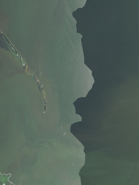
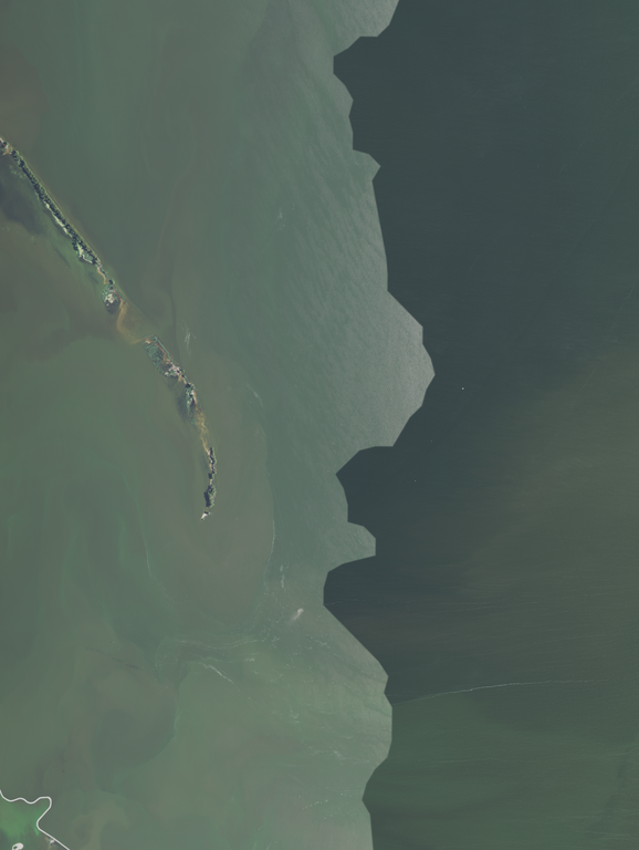
English: Aerial view of Long Tail Point, including the Long Tail Point Light (center and to the left, with a shadow pointing left) in Brown County, Wisconsin, taken July 28, 2020
Coordinates:
|
|||
| Дата | ||||
| Источник | converted to .png by Epiphyllumlover from the original .tif available as item M_4408725_NW_16_060_20200728 on EarthExplorer | |||
| Автор | Aerial Photography Field Office (APFO) for NAIP, USGS; in contract with the Surdex Corporation | |||
| Права (Повторное использование этого файла) |
|
История файла
Нажмите на дату/время, чтобы посмотреть файл, который был загружен в тот момент.
| Дата/время | Миниатюра | Размеры | Участник | Примечание | |
|---|---|---|---|---|---|
| текущий | 02:05, 27 марта 2022 | | 9470 × 12 577 (200,38 МБ) | Epiphyllumlover | c:User:Rillke/bigChunkedUpload.js: {{Information | Description = {{en|1=Aerial view of Long Tail Point, including the Long Tail Point Light (center and to the left, with a shadow pointing left) in Brown County, Wisconsin, taken July 28, 2020 Coordinates: *Center Latitude 44°35'38.41"N *Center Longitude 87°58'06.65"W *NW Corner Lat 44°37'39.56"N *NW Corner Long 88°00'17.60"W *NE Corner Lat 44°37'41.74"N *NE Corner Long 87°55'5... |
Использование файла
Нет страниц, использующих этот файл.