Файл:Cape of Good Hope Iss059e078303 lrg, Cape Peninsula.jpg
Перейти к навигации
Перейти к поиску

Размер этого предпросмотра: 800 × 429 пкс. Другие разрешения: 320 × 172 пкс | 640 × 344 пкс | 1024 × 550 пкс | 1280 × 687 пкс | 3161 × 1697 пкс.
Исходный файл (3161 × 1697 пкс, размер файла: 1,31 МБ, MIME-тип: image/jpeg)
Этот файл находится на Викискладе. Сведения о нём показаны ниже.
Викисклад — централизованное хранилище для свободных файлов, используемых в проектах Викимедиа.
|
Краткое описание
| Описание |
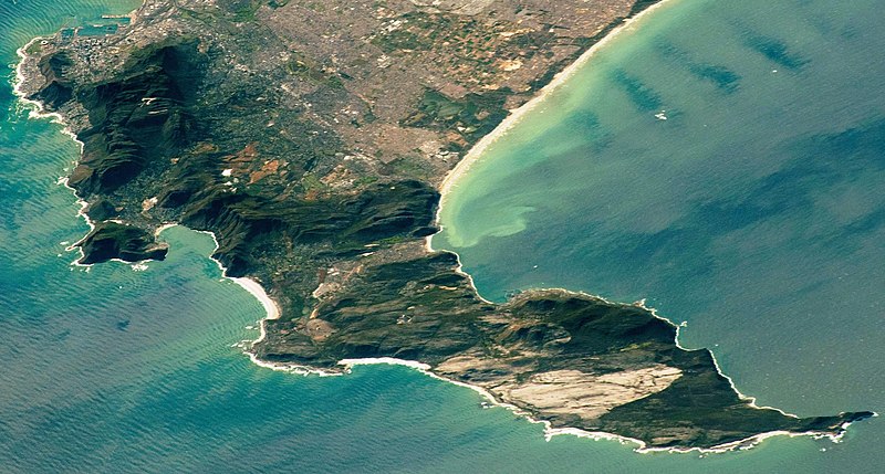
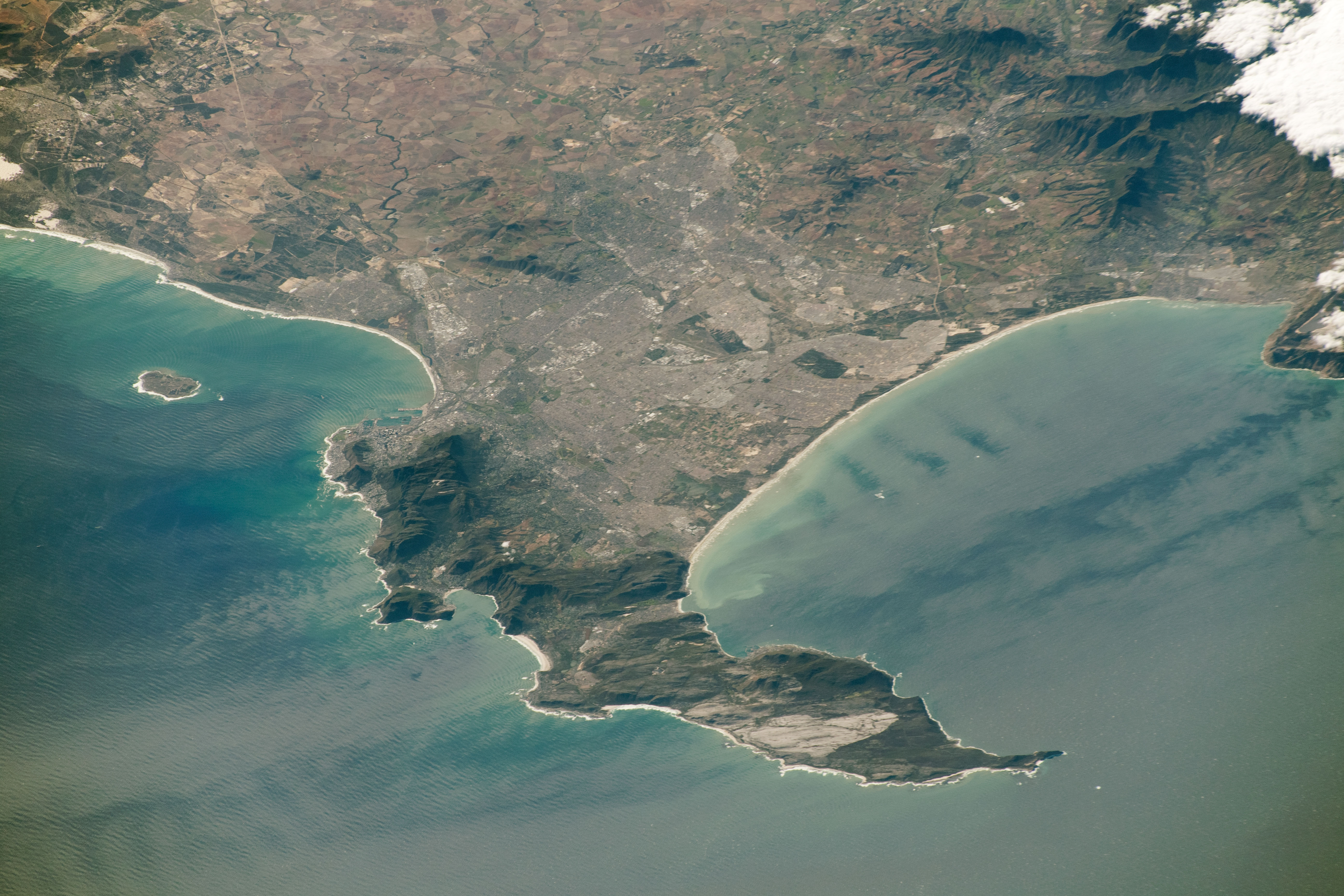
Afrikaans: Gesig op die hele Kaapse Skiereiland in die Wes-Kaap, Suid-Afrika. Ruimtevaarderfoto ISS059-E-78303 is op 28 Mei 2019 verkry deur middel van 'n Nikon D5 digitale kamera met 340 millimeter lens, en is voorsien deur die IRS-bemanning se Aardwaarnemingsgerief en die Aardwetenskap-en-Afstandwaarnemingseenheid van die Johnson-ruimtesentrum. Die foto is geneem deur 'n lid van die Ekspedisie 59-span.
English: View of the whole Cape Peninsula in the Western Cape, South Africa. Astronaut photograph ISS059-E-78303 was acquired on May 28, 2019, with a Nikon D5 digital camera using a 340 millimeter lens and is provided by the ISS Crew Earth Observations Facility and the Earth Science and Remote Sensing Unit, Johnson Space Center. The image was taken by a member of the Expedition 59 crew. |
| Дата | |
| Источник | https://eoimages.gsfc.nasa.gov/images/imagerecords/145000/145476/iss059e078303_lrg.jpg |
| Автор |
Afrikaans: Die Internasionale Ruimtestasieprogram ondersteun die laboratorium as deel van die IRS Nasionale Laboratorium om ruimtevaarders te help om foto's van die Aarde te neem wat die grootste waarde vir wetenskaplikes en die publiek sal hê, en om hierdie beelde vrylik op die internet beskikbaar te stel. Bykomende beelde wat deur ruimtevaarders en kosmonoute geneem is, kan besigtig word by die NASA/JSC Gateway to Astronaut Photography of Earth. Onderskrif deur Sarah Deitrick, 'n Jacobs-JETS-gekontrakteerde by NASA-JSC.
English: The International Space Station Program supports the laboratory as part of the ISS National Lab to help astronauts take pictures of Earth that will be of the greatest value to scientists and the public, and to make those images freely available on the Internet. Additional images taken by astronauts and cosmonauts can be viewed at the NASA/JSC Gateway to Astronaut Photography of Earth. Caption by Sarah Deitrick, Jacobs-JETS Contract at NASA-JSC. |
| Другие версии |
 |
| Местоположение объекта | | Это и другие изображения по их местоположению на OpenStreetMap |
|---|
Лицензирование
| Этот файл находится в общественном достоянии (англ. public domain), так как он был создан NASA (Национальным управлением по аэронавтике и исследованию космического пространства). Политика авторского права NASA гласит, что «Материал NASA не защищается авторским правом, если не указано иное». (См. Template:PD-USGov, страницу политики авторского права NASA или политику использования изображений JPL.) | ||
 |
Предупреждения:
|
История файла
Нажмите на дату/время, чтобы посмотреть файл, который был загружен в тот момент.
| Дата/время | Миниатюра | Размеры | Участник | Примечание | |
|---|---|---|---|---|---|
| текущий | 17:38, 9 июля 2020 | | 3161 × 1697 (1,31 МБ) | JMK | {{Information |description ={{en|1=Cape Peninsula}} |date =2019-05-28 |source =https://eoimages.gsfc.nasa.gov/images/imagerecords/145000/145476/iss059e078303_lrg.jpg |author =The International Space Station Program supports the laboratory as part of the ISS National Lab to help astronauts take pictures of Earth that will be of the greatest value to scientists and the public, and to make those images freely available on the Internet. Additional images taken by astronau... |
Использование файла
Нет страниц, использующих этот файл.