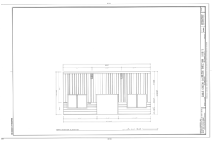
Файл:Eagle Creek Overlook Shelter, Columbia Gorge,Oregon-Washington Border, Bonneville, Multnomah County, OR HABS ORE,26-BOND.V,1- (sheet 9 of 9).tif
Материал из Википедии — свободной энциклопедии
Перейти к навигации
Перейти к поиску

Размер этого JPG-превью для исходного TIF-файла: 800 × 533 пкс. Другие разрешения: 320 × 213 пкс | 640 × 426 пкс | 1024 × 682 пкс | 1280 × 852 пкс | 2560 × 1705 пкс | 14 464 × 9632 пкс.
Исходный файл (14 464 × 9632 пкс, размер файла: 670 КБ, MIME-тип: image/tiff)
Этот файл находится на Викискладе. Сведения о нём показаны ниже.
Викисклад — централизованное хранилище для свободных файлов, используемых в проектах Викимедиа.
Сообщить об ошибке с файлом |
Краткое описание
| Внимание! | Изображение содержит очень большое количество пикселей, и при просмотре его в полном разрешении в некоторых обозревателях могут возникнуть такие проблемы, как загрузка искажённого изображения или зависание. |
|---|
| HABS ORE,26-BOND.V,1- (sheet 9 of 9) - Eagle Creek Overlook Shelter, Columbia Gorge,Oregon-Washington Border, Bonneville, Multnomah County, OR | |||||
|---|---|---|---|---|---|
| Фотограф |
Related names:
|
||||
| Название |
HABS ORE,26-BOND.V,1- (sheet 9 of 9) - Eagle Creek Overlook Shelter, Columbia Gorge,Oregon-Washington Border, Bonneville, Multnomah County, OR |
||||
| Изображённое место | Oregon; Multnomah County; Bonneville | ||||
| Дата | Documentation compiled after 1933 | ||||
| Размеры | 24 x 36 in. (D size) | ||||
| Текущее местонахождение |
Library of Congress Prints and Photographs Division Washington, D.C. 20540 USA http://hdl.loc.gov/loc.pnp/pp.print |
||||
| Инвентарный номер |
HABS ORE,26-BOND.V,1- (sheet 9 of 9) |
||||
| Дополнительная информация |
|
||||
| Примечания |
|
||||
| Источник | https://www.loc.gov/pictures/item/or0385.sheet.00009a | ||||
| Права (Повторное использование этого файла) |
|
||||
| Другие версии |
         |
||||
| Местоположение объекта | 45° 38′ 10″ с. ш., 121° 57′ 02,99″ з. д. | Это и другие изображения по их местоположению на OpenStreetMap |
|---|
Краткие подписи
Добавьте однострочное описание того, что собой представляет этот файл
Элементы, изображённые на этом файле
изображённый объект
45°38'10.00"N, 121°57'2.99"W
45°38'10.00"N, 121°57'2.99"W
История файла
Нажмите на дату/время, чтобы посмотреть файл, который был загружен в тот момент.
| Дата/время | Миниатюра | Размеры | Участник | Примечание | |
|---|---|---|---|---|---|
| текущий | 08:28, 2 августа 2014 |  | 14 464 × 9632 (670 КБ) | Fæ | GWToolset: Creating mediafile for Fæ. HABS 2014-08-01 2601-2900 missing |
Использование файла
Нет страниц, использующих этот файл.
Метаданные
Файл содержит дополнительные данные, обычно добавляемые цифровыми камерами или сканерами. Если файл после создания редактировался, то некоторые параметры могут не соответствовать текущему изображению.
| Автор | Library of Congress |
|---|---|
| Ширина | 14 464 пикс. |
| Высота | 9632 пикс. |
| Метод сжатия | CCITT Group 4, факсовое кодирование |
| Цветовая модель | Чёрный и белый (белый — 0) |
| Ориентация кадра | Нормальная |
| Количество цветовых компонентов | 1 |
| Количество строк в 1 блоке | 4 |
| Горизонтальное разрешение | 400 точек на дюйм |
| Вертикальное разрешение | 400 точек на дюйм |
| Принцип организации данных | формат «chunky» |
| Дата и время изменения файла | 12:37, 18 сентября 2000 |

